|
Synthetic-aperture Sonar
Synthetic-aperture sonar (SAS) is a form of sonar in which sophisticated post-processing of sonar data is used in ways closely analogous to synthetic-aperture radar. Synthetic-aperture sonars combine a number of acoustic pings to form an image with much higher along-track resolution than conventional sonars. The along-track resolution can approach half the length of one sonar element, though is downward limited by 1/4 wavelength. The principle of synthetic-aperture sonar is to move the sonar while illuminating the same spot on the sea floor with several pings. When moving along a straight line, those pings that have the image position within the beamwidth constitute the synthetic array. By coherent reorganization of the data from all the pings, a synthetic-aperture image is produced with improved along-track resolution. In contrast to conventional side-scan sonar (SSS), SAS processing provides range-independent along-track resolution. At maximum range the resolution can be magni ... [...More Info...] [...Related Items...] OR: [Wikipedia] [Google] [Baidu] |
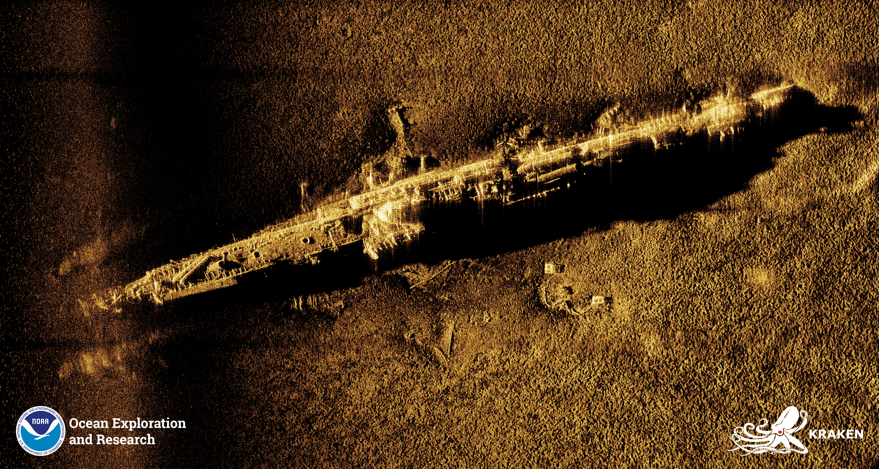
U-853 SAS Image
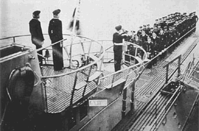
German submarine ''U-853'' was a Type IXC/40 U-boat of Nazi Germany's ''Kriegsmarine'' during World War II. Her keel was laid down on 21 August 1942 by DeSchiMAG AG Weser of Bremen. She was commissioned on 25 June 1943 with ''Kapitänleutnant'' Helmut Sommer in command. ''U-853'' saw action during the Battle of the Atlantic in World War II. She conducted three patrols, sinking two ships totalling and 430 tons. On her final patrol, ''U-853'' was sent to harass United States coastal shipping. She destroyed near Portland, Maine. Just days before Germany's surrender, ''U-853'' torpedoed and sank the collier ''Black Point'' during the Battle of Point Judith. The day before Germany surrendered, American warships quickly found ''U-853'' and sank her east of Block Island, Rhode Island, resulting in the loss of her entire crew. ''U-853'' is a popular deep sea diving site. She rests in of water. Design German Type IXC/40 submarines were slightly larger than the original Type IXCs ... [...More Info...] [...Related Items...] OR: [Wikipedia] [Google] [Baidu] |
Sonar
Sonar (sound navigation and ranging or sonic navigation and ranging) is a technique that uses sound propagation (usually underwater, as in submarine navigation) to navigate, measure distances ( ranging), communicate with or detect objects on or under the surface of the water, such as other vessels. "Sonar" can refer to one of two types of technology: ''passive'' sonar means listening for the sound made by vessels; ''active'' sonar means emitting pulses of sounds and listening for echoes. Sonar may be used as a means of acoustic location and of measurement of the echo characteristics of "targets" in the water. Acoustic location in air was used before the introduction of radar. Sonar may also be used for robot navigation, and SODAR (an upward-looking in-air sonar) is used for atmospheric investigations. The term ''sonar'' is also used for the equipment used to generate and receive the sound. The acoustic frequencies used in sonar systems vary from very low ( infrasonic) to ex ... [...More Info...] [...Related Items...] OR: [Wikipedia] [Google] [Baidu] |
Synthetic-aperture Radar
Synthetic-aperture radar (SAR) is a form of radar that is used to create two-dimensional images or three-dimensional reconstructions of objects, such as landscapes. SAR uses the motion of the radar antenna over a target region to provide finer spatial resolution than conventional stationary beam-scanning radars. SAR is typically mounted on a moving platform, such as an aircraft or spacecraft, and has its origins in an advanced form of side looking airborne radar (SLAR). The distance the SAR device travels over a target during the period when the target scene is illuminated creates the large ''synthetic'' antenna aperture (the ''size'' of the antenna). Typically, the larger the aperture, the higher the image resolution will be, regardless of whether the aperture is physical (a large antenna) or synthetic (a moving antenna) – this allows SAR to create high-resolution images with comparatively small physical antennas. For a fixed antenna size and orientation, objects which ... [...More Info...] [...Related Items...] OR: [Wikipedia] [Google] [Baidu] |
Sidescan Sonar
Side-scan sonar (also sometimes called side scan sonar, sidescan sonar, side imaging sonar, side-imaging sonar and bottom classification sonar) is a category of sonar system that is used to efficiently create an image of large areas of the sea floor. Uses Side-scan sonar may be used to conduct surveys for marine archaeology; in conjunction with seafloor samples it is able to provide an understanding of the differences in material and texture type of the seabed. Side-scan sonar imagery is also a commonly used tool to detect debris items and other obstructions on the seafloor that may be hazardous to shipping or to seafloor installations by the oil and gas industry. In addition, the status of pipelines and cables on the seafloor can be investigated using side-scan sonar. Side-scan data are frequently acquired along with bathymetric soundings and sub-bottom profiler data, thus providing a glimpse of the shallow structure of the seabed. Side-scan sonar is also used for fisheries ... [...More Info...] [...Related Items...] OR: [Wikipedia] [Google] [Baidu] |
Autonomous Underwater Vehicle
An autonomous underwater vehicle (AUV) is a robot that travels underwater without requiring input from an operator. AUVs constitute part of a larger group of undersea systems known as unmanned underwater vehicles, a classification that includes non-autonomous remotely operated underwater vehicles (ROVs) – controlled and powered from the surface by an operator/pilot via an umbilical or using remote control. In military applications an AUV is more often referred to as an unmanned undersea vehicle (UUV). Underwater gliders are a subclass of AUVs. History The first AUV was developed at the Applied Physics Laboratory at the University of Washington as early as 1957 by Stan Murphy, Bob Francois and later on, Terry Ewart. The "Special Purpose Underwater Research Vehicle", or SPURV, was used to study diffusion, acoustic transmission, and submarine wakes. Other early AUVs were developed at the Massachusetts Institute of Technology in the 1970s. One of these is on dis ... [...More Info...] [...Related Items...] OR: [Wikipedia] [Google] [Baidu] |
Towed Array Sonar
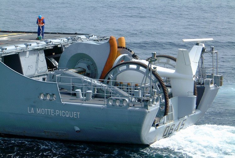
A towed array sonar is a system of hydrophones towed behind a submarine or a surface ship on a cable. Trailing the hydrophones behind the vessel, on a cable that can be kilometers long, keeps the array's sensors away from the ship's own noise sources, greatly improving its signal-to-noise ratio, and hence the effectiveness of detecting and tracking faint contacts, such as quiet, low noise-emitting submarine threats, or seismic signals. A towed array offers superior resolution and range compared with hull mounted sonar. It also covers the baffles, the blind spot of hull mounted sonar. However, effective use of the system limits a vessel's speed and care must be taken to protect the cable from damage. History During World War I, a towed sonar array known as the "Electric Eel" was developed by Harvey Hayes, a U.S. Navy physicist. This system is believed to be the first towed sonar array design. It employed two cables, each with a dozen hydrophones attached. The project was discont ... [...More Info...] [...Related Items...] OR: [Wikipedia] [Google] [Baidu] |
Nadir
The nadir (, ; ar, نظير, naẓīr, counterpart) is the direction pointing directly ''below'' a particular location; that is, it is one of two vertical directions at a specified location, orthogonal to a horizontal flat surface. The direction opposite of the nadir is the zenith. Definitions Space science Since the concept of ''being below'' is itself somewhat vague, scientists define the nadir in more rigorous terms. Specifically, in astronomy, geophysics and related sciences (e.g., meteorology), the nadir at a given point is the local vertical direction pointing in the direction of the force of gravity at that location. The term can also be used to represent the lowest point that a celestial object reaches along its apparent daily path around a given point of observation (i.e. the object's ''lower culmination''). This can be used to describe the position of the Sun, but it is only technically accurate for one latitude at a time and only possible at the low latitudes. T ... [...More Info...] [...Related Items...] OR: [Wikipedia] [Google] [Baidu] |
Naval Mine
A naval mine is a self-contained explosive device placed in water to damage or destroy surface ships or submarines. Unlike depth charges, mines are deposited and left to wait until they are triggered by the approach of, or contact with, any vessel or a particular vessel type, akin to anti-infantry vs. anti-vehicle mines. Naval mines can be used offensively, to hamper enemy shipping movements or lock vessels into a harbour; or defensively, to protect friendly vessels and create "safe" zones. Mines allow the minelaying force commander to concentrate warships or defensive assets in mine-free areas giving the adversary three choices: undertake an expensive and time-consuming minesweeping effort, accept the casualties of challenging the minefield, or use the unmined waters where the greatest concentration of enemy firepower will be encountered. Although international law requires signatory nations to declare mined areas, precise locations remain secret; and non-complying individuals ... [...More Info...] [...Related Items...] OR: [Wikipedia] [Google] [Baidu] |
Malaysia Airlines Flight 370
Malaysia Airlines Flight 370 (MH370/MAS370) was an international passenger flight operated by Malaysia Airlines that disappeared on 8 March 2014 while flying from Kuala Lumpur International Airport in Malaysia to its planned destination, Beijing Capital International Airport. The crew of the Boeing 777-200ER registered as 9M-MRO, last communicated with air traffic control (ATC) around 38 minutes after takeoff when the flight was over the South China Sea. The aircraft was lost from ATC radar screens minutes later, but was tracked by military radar for another hour, deviating westward from its planned flight path, crossing the Malay Peninsula and Andaman Sea. It left radar range northwest of Penang Island in northwestern Peninsular Malaysia. With all 227 passengers and 12 crew aboard presumed dead, the disappearance of Flight 370 was the deadliest incident involving a Boeing 777 and the deadliest in Malaysia Airlines' history until it was surpassed i ... [...More Info...] [...Related Items...] OR: [Wikipedia] [Google] [Baidu] |
Carbon Dioxide
Carbon dioxide ( chemical formula ) is a chemical compound made up of molecules that each have one carbon atom covalently double bonded to two oxygen atoms. It is found in the gas state at room temperature. In the air, carbon dioxide is transparent to visible light but absorbs infrared radiation, acting as a greenhouse gas. It is a trace gas in Earth's atmosphere at 421 parts per million (ppm), or about 0.04% by volume (as of May 2022), having risen from pre-industrial levels of 280 ppm. Burning fossil fuels is the primary cause of these increased CO2 concentrations and also the primary cause of climate change.IPCC (2022Summary for policy makersiClimate Change 2022: Mitigation of Climate Change. Contribution of Working Group III to the Sixth Assessment Report of the Intergovernmental Panel on Climate Change Cambridge University Press, Cambridge, United Kingdom and New York, NY, USA Carbon dioxide is soluble in water and is found in groundwater, lakes, i ... [...More Info...] [...Related Items...] OR: [Wikipedia] [Google] [Baidu] |


