|
St Thomas' Street, Oxford
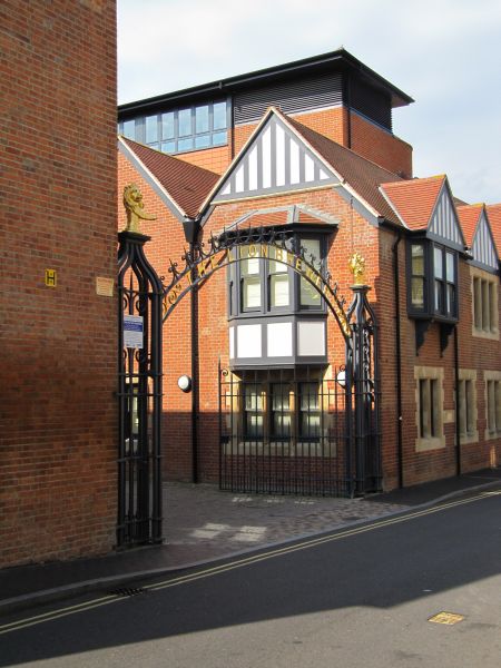
St Thomas' Street is a historical street in central Oxford, England. It lies to the west of Oxford Castle, linking the Quaking Bridge, across Castle Mill Stream, to St Thomas the Martyr's Church, Oxford, St Thomas' Church. The street connects to Tidmarsh Lane, Oxford, Tidmarsh Lane, on the other side of the bridge, Paradise Street and crosses Hollybush Row near the church. The brewery and headquarters complex of Oxford brewers Morrells Brewery, Morrells, known as the Lion Brewery, was located on St Thomas' Street from 1743 until it was closed in 1998 and the site redeveloped into an apartment complex in 2002. Although some of the buildings were demolished during this redevelopment, the entrance, offices, engine house, chimney and waterwheel have been retained. The waterwheel at Lion Brewery was driven by the Wareham Stream, a side-stream of the Castle Mill Stream. St Thomas' Street passes over this stream on Bookbinders' Bridge. References Streets in Oxford {{Oxford ... [...More Info...] [...Related Items...] OR: [Wikipedia] [Google] [Baidu] |
Oxford
Oxford () is a City status in the United Kingdom, cathedral city and non-metropolitan district in Oxfordshire, England, of which it is the county town. The city is home to the University of Oxford, the List of oldest universities in continuous operation, oldest university in the English-speaking world; it has buildings in every style of Architecture of England, English architecture since late History of Anglo-Saxon England, Anglo-Saxon. Oxford's industries include motor manufacturing, education, publishing, science, and information technologies. Founded in the 8th century, it was granted city status in 1542. The city is located at the confluence of the rivers Thames (locally known as the Isis) and River Cherwell, Cherwell. It had a population of in . It is north-west of London, south-east of Birmingham and north-east of Bristol. History The history of Oxford in England dates back to its original settlement in the History of Anglo-Saxon England, Saxon period. The name †... [...More Info...] [...Related Items...] OR: [Wikipedia] [Google] [Baidu] |
Oxford Castle
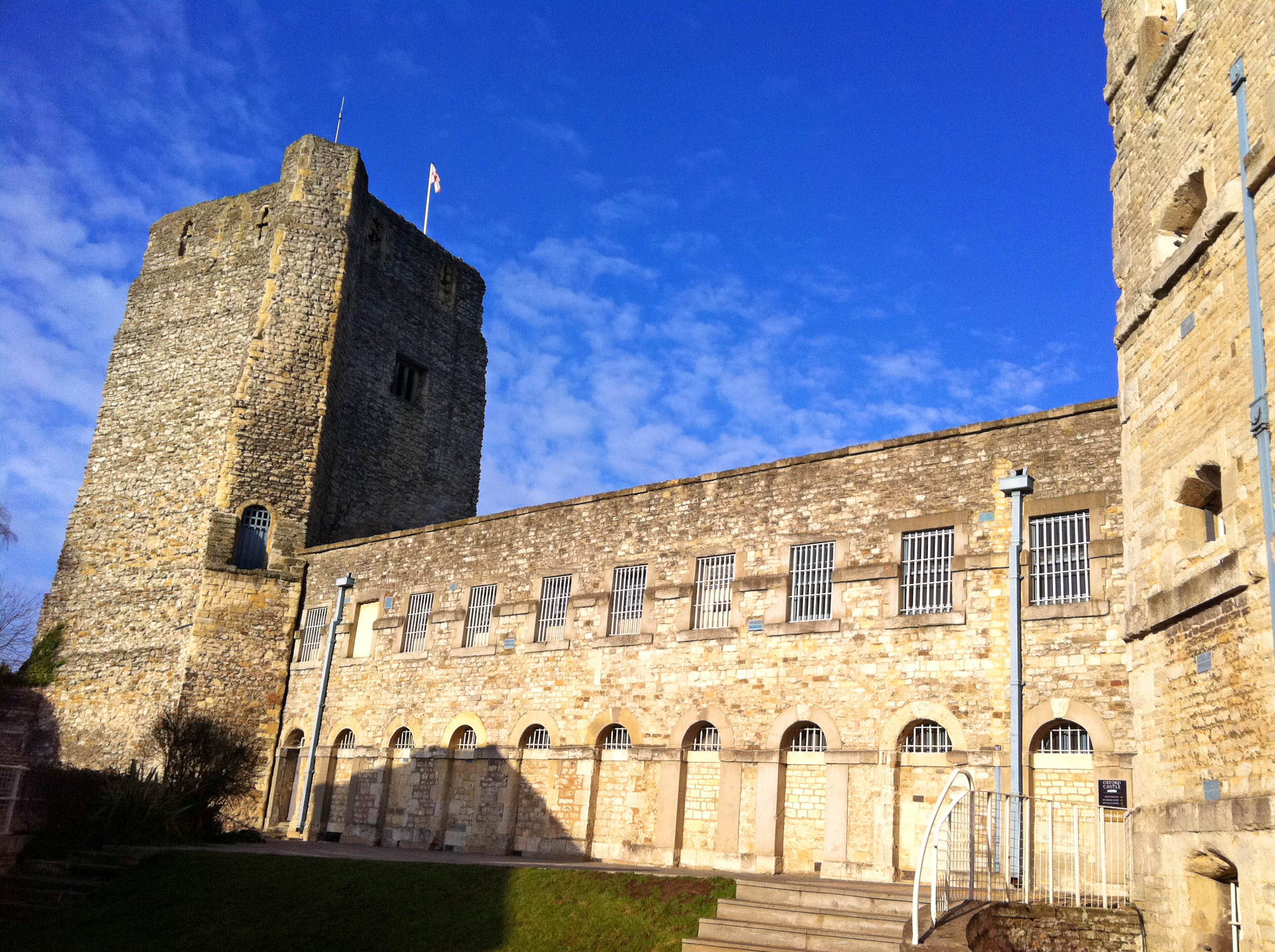
Oxford Castle is a large, partly ruined medieval castle on the western side of central Oxford in Oxfordshire, England. Most of the original moated, wooden motte and bailey castle was replaced in stone in the late 12th or early 13th century and the castle played an important role in the conflict of the Anarchy. In the 14th century the military value of the castle diminished and the site became used primarily for county administration and as a prison. The surviving rectangular St George's Tower is now believed to pre-date the remainder of the castle and be a watch tower associated with the original Saxon west gate of the city. Most of the castle was destroyed in the English Civil War and by the 18th century the remaining buildings had become Oxford's local prison. A new prison complex was built on the site from 1785 onwards and expanded in 1876; this became HM Prison Oxford. The prison closed in 1996 and was redeveloped as a hotel and visitor attraction. The medieval remains of ... [...More Info...] [...Related Items...] OR: [Wikipedia] [Google] [Baidu] |
Quaking Bridge
Quaking Bridge is a bridge over the Castle Mill Stream in the English city of Oxford. It connects St Thomas' Street, Oxford, St Thomas' Street and Paradise Street, Oxford, Paradise Street, to the west of the stream, with Tidmarsh Lane, Oxford, Tidmarsh Lane, to the east. Oxford Castle lies to the east, and has a pedestrian entrance from Tidmarsh Lane adjacent to the bridge. To the north, the Castle Mill Stream is crossed by Pacey's Bridge and Hythe Bridge, whilst to the south it is crossed by Swan Bridge. There has been a bridge at this location from at least the late 13th century. Quaking Bridge was first mentioned in 1297, but is probably much older. The origin of the bridge name is uncertain, but it may derive the unsafe condition of an early bridge. In the Close Rolls of May 1324 it is described as "''a bridge anciently constructed''" and it is stated that the Canon (priest), canons of Oseney Abbey "''were wont to pass''" for services in St George's Chapel at the castle. T ... [...More Info...] [...Related Items...] OR: [Wikipedia] [Google] [Baidu] |
Castle Mill Stream
Castle Mill Stream is a long Backwater (river), backwater of the River Thames in the west of Oxford, England. It has its own secondary backwater, known as the Wareham Stream, that is long. Course Castle Mill Stream The Castle Mill Stream leaves the main course of the River Thames at the south end of Port Meadow, immediately upstream of Medley Footbridge, split by the northern part of Fiddler's Island to the west. It flows between Port Meadow to the north and Cripley Meadow (largely Cripley Meadow#Allotments, allotments) to the south. It then passes under the Cherwell Valley Line, Cherwell Valley railway line and turns south, alongside the southern end of the Oxford Canal and the railway tracks, across which is the Castle Mill graduate housing development of the University of Oxford. Further south, the Isis Lock gives access to the Oxford Canal, and the short Sheepwash Channel leads west under the railway tracks to the main stream of the Thames. The stream then flows past th ... [...More Info...] [...Related Items...] OR: [Wikipedia] [Google] [Baidu] |
St Thomas The Martyr's Church, Oxford
St Thomas the Martyr Church is a Church of England parish church of the Anglo-Catholicism, Anglo-Catholic tradition, in Oxford, England, near Oxford railway station in Osney. It is located between Becket Street to the west and Hollybush Row to the east, with St Thomas' Street, Oxford, St Thomas' Street opposite. Overview The church was founded in the 12th century, dedicated to Thomas Becket, St Thomas Becket. The building still retains some of its original architecture, although substantial expansions and repairs have been made, particularly in the 17th century (under the curate, curacy of Robert Burton (scholar), Robert Burton) and in the 19th century. The church played a significant role in the early stages of the Oxford Movement, being the site of daily services as well as such ritualist practices as altar candles and the wearing of Eucharistic vestments. The leaders of the Movement preached at the church, and the early Tractarians were closely associated with St Thomas's. ... [...More Info...] [...Related Items...] OR: [Wikipedia] [Google] [Baidu] |
Tidmarsh Lane, Oxford
Tidmarsh is a village in West Berkshire, England. Its development is mainly residential and agricultural, and is centred on the A340 road between Pangbourne and Theale. The rural area is bounded by the M4 motorway to the south. It is centred south of Pangbourne, west of Reading and west of London. Geography Its civil parish council is shared with another village and is called Tidmarsh with Sulham. Further east, Sulham Woods separate the villages from Tilehurst, a western suburb of Reading. Its elevation ranges between in the north-east, and AOD in the western projection. The vast majority of the parish (more than 90%) is at more than above the River Pang. Much of the main street is between above the river level. Woodland covers less than a tenth of its total area but about a quarter of the western or south-western higher ground. The Pang flows north through the village and then through the Moor Copse Nature Reserve on its way to join the River Thames at Pangbourne. In ... [...More Info...] [...Related Items...] OR: [Wikipedia] [Google] [Baidu] |
Paradise Street
Paradise Street is a short street in the core area of Birmingham City Centre, in England. Paradise Street runs roughly from Victoria Square to Suffolk Street and Broad Street. The street existed in 1796 when a congregation gathered at a meeting hall for a sermon. Paradise Street is noted as the location of Birmingham Town Hall (started in 1832) and the former site of Queen's College, Birmingham (started 1843) which was the first establishment in Birmingham to grant degrees. The Birmingham and Midland Institute had its first building on Paradise Street (opened 1860) but moved to Margaret Street when the Inner Ring Road (A4400) was developed in the 1960s. The head office building of the Birmingham Canal Navigations Birmingham Canal Navigations (BCN) is a network of canals connecting Birmingham, Wolverhampton, and the eastern part of the Black Country. The BCN is connected to the rest of the English canal system at several junctions. It was owned and opera ... was built ... [...More Info...] [...Related Items...] OR: [Wikipedia] [Google] [Baidu] |
Hollybush Row
Oxpens Road is a road in central Oxford, England, linking west and south Oxford. It is named after the marshy area of Oxpens, next to one of the branches of the River Thames in Oxford. It forms part of the A420 road. Locale To the northwest, Oxpens Road becomes Hollybush Row, meeting at Frideswide Square, forming the major junction of the Botley Road, Park End Street and Hythe Bridge Street near the Saïd Business School and Oxford railway station (to the west of the city centre). To the southeast it becomes Thames Street, just north of the River Thames, and meets the junction with the south end of St Aldates near Christ Church Meadow (to the south of the city centre). It forms part of an inner ring road for the southwest part of the centre of Oxford. Halfway along is the Oxford Ice Rink, a distinctive 1984 building by Nicholas Grimshaw, which is the home of the Oxford City Stars ice hockey team. One of the campuses of the City of Oxford College is located here on the north ... [...More Info...] [...Related Items...] OR: [Wikipedia] [Google] [Baidu] |
Morrells Brewery
Morrell's Brewing Company, also known as the Lion Brewery, was the only major brewery in Oxford, England. It operated between 1782 and 1998. Early history Morrell's was founded by Richard Tawney in 1743 as the Lion Brewery. In 1782 he formed a partnership with Mark and James Morrell, who eventually became the owners. 1863 and 1864 saw the deaths of James Morrell and his wife Alicia leaving the brewery to their ten year old daughter Emily Morrell. Her inheritance was put under the control of three trustees who tried to deal with Emily's crush on a distant cousin by sending her away to an aunt and forbidding any communication between the pair. Morrell's brewed its beers at the Lion Brewery in St Thomas Street. In the 19th century Morrell's redeveloped and extended the Lion Brewery a number of times. A large brewing shed was added in 1879, a blacksmith's shop and engine house in 1880, a further shed and new yard in 1882, stables in 1889, new offices in 1892, a tun room in 1895 ... [...More Info...] [...Related Items...] OR: [Wikipedia] [Google] [Baidu] |


