|
St. Finian's Bay
St. Finian's Bay (or St. Finan’s Bay, ) is an exposed bay on the Atlantic coast of County Kerry, Ireland. Location St. Finian's Bay is on the Atlantic coast of County Kerry, Ireland. The bay lies between Puffin Island to the north and Ducalla Head to the south. It is crescent shaped, with headlands at each end. Inland of the bay there are gently sloping grassy hills. Puffin Island is very close to the coast, while the Skellig Islands (Skellig Michael and Little Skellig) can be seen further out to sea. The bay is between the village of Portmagee and the Ballinskelligs area on the Skellig Ring drive. The pier in St. Finian’s Bay is used by divers as a launching point for exploration of the Skellig Rocks. Surfers use Glen's Beach in the bay. Name The bay is named after Saint Finan Cam. He may have been the first founder of the oratory on Skellig Michael, directly opposite St. Finian's Bay. When the Danes were raiding Ireland the monastery was moved to the mainland, and ... [...More Info...] [...Related Items...] OR: [Wikipedia] [Google] [Baidu] |
County Kerry
County Kerry () is a Counties of Ireland, county on the southwest coast of Republic of Ireland, Ireland, within the Provinces of Ireland, province of Munster and the Southern Region, Ireland, Southern Region. It is bordered by two other counties; County Limerick, Limerick to the east, and County Cork, Cork to the south and east. It is separated from County Clare, Clare to the north by the Shannon Estuary. With an area of and a population of 156,458 as of 2022, it is the List of Irish counties by area, 5th largest of Ireland's 32 counties by land area, and the List of Irish counties by population, 15th most populous. The governing Local government in the Republic of Ireland, local authority is Kerry County Council. Bounded by the Atlantic Ocean, Kerry is Ireland's most westerly county. Its List of Irish counties by coastline, rugged coastline stretches for and is characterised by bays, sea cliffs, beaches and many small offshore islands, of which the Blaskets and the Skelligs a ... [...More Info...] [...Related Items...] OR: [Wikipedia] [Google] [Baidu] |
Puffin Island (County Kerry)
Puffin Island (), historically called Inishfearglin, is an uninhabited steep rocky island lying off the coast of the Iveragh Peninsula, County Kerry, Ireland. Geography The island is about 1.5 km long and 0.7 km wide, and rises to 213 metres. It is separated from the mainland by Puffin Sound, which is only about 250 metres across. Day visits to the island from Valentia or The Glen Pier can be arranged. It lies off the northern headland of St. Finian's Bay. Nature conservation Puffin Island holds important populations of several seabird species, including Atlantic puffins, Manx shearwaters and European storm-petrels, and was acquired as a nature reserve by the Irish Wildbird Conservancy (now BirdWatch Ireland) in the early 1980s. History The island also has some signs of ancient human habitation, and it has attracted the interest of archaeologists. References Photo gallery File:Puffin Island.jpg, Puffin Island from mainland File:Puffin Island - geograph.org.u ... [...More Info...] [...Related Items...] OR: [Wikipedia] [Google] [Baidu] |
Skellig Michael
Skellig Michael ( ), also called Great Skellig ( ), is a twin-pinnacled crag west of the Iveragh Peninsula in County Kerry, Ireland. The island is named after the archangel Michael, with "Skellig" derived from the Irish language word , meaning a splinter of stone. Its twin island, Little Skellig (), is smaller and inaccessible (landing is not permitted). The two islands rose c. 374–360 million years ago during a period of mountain formation, along with the MacGillycuddy's Reeks mountain range. Later, they were separated from the mainland by rising water levels. Skellig Michael consists of approximately of rock, with its highest point, known as the Spit, above sea level. The island is defined by its twin peaks and intervening valley (known as Christ's Saddle), which make its landscape steep and inhospitable. It is best known for its Gaelic monastery, founded between the 6th and 8th centuries, and its variety of inhabiting species, which include gannets, puffins, a colony ... [...More Info...] [...Related Items...] OR: [Wikipedia] [Google] [Baidu] |
Little Skellig
Little Skellig ( Irish: ''Sceilig Bheag'') is a small, steep rocky island in the Atlantic Ocean, 11 km off the Iveragh Peninsula of County Kerry, Ireland. It is one of the two Skellig Islands, together with the larger Skellig Michael. Little Skellig is a nature reserve and bird colony. Landing on Little Skellig is not allowed. Geography Little Skellig is the smaller of the two Skellig Islands, the other being Skellig Michael, 1 km to the south-west. The islands rose c. 374–360 million years ago during a period of mountain formation, along with the MacGillycuddy's Reeks mountain range. Later, they were separated from the mainland by rising water levels. Wildlife The island has a large bird population, including a colony of northern gannets which is the largest in Ireland, and one of the largest in the world. The island, together with Skellig Michael, is part of a 364 ha Important Bird Area An Important Bird and Biodiversity Area (IBA) is an area identified u ... [...More Info...] [...Related Items...] OR: [Wikipedia] [Google] [Baidu] |
Portmagee
Portmagee () is a village in County Kerry, Ireland. The village is located on the Iveragh peninsula south of Valentia Island and is known locally as 'the ferry', in reference to its purpose as a crossing point to the island. Access to Valentia Island is now via the Maurice O'Neill Memorial Bridge ( R565 road) from Portmagee, which was built in 1970 and named in memory of a member of the IRA executed in 1942 for his part in the shooting dead of Detective George Mordaunt in Dublin. Name The name Portmagee (Port Magee and Magee's Port as it was formerly known) comes from Captain Theobald Magee, a notorious 18th-century smuggler. Having served in the army of King James as an officer, Magee 'retired' to a life of merchant shipping between France, Portugal and Ireland. Thanks to the many inlets around the South West coast, his trade in contraband spirits, textiles and tea and tobacco was hard to police and therefore very profitable. He married Bridget Morgell, the widow of a rich Din ... [...More Info...] [...Related Items...] OR: [Wikipedia] [Google] [Baidu] |
Ballinskelligs
Ballinskelligs, officially ( Irish for "town (townland) of the craggy rock"), is a townland in the civil parish of Prior, County Kerry, Ireland. It may also refer to the wider district around the townland. It is located in the south-west of the Iveragh peninsula (''Uíbh Ráthach'') and is within the Gaeltacht. According to the 2016 census about 10% of the population of the electoral division speak Irish on a daily basis outside the education system. The townland was in the poor law union of Cahersiveen. The rocks referred to in the area’s Irish name are the Skellig Islands— Skellig Michael and Little Skellig—an ancient monastic colony which lies off the coast from Ballinskelligs. The town is also the site of a beach. Ballinskelligs was the termination site of an early transatlantic telegraph cable Transatlantic telegraph cables were undersea cables running under the Atlantic Ocean for telegraph communications. Telegraphy is a largely obsolete form of communication ... [...More Info...] [...Related Items...] OR: [Wikipedia] [Google] [Baidu] |
Finan Cam
Finan Cam (or Fionan, Finian), Abbot of Kinnity was an early Irish saint associated with County Kerry, Ireland, who lived in the 6th century AD, and possibly the 7th century. To distinguish him from other saints of the same name the appellation of ''Cam'' or "crooked" has been given to him, either because he was stooped or because he had a squint. His feast day is 7 April. Origins According to O'Hanlon (1875), Finan was descended from the family of Conaire Cóem, King of Ireland; and his father was Kennedy, son to Maenag, son of Ardeus, son to Fidai, son of Corcain, son to Nicadin, son of Irchuinnius, son to Cormac Finn, son of Corcodubnius, son to Cairbre Musc, son of King Conaire. Thus, he descended from the Corcu Duibne, i.e. of the race of Cairbre Musc, son to Conaire, who belonged to the posterity of Érimón. The O'Clerys state that Becnat, daughter of Cian, was his mother. The ''Life of St. Brendan'' describes Finan's father, Mac Airde, as a man of considerable wealth who ... [...More Info...] [...Related Items...] OR: [Wikipedia] [Google] [Baidu] |
Bronze Age
The Bronze Age () was a historical period characterised principally by the use of bronze tools and the development of complex urban societies, as well as the adoption of writing in some areas. The Bronze Age is the middle principal period of the three-age system, following the Stone Age and preceding the Iron Age. Conceived as a global era, the Bronze Age follows the Neolithic, with a transition period between the two known as the Chalcolithic. The final decades of the Bronze Age in the Mediterranean basin are often characterised as a period of widespread societal collapse known as the Late Bronze Age collapse (), although its severity and scope are debated among scholars. An ancient civilisation is deemed to be part of the Bronze Age if it either produced bronze by smelting its own copper and alloying it with tin, arsenic, or other metals, or traded other items for bronze from producing areas elsewhere. Bronze Age cultures were the first to History of writing, develop writin ... [...More Info...] [...Related Items...] OR: [Wikipedia] [Google] [Baidu] |
Souterrain
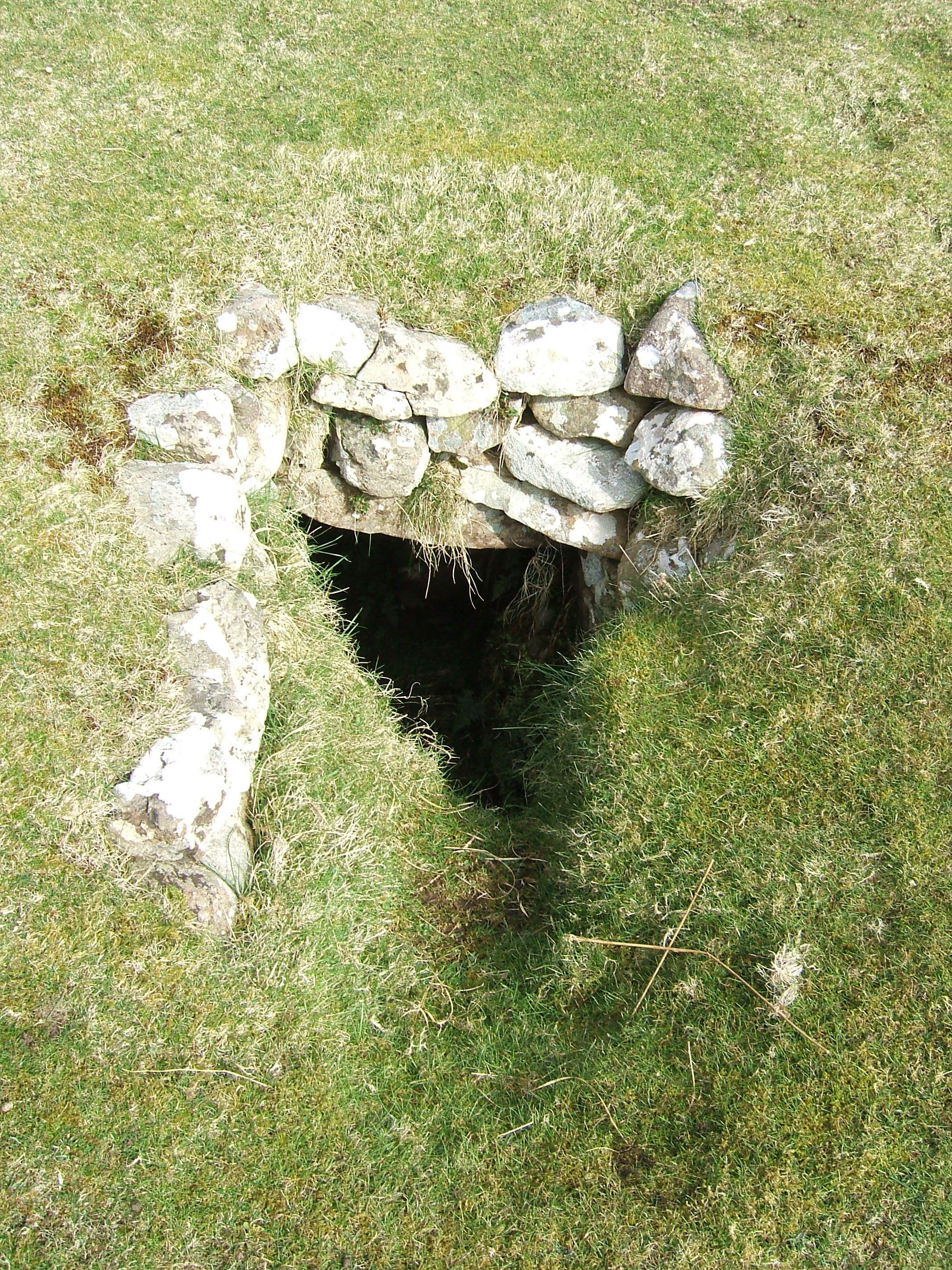
''Souterrain'' (from French ', meaning "subterrain", is a name given by archaeologists to a type of underground structure associated mainly with the European Atlantic Iron Age. These structures appear to have been brought northwards from Gaul during the late Iron Age. Regional names include earth houses, fogous and Pict PICT is a graphics file format introduced on the original Apple Macintosh computer as its standard metafile format. It allows the interchange of graphics (both bitmapped and vector), and some limited text support, between Mac applications, an ...ish houses. The term ''souterrain'' has been used as a distinct term from ''fogou'' meaning 'cave'. In Cornwall the regional name of ''fogou'' (Cornish language, Cornish for 'cave') is applied to souterrain structures. The design of underground structures has been shown to differ among regions; for example, in western Cornwall the design and function of the fogou appears to correlate with a larder use. Etymology T ... [...More Info...] [...Related Items...] OR: [Wikipedia] [Google] [Baidu] |
Killemlagh Church
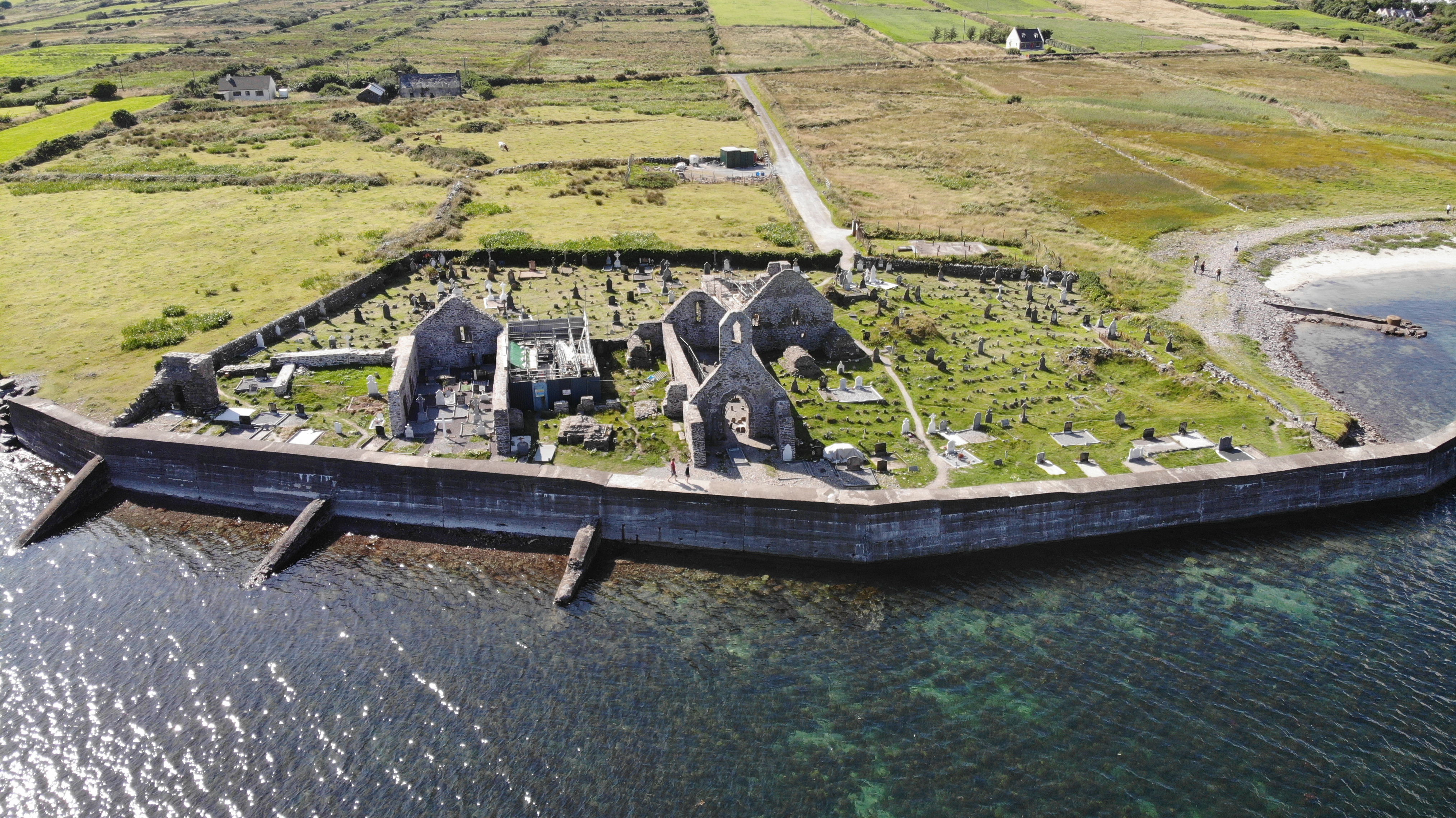
Killemlagh Church () is a ruined 12th-century church in County Kerry in the southwest of Ireland. Name and location Killemlagh, or ''Cill Imleach'', means "church (''cill'') on marginal land (''imleach'')", or "church on border land". John O'Hanlon (1821–1905) states that the name is due to the church lying beside the sea. The church gives its name to the parish of Killemlagh in the Barony of Iveragh, County Kerry. The graveyard is locally known as Glen graveyard, after the Glen parish church which adjoins the older Killemlagh Church. It may be so-named because it is situated within a glen between Knocknaskereighta Mountain to the northeast and Canuig Mountain to the southwest. The church is on the Skellig Ring drive between Portmagee and Ballinskelligs, looking over St. Finian's Bay. From the church one can see the Skellig Islands. The megalithic stone structure called the "Pagan's Grave" is nearby. The site is said to be that of the monastery of Finnian of Clonard Finn ... [...More Info...] [...Related Items...] OR: [Wikipedia] [Google] [Baidu] |


