|
Southport
Southport is a seaside resort, seaside town in the Metropolitan Borough of Sefton in Merseyside, England. It lies on the West Lancashire Coastal Plain, West Lancashire coastal plain and the east coast of the Irish Sea, approximately north of Liverpool and southwest of Preston, Lancashire, Preston. At the United Kingdom Census 2021, 2021 census, Southport had a population of 94,421, making it the List of North West England cities and metropolitan areas by population, eleventh most populous settlement in North West England and the third most populous settlement in the Liverpool City Region. The town was founded in 1792 by William Sutton (Southport), William Sutton, an innkeeper from Churchtown, Merseyside, Churchtown, who built a bathing house at what is now the south end of Lord Street, Southport, Lord Street.''North Meols and Southport – a History'', Chapter 9, Peter Aughton (1988) The area was previously known as South Hawes, and was sparsely populated and dominated ... [...More Info...] [...Related Items...] OR: [Wikipedia] [Google] [Baidu] |
Southport (UK Parliament Constituency)
Southport is a List of United Kingdom Parliament constituencies, constituency in Merseyside which has been represented in the House of Commons of the United Kingdom, House of Commons of the Parliament of the United Kingdom, UK Parliament since 2024 by Patrick Hurley (British politician), Patrick Hurley of the Labour Party (UK), Labour Party. Boundaries Historic 1885–1918: The Borough of Southport, the Sessional Division of Southport, and the parishes of Blundell, Great and Little Crosby, Ince, and Thornton. 1918–1983: The County Borough of Southport. 1983–2024: The Metropolitan Borough of Sefton wards of Ainsdale, Birkdale, Cambridge, Dukes, Kew, Meols, and Norwood. Current Further to the 2023 Periodic Review of Westminster constituencies which came into effect for the 2024 United Kingdom general election, 2024 general election, the constituency was defined as being composed of the following as they existed on 1 December 2020: * The Metropolitan Borough of Sefton ... [...More Info...] [...Related Items...] OR: [Wikipedia] [Google] [Baidu] |
Southport Pier
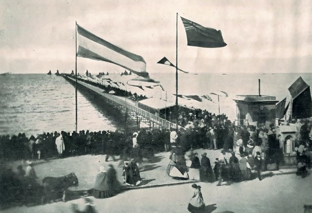
Southport Pier is a pleasure pier in Southport, Merseyside, England. Opened in August 1860, it is the oldest iron pier in the country. Its length of makes it the second-longest in Great Britain, after Southend Pier. Although at one time spanning , a succession of storms and fires during the late 19th and early 20th centuries reduced its length to that of the present day. The pier has been host to famous entertainers, including Charlie Chaplin in the early 20th century. It was visited by Paddle steamer, steamliners in its heyday, but silting of the channel meant that by the 1920s very few steamers were able to reach the pier, and the service ceased in 1929. The pier fell into disrepair throughout the late 20th century, and by 1990 it was operating at a significant annual loss with rising maintenance costs. The local council sought to have the pier demolished, but were defeated in their attempt by a single vote. The pier was significantly restored during 2000–2002, and opene ... [...More Info...] [...Related Items...] OR: [Wikipedia] [Google] [Baidu] |
Banks, Lancashire
Banks is a coastal village in the civil parish of North Meols, in the West Lancashire district, in Lancashire, England, south of the Ribble and Alt Estuaries, Ribble estuary four miles (6 km) north-east of Southport town centre. In 2021 it had a population of 4430. It is in the Southport (UK Parliament constituency), Southport parliamentary constituency. Banks is the largest village in the parish of North Meols on the West Lancashire Coastal Plain, West Lancashire coastal plain. It was primarily an agricultural community due to the excellent soil, although there was fishing activity for many years. Production of flowers and vegetables is common on the farms surrounding the village. The proximity of Southport and Preston, Lancashire, Preston have led to its expansion as a dormitory town, dormitory for commuters. History Etymology Banks is believed to have been named for the many artificial Levee, embankments built in the north of the village to protect it from winter f ... [...More Info...] [...Related Items...] OR: [Wikipedia] [Google] [Baidu] |
Birkdale, Southport
Birkdale is an area of Southport, within the Metropolitan Borough of Sefton, Merseyside, in the north-west of England. The area is on the Irish Sea coast, and forms the southern part of Southport's built-up area. At the 2021 census, the population of Birkdale (ward), Birkdale ward (which includes Hillside, Merseyside, Hillside) was 12,689. This does not include the area west of the railway line, which is part of Dukes (ward), Duke's ward. History Birkdale probably takes its name from two Old Norse words, ''birki'' meaning "birch-copse" and ''dalr'' meaning "dale" or "valley". The area was developed in the Victorian era; an Ordnance Survey map of 1848 shows the newly built Liverpool, Crosby and Southport Railway passing through farmland all the way to Southport station, while an 1894 map has Birkdale railway station, Birkdale station surrounded by many streets lined with houses, as well as churches, schools and the Birkdale Palace Hotel, Palace Hotel. Geography Birkdale lies ... [...More Info...] [...Related Items...] OR: [Wikipedia] [Google] [Baidu] |
Churchtown, Merseyside
Churchtown is a suburb of Southport, Merseyside, England. Historically in Lancashire, it is surrounded by Crossens, High Park, Merseyside, High Park and Marshside, Sefton, Marshside in the ancient parish of North Meols on the northern fringe of what is now Southport. History In 1575, a shipwreck occurred off the Churchtown coast; its cargo, containing potatoes, was washed ashore. Subsequently, the village became the first place in England where they were grown. The Botanic Gardens was at one time the terminus for the Southport tram system, and evidence can be seen in the large turning circle at the front of the gardens. Stocks dating from 1741 can be found adjacent to the church wall on St. Cuthbert's Road close to Botanic Gardens. The centre of the old village retains much of its character from bygone ages - with the green in front of St Cuthbert's Church flanked by the two local pubs - the Bold Arms and the Hesketh Arms. This is covered by a preservation order which covers ... [...More Info...] [...Related Items...] OR: [Wikipedia] [Google] [Baidu] |
Merseyside
Merseyside ( ) is a ceremonial counties of England, ceremonial and metropolitan county in North West England. It borders Lancashire to the north, Greater Manchester to the east, Cheshire to the south, the Wales, Welsh county of Flintshire across the Dee Estuary to the southwest, and the Irish Sea to the west. The largest settlement is the city of Liverpool. The county is highly urbanised, with an area of and a population of 1.42 million in 2007. After Liverpool (552,267), the largest settlements are Birkenhead (143,968), St Helens, Merseyside, St Helens (102,629), and Southport (94,421). For Local government in England, local government purposes the county comprises five metropolitan boroughs: Metropolitan Borough of Knowsley, Knowsley, Metropolitan Borough of St Helens, St Helens, Metropolitan Borough of Sefton, Sefton, Metropolitan Borough of Wirral, Wirral, and Liverpool. The borough councils, together with that of Borough of Halton, Halton in Cheshire, collaborate through th ... [...More Info...] [...Related Items...] OR: [Wikipedia] [Google] [Baidu] |
Ainsdale
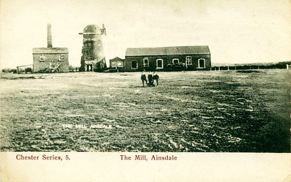
Ainsdale is a village near Southport, in the Metropolitan Borough of Sefton, Sefton district, in Merseyside, England, situated three miles south of the centre of Southport. Originally in the Historic counties of England, historic county of Lancashire, at the United Kingdom Census 2001, 2001 Census it had a population of 12,723. By the time of the 2011 census, only figures for Ainsdale (ward) were available. It makes up the southern edge of the town, separated from neighbouring Formby by RAF Woodvale. The village and roads leading to the beach are middle class areas, with some new modern developments around the station, including the addition of the private estate Village Row in 2006, and the Belway estate in 2013. History Prior to 1600 Ainsdale was listed in the ''Domesday Book'' as ''Einulvesdel''. Deriving from Old Norse name ''Einulfsdalr'', this apparently was the valley occupied by a Scandinavian by the name of Einulf. 1600–present Ainsdale formed part of Sir Cuthbert Ha ... [...More Info...] [...Related Items...] OR: [Wikipedia] [Google] [Baidu] |
Blowick
Blowick is a suburb on the east side of the town of Southport, Merseyside, England. History and etymology Blowick is part of the ancient parish of North Meols and was formerly a detached settlement, on the northern fringe of what is now Southport. The name derives from the Old Norse name ''Bla Vik'' meaning "dark bay" as it was located at the end of a large inlet on the ancient lake of Martin Mere called "The Wyke" which ended roughly at Crowland Street and drained into the Old Pool. There are historically two Blowicks: Higher Blowick, situated around what is now the junction of Everard Road and Southbank Road, and Lower Blowick (Butts Lane, Norwood Road, etc.), which is the area around what locals tend to refer to now as simply Blowick. The countryside on which the nearby Kew Housing Estate is built on what was known as Blowick Moss, and a local road on the estate is known as Blowick Moss Lane. Landmarks The Southport gas holder on Crowland Street was the tallest building o ... [...More Info...] [...Related Items...] OR: [Wikipedia] [Google] [Baidu] |
Metropolitan Borough Of Sefton
The Metropolitan Borough of Sefton is a metropolitan borough of Merseyside, England. It was formed on Local Government Act 1972, 1 April 1974, by the amalgamation of the county boroughs of Bootle and Southport, the municipal borough of Crosby, Merseyside, Crosby, the Urban district (Great Britain and Ireland), urban districts of Formby and Litherland, and part of West Lancashire Rural District. It consists of a Sefton Coast, coastal strip of land on the Irish Sea which extends from Southport in the north to Bootle in the south, and an inland part to Maghull in the south-east, bounded by the city of Liverpool to the south, the Metropolitan Borough of Knowsley to the south-east, and West Lancashire to the east. It is named after Sefton, Sefton, Sefton, near Maghull. When the borough was created, a name was sought that would not unduly identify the borough with any of its constituent parts, particularly the former county boroughs of Bootle and Southport. The area had strong links w ... [...More Info...] [...Related Items...] OR: [Wikipedia] [Google] [Baidu] |
Meols Cop
Meols Cop () is a small area within the Blowick suburb, in the coastal town of Southport, Merseyside Merseyside ( ) is a ceremonial counties of England, ceremonial and metropolitan county in North West England. It borders Lancashire to the north, Greater Manchester to the east, Cheshire to the south, the Wales, Welsh county of Flintshire across ... in north-western England. It is not a suburb or ward in its own right. It is not to be confused with Meols on the Wirral Peninsula. The two can be differentiated by pronunciation — Meols Cop is pronounced ''Meels'', but Meols, Wirral is pronounced ''Mells''. The area is served by station of the same name with trains to Southport railway station or Wigan Wallgate railway station and beyond. Meols Cop railway station opened on 2 September 1887, and served both lines. The line from Butts Lane Junction to closed on 26 September 1938, but the line through Meols Cop is still open today. As in 1965, the direct line from ... [...More Info...] [...Related Items...] OR: [Wikipedia] [Google] [Baidu] |
Hillside, Merseyside
Hillside is a residential suburb of the seaside town of Southport, England. It is surrounded by Birkdale, a former town in its own right, but part of Southport itself since amalgamation in 1912. It takes its name from a building named Hill Side, clearly evident on early maps. There was also Hillside Farm, part of which still survives on Hillside Golf Course. The original Birkdale station was in Hillside, situated at the present junction of Dunkirk Road and Dover Road. Transport There are good networks of transport to Hillside. Rail A popular method of transport is via the Hillside railway station, which opened in May 1926 links the suburb with Southport and Liverpool. The station is very popular in the golfing season or when the Golf Open Championship is held at the Royal Birkdale Golf Club as Hillside station is the nearest train station to Royal Birkdale. Road There are two A roads that run through or close to the suburb, these being the A565 road and the A5267 road. Bu ... [...More Info...] [...Related Items...] OR: [Wikipedia] [Google] [Baidu] |
Crossens
Crossens is the northernmost district of the town of Southport, Merseyside, England. Historically part of the ancient parish of North Meols and entirely in Lancashire, most of Crossens was transferred to Merseyside on 1 April 1974, when local government boundaries were reorganised nationally. Part of northern Crossens, known as Fiddlers Ferry, is in West Lancashire. Formerly, the village was a detached settlement lying on the western edge of Martin Mere, but after the drainage of the Mere and the expansion of Southport, it had become absorbed into the town's conurbation. History Formerly ''Crossenes'' or ''Crosnes'', meaning a “ness” or headland with a cross. The cross was possibly a guide for shipping or people crossing the Ribble Estuary from Freckleton (near Lytham). A hospice or lodging house was sited in Crossens where travellers could rest after making the crossing. It is also believed to be the point at which 2,000 horsemen from a retreating Royalist force crossed ... [...More Info...] [...Related Items...] OR: [Wikipedia] [Google] [Baidu] |


