|
Skålværet
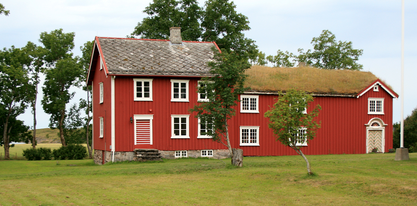
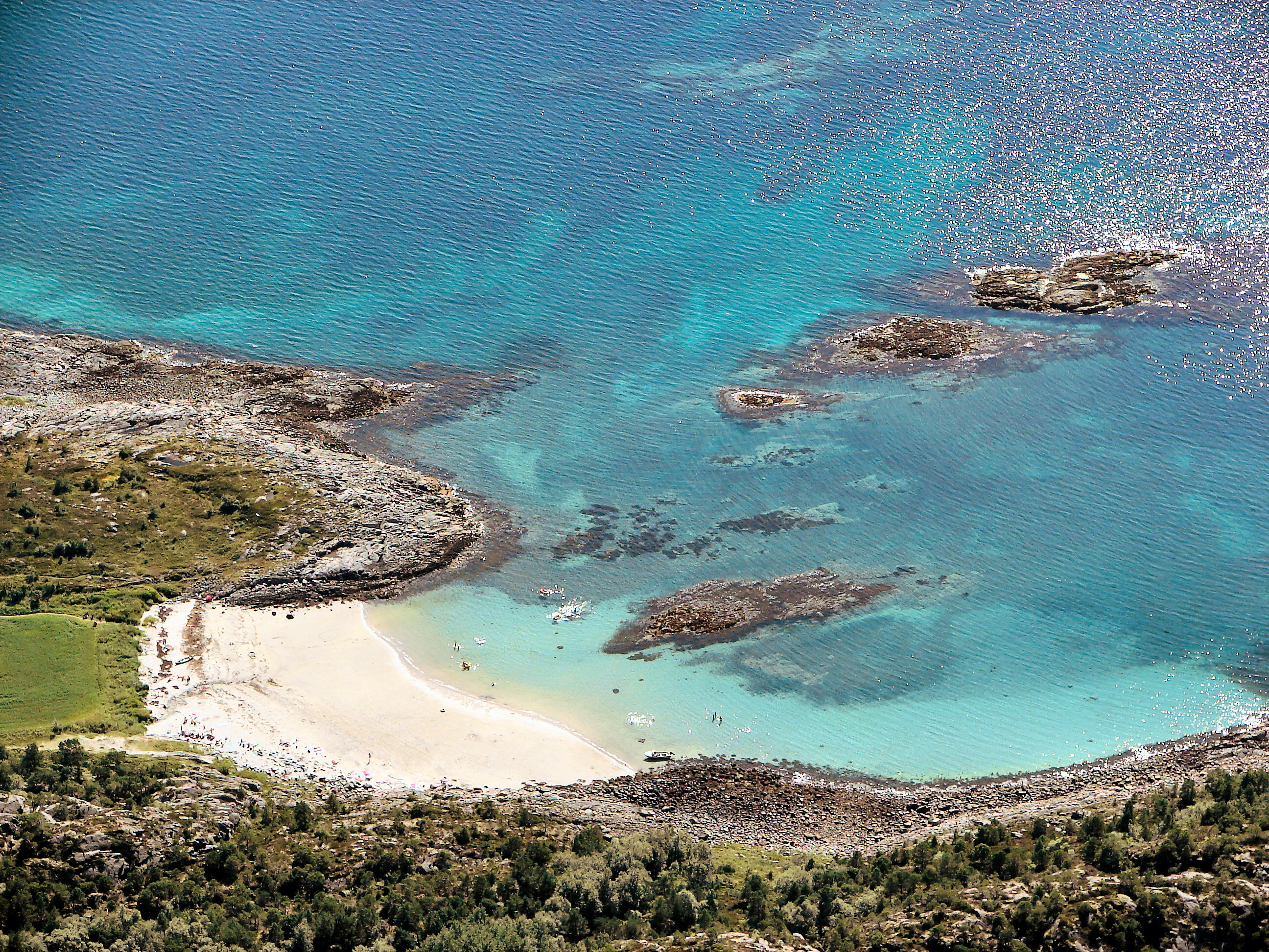
Skålværet are a group of islands in Alstahaug Municipality in Nordland county, Norway. The islands are located in the western part of Alstahaug, about northwest of the island of Tjøtta, just west of the southern tip of the island of Altra, and about south of the village of Silvalen (in Herøy Municipality). The islands were formerly a part of Vega Municipality, but in 1971 it was transferred to Alstahaug Municipality. Skålværet was once a thriving trading post and had many residents, but it has since declined in importance. Today, much of Skålværet is an outdoor recreation area for Alstahaug Municipality. In addition, there are about fifteen private houses and cottages scattered around the main island. Since 2007, there are no longer any permanent residents on Skålværet, but the place is far from abandoned. Summer residents live on the island, and Skålvær Church holds services on the island infrequently. See also *List of islands of Norway This is a list of isl ... [...More Info...] [...Related Items...] OR: [Wikipedia] [Google] [Baidu] |
Alstahaug
Alstahaug is a List of municipalities of Norway, municipality in Nordland Counties of Norway, county, Norway. It is part of the Helgeland Districts of Norway, region. The administrative centre of the municipality is the town of Sandnessjøen. Some of the villages in Alstahaug include Søvika and Tjøtta. Most residents of Alstahaug live in the town of Sandnessjøen which is situated on the island of Alsta. The characteristic De syv søstre, Seven Sisters mountain range is found on the eastern part of the island. Local legend has made this chain of peaks into seven sisters, two adjacent peaks representing twin sisters. The island is connected to the mainland via the large Helgeland Bridge along Norwegian County Road 17. The Sandnessjøen Airport, Stokka is located south of Sandnessjøen. The municipality is the 308th largest by area out of the 357 municipalities in Norway. Alstahaug is the 137th most populous municipality in Norway with a population of 7,421. The municipalit ... [...More Info...] [...Related Items...] OR: [Wikipedia] [Google] [Baidu] |
Alstahaug Municipality
Alstahaug is a municipality in Nordland county, Norway. It is part of the Helgeland region. The administrative centre of the municipality is the town of Sandnessjøen. Some of the villages in Alstahaug include Søvika and Tjøtta. Most residents of Alstahaug live in the town of Sandnessjøen which is situated on the island of Alsta. The characteristic Seven Sisters mountain range is found on the eastern part of the island. Local legend has made this chain of peaks into seven sisters, two adjacent peaks representing twin sisters. The island is connected to the mainland via the large Helgeland Bridge along Norwegian County Road 17. The Sandnessjøen Airport, Stokka is located south of Sandnessjøen. The municipality is the 308th largest by area out of the 357 municipalities in Norway. Alstahaug is the 137th most populous municipality in Norway with a population of 7,421. The municipality's population density is and its population has increased by 0.4% over the previous 1 ... [...More Info...] [...Related Items...] OR: [Wikipedia] [Google] [Baidu] |
Nordland
Nordland (; , , , ) is one of the three northernmost Counties of Norway, counties in Norway in the Northern Norway region, bordering Troms in the north, Trøndelag in the south, Norrbotten County in Sweden to the east, Västerbotten County to the south-east, and the Atlantic Ocean (Norwegian Sea) to the west. The county was formerly known as ''Nordlandene amt''. The county administration is in the Bodø (town), town of Bodø. The remote Arctic island of Jan Mayen has been administered from Nordland since 1995. In the southern part of the county is Vega Municipality, Vega, listed on the UNESCO World Heritage Site list. Districts The county is divided into traditional districts. These are Helgeland in the south (south of the Arctic Circle), Salten in the centre, and Ofoten in the north-east. In the north-west lie the archipelagoes of Lofoten and Vesterålen. Geography Nordland is located along the northwestern coast of the Scandinavian Peninsula in Northern Norway. Due to t ... [...More Info...] [...Related Items...] OR: [Wikipedia] [Google] [Baidu] |
Norway
Norway, officially the Kingdom of Norway, is a Nordic countries, Nordic country located on the Scandinavian Peninsula in Northern Europe. The remote Arctic island of Jan Mayen and the archipelago of Svalbard also form part of the Kingdom of Norway. Bouvet Island, located in the Subantarctic, is a Dependencies of Norway, dependency, and not a part of the Kingdom; Norway also Territorial claims in Antarctica, claims the Antarctic territories of Peter I Island and Queen Maud Land. Norway has a population of 5.6 million. Its capital and largest city is Oslo. The country has a total area of . The country shares a long eastern border with Sweden, and is bordered by Finland and Russia to the northeast. Norway has an extensive coastline facing the Skagerrak strait, the North Atlantic Ocean, and the Barents Sea. The unified kingdom of Norway was established in 872 as a merger of Petty kingdoms of Norway, petty kingdoms and has existed continuously for years. From 1537 to 1814, Norway ... [...More Info...] [...Related Items...] OR: [Wikipedia] [Google] [Baidu] |
Norwegian Mapping Authority
The Norwegian Mapping Authority (NMA) () is Norway's national mapping agency, dealing with land surveying, geodesy Geodesy or geodetics is the science of measuring and representing the Figure of the Earth, geometry, Gravity of Earth, gravity, and Earth's rotation, spatial orientation of the Earth in Relative change, temporally varying Three-dimensional spac ..., hydrographic surveying, cadastre and cartography. The current director is Johnny Welle. Its headquarters are in Hønefoss in Ringerike Municipality. It is a public agency under the Ministry of Local Government and Regional Development. NMA was founded in 1773. The Norwegian Mapping Authority participates in research and development and cooperates with Norwegian industry and other government agencies in areas such as export-oriented measures. Tasks The NMA carries out the following tasks: *Define frameworks, methodologies and specifications for the Norwegian Spatial Data Infrastructure *Administrator and drivin ... [...More Info...] [...Related Items...] OR: [Wikipedia] [Google] [Baidu] |
Tjøtta (island)
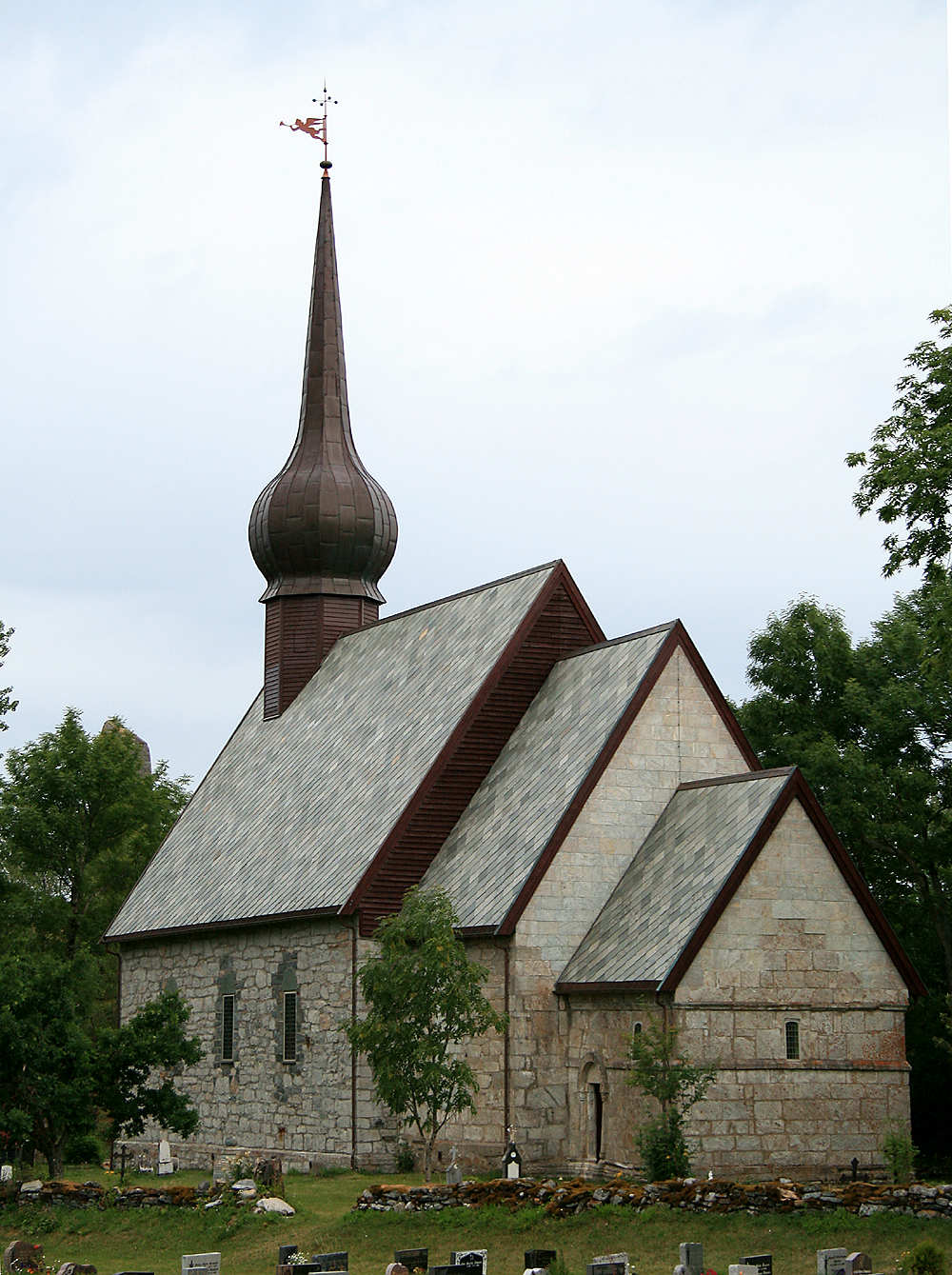
Tjøtta is an island in Alstahaug Municipality in Nordland county, Norway. The island lies at the entrance to the Vefsnfjorden, just south of the island of Alsta. The U-shaped island is relatively flat, and the highest point is the tall Kalvberghaugen, just east of the village of Tjøtta. The island has two main villages on it: Tjøtta and Svinnes. The Norwegian County Road 17 crosses the island and it connects it to the neighboring islands of Offersøya and Alsta by two causeways. History Tjøtta has one of the largest and oldest Iron Age farms in Northern Norway, and hardly any places in the region have this many historical relics preserved in one limited area. The chief Hårek of Tjøtta was from here. He was known in the stories of Snorre Sturlason as the governor of Hålogaland. The island was historically the centre of Tjøtta Municipality which existed from 1862 until 1965. Gullhaugen Gullhaugen is located on Tjøtta. The name comes from the Old Norse word ''haugr'' me ... [...More Info...] [...Related Items...] OR: [Wikipedia] [Google] [Baidu] |
Altra, Nordland
Altra is an island in Alstahaug Municipality in Nordland county, Norway. The island lies between the large island of Alsta and the small island of Tenna (in Herøy Municipality). The flat island is rather unusual in the area because it is about long and at most about wide at the northern end. Most of the island is very narrow, and in some places, it is only about wide. There are a few small villages on the island: Austbø in the north, Korsvegen and Blomsøya in the middle, and Hestøya in the south. The island has a regular ferry connection to the neighboring islands of Alsta and Sør-Herøy. In 2016, there were 76 residents living on the island. See also *List of islands of Norway This is a list of islands of Norway sorted by name. For a list sorted by area, see List of islands of Norway by area. A * Alden * Aldra * Algrøy * Alsta * Altra * Anda * Andabeløya * Andørja * Andøya, Vesterålen * Andøya, Agder ... References Alstahaug Islands of ... [...More Info...] [...Related Items...] OR: [Wikipedia] [Google] [Baidu] |
Silvalen
Silvalen or Herøyholmen is the administrative centre of Herøy Municipality in Nordland county, Norway. The village is located on two different islands, Nord-Herøy and Sør-Herøy, with the Herøysundet strait running between them. The Herøysundet Bridge crosses the strait, connecting both sides of the village. Herøy Church is located in the southern part of the village. The village has a population (2024) of 860 and a population density Population density (in agriculture: Standing stock (other), standing stock or plant density) is a measurement of population per unit land area. It is mostly applied to humans, but sometimes to other living organisms too. It is a key geog ... of . References Villages in Nordland Herøy, Nordland {{Nordland-geo-stub ... [...More Info...] [...Related Items...] OR: [Wikipedia] [Google] [Baidu] |
Herøy Municipality (Nordland)
Herøy is a municipality in Nordland county, Norway. It is part of the Helgeland traditional region. The administrative centre of the municipality is the village of Silvalen. The island municipality is located about west of the town of Sandnessjøen. The municipality is the 344th largest by area out of the 357 municipalities in Norway. Herøy is the 291st most populous municipality in Norway with a population of 1,842. The municipality's population density is and its population has increased by 6.3% over the previous 10-year period. General information The municipality of Herøy was established in 1864 when it was separated from Alstahaug Municipality. Initially the population of Herøy was 2,438. On 1 July 1917, the northern district of Herøy (population: 1,530) was separated from Herøy to become the new Nordvik Municipality. This left Herøy with 2,555 residents. During the 1960s, there were many municipal mergers across Norway due to the work of the Schei Committee. ... [...More Info...] [...Related Items...] OR: [Wikipedia] [Google] [Baidu] |
Vega Municipality
Vega is a municipality in Nordland county, Norway. It is part of the Helgeland traditional region. The administrative centre of the municipality is the village of Gladstad. Other villages include Holand and Ylvingen. The municipality comprises about 6,500 islands in the Vega Archipelago. The main island of the municipality is the island of Vega, and it is also the largest at . Bremstein Lighthouse is located in the southwestern part of the municipality. The municipality is the 315th largest by area out of the 357 municipalities in Norway. Vega is the 321st most populous municipality in Norway with a population of 1,208. The municipality's population density is and its population has decreased by 1.2% over the previous 10-year period. General information The municipality of Vega was established on 1 January 1838 (see formannskapsdistrikt law). On 1 January 1965, the Skogsholmen area (population: 196) was transferred from Tjøtta Municipality to Vega Municipality. Then on ... [...More Info...] [...Related Items...] OR: [Wikipedia] [Google] [Baidu] |
Skålvær Church
Skålvær Church () is a parish church of the Church of Norway in Alstahaug Municipality in Nordland county, Norway. It is located on the island of Skålvær. It is one of the churches for the Tjøtta parish which is part of the Nord-Helgeland prosti (deanery) in the Diocese of Sør-Hålogaland. The white, wooden church was built in a long church style in 1889 using plans drawn up by the architect Nils Kristian Andersen. The church seats about 200 people. History In 1882, the people of Skålvær began talking and planning for a church in Skålvær. In 1888, the church building committee purchased the materials from the old Malm Church in Trøndelag. The old church was being replaced and most of the materials were still in good condition. Nils Kristian Andersen from Tjøtta was hired as the builder with the completion deadline of August 1889. The new building was consecrated on 6 September 1889. The parish decided that the church would have 11 worship services each year (roug ... [...More Info...] [...Related Items...] OR: [Wikipedia] [Google] [Baidu] |


