|
Shorne
Shorne is a village and civil parish in the borough of Gravesham in Kent, England. The parish lies east of Gravesend. Most of the land is well-drained but its marshes, the Shorne Marshes reach down to the Thames Estuary and are an SSSI amid the North Kent Marshes on the Hoo Peninsula proper. History Shorne Barrow (or tumulus) and Randalls Wood Barrow are indications of Stone Age occupation. Randall Manor was a 14th-century manor, the remains of which are in Shorne Woods Country Park. Demographics According to the census results for 2001 there were 2,485 people in 1,028 households in the Parish of Shorne. Of those residents between the ages of 16 and 74, 60% had a higher qualification (at level 2 to 5) and 86% of the dwellings were owner occupied. The population of Shorne Parish at the 2011 census was 2487 residents in 1033 households. Transport In April 2017, it was announced that the government choice for the Lower Thames Crossing was for a tunnel under the Thames between ... [...More Info...] [...Related Items...] OR: [Wikipedia] [Google] [Baidu] |
Shorne Woods Country Park
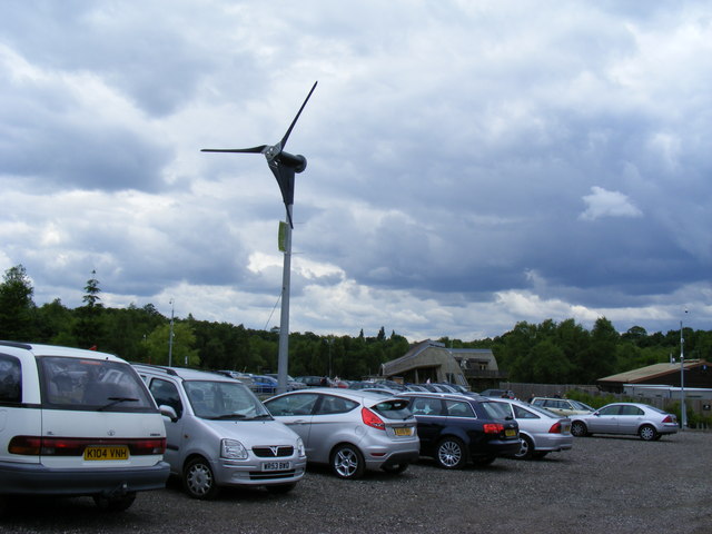
Shorne Woods Country Park is located between Strood and Gravesend, in the English county of Kent. It was once part of a large estate, later passed to the county council to be used as a country park. History This park was once part of the large Cobham Hall Estate. The main entrance to the Hall leads through the park, with various other carriage rides around the estate. Then from the 1930s to the 1970s, part of the estate was leased by Lord Darnley, and was used for clay extraction by a cement company, drawing from a clay pit beneath the ancient woodland. Then in 1987, Kent County Council took ownership of the of land, and with the help of Gravesham Borough Council, it was turned into a country park and opened to the public. Facilities It has large areas of ancient woodland and heathland meadows. The former claypit is being returned to nature (with woodland and wetland areas). The wetland ponds have many species of dragonflies, which breed in the park. A large part of the park ... [...More Info...] [...Related Items...] OR: [Wikipedia] [Google] [Baidu] |
Gravesham
Gravesham ( ) is a local government district with borough status in north-west Kent, England. The council is based in its largest town of Gravesend. The borough is indirectly named after Gravesend, using the form of the town's name as it appeared in the Domesday Book of 1086. The district also contains Northfleet and a number of villages and surrounding rural areas. Parts of the borough lie within the Kent Downs, a designated Area of Outstanding Natural Beauty. The neighbouring districts are Dartford, Sevenoaks, Tonbridge and Malling, and Medway, plus Thurrock on the opposite side of the River Thames. Gravesham is twinned with Cambrai in Hauts-de-France, France and Neumünster in Schleswig-Holstein, Germany. The Gravesham parliamentary constituency covers the same area as the borough. History The first borough in the area of modern Gravesham was "Gravesend and Milton", an ancient borough which had been incorporated in 1568 by Elizabeth I. The borough had been reformed in 18 ... [...More Info...] [...Related Items...] OR: [Wikipedia] [Google] [Baidu] |
Lower Thames Crossing
The Lower Thames Crossing is a planned road crossing of the Thames estuary downstream of the Dartford Crossing that links the counties of Kent and Essex, and its proposed approaches. When built it will pass through the districts of Thurrock and Gravesham, supplementing the Dartford route. First proposed in the late 2000s, the crossing is designed to relieve the pressure on the existing A282 Dartford Crossing. The proposed route would connect the M25 motorway and A13 north of the river to the M2 motorway south of the river. If built, the crossing would have the longest road tunnel in the UK at . The road number A122 has been reserved for the new road. The crossing is estimated to cost approximately £9 billion and would take about six years to build following the granting of planning permission. A planning application was submitted in 2020, and withdrawn. A new planning application was submitted in November 2022; the planning process was expected to take 18 months, but th ... [...More Info...] [...Related Items...] OR: [Wikipedia] [Google] [Baidu] |
Gravesend, Kent
Gravesend is a town in northwest Kent, England, situated 21 miles (35 km) east-southeast of Charing Cross (central London) on the Bank (geography), south bank of the River Thames, opposite Tilbury in Essex. Located in the diocese of Rochester, it is the administrative centre of the borough of Gravesham. Gravesend marks the eastern limit of the Greater London Built-up Area, as defined by the UK Office for National Statistics. It had a population of 58,102 in 2021. Its geographical situation has given Gravesend strategic importance throughout the maritime history, maritime and History of communication, communications history of South East England. A Thames Gateway commuter town, it retains strong links with the River Thames, not least through the Port of London Authority Pilot Station, and has witnessed rejuvenation since the advent of High Speed 1 rail services via Gravesend railway station. The station was recently refurbished and has a new bridge. Name Recorded as Graves ... [...More Info...] [...Related Items...] OR: [Wikipedia] [Google] [Baidu] |
Gravesham (UK Parliament Constituency)
Gravesham () is a British parliamentary constituency in Kent, represented by Lauren Sullivan of the Labour Party since the 2024 general election. Constituency profile The seat covers the historic riverside town of Gravesend and a more rural area extending to Higham and Vigo Village on the North Downs. The electorate voted strongly to leave in the 2016 EU referendum. Health and wealth are roughly average for the UK. Boundaries 1983–present: The Borough of Gravesham wards of: Central; Chalk; Coldharbour; Higham; Istead Rise; Meopham North; Meopham South and Vigo; Northfleet North; Northfleet South; Painters Ash; Pelham; Riverside; Riverview; Shorne, Cobham and Luddesdown; Singlewell; Westcourt, Whitehill; Woodlands. Since the constituency's creation, its boundaries have been co-terminous with those of the Borough of Gravesham. The largest town in the constituency is Gravesend. The 2023 periodic review of Westminster constituencies left the boundaries unchanged. Histor ... [...More Info...] [...Related Items...] OR: [Wikipedia] [Google] [Baidu] |
Thames Estuary
The Thames Estuary is where the River Thames meets the waters of the North Sea, in the south-east of Great Britain. Limits An estuary can be defined according to different criteria (e.g. tidal, geographical, navigational or in terms of salinity). For this reason the limits of the Thames Estuary have been defined differently at different times and for different purposes. Western This limit of the estuary has been defined in two main ways: * The narrow estuary is strongly tidal and is known as the Tideway. It starts in south-west London at Teddington Lock and weir, Teddington/Ham, London, Ham. This point is also mid-way between Richmond Lock which only keeps back a few miles of human-made head (hydrology), head (stasis) of water during low tide and the extreme modern-era head at Thames Ditton Island on Kingston upon Thames, Kingston reach where slack water occurs at maximal high tide in times of rainfall-caused flooded banks. In terms of salinity the transition from freshwater t ... [...More Info...] [...Related Items...] OR: [Wikipedia] [Google] [Baidu] |
North Kent Marshes
The North Kent Marshes are in the far north of the county of Kent spanning dry and wet south banks and inlets of the Thames Estuary in south-east England. The marshes are one of 22 environmentally sensitive areas recognised by the UK's Department for Environment, Food and Rural Affairs (DEFRA). They are in the Thames Gateway regional planning area.TGKP Working Document 2. 26 Nov 2002 They include the South Thames Estuary and Marshes biological SSSI. Governance The marshes are nearly contiguous and span the districts of Dartford, Gravesham, Medway, Swale and Canterbury. They are protected in the Kent and Medway Structure Plan. In successive Local Plans, required by UK Planning Law they have been included, regard being had to their environmental benefit. The marshes serve as emergency natural flood protection for London. Ecology Most of the northern edge of Kent, west of the relatively modest Thanet peninsula, has been marshland for millennia. Steeper gravel beaches wit ... [...More Info...] [...Related Items...] OR: [Wikipedia] [Google] [Baidu] |
Civil Parishes In Kent
Civil may refer to: *Civility, orderly behavior and politeness *Civic virtue, the cultivation of habits important for the success of a society *Civil (journalism) ''The Colorado Sun'' is an online news outlet based in Denver, Colorado. It launched on September 10, 2018, to provide long-form, in-depth coverage of news from all around Colorado. It was started with two years of funding from blockchain ventu ..., a platform for independent journalism * Civil (surname) See also * {{Disambiguation ... [...More Info...] [...Related Items...] OR: [Wikipedia] [Google] [Baidu] |
Magistrate
The term magistrate is used in a variety of systems of governments and laws to refer to a civilian officer who administers the law. In ancient Rome, a '' magistratus'' was one of the highest ranking government officers, and possessed both judicial and executive powers. In other parts of the world, such as China, magistrate is a word applied to a person responsible for administration over a particular geographic area. Today, in some jurisdictions, a magistrate is a judicial officer who hears cases in a lower court, and typically deals with more minor or preliminary matters. In other jurisdictions (e.g., England and Wales), magistrates are typically trained volunteers appointed to deal with criminal and civil matters in their local areas. Original meaning In ancient Rome, the word '' magistratus'' referred to one of the highest offices of state. Analogous offices in the local authorities, such as '' municipium'', were subordinate only to the legislature of which they generally ... [...More Info...] [...Related Items...] OR: [Wikipedia] [Google] [Baidu] |
Listed Building
In the United Kingdom, a listed building is a structure of particular architectural or historic interest deserving of special protection. Such buildings are placed on one of the four statutory lists maintained by Historic England in England, Historic Environment Scotland in Scotland, in Wales, and the Historic Environment Division of the Department for Communities in Northern Ireland. The classification schemes differ between England and Wales, Scotland, and Northern Ireland (see sections below). The term has also been used in the Republic of Ireland, where buildings are protected under the Planning and Development Act 2000, although the statutory term in Ireland is "Record of Protected Structures, protected structure". A listed building may not be demolished, extended, or altered without permission from the local planning authority, which typically consults the relevant central government agency. In England and Wales, a national amenity society must be notified of any work to ... [...More Info...] [...Related Items...] OR: [Wikipedia] [Google] [Baidu] |
Conservation Area
Protected areas or conservation areas are locations which receive protection because of their recognized natural or cultural values. Protected areas are those areas in which human presence or the exploitation of natural resources (e.g. firewood, non-timber forest products, water, ...) is limited. The term "protected area" also includes marine protected areas and transboundary protected areas across multiple borders. As of 2016, there are over 161,000 protected areas representing about 17 percent of the world's land surface area (excluding Antarctica). For waters under national jurisdiction beyond inland waters, there are 14,688 Marine Protected Areas (MPAs), covering approximately 10.2% of coastal and marine areas and 4.12% of global ocean areas. In contrast, only 0.25% of the world's oceans beyond national jurisdiction are covered by MPAs. In recent years, the 30 by 30 initiative has targeted to protect 30% of ocean territory and 30% of land territory worldwide by 2030; t ... [...More Info...] [...Related Items...] OR: [Wikipedia] [Google] [Baidu] |


