|
Owens Lake
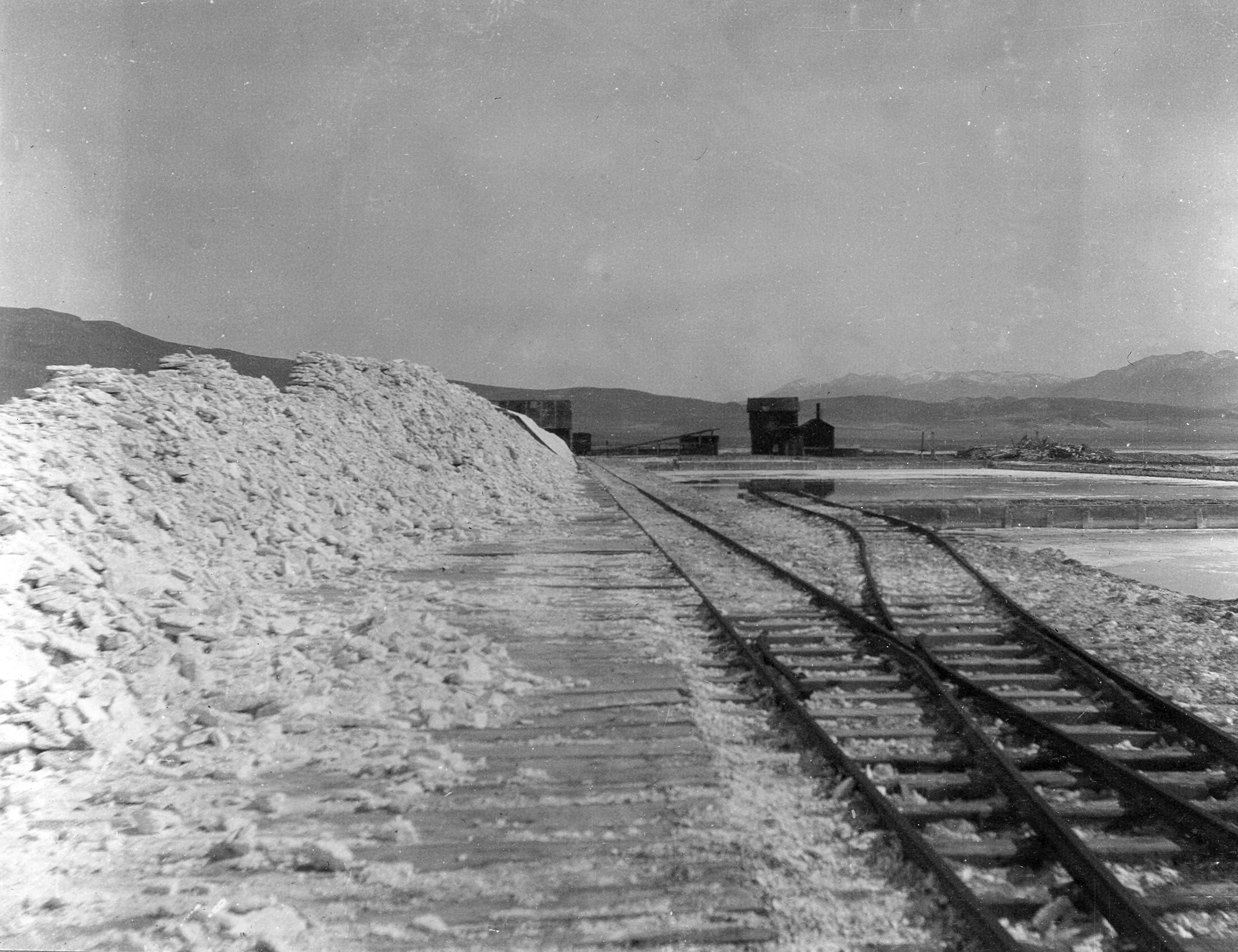
Owens Lake is a dry lake in the Owens Valley on the eastern side of the Sierra Nevada in Inyo County, California. It is about south of Lone Pine. Unlike most dry lakes in the Basin and Range Province that have been dry for thousands of years, Owens held significant water until 1913, when much of the Owens River was diverted into the Los Angeles Aqueduct, causing the lake to desiccate by 1926. In 2006, 5% of the water flow was restored. As of 2013, it is the largest single source of dust pollution in the United States, and has been known since at least the 1990s as a pervasive source of fine alkaline dust containing harmful levels of particulates and chemicals. History Owens Lake was given its present name by the explorer John C. Frémont, in honor of one of his guides, Richard Owens. The lake is called ''Patsiata'' by the Mono people. During the late Pleistocene, Owens Lake could reach a depth of and formed part of an interconnected series of seven lakes, hundreds of mi ... [...More Info...] [...Related Items...] OR: [Wikipedia] [Google] [Baidu] |
Whitney Portal
Whitney Portal (formerly Hunter Flat and Hunters Camp) is the end of the Whitney Portal road in Inyo County, California, west of Lone Pine, California, Lone Pine at an elevation of . Whitney Portal is the gateway to Mount Whitney, the highest point in the contiguous United States; it is the trailhead for the Mount Whitney Trail. It is also the trailhead for mountaineering routes such as the East Face (Mount Whitney), first climbed in 1931, and the Mountaineer's Route, first climbed by John Muir in 1873. Campgrounds, parking lots, bearproof food storage facilities, a store and a restaurant are located at Whitney Portal. The restaurant is known for serving "obscenely large pancakes, one-inch thick and large enough to be a hubcab on a tractor". as well as a variety of burgers, fries and beers. History A road reached Whitney Portal in 1936. Previously, the place was called Hunter Flat in honor of William L. Hunter, an Owens Valley pioneer. In media The road was used in scenes i ... [...More Info...] [...Related Items...] OR: [Wikipedia] [Google] [Baidu] |
Owens Valley Paiute
The Mono ( ) are a Native American people who traditionally live in the central Sierra Nevada, the Eastern Sierra (generally south of Bridgeport), the Mono Basin, and adjacent areas of the Great Basin. They are often grouped under the historical label "Paiute" together with the Northern Paiute and Southern Paiute – but these three groups, although related within the Numic group of Uto-Aztecan languages, do not form a single, unique, unified group of Great Basin tribes. Today, many of the tribal citizens and descendants of the Mono tribe inhabit the town of North Fork (thus the label "Northfork Mono") in Madera County. People of the Mono tribe are also spread across California in: the Owens River Valley; the San Joaquin Valley and foothills areas, especially Fresno County; and in the San Francisco Bay Area. Tribal groups The Mono lived on both sides of the Sierra Nevada and are divided into two regional tribal/dialect groups, roughly based on the Sierra crest: * Eastern Mo ... [...More Info...] [...Related Items...] OR: [Wikipedia] [Google] [Baidu] |
Owens River Gorge
The Owens River Gorge is a steep 10 mi (16 km) canyon on the upper Owens River in eastern California in the United States. The canyon is located at the eastern edge of the Sierra Nevada mountains in southern Mono County, along the stretch of the river where it exits the Long Valley near its source and enters the north end of Owens Valley. The gorge is a popular destination for rock climbing. Geology The Owens River Gorge was formed when the Owens River cut through the Bishop Tuff: a layer of welded ash formed from the eruption of the Long Valley Caldera. This erosion exposed the tuff layers, including rare columnar rhyolite formations. Water restoration The Los Angeles Department of Water and Power constructed the Long Valley Dam at the head of the Owens River Gorge as part of a hydropower project in 1941, and completely dewatered the 16-km Lower Gorge reach from 1953 to 1991. Beginning in 1991, a limited range of flows has been released to rewater the reach, recreat ... [...More Info...] [...Related Items...] OR: [Wikipedia] [Google] [Baidu] |
Flood Control
Flood management or flood control are methods used to reduce or prevent the detrimental effects of flood waters. Flooding can be caused by a mix of both natural processes, such as extreme weather upstream, and human changes to waterbodies and runoff. Flood management methods can be either of the ''structural'' type (i.e. flood control) and of the ''non-structural'' type. Structural methods hold back floodwaters physically, while non-structural methods do not. Building hard infrastructure to prevent flooding, such as flood walls, is effective at managing flooding. However, it is best practice within landscape engineering to rely more on soft infrastructure and Nature-based solutions, natural systems, such as marshes and Floodplain, flood plains, for handling the increase in water. Flood management can include ''flood risk management,'' which focuses on measures to reduce risk, vulnerability and exposure to flood disasters and providing risk analysis through, for example, flood ris ... [...More Info...] [...Related Items...] OR: [Wikipedia] [Google] [Baidu] |
Lake Crowley
Crowley Lake is a reservoir on the upper Owens River in southern Mono County, California, in the United States. Crowley Lake is south of Mammoth Lakes. The lake was created in 1941 by the building of the Long Valley Dam by the Los Angeles Department of Water and Power (DWP), as storage for the Los Angeles Aqueduct and for flood control. The dam is high and impounds . For more on the history of the lake, see Owens Lake. It is known for its trout fishing. Between 6,000 and 10,000 anglers hit the lake on opening day. Crowley Lake Fish Camp, run in cooperation with the Los Angeles Department of Water and Power, is the only way to access the lake, and visitors can rent boats, book camping sites, and buy supplies at the Fish Camp. The lake is named after Fr. John J. Crowley, "the desert Padre", who was a key figure in Owens Valley history and a local hero. When it became obvious that the city of Los Angeles's appropriation of the water supply had made agriculture impossible in the ... [...More Info...] [...Related Items...] OR: [Wikipedia] [Google] [Baidu] |
Long Valley Dam
Long may refer to: Measurement * Long, characteristic of something of great duration * Long, characteristic of something of great length * Longitude (abbreviation: long.), a geographic coordinate * Longa (music), note value in early music mensural notation Places Asia * Long District, Laos * Long District, Phrae, Thailand * Longjiang (other) or River Long (lit. "dragon river"), one of several rivers in China * Yangtze River or Changjiang (lit. "Long River"), China Elsewhere * Long, Somme, France People * Long (Chinese surname) * Long (Western surname) Fictional characters * Long (''Bloody Roar''), in the video game series * Long, Aeon of Permanence in Honkai: Star Rail Sports * Long, a fielding term in cricket * Long, in tennis and similar games, beyond the service line during a serve and beyond the baseline during play Other uses * , a U.S. Navy ship name * Long (finance), a position in finance, especially stock markets * Lòng, name for a laneway in Sh ... [...More Info...] [...Related Items...] OR: [Wikipedia] [Google] [Baidu] |
Aqueduct (water Supply)
An aqueduct is a watercourse constructed to carry water from a source to a distribution point far away. In modern engineering, the term ''aqueduct'' is used for any system of pipes, ditches, canals, tunnels, and other structures used for this purpose. The term ''aqueduct'' also often refers specifically to aqueduct (bridge), a bridge carrying an artificial watercourse. Aqueducts were used in ancient Greece, the ancient Near East, Roman aqueduct, ancient Rome, Chapultepec aqueduct, ancient Aztec, and Inca aqueducts, ancient Inca. The simplest aqueducts are small ditches cut into the earth. Much larger channels may be used in modern aqueducts. Aqueducts sometimes run for some or all of their path through tunnels constructed underground. Modern aqueducts may also use pipelines. Historically, agricultural societies have constructed aqueducts to irrigate crops and supply large cities with drinking water. Etymology The word ''aqueduct'' is derived from the Latin words (''water'') a ... [...More Info...] [...Related Items...] OR: [Wikipedia] [Google] [Baidu] |
Keeler, California
Keeler, formerly known as Hawley, is an unincorporated community in Inyo County, California, United States. Keeler is located on the east shore of Owens Lake south-southeast of New York Butte. The population was 71 people at the 2020 census, up from 66 at the 2010 census. For statistical purposes, the United States Census Bureau has defined Keeler as a census-designated place (CDP). History When the 1872 Lone Pine earthquake rendered the pier in nearby Swansea inaccessible by uplifting the shoreline, a new pier was constructed to the south at a community named Hawley. In 1880 a new mill was constructed at Hawley by the Owens Lake Mining and Milling Company for processing silver ore from the Cerro Gordo Mines in the mountains to the east. A town was laid out by the company agent Julius M. Keeler, for whom the town of Hawley was later renamed. The steamship ''Bessie Brady'' brought ore from Keeler across the lake to the town of Cartago. There was a at Keeler, and the steams ... [...More Info...] [...Related Items...] OR: [Wikipedia] [Google] [Baidu] |
Los Angeles Department Of Water And Power
The Los Angeles Department of Water and Power (LADWP) is the largest municipal Public utility, utility in the United States with 8,100 megawatts of electric generating capacity (2021–2022) and delivering an average of 435 million gallons of water per day (487,000 acre-ft per year) to more than four million residents and local businesses in the City of Los Angeles and several adjacent cities and communities in southwestern Los Angeles County, California. It was founded in 1902 to supply water to residents and businesses in the city of Los Angeles and several of its immediately adjacent communities. In 1917, LADWP began to deliver electric power, electricity to portions of the city. It has been involved in a number of controversies and media portrayals over the years, including the 1928 St. Francis Dam failure and the books ''Water and Power'' and ''Cadillac Desert''. History Private operators By the middle of the 19th century, Los Angeles's rapid population growth magnified p ... [...More Info...] [...Related Items...] OR: [Wikipedia] [Google] [Baidu] |
Mojave Desert
The Mojave Desert (; ; ) is a desert in the rain shadow of the southern Sierra Nevada mountains and Transverse Ranges in the Southwestern United States. Named for the Indigenous peoples of the Americas, indigenous Mohave people, it is located primarily in southeastern California and southwestern Nevada, with small portions extending into Arizona and Utah. The Mojave Desert, together with the Sonoran Desert, Sonoran, Chihuahuan Desert, Chihuahuan, and Great Basin Desert, Great Basin deserts, form a larger List of North American deserts, North American desert. Of these, the Mojave is the smallest and driest. It displays typical basin and range topography, generally having a pattern of a series of parallel mountain ranges and valleys. It is also the site of Death Valley, which is the lowest elevation in North America. The Mojave Desert is often colloquially called the "high desert", as most of it lies between . It supports a diversity of flora and fauna. The desert supports a numb ... [...More Info...] [...Related Items...] OR: [Wikipedia] [Google] [Baidu] |
China Lake, Kern County, California
China Lake is an unincorporated community in Kern County, California. It is located north-northeast of Ridgecrest, at an elevation of 2,264 feet (690 m). The place is on China Lake, a dry lake near the Naval Air Weapons Station China Lake. The first post office at China Lake opened in 1948. History Prehistory The locale was originally settled by the Coso People, who were prolific artisans in creating rock art. The Coso left archaeological evidence substantiating trade between the Coso and other Native American tribes. For example, distant trade with the Chumash People is confirmed by archaeological recovery of obsidian that has been linked to the Cosos and was discovered as far away as coastal California prehistoric sites in San Luis Obispo County. Early 1900s (origin of name) Chinese prospectors harvested borax from the dry lake bed approximately 1.5 miles south of Paxton Ranch. The operation was known locally as "The Little Chinese Borax Works". This led to the area be ... [...More Info...] [...Related Items...] OR: [Wikipedia] [Google] [Baidu] |
Ridgecrest, California
Ridgecrest is a city in Kern County, California, United States, along U.S. Route 395 in California, U.S. Route 395 in the Indian Wells Valley in northeastern Kern County, adjacent to the Naval Air Weapons Station China Lake (NAWS, or China Lake). It was incorporated as a city in 1963. The population was 27,959 at the 2020 United States census, 2020 census, up slightly from 27,616 at the 2010 United States Census, 2010 census, making it the third-largest city in Kern County. Ridgecrest is surrounded by four mountain ranges; the Sierra Nevada on the west, the Coso Range, Coso Range on the north, the Argus Range on the east, and the El Paso Mountains on the south. The most isolated community in Kern county, it is approximately from the Lancaster, California, Lancaster/Palmdale, California, Palmdale area, from Bakersfield, California, Bakersfield, and from San Bernardino, California, San Bernardino, the three nearest major urban centers. Private air travel in and out of the city i ... [...More Info...] [...Related Items...] OR: [Wikipedia] [Google] [Baidu] |


