|
Orton, Westmorland And Furness
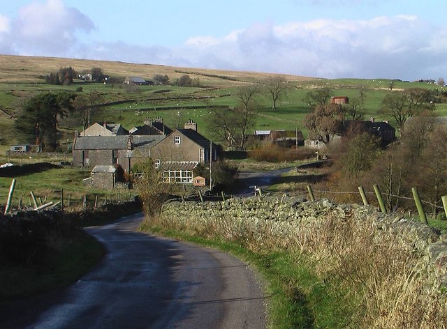
Orton is a village and civil parish in the Westmorland and Furness district, in the ceremonial county of Cumbria, England. It lies south of Penrith, from Appleby-in-Westmorland and from the M6 motorway. The village is in the upper Lune Valley, at the foot of Orton Scar in the Orton Fells. The Lake District is nearby. The parish includes a wide area outside the village, and had a population of 594 in 2001, decreasing to 588 at the 2011 Census. Until 1974 it was in Westmorland, from 1974 to 2023 it was in Eden district. Orton village Orton has many 17th and 18th-century cottages. Most of these traditional dwellings are stone-faced or whitewashed. Other features in the village are the 13th-century All Saints Church, a Methodist chapel, a primary school, a pub called the ''George Hotel'', and a small handmade-chocolate factory. In addition it has a Village Tearoom and several B&Bs. The shop-cum-post office is open ten hours a day. There are many local businesses around the v ... [...More Info...] [...Related Items...] OR: [Wikipedia] [Google] [Baidu] |
Westmorland And Furness
Westmorland and Furness is a Unitary authorities of England, unitary authority area in Cumbria, England. The economy is mainly focused on tourism around both the Lake District and Cumbria Coast, shipbuilding and the Royal Port of Barrow, Royal Port in Barrow-in-Furness, and agriculture in the rural parts of the area. The council area was formed on 1 April 2023, on the abolition of Cumbria County Council. The council covers the areas formerly served by the districts of Borough of Barrow-in-Furness, Barrow-in-Furness, Eden District, Eden, and South Lakeland, which also ceased to function. It includes all of the area of the historic county of Westmorland as well as the Furness district of historic Lancashire. It also incorporates a very small part of historic Yorkshire, together with about a quarter of the area of (but only 10% of the population of) the historic county of Cumberland. The other part of Cumbria, to the north and west, forms the unitary authority area of Cumberland (u ... [...More Info...] [...Related Items...] OR: [Wikipedia] [Google] [Baidu] |
Middle Ages
In the history of Europe, the Middle Ages or medieval period lasted approximately from the 5th to the late 15th centuries, similarly to the post-classical period of global history. It began with the fall of the Western Roman Empire and transitioned into the Renaissance and the Age of Discovery. The Middle Ages is the middle period of the three traditional divisions of Western history: classical antiquity, the medieval period, and the modern period. The medieval period is itself subdivided into the Early, High, and Late Middle Ages. Population decline, counterurbanisation, the collapse of centralised authority, invasions, and mass migrations of tribes, which had begun in late antiquity, continued into the Early Middle Ages. The large-scale movements of the Migration Period, including various Germanic peoples, formed new kingdoms in what remained of the Western Roman Empire. In the 7th century, North Africa and the Middle East—once part of the Byzantine Empire� ... [...More Info...] [...Related Items...] OR: [Wikipedia] [Google] [Baidu] |
A66 Road
The A66 is a major road in Northern England, which in part follows the course of the Roman road from Scotch Corner to Penrith. It runs from east of Middlesbrough in North Yorkshire to Workington in Cumbria. The road has been progressively improved with dual carriageway sections, but with stretches of single carriageway road. The road is set to be completely dualled between Scotch Corner and Penrith, with a £1.3 billion scheme being announced in March 2024. Route From its eastern terminus between Redcar and Middlesbrough it runs past Stockton-on-Tees and Darlington mainly as two-lane dual-carriageway and single carriageway past Darlington, becoming motorway standard as the A66(M) shortly before meeting junction 57 of the A1(M). It shares the A1(M) route south to Scotch Corner, from where it continues west across the Pennines, past Brough, Appleby, Kirkby Thore, Temple Sowerby and Penrith until it reaches Junction 40 of the M6 motorway at Skirsgill Interchange ... [...More Info...] [...Related Items...] OR: [Wikipedia] [Google] [Baidu] |
Blackpool Tower
Blackpool Tower is a tourist attraction in Blackpool, Lancashire, England, which was opened to the public on 14 May 1894. When it opened, Blackpool Tower was the tallest man-made structure in the British Empire. Inspired by the Eiffel Tower in Paris, France, it is tall and is the 125th-tallest freestanding tower in the world. Blackpool Tower is also the common name for the Tower Buildings, an entertainment complex in a red-brick three-storey block that comprises the tower, Tower Circus, the Tower Ballroom, and roof gardens, which was designated a Listed building, Grade I listed building in 1973. Background The Blackpool Tower Company was founded by London-based Standard Contract & Debenture Corporation in 1890; it bought an aquarium on Central Promenade with the intention of building a replica Eiffel Tower on the site. John Bickerstaffe, a former mayor of Blackpool, was asked to become chairman of the new company, and its shares went on sale in July 1891. The Standard Corporatio ... [...More Info...] [...Related Items...] OR: [Wikipedia] [Google] [Baidu] |
Limestone Pavement
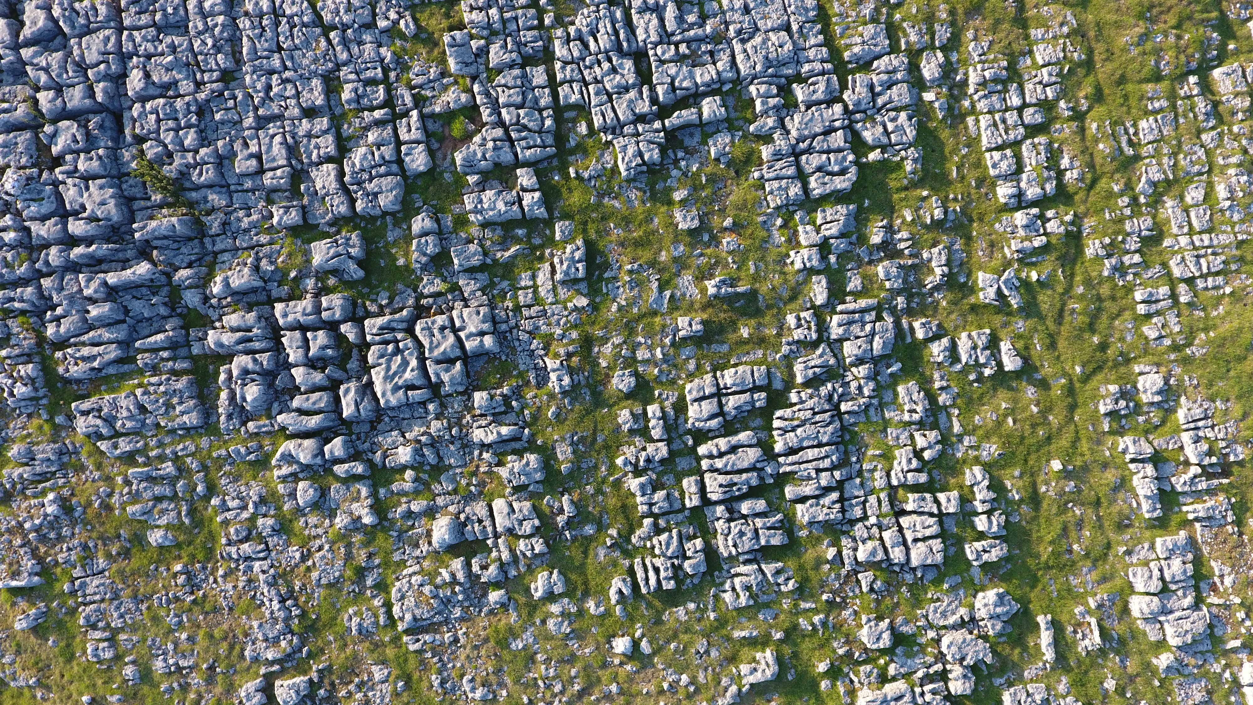
A limestone pavement is a natural karst landform consisting of a flat, incised surface of exposed limestone that resembles an artificial Sidewalk, pavement. The term is mainly used in the UK and Ireland, where many of these landforms have developed distinctive surface patterning resembling paving blocks. Similar landforms in other parts of the world are known as alvars. Formation of a limestone pavement Conditions for limestone pavements are created when an advancing glacier scrapes away overburden and exposes horizontally Bedding (geology), bedded limestone, with subsequent glacial retreat leaving behind a flat, bare surface. Limestone is slightly soluble in water and especially in acid rain, so corrosive drainage along joints and cracks in the limestone can produce slabs called ''clints'' isolated by deep fissures called ''grikes'' or ''grykes'' (terms derived from a English language in northern England, northern English dialect). If the grykes are fairly straight and the clin ... [...More Info...] [...Related Items...] OR: [Wikipedia] [Google] [Baidu] |
Raisbeck
Raisbeck is a hamlet in the civil parish of Orton, in the Westmorland and Furness district of Cumbria, England. The surname Raisbeck originates from the hamlet. The name of the hamlet derives from Hrridarr, a personal name and beck, a stream or river. There is also the smaller hamlet of Sunbiggin nearby. Circa 1870, it had a population of 214 as recorded in the Imperial Gazetteer of England and Wales The ''Imperial Gazetteer of England and Wales'' is a substantial topographical dictionary first published between 1870 and 1872, edited by the Reverend John Marius Wilson. It contains a detailed description of England and Wales. Its six volumes h .... Northwest of the hamlet is the Gamelands stone circle.Aubrey Burl (2005) ''A Guide to the Stone Circles of Britain, Ireland and Brittany'', page 80. See also * Listed buildings in Orton, Westmorland and Furness References External links Cumbria County History Trust: Orton(nb: provisional research only – see Talk p ... [...More Info...] [...Related Items...] OR: [Wikipedia] [Google] [Baidu] |
Sunbiggin
Sunbiggin is a hamlet in the civil parish of Orton, in the Westmorland and Furness district, in the ceremonial county of Cumbria, England. Location It is near the villages of Raisbeck and Orton. Transport For transport there is the M6 motorway The M6 motorway is the longest motorway in the United Kingdom. It is located entirely within England, running for just over from the Midlands to the border with Scotland. It begins at Junction 19 of the M1 motorway, M1 and the western end of t ..., A685 road, B6260 road and B6261 road nearby. It has a tarn called Sunbiggin Tarn. References * http://www.visitcumbria.com/pen/sunbiggintarn.htm * http://www.british-towns.net/sc/level_4_display_local_websites.asp?GetL3=16609 Hamlets in Cumbria Orton, Westmorland and Furness {{Cumbria-geo-stub ... [...More Info...] [...Related Items...] OR: [Wikipedia] [Google] [Baidu] |
Kelleth
Kelleth is a hamlet in Cumbria, England, containing around a dozen houses and formerly a toy factory. It is approximately from Penrith. It is in the Lune Valley, is situated next to the River Lune and is at an altitude of . The oldest houses in the hamlet date as far back as the 17th century. The hamlet has previously gone by the names "Kellath" and "Kellathe". Geography and Land Use Kelleth is a rural hamlet and much of the land (more than 50%) is used for farming. Situated on the outskirts of the hamlet are 3 disused limekiln A lime kiln is a kiln used for the calcination of limestone (calcium carbonate) to produce the form of lime (material), lime called ''quicklime'' (calcium oxide). The chemical equation for this chemical reaction, reaction is: Calcium carbonat ...s. See also * Listed buildings in Orton, Westmorland and Furness Sources Further References and External LinksKelleth information on UK Villages site [...More Info...] [...Related Items...] OR: [Wikipedia] [Google] [Baidu] |
Scout Green
Scout Green is a hamlet and small area of farm land near the village of Tebay in Cumbria, England. History It is best known among railway enthusiasts as a location for trainspotting and photography on the West Coast Main Line between Penrith and Oxenholme, and has been a popular vantage point on the railway since soon after the opening of this section of the Lancaster and Carlisle Railway in December 1846.Awdry, p. 86 Northbound steam hauled trains were often banked up the 1 in 75 gradient towards Shap whilst southbound trains can be observed accelerating downhill from Shap Summit. A signal box was located at Scout Green, but this was removed in the early 1970s when the WCML was electrified. An unusual feature of Scout Green is its access road — it involves travelling up a single track road which runs between the carriageways of the M6 motorway A controlled-access highway is a type of highway that has been designed for high-speed vehicular traffic, with all ... [...More Info...] [...Related Items...] OR: [Wikipedia] [Google] [Baidu] |
Greenholme
Greenholme is a Hamlet (place)#United Kingdom, hamlet in Cumbria, England. The Greenholme Gala and Agricultural Show is held there annually. Greenholme Bridge crosses the Birk Beck in the hamlet. This bridge appears upon a 1679 list of public bridges. Greenholme School was founded in 1733 as a Free Grammar School, and as of 1817 held 20 to 40 pupils. It closed c.1963. The hamlet of Lower Greenholme some 600 yards to the south-east is the site of a putative motte-and-bailey castle, located on the south bank of where the Birk Beck bends sharply east, and conjectured to be an outpost of Castle Howe, although the site is currently interpreted as probably consisting of only natural features. References {{coord, 54.445181, -2.621617, display=title Hamlets in Cumbria Orton, Westmorland and Furness ... [...More Info...] [...Related Items...] OR: [Wikipedia] [Google] [Baidu] |
Hamlet (place)
A hamlet is a human settlement that is smaller than a town or village. This is often simply an informal description of a smaller settlement or possibly a subdivision or satellite entity to a larger settlement. Sometimes a hamlet is defined for official or Administrative division, administrative purposes. The word and concept of a hamlet can be traced back to Anglo-Normans, Norman England, where the Old French came to apply to small human settlements. Etymology The word comes from Anglo-Norman language, Anglo-Norman ', corresponding to Old French ', the diminutive of Old French ' meaning a little village. This, in turn, is a diminutive of Old French ', possibly borrowed from (West Germanic languages, West Germanic) Franconian languages. It is related to the modern French ', Dutch language, Dutch ', Frisian languages, Frisian ', German ', Old English ', and Modern English ''home''. By country Afghanistan In Afghanistan, the counterpart of the hamlet is the Qila, qala ... [...More Info...] [...Related Items...] OR: [Wikipedia] [Google] [Baidu] |


