|
Ngāi Tai Ki Tāmaki
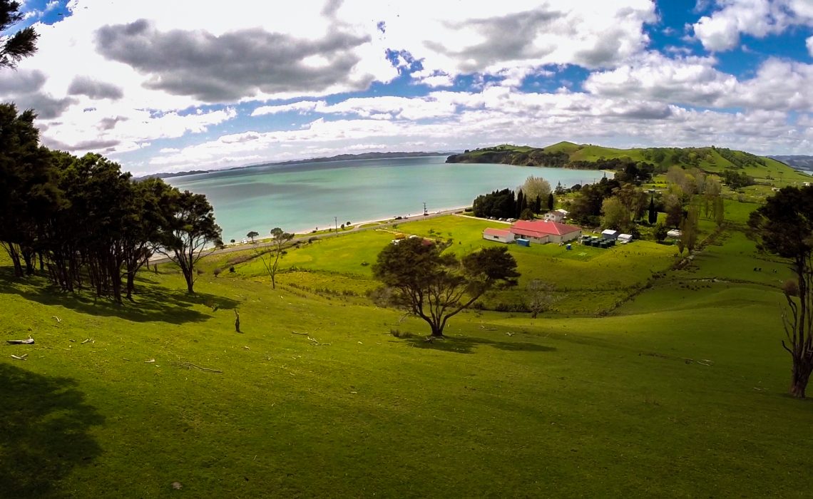
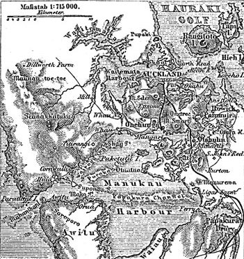
Ngāi Tai ki Tāmaki is a Māori tribe that is based in the area around Clevedon, part of the Auckland region (''Tāmaki'' in the Māori language). It is one of the twelve members of the Hauraki Collective of tribes. The founding ancestors of Ngāi Tai ki Tāmaki came to New Zealand in the ''Tainui'' migration canoe and left it when it was dragged across Te Tō Waka, the portage from the Tāmaki River to the Manukau Harbour. Their descendants occupied parts of the Hauraki Gulf, including east Auckland as far inland as Otara and Maungarei, as well as Clevedon, Maraetai and Howick. Te Irirangi Drive, a major highway in Manukau City, is named after one of their ''rangatira'' (chiefs), Tara Te Irirangi. Ngāi Tai has a marae at Umupuia Beach, between Maraetai and Clevedon. They also use the Ngāti Tamaoho marae at Karaka. In 2015 the Crown settled with Ngāi Tai ki Tāmaki over historic grievances, including both financial and cultural compensation. See also *List of iwi ... [...More Info...] [...Related Items...] OR: [Wikipedia] [Google] [Baidu] |
Māori People
The Māori (, ) are the indigenous Polynesian people of mainland New Zealand (). Māori originated with settlers from East Polynesia, who arrived in New Zealand in several waves of canoe voyages between roughly 1320 and 1350. Over several centuries in isolation, these settlers developed their own distinctive culture, whose language, mythology, crafts, and performing arts evolved independently from those of other eastern Polynesian cultures. Some early Māori moved to the Chatham Islands, where their descendants became New Zealand's other indigenous Polynesian ethnic group, the Moriori. Initial contact between Māori and Europeans, starting in the 18th century, ranged from beneficial trade to lethal violence; Māori actively adopted many technologies from the newcomers. With the signing of the Treaty of Waitangi in 1840, the two cultures coexisted for a generation. Rising tensions over disputed land sales led to conflict in the 1860s, and massive land confiscations, to which ... [...More Info...] [...Related Items...] OR: [Wikipedia] [Google] [Baidu] |
Maungarei
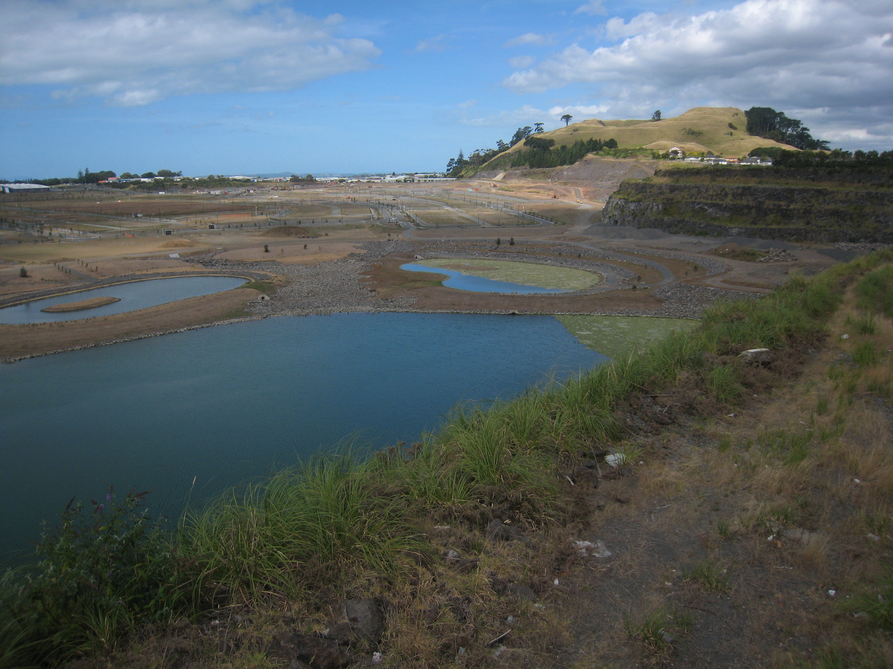
Maungarei (officially known as Maungarei / Mount Wellington) is a 135-metre volcanic peak and Tūpuna Maunga (ancestral mountain) located in the Auckland volcanic field of Auckland, New Zealand. It is the youngest onshore volcano of the Auckland volcanic field, having been formed by an eruption around 10,000 years ago. It is the largest of Auckland's scoria cones and has a near-circular base with a flattish rim and three small craters. It is situated in the Mount Wellington suburb of East Auckland. Geology A number of lava flows were created by the mountain's eruption, including one which was six kilometres in length, stretching to the Manukau Harbour at Southdown. Another lava flow blocked the course of a river valley, forming Lake Waiatarua. History The name is short for Te Maungarei ā Pōtaka, the ancient Ngāi Tai ki Tāmaki / Te Waiōhua chief whose domain included the mountain and surrounding areas. Maungarei is also translated as "the watchful mountain" or "t ... [...More Info...] [...Related Items...] OR: [Wikipedia] [Google] [Baidu] |
List Of Iwi
This is a list of iwi (New Zealand Māori tribes). List of iwi This list includes groups recognised as iwi (tribes) in certain contexts. Many are also hapū (sub-tribes) of larger iwi. Moriori are included on this list. Although they are distinct from the Māori people, they share common ancestors.Skinner, H.D., The Morioris of the Chatham Islands, Honolulu, 1923. K. R. Howe''Ideas of Māori origins'' ''Te Ara - the Encyclopedia of New Zealand'', updated 28 October 2008. Thomson, Arthur, ''The Story of New Zealand, Past and Present, Savage and Civilized'', 2 vols, London, 1859, i, 61. Belich, James, ''Making Peoples: A History of the New Zealanders, from Polynesian Settlement to the End of the Nineteenth Century'', University of Hawaii Press, 2002, pp.26, 65-66. Map of iwi See also * List of Māori waka * Lists of marae in New Zealand * Ngāti Rānana References External linksIwi Hapū Names Listfrom the National Library of New ZealandTe Kāhui Māngai (directory of iwi an ... [...More Info...] [...Related Items...] OR: [Wikipedia] [Google] [Baidu] |
Stuff
Stuff, stuffed, and stuffing may refer to: *Physical matter *General, unspecific things, or entities Arts, media, and entertainment Books *''Stuff'' (1997), a novel by Joseph Connolly (author), Joseph Connolly *''Stuff'' (2005), a book by Jeremy Strong (author), Jeremy Strong Fictional character *A flying creature in the video game ''Kya: Dark Lineage'' Film *''The Stuff'', a 1985 horror/comedy film by Larry Cohen *Stuff (film), ''Stuff'' (film), a 1993 documentary about John Frusciante's life Illustration *Henry Wright (artist), Henry Wright (1849–1937), worked for ''Vanity Fair'' under the pseudonym "Stuff" Music *Stuff (Holly McNarland album), ''Stuff'' (Holly McNarland album), 1997 *Stuff (band), a 1970s-1980s fusion/rhythm and blues music group **Stuff (Stuff album), ''Stuff'' (Stuff album) *''Stuff'', a 1992 album by Bill Wyman *Stuff (song), "Stuff" (song), a 2000 single by Diamond Rio from the album ''One More Day'' *Stuff (Eleanor McEvoy album), ''Stuff'' (Eleanor ... [...More Info...] [...Related Items...] OR: [Wikipedia] [Google] [Baidu] |
Karaka, New Zealand
Karaka is a small rural area in the south of Auckland, New Zealand. Formerly part of Franklin District and under the authority of the Franklin District Council, it is now part of Auckland Council (under the Franklin Local Board) following the amalgamation of the Auckland region's councils. To the west of Karaka is Kingseat, a small town where the former Kingseat Psychiatric Hospital was previously located. In 2005 the hospital was turned into a haunted attraction called Spookers. The area includes Karaka Lakes and Karaka Harbourside Estate. History Between 1870 and 1900, Karaka, Waiuku and the Āwhitu Peninsula were major centres for the kauri gum industry. Demographics Kingseat-Karaka statistical area covers and had an estimated population of as of with a population density of people per km2. Kingseat-Karaka had a population of 2,904 at the 2018 New Zealand census, an increase of 354 people (13.9%) since the 2013 census, and an increase of 408 people (16.3%) sinc ... [...More Info...] [...Related Items...] OR: [Wikipedia] [Google] [Baidu] |
Ngāti Tamaoho
Ngāti Tamaoho is a Māori iwi (tribe) of Auckland and the Waikato District of New Zealand. It is part of the Waiohua confederation of tribes. They have three marae, which are at Karaka, Mangatangi and Pukekohe. The tribe is a strong supporter of the Māori King Movement. In December 2012 they signed an agreement in principle to settle historic claims with the government of New Zealand under the Treaty of Waitangi settlement process. A settlement was signed on 30 April 2017. See also *List of Māori iwi This is a list of iwi (New Zealand Māori tribes). List of iwi This list includes groups recognised as iwi (tribes) in certain contexts. Many are also hapū (sub-tribes) of larger iwi. Moriori are included on this list. Although they are distin ... References External linksNgāti Tamaoho Trust Board {{Maori-stub ... [...More Info...] [...Related Items...] OR: [Wikipedia] [Google] [Baidu] |
Te Puni Kōkiri
Te Puni Kōkiri (TPK), the Ministry of Māori Development, is the principal policy advisor of the Government of New Zealand on Māori wellbeing and development. Te Puni Kōkiri was established under the Māori Development Act 1991 with responsibilities to promote Māori achievement in education, training and employment, health, and economic development; and monitor the provision of government services to Māori. The name means "a group moving forward together". History Protectorate Department (1840-1846) Te Puni Kōkiri, or the Ministry of Māori Development, traces its origins to the missionary-influenced Protectorate Department, which existed between 1840 and 1846. The Department was headed by the missionary and civil servant George Clarke, who held the position of Chief Protector. Its goal was to protect the rights of the Māori people in accordance with the Treaty of Waitangi. The Protectorate was also tasked with advising the Governor on matters relating to Māori and actin ... [...More Info...] [...Related Items...] OR: [Wikipedia] [Google] [Baidu] |
Marae
A ' (in New Zealand Māori, Cook Islands Māori, Tahitian), ' (in Tongan), ' (in Marquesan) or ' (in Samoan) is a communal or sacred place that serves religious and social purposes in Polynesian societies. In all these languages, the term also means cleared and free of weeds or trees. generally consist of an area of cleared land roughly rectangular (the itself), bordered with stones or wooden posts (called ' in Tahitian and Cook Islands Māori) perhaps with ' (terraces) which were traditionally used for ceremonial purposes; and in some cases, a central stone ' or ''a'u''. In the Rapa Nui culture of Easter Island, the term ' has become a synonym for the whole marae complex. In some modern Polynesian societies, notably that of the Māori of New Zealand, the marae is still a vital part of everyday life. In tropical Polynesia, most marae were destroyed or abandoned with the arrival of Christianity in the 19th century, and some have become an attraction for tourists or archaeol ... [...More Info...] [...Related Items...] OR: [Wikipedia] [Google] [Baidu] |
Rangatira
In Māori culture, () are tribal chiefs, the hereditary Māori leaders of a hapū. Ideally, rangatira were people of great practical wisdom who held authority () on behalf of the tribe and maintained boundaries between a tribe's land and that of other tribes. Changes to land ownership laws in the 19th century, particularly the individualisation of land title, undermined the power of rangatira, as did the widespread loss of land under the colonial government. The concept of rangatira and rangatiratanga, however, remain strong, and a return to rangatiratanga and the uplifting of Māori by the system has been widely advocated for since the Māori renaissance. Moana Jackson, Ranginui Walker, Tipene O'Regan are among the most famous of these advocates. The concept of a rangatira is central to —a Māori system of governance, self-determination and sovereignty—based on the essential leadership of all peoples through direct democracy. Etymology The word means "chief (male or fem ... [...More Info...] [...Related Items...] OR: [Wikipedia] [Google] [Baidu] |
Howick, New Zealand
Howick is an eastern suburb of Auckland, New Zealand, forming part of what is sometimes called East Auckland. Modern Howick draws much of its character from the succeeding waves of Asian settlement that it has experienced since New Zealand’s immigration reforms of the 1980s, with a strong Chinese New Zealander presence in the suburb’s business and education sectors. Demographics Howick covers and had an estimated population of as of with a population density of people per km2. Howick had a population of 11,067 at the 2018 New Zealand census, an increase of 555 people (5.3%) since the 2013 census, and an increase of 1,269 people (13.0%) since the 2006 census. There were 3,822 households, comprising 5,325 males and 5,739 females, giving a sex ratio of 0.93 males per female, with 2,199 people (19.9%) aged under 15 years, 2,058 (18.6%) aged 15 to 29, 5,184 (46.8%) aged 30 to 64, and 1,626 (14.7%) aged 65 or older. Ethnicities were 67.6% European/Pākehā, 6.2% Māori, ... [...More Info...] [...Related Items...] OR: [Wikipedia] [Google] [Baidu] |
Maraetai
Maraetai is a coastal town and the easternmost suburb of greater Auckland in New Zealand. The closest town, Beachlands, lies approximately 4 km to the west. Its name is Māori meaning "meeting place by the sea". Maraetai was the original name for the smooth, calm tidal passage now known as Tamaki Strait, which is sheltered by Te Motu Arai-roa ("The Long Sheltering Island") now called Waiheke Island. The site of present-day Maraetai suburb was formerly the pā and kāinga (village) settlement known as Pohaturoa. In English, Maraetai means "meeting place by the sea". One of the better known functions of a marae is to facilitate hui (tribal gatherings). Maraetai's residents do not use city mains water and instead must use water tanks and bore water. Many residents prefer it to be kept this way to maintain the town's rural aspect. Maraetai's beaches are popular destinations for other Aucklanders and are often crowded in the summer months. Demographics Maraetai covers an ... [...More Info...] [...Related Items...] OR: [Wikipedia] [Google] [Baidu] |


