|
New Brunswick Route 2
Route 2 is a major state highway, provincial highway in the Provinces and territories of Canada, Canadian province of New Brunswick, carrying the main route of the Trans-Canada Highway in the province. The highway connects with Autoroute 85 (Quebec), Autoroute 85 at the border with Quebec, Highway 104 (Nova Scotia), Highway 104 at the border with Nova Scotia, as well as with traffic from Interstate 95 in Maine, Interstate 95 in the U.S. state of Maine via the short Route 95 (New Brunswick), Route 95 connector. A core route in the National Highway System (Canada), National Highway System, Route 2 is a four-lane freeway in its entirety, and directly serves the cities of Edmundston, Fredericton, and Moncton. A 20-year project to replace the original 1960s-era two-lane Trans-Canada Highway with a four-lane freeway was completed on November 1, 2007. The final upgrade to Route 2 and Route 95 extended the continuous freeway network of North America east to New Glasgow, Nova Scotia. Once ... [...More Info...] [...Related Items...] OR: [Wikipedia] [Google] [Baidu] |
Trans-Canada Highway
The Trans-Canada Highway (Canadian French, French: ; abbreviated as the TCH or T-Can) is a transcontinental federal–provincial highway system that travels through all ten provinces of Canada, from the Pacific Ocean on the west coast to the Atlantic Ocean on the east coast. The main route spans across the country, one of the longest routes of its type in the world. The highway system is recognizable by its distinctive white-on-green maple leaf route shield, route markers, although there are small variations in the markers in some provinces. While by definition the Trans-Canada Highway is a highway ''system'' that has several parallel routes throughout most of the country, the term "Trans-Canada Highway" often refers to the main route that consists of Highway 1 (British Columbia, Alberta, Saskatchewan, and Manitoba), Highways 11 & 17/417 (Ontario), Autoroutes 40, 25, 20, 85 & 185 (Quebec), Highway 2 (New Brunswick), Highways 104 and 105 (Nova Scotia), and ... [...More Info...] [...Related Items...] OR: [Wikipedia] [Google] [Baidu] |
Nova Scotia
Nova Scotia is a Provinces and territories of Canada, province of Canada, located on its east coast. It is one of the three Maritime Canada, Maritime provinces and Population of Canada by province and territory, most populous province in Atlantic Canada, with an estimated population of over 1 million as of 2024; it is also the second-most densely populated province in Canada, and second-smallest province by area. The province comprises the Nova Scotia peninsula and Cape Breton Island, as well as 3,800 other coastal islands. The province is connected to the rest of Canada by the Isthmus of Chignecto, on which the province's land border with New Brunswick is located. Nova Scotia's Capital city, capital and largest municipality is Halifax, Nova Scotia, Halifax, which is home to over 45% of the province's population as of the 2021 Canadian census, 2021 census. Halifax is the List of census metropolitan areas and agglomerations in Canada, twelfth-largest census metropolitan area in ... [...More Info...] [...Related Items...] OR: [Wikipedia] [Google] [Baidu] |
Perth-Andover, New Brunswick
Perth-Andover is a former village in Victoria County, New Brunswick, Canada. It held village status prior to 2023. It is now part of the village of Southern Victoria. History Andover was originally called Little Tobique, the community was given the name Andover, from the town in Hampshire, England. Much of Andover's original land grants were to English soldiers and Loyalist from the American Revolution. Much of Perth (originally called Larlee) was originally part of the territory of the Tobique First Nation, whose reserve was established in 1801, at the band's request. Due to squatters, the First Nation were forced to surrender a total of 2,539 acres, much in Perth-Andover."Background and History of the Claim" , Tobique Land Rights: No Consent and No Surrender, Official Website, accessed 25 November 2011 In 1 ... [...More Info...] [...Related Items...] OR: [Wikipedia] [Google] [Baidu] |
Grand Falls, New Brunswick
Grand Falls () is a town in northwestern New Brunswick, Canada, on the Saint John River (Bay of Fundy), Saint John River. Its name comes from a waterfall created by a series of rock ledges over which the river drops . 2023 New Brunswick local governance reform, On 1 January 2023, Grand Falls expanded to include Drummond, New Brunswick, Drummond, the rural community of Saint-André, the Local service district (New Brunswick), local service district of the parish of Grand Falls, and part of the LSD of the parish of Drummond. Revised census figures have not been released. History In 1686, Jean-Baptiste de La Croix de Chevrières de Saint-Vallier, Monsignor de Saint-Vallier (of Quebec) was the first known person to mention in writing the magnificent falls for which Grand Falls is named. His words describing the area can be found on a monument erected at the mouth of Davis Park in 1986. He recounts his trip to the region in 1686. He writes: "On May 16 we arrived at a place called ... [...More Info...] [...Related Items...] OR: [Wikipedia] [Google] [Baidu] |
Saint John River (New Brunswick)
The Saint John River (; Maliseet-Passamaquoddy: ''Wolastoq'') is a river flowing within the Dawnland region from headwaters in the Notre Dame Mountains near the Maine-Quebec border through western New Brunswick to the northwest shore of the Bay of Fundy. Eastern Canada's longest river, its drainage basin is one of the largest on the east coast at about . This “River of the Good Wave” and its tributary drainage basin formed the territorial countries of the Wolastoqiyik and Passamaquoddy First Nations (named Wolastokuk and Peskotomuhkatik, respectively) prior to European colonization, and it remains a cultural centre of the Wabanaki Confederacy to this day. The Webster–Ashburton Treaty following the Aroostook War established a border between New Brunswick and Maine following of the river, while a tributary forms of the border between Quebec and Maine. Maine communities along the river include Fort Kent, Madawaska, and Van Buren. New Brunswick settlements through wh ... [...More Info...] [...Related Items...] OR: [Wikipedia] [Google] [Baidu] |
Madawaska River (Saint John)
The Madawaska River flows from Lake Témiscouata in Quebec, through Degelis, Quebec, to join the Saint John River (New Brunswick), Saint John River at Edmundston, New Brunswick. The course of the Madawaska River is accessible in Quebec by Quebec route 185, route 185 and New Brunswick by Highway 2, which run along the river side South West. Toponymy Various theories exist over the etymology of the word Madawaska. One is that the river's name comes from the Algonquian languages, Algonquian word "Madoueskak", which means "land of the porcupine". In Malecite-Passamaquoddy language, Maliseet, the word "Matawaskiyak" translates to "at the place where water flows out over grass", there is also speculation that it refers to the 'meeting of two rivers where there is grass'. The Madawaska river is a large drainage basin for Lake Temiscouata and other waterways from the north. Before the city of Edmundston changed the natural course of the river, the spring freshet would cause several branc ... [...More Info...] [...Related Items...] OR: [Wikipedia] [Google] [Baidu] |
Highway2 OutsideMoncton
A highway is any public or private road or other public way on land. It includes not just major roads, but also other public roads and rights of way. In the United States, it is also used as an equivalent term to controlled-access highway, or a translation for ''motorway'', ''Autobahn'', ''autostrada'', '' autoroute'', etc. According to Merriam-Webster, the use of the term predates the 12th century. According to Etymonline, "high" is in the sense of "main". In North American and Australian English, major roads such as controlled-access highways or arterial roads are often state highways (Canada: provincial highways). Other roads may be designated "county highways" in the US and Ontario. These classifications refer to the level of government (state, provincial, county) that maintains the roadway. In British English, "highway" is primarily a legal term. Everyday use normally implies roads, while the legal use covers any route or path with a public right of access, including foot ... [...More Info...] [...Related Items...] OR: [Wikipedia] [Google] [Baidu] |
Central Canada
Central Canada (, sometimes the ''Central Provinces'') is a Canadian region consisting of Ontario and Quebec, the largest and most populous provinces of the country. Geographically, they are not at the centre of Canada but instead overlap with Eastern Canada toward the east. Because of their large populations, Ontario and Quebec have traditionally held a significant amount of political power in Canada, leading to some amount of resentment from other regions of the country. Before Confederation, the term "Canada" specifically referred to Central Canada. Today, the term "Central Canada" is less often used than the names of the individual provinces. History Before Confederation, the region known as Canada was what is now called Central Canada. Southern Ontario was once called Upper Canada and later Canada West and southern Quebec was called Lower Canada and later Canada East. Both were part of the United Province of Canada in 1841. Geography Ontario, Canada's four ... [...More Info...] [...Related Items...] OR: [Wikipedia] [Google] [Baidu] |
New Glasgow, Nova Scotia
New Glasgow is a town in Pictou County, in the province of Nova Scotia, Canada. It is situated on the banks of the East River of Pictou, which flows into Pictou Harbour, a sub-basin of the Northumberland Strait. The town's population was 9,471 in the 2021 census. New Glasgow is at the centre of the province's fourth largest urban area; the population of the New Glasgow Census geographic units of Canada, census agglomeration in the 2021 census was 34,397. The New Glasgow census agglomeration includes the smaller adjacent towns of Stellarton, Westville, Nova Scotia, Westville, and Trenton, Nova Scotia, Trenton as well as adjacent rural areas of the county. History Scottish immigrants, including those on the ship Hector (immigration ship), Hector in 1773, settled the area of the East River of Pictou during the late 18th and early 19th centuries. Deacon Thomas Fraser (deacon), Thomas Fraser first settled the area at the head of navigation on the East River of Pictou in 1784. The ... [...More Info...] [...Related Items...] OR: [Wikipedia] [Google] [Baidu] |
Edmundston
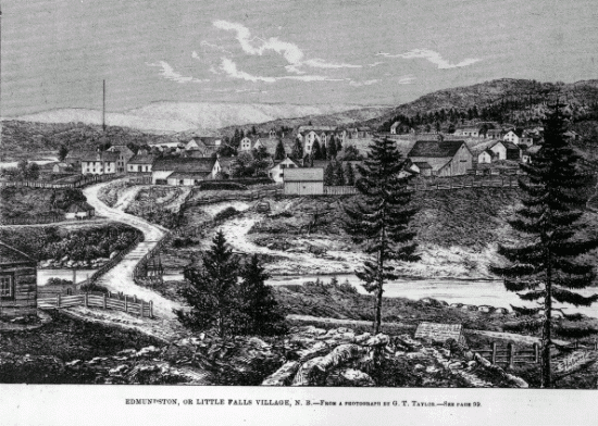
Edmundston () is a city in Madawaska County, New Brunswick, Canada. Established in 1850, it had a population of 16,437 as of 2021. On January 1, 2023, Edmundston amalgamated with the village of Rivière-Verte, New Brunswick, Rivière-Verte and parts of two Local service district (New Brunswick), local service districts; revised census figures have not been released. History During the early colonial period, the area was a camping and meeting place of the Maliseet people, Maliseet (Wolastoqiyik) Nation during seasonal migrations. From the mid to late eighteenth century, one of the largest Maliseet villages had been established at Madawaska and had become a refuge site for other Wabanaki peoples. The Maliseet village was originally located near the falls at the confluence of the Madawaska and Saint John Rivers. Currently, the City of Edmundston surrounds a federal Indian Reserve (St. Basile 10/Madawaska Maliseet First Nation). Originally named ''Petit-Sault'' (Little Falls) in r ... [...More Info...] [...Related Items...] OR: [Wikipedia] [Google] [Baidu] |
National Highway System (Canada)
The National Highway System () in Canada is a federal designation for a strategic transport network of highways and freeways. The system includes but is not limited to the Trans-Canada Highway, and currently consists of of roadway designated under one of three classes: Core Routes, Feeder Routes, and Northern and Remote Routes. The Government of Canada maintains very little power or authority over the maintenance or expansion of the system beyond sharing part of the cost of economically significant projects within the network. Highways within the system are not given any special signage, except where they are part of a Trans-Canada Highway route. History The system was first designated in 1988 by the Federal/Provincial/Territorial Council of Ministers Responsible for Transportation and Highway Safety, a council consisting of the federal, provincial and territorial Ministers of Transport. A total of of highway were originally designated as part of the system. Highways selected f ... [...More Info...] [...Related Items...] OR: [Wikipedia] [Google] [Baidu] |


