|
Murthal
Murthal, also known as Morthal Khas, is a village in Sonipat district of the Indian state of Haryana. It is located north of Sonipat, from the national capital New Delhi, and southwest of Chandigarh, the state capital. It is famous for its parathas. Demographics As per the 2011 Indian Census, Murthal (or Morthal Khas) had a total population of 16,722, of which 8,920 were males and 7,802 were females. Population within the age group of 0 to 6 years was 2,221. The total number of literates in Murthal was 11,325, which constituted 67.7% of the population with male literacy of 74.1% and female literacy of 60.4%. The effective literacy rate of 7+ population of Murthal was 78.1%, of which male literacy rate was 85.9% and female literacy rate was 69.3%. The Scheduled Castes population was 3,258. Murthal had 3,274 households in 2011. Communities According to the 1883 gazetteer of the Gurgaon District, the inhabitants of this village were Jats, mainly those of Antal clan. Culture ... [...More Info...] [...Related Items...] OR: [Wikipedia] [Google] [Baidu] |
Deenbandhu Chhotu Ram University Of Science And Technology
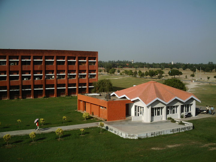
Deenbandhu Chhotu Ram University of Science and Technology (DCRUST), formerly Chhotu Ram State College of Engineering, Murthal (CRSCE), is a state university located in Murthal, Sonipat, Haryana, India. It was established in 2006 by an Act of the Government of Haryana, upgrading a 1986 established college. History It was founded in 1986 by the Government of Haryana in memory of Sir Chhotu Ram (1881–1945). It was then known as the Chhotu Ram State College of Engineering, Murthal until the government of Haryana upgraded it to University on 6 November 2006 through an Act 29 of 2006 of the Legislature of the state of Haryana. The university has been considered eligible for grants under Section 12(B) of UGC Act, 1956 in March, 2009 Location The university is in Murthal on National Highway No. 44, from Inter State Bus Terminal, Delhi and from Sonipat bus stand. The campus of the college has been developed on of land which falls within the industrial and commercial belt e ... [...More Info...] [...Related Items...] OR: [Wikipedia] [Google] [Baidu] |
Sonipat
Sonipat is a planned industrial city and administrative headquarter in Sonipat district of Haryana state of India. It comes under the National Capital Region and is around from New Delhi. It lies 214 km (128 miles) southwest of Chandigarh, the state capital. The Yamuna River runs along its eastern boundary. Sonipat was historically known as Sonprastha. On 22 December 1972, Sonipat designated a full-fledged district. Sonipat Junction railway station is the main railway junction on Delhi-Kalka line. It lies on Delhi Western Peripheral Expressway, Eastern Peripheral Expressway (NE II) and Grand Trunk Road (NH 44) as well as the planned Delhi–Sonipat–Panipat Regional Rapid Transit System. Etymology According to legend, Sonipat was earlier known as Swarnprastha, (). which later on became Swarnpath, and then Sonipat. History Reference to the city comes in the epic ''Mahabharata'' as Svarnaprastha. It was one of the five villages demanded by Pandavas as the price o ... [...More Info...] [...Related Items...] OR: [Wikipedia] [Google] [Baidu] |
Sonipat District
Sonipat district is one of the 22 districts of Haryana state in northern India. Sonipat town is the district headquarters. It is a part of National Capital Region. It is bordered by Delhi, Panipat, Rohtak, Jind, Jhajjar and Baghpat (Uttar Pradesh). The district borders union territory of Delhi in south, Panipat District in the north, Jind District in the north-west, Uttar Pradesh state in the east with the Yamuna River acting as a border and Rohtak District in the west. Origin of name The district is named after its administrative headquarters, Sonipat. Sonipat was earlier known as ''Sonprastha'', which later became '' Swarnprastha'' (Golden City), which is derived from two Sanskrit words, ''Svarna'' (Gold) and ''Prastha'' (Place). Over a period of time, the classical name Swarnprastha's pronunciation degraded into ''Svarnpat'', and then to its current form, ''Sonipat''. The earliest reference of this city comes in the historical book of Mahabharata, and at that time, it w ... [...More Info...] [...Related Items...] OR: [Wikipedia] [Google] [Baidu] |
Panipat
Panipat () is an industrial , located 95 km north of Delhi and 169 km south of Chandigarh on NH-44 in Panipat district, Haryana, India. It is famous for three major battles fought in 1526, 1556 and 1761. The city is also known as 'city of weavers', 'textile city' and 'cast-off clothes capital' of the world. It is home to industries like wool and cotton milling, saltpetre refining and manufacture of glass, electrical appliances, and other products. The city is included in the list of critically polluted industrial areas in India. As in Dec 2009, the Comprehensive Environment Pollution Index (CEPI) of the city was 59.00, as against 88.50 of Ankaleshwar (Gujarat). The three battles fought in the fatal field of Panipat changed the course of India's history, first two resulting in creation and confirmation of the Mughal Empire. The third battle led to the decisive defeat of the Maratha Confederacy in North India, which had become a dominating power in Delhi by then an ... [...More Info...] [...Related Items...] OR: [Wikipedia] [Google] [Baidu] |
Delhi
Delhi, officially the National Capital Territory (NCT) of Delhi, is a city and a union territory of India containing New Delhi, the capital of India. Straddling the Yamuna river, but spread chiefly to the west, or beyond its Bank (geography), right bank, Delhi shares borders with the state of Uttar Pradesh in the east and with the state of Haryana in the remaining directions. Delhi became a union territory on 1 November 1956 and the NCT in 1995. The NCT covers an area of . According to the 2011 census, Delhi's city proper population was over 11 million, while the NCT's population was about 16.8 million. The topography of the medieval fort Purana Qila on the banks of the river Yamuna matches the literary description of the citadel Indraprastha in the Sanskrit epic ''Mahabharata''; however, excavations in the area have revealed no signs of an ancient built environment. From the early 13th century until the mid-19th century, Delhi was the capital of two major empires, ... [...More Info...] [...Related Items...] OR: [Wikipedia] [Google] [Baidu] |
Jats
The Jat people (, ), also spelt Jaat and Jatt, are a traditionally agricultural community in Northern India and Pakistan. Originally pastoralists in the lower Indus river-valley of Sindh, many Jats migrated north into the Punjab region in late medieval times, and subsequently into the Delhi Territory, northeastern Rajputana, and the western Gangetic Plain in the 17th and 18th centuries. Quote: "Hiuen Tsang gave the following account of a numerous pastoral-nomadic population in seventh-century Sin-ti (Sind): 'By the side of the river.. f Sind along the flat marshy lowlands for some thousand li, there are several hundreds of thousands very great manyfamilies .. hichgive themselves exclusively to tending cattle and from this derive their livelihood. They have no masters, and whether men or women, have neither rich nor poor.' While they were left unnamed by the Chinese pilgrim, these same people of lower Sind were called Jats' or 'Jats of the wastes' by the Arab geographers. ... [...More Info...] [...Related Items...] OR: [Wikipedia] [Google] [Baidu] |
Chandigarh
Chandigarh is a city and union territory in northern India, serving as the shared capital of the states of Punjab and Haryana. Situated near the foothills of the Shivalik range of Himalayas, it borders Haryana to the east and Punjab in the remaining directions. Chandigarh constitutes the bulk of the Chandigarh Capital Region or Greater Chandigarh, which also includes the adjacent satellite cities of Panchkula in Haryana and Mohali in Punjab. It is located 260 km (162 miles) northwest of New Delhi and 229 km (143 miles) southeast of Amritsar and 104 km (64 miles) southwest of Shimla. Chandigarh is one of the earliest planned cities in post independence India and is internationally known for its architecture and urban design. The master plan of the city was prepared by Swiss-French architect Le Corbusier, which built upon earlier plans created by the Polish architect Maciej Nowicki and the American planner Albert Mayer. Narinder Singh Lamba, in the capacity ... [...More Info...] [...Related Items...] OR: [Wikipedia] [Google] [Baidu] |
New Delhi
New Delhi (; ) is the Capital city, capital of India and a part of the Delhi, National Capital Territory of Delhi (NCT). New Delhi is the seat of all three branches of the Government of India, hosting the Rashtrapati Bhavan, New Parliament House, New Delhi, Sansad Bhavan, and the Supreme Court of India, Supreme Court. New Delhi is a Municipal governance in India, municipality within the NCT, administered by the New Delhi Municipal Council (NDMC), which covers mostly Lutyens' Delhi and a few adjacent areas. The municipal area is part of a larger List of districts in India, administrative district, the New Delhi district. Although colloquially ''Delhi'' and ''New Delhi'' are used interchangeably to refer to the National Capital Territory of Delhi, both are distinct entities, with the municipality and the New Delhi district forming a relatively small part within the megacity of Delhi. The National Capital Region (India), National Capital Region is an even larger entity, compris ... [...More Info...] [...Related Items...] OR: [Wikipedia] [Google] [Baidu] |
States And Territories Of India
India is a federalism, federal union comprising 28 federated state, states and 8 union territory, union territories, for a total of 36 subnational entities. The states and union territories are further subdivided into 800 List of districts in India, districts and smaller administrative divisions of India, administrative divisions by the respective subnational government. The states of India are self-governing administrative divisions, each having a State governments of India, state government. The governing powers of the states are shared between the state government and the Government of India, union government. On the other hand, the union territories are directly governed by the union government. History 1876–1919 The British Raj was a very complex political entity consisting of various imperial divisions and states and territories of varying autonomy. At the time of its establishment in 1876, it was made up of 584 princely state, constituent states and the prov ... [...More Info...] [...Related Items...] OR: [Wikipedia] [Google] [Baidu] |
Vidhan Sabha
The State Legislative Assembly, also known as the Vidhan Sabha or the Saasana Sabha, is a legislative body in each of the states and certain union territories of India. Members of the legislative assembly are often directly elected to serve five year terms from single-member constituencies. A legislative assembly may be dissolved in a state of emergency, by the governor on request of the chief minister of the respective state or union territory, or if a motion of no confidence is passed against the ruling majority party or coalition. Definition and powers As per the Constitution of India, where there is a unicameral legislature, the legislative body is termed as the legislative assembly. In bicameral jurisdictions, there exists a State Legislative Council. The legislative assembly has the power to create or abolish the legislative council of the respective state or union territory by passing a resolution to that effect by a majority of not less than two-thirds of the memb ... [...More Info...] [...Related Items...] OR: [Wikipedia] [Google] [Baidu] |


