|
Municipalities Of The Canton Of Graubünden
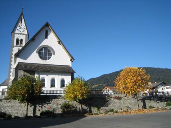
There are 100 municipalities in the canton of Graubünden, Switzerland (). List * Albula/Alvra *Andeer *Arosa *Avers * Bergün Filisur * Bever * Bonaduz * Bregaglia *Breil/Brigels *Brusio * Buseno * Calanca * Cama * Castaneda * Cazis *Celerina/Schlarigna *Chur *Churwalden * Conters im Prättigau *Davos * Disentis/Mustér *Domat/Ems * Domleschg *Falera * Felsberg * Ferrera * Fideris *Fläsch * Flerden *Flims * Furna * Fürstenau *Grono * Grüsch *Ilanz/Glion * Jenaz * Jenins * Klosters-Serneus * Küblis * La Punt Chamues-ch *Laax * Landquart * Lantsch/Lenz *Lostallo *Lumnezia * Luzein * Madulain *Maienfeld * Malans * Masein *Medel (Lucmagn) * Mesocco *Muntogna da Schons * Obersaxen Mundaun *Pontresina *Poschiavo * Rhäzüns *Rheinwald * Rongellen * Rossa * Rothenbrunnen * Roveredo *S-chanf *Safiental *Sagogn *Samedan *Samnaun * San Vittore * Santa Maria in Calanca * Scharans * Schiers * Schluein * Schmitten *Scuol * Seewis im Prättigau * Sils im Domleschg * Sils im Engad ... [...More Info...] [...Related Items...] OR: [Wikipedia] [Google] [Baidu] |
Cazis
Cazis ''( Romansh: Tgazas)'' is a municipality in the Viamala Region in the Swiss canton of Graubünden. On 1 January 2010 the municipalities of Portein, Präz, Sarn and Tartar merged into the municipality of Cazis. History Cazis is first mentioned in 926 as ''Cacias''. Geography Cazis has an area, , of . Of this area, 41% is used for agricultural purposes, while 41.1% is forested. Of the rest of the land, 13.6% is settled (buildings or roads) and the remainder (4.3%) is non-productive (rivers, glaciers or mountains). Before 2017, the municipality was located in the Thusis sub-district, of the Heinzenberg district, after 2017 it was part of the Viamala Region. It is located on the western side of the Hinterrhein valley. It consists of the linear village of Cazis and the hamlets of Ober- and Unterrealta, Luvreu, Ratitsch, Summaprada, Schauenberg and Valleina. The municipalities of Cazis, Portein, Präz, Sarn, and Tartar merged on 1 January 2010 into a new municipa ... [...More Info...] [...Related Items...] OR: [Wikipedia] [Google] [Baidu] |
Fläsch
Fläsch is a municipality in the Landquart Region in the Swiss canton of Graubünden. History Fläsch is first mentioned in 831 as ''Villa Flasce''. Painter Anna Barbara Bansi was a native of the town.Profile at the ''Dictionary of Pastellists Before 1800''. In 1949, the Ellhorn mountain owned by the Balzers municipality in was ceded to Switzerland and became a part of Fläsch. Geography Fläsch has an area, , of . Of this area, 35.3% is used for agricultural purposes, while 43.8% is forested. ...[...More Info...] [...Related Items...] OR: [Wikipedia] [Google] [Baidu] |
Fideris
Fideris ''( Romansh: Fadrein)'' is a Swiss village in the Prättigau and a municipality in the political district Prättigau/Davos Region in the canton of Graubünden. History Fideris is first mentioned in 1370 as ''Fidris''. Geography Fideris has an area, (as of the 2004/09 survey) of . Of this area, about 58.7% is used for agricultural purposes, while 28.8% is forested. Of the rest of the land, 3.1% is settled (buildings or roads) and 9.4% is unproductive land. In the 2004/09 survey a total of or about 1.3% of the total area was covered with buildings. Of the agricultural land, is fields and grasslands and consists of alpine grazing areas. Since 1985 the amount of agricultural land has decreased by . Over the same time period the amount of forested land has increased by . Rivers and lakes cover in the municipality. [...More Info...] [...Related Items...] OR: [Wikipedia] [Google] [Baidu] |
Ferrera
Ferrera is a municipality in the Viamala Region in the Grisons, Switzerland. It was formed on 1 January 2008 through the merger of Innerferrera and Ausserferrera. Geographically, it covers the entire Ferrera valley. Historical population The combined historical population of the two municipalities is given in the following table: : Population increase due to construction of the dam at Valle di Lei Languages Weather Innerferrera village in Ferrera has an average of 118.2 days of rain per year and on average receives of precipitation In meteorology, precipitation is any product of the condensation of atmospheric water vapor that falls from clouds due to gravitational pull. The main forms of precipitation include drizzle, rain, rain and snow mixed ("sleet" in Commonwe .... The wettest month is August during which time Innerferrera receives an average of of precipitation. During this month there is precipitation for an average of 12.2 days. The month wi ... [...More Info...] [...Related Items...] OR: [Wikipedia] [Google] [Baidu] |
Felsberg, Switzerland
Felsberg (; ) is a municipalities of Switzerland, municipality in the Imboden Region in the Switzerland, Swiss Cantons of Switzerland, canton of Graubünden. History Felsberg is first mentioned about 840 as ''in villa Fagonio''. In 1290 it was mentioned, in German, as ''veltsperch''. Geography Felsberg has an area, , of . Of this area, 20.2% is used for agricultural purposes, while 43.6% is forested. Of the rest of the land, 4.3% is settled (buildings or roads) and the remainder (31.9%) is non-productive (rivers, glaciers or mountains). Before 2017, the municipality was located in the Trin sub-district of the Imboden district, it is in a small valley north of the Rhine and between Chur and Domat/Ems. Demographics Felsberg has a population (as of ) of . , 8.6% of the population was made up of foreign nationals. Over the last 10 years the population has grown at a rate of 3.2%. [...More Info...] [...Related Items...] OR: [Wikipedia] [Google] [Baidu] |
Falera
Falera is a Municipalities of Switzerland, municipality in the Surselva Region in the Switzerland, Swiss Cantons of Switzerland, canton of Graubünden. Falera is a part of the ''Alpenarena'' along with the towns of Flims and Laax and is the most secluded of the three. History Falera is a town of rich culture and history. In 1800 B.C., a settlement was started on the Mutta. This came during the Bronze Age and was very significant in the early development of what today is Switzerland. The village is first mentioned in 765 as ''Falariae''. While the first actual mention of a church in Falera was in 840-841. However, the current church was not built until 1491. The church was built on the foot of the Mutta and was named after St. Remigius. Around the church are stone pillars (megaliths or menhirs), arranged geometrically, that are said to date around 1500 B.C. Later, in the year 1903, another church was built. This church was built directly in the village and was named the Herz- ... [...More Info...] [...Related Items...] OR: [Wikipedia] [Google] [Baidu] |
Domleschg
Domleschg is a municipality in the Viamala Region in the Swiss canton of Graubünden. On 1 January 2015 the former municipalities of Almens, Paspels, Pratval, Rodels and Tomils merged to form the new municipality of Domleschg.Amtliches Gemeindeverzeichnis der Schweiz published by the Swiss Federal Statistical Office accessed 2 January 2013 History Almens is first mentioned in the first half of the 9th Century as ''de Lemenne''. Paspels is first mentioned in 1237 as ''in villa Pascuals'' though the original record no longer exists. In 1246 it was mentioned as ''de Pascuals''. Pratval is first mentioned in 1345 as ''Prau de Valle''. Rodels is first menti ...[...More Info...] [...Related Items...] OR: [Wikipedia] [Google] [Baidu] |
Domat/Ems
Domat/Ems ( ; ) is a municipalities of Switzerland, municipality in the Imboden Region in the Switzerland, Swiss Cantons of Switzerland, canton of Graubünden. History Domat/Ems is first mentioned in 765 as ''colonia de Amede''. Ems is the German name for the municipality, Domat is the Romansh language, Romansh name and since 1943 the official name has been the combination of both. Geography Domat/Ems has an area, , of . Of this area, 27.7% is used for agricultural purposes, while 53.8% is forested. Of the rest of the land, 12.2% is settled (buildings or roads) and the remainder (6.4%) is non-productive (rivers, glaciers or mountains). Before 2017, the municipality was located in the Rhäzüns sub-district, of the Imboden district, after 2017 it was part of the Imboden Region. It is located on the right bank of the Rhine river. Until 1943 Domat/Ems was known as Ems. [...More Info...] [...Related Items...] OR: [Wikipedia] [Google] [Baidu] |
Disentis/Mustér
Mustér (, Romansh language, Romansh) or Disentis (German), with its official name Disentis/Mustér is a village and a Municipalities of Switzerland, municipality in the Surselva Region in the Switzerland, Swiss Cantons of Switzerland, canton of Grisons. The skiing and summer tourism resort high up in the Rhine valley is the site of one of the oldest Disentis Abbey, Benedictine monasteries in Switzerland. The monastery dates back to 720, its huge current complex dates from 1696 to 1712. History Disentis is first mentioned in 765 as ''Desertina''. In 1127 it was mentioned as ''monasterium Dissertinensis''. The name Disentis is supposed to come from Latin Desertina, used for the deserted valley in late antique times, while the Romansh name Mustér refers to the monastery. Disentis Abbey, founded in ca. 720, was already in early medieval times the cultural and political center of the later Grisons. Situated on the road to the Lukmanier pass used by the German emperors on their way ... [...More Info...] [...Related Items...] OR: [Wikipedia] [Google] [Baidu] |
Davos
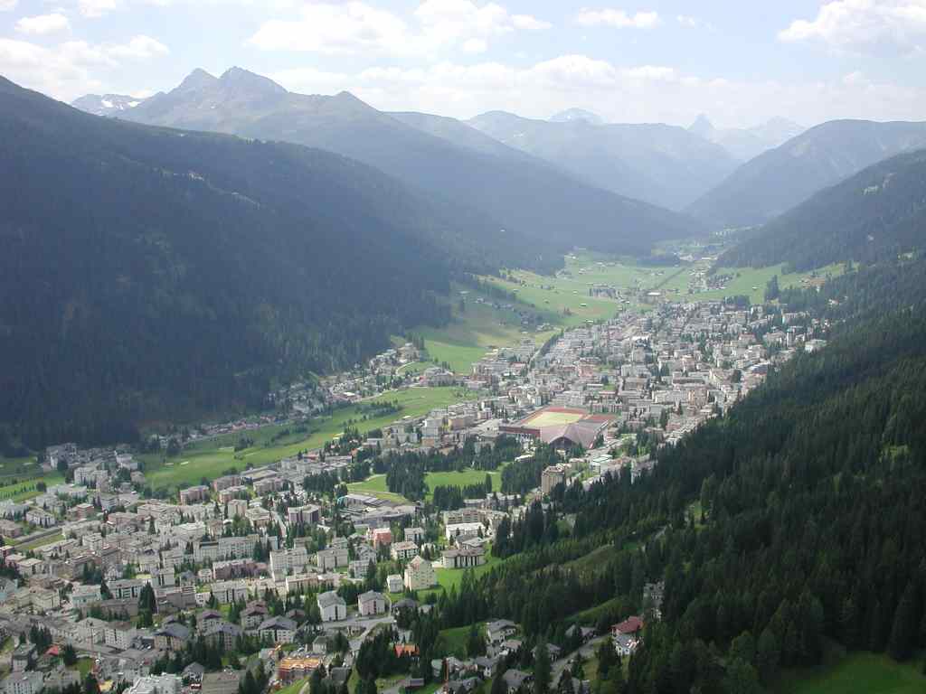
Davos (, ; or ; ; Old ) is an Alpine resort town and municipality in the Prättigau/Davos Region in the canton of Graubünden, Switzerland. It has a permanent population of (). Davos is located on the river Landwasser, in the Rhaetian Alps, between the Plessur and Albula Ranges. The municipality covers nearly the entire valley of the Landwasser, and the centre of population, economic activity and administration is two adjacent villages, ''Davos Dorf'' (engl.: Davos Village) and ''Davos Platz'' (Davos Place), which are above sea level. Gaining prominence in the 19th century as a mountain health resort, Davos is perhaps best known today for hosting the World Economic Forum, an annual meeting of global political and corporate leaders. With its long history of winter sports, Davos also has one of Switzerland's largest ski resorts and hosts the international Spengler Cup, an ice hockey tournament, every December. Name ''Tavau'', the Romansh name, derives from the La ... [...More Info...] [...Related Items...] OR: [Wikipedia] [Google] [Baidu] |
Conters Im Prättigau
Conters im Prättigau () is a Swiss village in the Prättigau and a municipality in the political district of Prättigau/Davos Region in the canton of Graubünden. History Conters im Prättigau is first mentioned in 1290 as ''Cunters''. Geography Conters im Prättigau has an area, , of . Of this area, 49.4% is used for agricultural purposes, while 45% is forested. Of the rest of the land, 1.3% is settled (buildings or roads) and the remainder (4.4%) is non-productive (rivers, glaciers or mountains). Before 2017, the municipality was located in the Küblis sub-district of the Oberlandquart district, after 2017 it was part of the Prättigau/Davos Region. [...More Info...] [...Related Items...] OR: [Wikipedia] [Google] [Baidu] |


