|
Miners' Institute
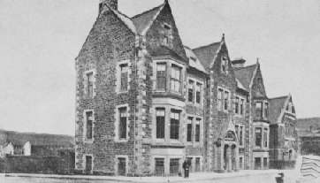
Miners' institutes, sometimes known as ''workingmen's institutes'', ''mine workers' institutes'', or ''miners' welfare halls'' are large institutional buildings that were typically built during the height of the industrial period as a meeting and educational venue. More commonly found in Britain, miners' institutes were owned by miner groups who gave a proportion of their wage into a communal fund to pay for the construction and running of the building. The institutes would normally contain a library, reading room and meeting room. Miners' institutes of North and South Wales During the late 19th century, with the population growth seen in former rural communities, many industrialised areas saw workers contributing to funds to build institutes. This was typified in the southern coalfield of Wales, which by 1910 saw institutes built in most towns and villages.''The Welsh Academy Encyclopaedia of Wales''. John Davies, Nigel Jenkins, Menna Baines and Peredur Lynch (2008) pg558 T ... [...More Info...] [...Related Items...] OR: [Wikipedia] [Google] [Baidu] |
Rhondda
Rhondda , or the Rhondda Valley ( ), is a former coalmining area in South Wales, historically in the county of Glamorgan. It takes its name from the River Rhondda, and embraces two valleys – the larger Rhondda Fawr valley (, 'large') and the smaller Rhondda Fach valley (, 'small') – so that the singular "Rhondda Valley" and the plural are both commonly used. The area forms part of the South Wales Valleys. From 1897 until 1996 there was a local government district of Rhondda. The former district at its abolition comprised 16 communities. Since 1996 these 16 communities of the Rhondda have been part of Rhondda Cynon Taf County Borough. The area of the former district is still used as the Rhondda Senedd constituency and Westminster constituency, having an estimated population in 2020 of 69,506. It is most noted for its historical coalmining industry, which peaked between 1840 and 1925. The valleys produced a strong Nonconformist movement manifest in the Baptist chapels ... [...More Info...] [...Related Items...] OR: [Wikipedia] [Google] [Baidu] |
West Lothian
West Lothian (; ) is one of the 32 council areas of Scotland, bordering (in a clockwise direction) the City of Edinburgh council area, Scottish Borders, South Lanarkshire, North Lanarkshire and Falkirk (council area), Falkirk. The modern council area was formed in 1975 when the West Lothian (historic), historic county of West Lothian, also known as Linlithgowshire, was reshaped substantially as part of local government reforms; some areas that had formerly been part of Midlothian (historic), Midlothian were added to a new West Lothian Districts of Scotland, District within the Local government areas of Scotland 1973 to 1996, Region of Lothian, whilst some areas in the north-west were transferred to the Falkirk District and areas in the north-east were transferred to the Edinburgh (district), City of Edinburgh District. In 1996 West Lothian became a unitary authority area, using the same name and territory as in 1975. West Lothian lies on the southern shore of the Firth of Forth ... [...More Info...] [...Related Items...] OR: [Wikipedia] [Google] [Baidu] |
Addiewell
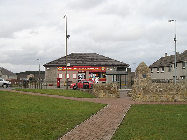
Addiewell (, ) is a former mining village in the Scottish council area of West Lothian. Historically it lies within the County of Midlothian. A new prison, HMP Addiewell, opened in 2008. There are two separate districts, Addiebrownhill and Loganlea. Addiewell is near Stoneyburn and West Calder. History In 1852 James Young left Manchester to return to live in Scotland. On return he bought the United States-registered patent for the production of paraffin oil by distillation of coal, known as the oil shale industry. Both the US and UK patents were subsequently upheld in both countries in a series of lawsuits, and other producers were obliged to pay him royalties. After his patents expired in 1864, in 1865 Young bought out his business partners at the Bathgate-based chemical works, and choose to build a larger factory at Addiewell, due to its location on the Breich river. After agreeing purchase of west from the village of West Calder, Young needed to develop a model vill ... [...More Info...] [...Related Items...] OR: [Wikipedia] [Google] [Baidu] |
Lochgelly
Lochgelly ( ; , IPA: �ɫ̪ɔxˈʝaɫ̪ai is a town in Fife, Scotland. It is located between Lochs Ore and Gelly to the north-west and south-east respectively. It is separated from Cowdenbeath by the village of Lumphinnans. According to the 2007 population estimate, the town has a population of 6,834. History Lochgelly, as part of the old parliamentary constituency of West Fife, was known as " Little Moscow" up to the 1950s owing to its Communist political leanings. An area of Lochgelly was known as the Happy Lands (or Happy Valley) and is referenced in the Scottish folk song 'The Kelty Clippie'. The town is served by Lochgelly railway station on the line between Edinburgh and Markinch. Economy In the 1970s new investment was brought in the form of a factory and development office built by the Andrew Corporation. This created microwave antennae under the banner of Andrew Antennas, symbolised by a red lightning flash on the dishes they made. These dishes were primarily fo ... [...More Info...] [...Related Items...] OR: [Wikipedia] [Google] [Baidu] |
Bannockburn
Bannockburn () is an area immediately south of the centre of Stirling in Scotland. It is part of the City of Stirling. It is named after the Bannock Burn, a stream running through the town before flowing into the River Forth. History Land in the vicinity of Bannockburn town, probably between the Pelstream and Bannock burns (hence Bannockburn), was the site of the Battle of Bannockburn fought in 1314—one of the pivotal battles of the 13th/14th century Wars of Independence between the kingdoms of Scotland and England. A large monument and visitor centre is located near the site of the battle. In previous generations tourists came to visit the site and look at the Borestone. The dignity of the barony of Bannockburn is currently held by Hope Vere Anderson, a descendant of the Sandilands and Vere families of Sandilands and Lesmahagow, Lanarkshire who were the original Barons of Bannockburn in the 14th century. In the year of 1746, after the Battle of Culloden, Bonnie Prince Ch ... [...More Info...] [...Related Items...] OR: [Wikipedia] [Google] [Baidu] |
Garforth
Garforth () is a town in the metropolitan borough of the City of Leeds, West Yorkshire, England. It sits in the Garforth and Swillington ward of Leeds City Council and the Leeds East parliamentary constituency. As of 2011, the population of Garforth was 14,957, having decreased since the last census. It is east of Central Leeds, south-west of York and north of Wakefield. It is mostly an Un-Parished area, like much of Greater Leeds. Etymology The place-name ''Garforth'' appears first in the Domesday Book of 1086 as ''Gereford'' and ''Gereforde'', with ''gar-'' spellings first appearing in 1336 in the form ''Garford''. The name seems to derive from the Norse words ''gāra'' ('triangular plot of land', derived from the word ''gār'', 'spear') and ''ford'' ('ford)', and thus meant 'ford at a triangular plot of land'. Or perhaps; Spear of the River Crossing. The plot is thought to have lain at a sharp turn in the road now called The Beck. Spellings beginning with ''ger- ... [...More Info...] [...Related Items...] OR: [Wikipedia] [Google] [Baidu] |
Hamstead, West Midlands
Hamstead is an area straddling the border of Birmingham and Sandwell, England, between Handsworth Wood and Great Barr, and adjacent to the Sandwell Valley area of West Bromwich. Hamstead Colliery was worked from the 19th century to the 1960s, with much housing built for the miners. Today the area is still referred to as Hamstead Village. The River Tame enters Hamstead after passing through Sandwell Valley, and runs through the village before exiting into Perry Hall Park. It is the largest tributary of the River Trent but is not navigable. After heavy rains it can overspill its banks, flooding the village. , flood alleviation works are being undertaken at Sandwell Valley, to protect Hamstead. Two brick bridges over the Tame in Hamstead are Grade II listed. St Paul's Church, Hamstead was consecrated in 1892. Its grounds include Hamstead War Memorial, commemorating local men who died in World War I. Both church and memorial are Grade II listed. There is also a secondary ... [...More Info...] [...Related Items...] OR: [Wikipedia] [Google] [Baidu] |
Thurcroft
Thurcroft is a village and civil parish situated south-east of Rotherham in the Metropolitan Borough of Rotherham in South Yorkshire, England. From 1902 to 1991, it was a mining community. It has a population of 5,296, increasing to 6,900 at the 2011 Census. History The name Thurcroft has Norse (Viking) roots as 'thorr' means thunder in old Norse, so is probably at least a thousand years old. According to A. D. Mills in his ''Dictionary of English Place-Names'', the first mention of Thurcroft is in 1319. Thurscroft: 'Enclosure of a man called Thorir. Old Scandinavian person's name + Old English word Croft. Until the 20th century, Thurcroft consisted of Thurcroft Hall, the longtime holding of the Mirfin family, and three other farms. Thurcroft Hall was held by the Mirfins (sometimes spelled Mirfield) until 1644 when Robert Mirfin, the lord of the manor, died childless. The property then was carried into the Beckwith family by his widow, who was also his stepsister. The Mir ... [...More Info...] [...Related Items...] OR: [Wikipedia] [Google] [Baidu] |
Working Men's Club
Working men's clubs are British private social clubs first created in the 19th century in industrial areas, particularly the North of England, Midlands, Scotland, Northern Ireland and South Wales Valleys, to provide recreation and education for working class men and their families. History The first working men's club opened in 1857 in Reddish, Reddish Working Men's Club is still located on Greg Street, and was established for the workers of Victoria and Albert Mill. Wisbech Working Men's Club & Institute was formed in 1864 in Wisbech, Isle of Ely, and moved to its present site in 1867. It was once the most financially successful of all the clubs in England, with over 1,300 members in 1904. Working men's clubs provided a framework for members to engage in a range of political, educational, or recreational activities. Despite the original educational ambitions, most working men's clubs are now mainly recreational. Typically, a club would have a room, often referred to (esp ... [...More Info...] [...Related Items...] OR: [Wikipedia] [Google] [Baidu] |
St Fagans National History Museum
St Fagans National Museum of History ( ; ), commonly referred to as St Fagans after the village where it is located, is an open-air museum in St Fagans, Cardiff, Wales, chronicling the historical lifestyle, culture, and architecture of the Welsh people. The museum is part of the wider network of Amgueddfa Cymru – Museum Wales. It consists of more than forty re-erected buildings from various locations in Wales, and is set in the grounds of St Fagans Castle, a Grade I listed Elizabethan manor house. In 2011 ''Which?'' magazine named the museum the United Kingdom's favourite visitor attraction. A six-year, £30-million revamp was completed in 2018 and the museum was named the Art Fund Museum of the Year in 2019. History The museum was founded in 1946 following the donation of the castle and lands by the Earl of Plymouth. It opened its doors to the public in 1948, under the name of the Welsh Folk Museum. The museum's name in Welsh (also meaning "Welsh Folk Museum") has remained ... [...More Info...] [...Related Items...] OR: [Wikipedia] [Google] [Baidu] |
Newbridge, Caerphilly
Newbridge () is a town and community in the county borough of Caerphilly, south Wales. It lies within the historic boundaries of the county of Monmouthshire. Etymology The Welsh placename for Newbridge is often incorrectly shown on OS Maps as ''Cefn Bychan''. It is in fact ''Trecelyn'', meaning "the town of the holly trees". History The town is located within the historic boundaries of Monmouthshire, considered by some to be a part of England until the late 20th century. In medieval times what are now the separate townships of Abercarn, Cwmcarn and Newbridge were known as Abercarne, a manorial title which goes back to the Norman period. Until quite recently the three townships were also within the boundaries of the ancient parish of Mynyddislwyn. Newbridge, as its name implies, was the name of land around the "new bridge" built across the Ebbw River towards the end of the 18th century. Newbridge was then a predominantly Welsh agrarian community of rural farms and sheep ... [...More Info...] [...Related Items...] OR: [Wikipedia] [Google] [Baidu] |


