|
May Sho'ate
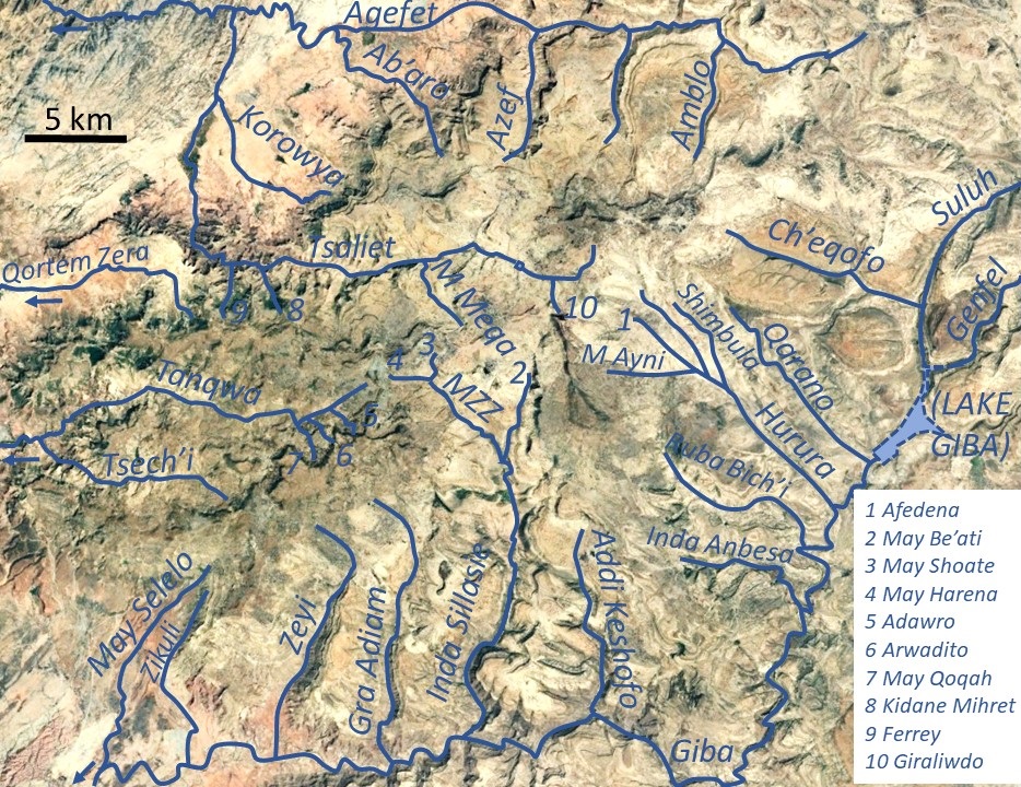
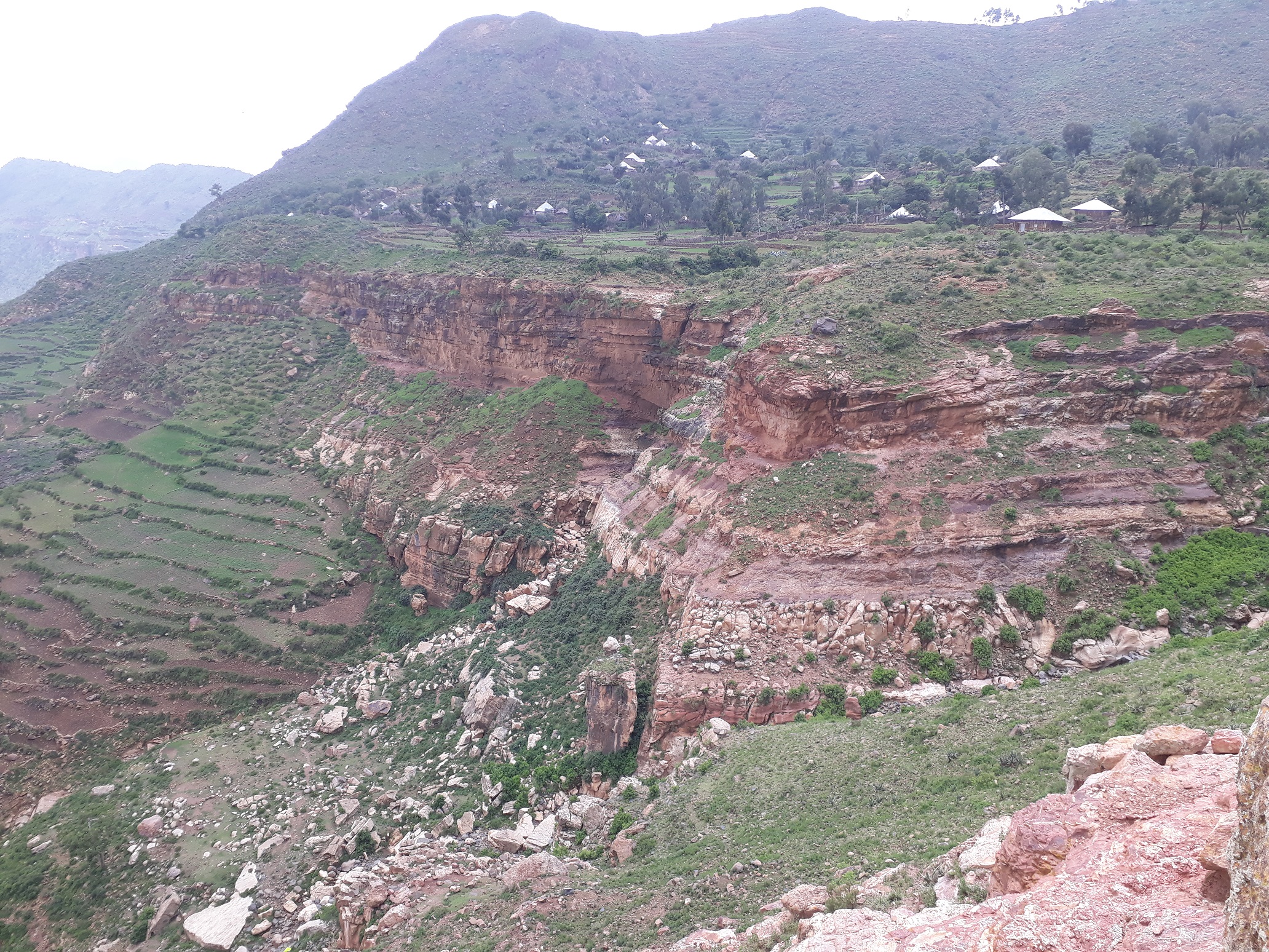
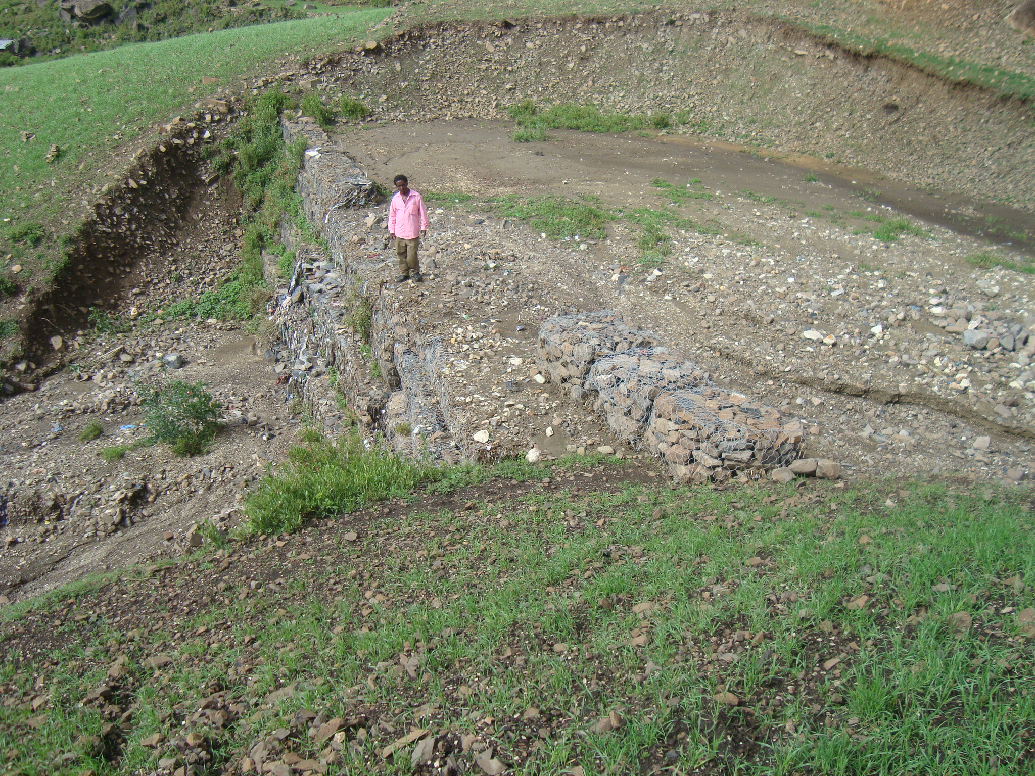
May Sho’ate (also called Argak'a) is a river of the Nile basin. Rising in the mountains of Dogu’a Tembien in northern Ethiopia, it flows southward to empty finally in Giba and Tekezé River. Characteristics It is a confined ephemeral river with an average slope gradient of 121 metres per kilometre. With its tributaries, the river has cut a deep gorge. May Zegzeg Integrated Catchment Management Project As part of outreach accompanying research in Dogu'a Tembien, the May Zegzeg Integrated Catchment Management Project was set up in 2004 in the catchment of the May Zegzeg River by researchers in cooperation with ADCS, a local NGO. There was a particular focus on the May Sho’ate subcatchment. The project included the implementation of conservation techniques to increase water infiltration and conserve the soil. The objective was to improve the livelihood of the communities of Harena, Hech'i and Addi Qolqwal as well as to demonstrate and promote global catchment management ... [...More Info...] [...Related Items...] OR: [Wikipedia] [Google] [Baidu] |
Degua Tembien
Dogu'a Tembien (, "Upper Tembien", sometimes transliterated as Degua Tembien) is a woreda in Tigray Region, Ethiopia. It is named in part after the former province of Tembien. Nowadays, the mountainous district is part of the Southeastern Tigray Zone. The administrative centre of this woreda is Hagere Selam. History Dogu’a Tembien holds numerous prehistoric sites, which have been dated to the Middle Stone Age in Ayninbirkekin, or Pastoral Neolithic in Aregen and Menachek. Geography Topography and landscapes Major mountains :* Tsatsen, 2815 metres, a wide mesa between Hagere Selam and Inda Maryam Qorar () :* Ekli Imba, 2799 metres, summit of the Arebay massif in Arebay ''tabia'' or district () :* Imba Zuw’ala, 2710 metres, near Hagere Selam () :* Aregen, 2660 metres, in Aregen ''tabia'' () :* Dabba Selama, 2630 metres, in Haddinnet ''tabia'' () (not to be confused with the homonymous monastery) :* Imba Dogu’a, 2610 metres, in Mizane Birhan ''tabia'' () :* I ... [...More Info...] [...Related Items...] OR: [Wikipedia] [Google] [Baidu] |
Baseflow
Baseflow (also called drought flow, groundwater recession flow, low flow, low-water flow, low-water discharge and sustained or fair-weather runoff) is the portion of the streamflow that is sustained between precipitation events, fed to streams by delayed pathways. It should not be confused with groundwater flow. Fair weather flow is also called base flow. Importance Baseflow is important for sustaining human centers of population and ecosystems. This is especially true for watersheds that do not rely on snowmelt. Different ecological processes will occur at different parts of the hydrograph. During the baseflow ascending limb, there is frequently more stream area and habitat available for water-dependent species, spawning salmon for example. During the recession limb which in California is from May to October, there is increasingly less stream area, indigenous species are more adept at surviving in low flow conditions than introduced species. Geology Baseflow is deri ... [...More Info...] [...Related Items...] OR: [Wikipedia] [Google] [Baidu] |
Antalo Limestone
The Antalo Limestone, also known as the Antalo Sequence, is a geological formation in Ethiopia. It is between 300 and 800 metres thick and comprises fossiliferous limestones and marls that were deposited in a reef. Marine microfossils have shown an age between 165 and 150 million years. Name and definition The Antalo Supersequence includes two main stratigraphic units: the Antalo Sequence and the Agula Group. The Antalo Sequence, or Antalo Limestone has been named after the town of Hintalo in Tigray, Ethiopia. The name of the formation was coined by geologist William Thomas Blanford, who accompanied the British Expedition to Abyssinia in 1868. At that time, Hintalo was a major town on the route of the invading British army. So far the nomenclature has not been proposed for recognition to the International Commission on Stratigraphy. Geographical extent The sedimentary succession is found in Ethiopia, in the Mekelle Outlier, in the Blue Nile gorge, in the Harrar Plateau an ... [...More Info...] [...Related Items...] OR: [Wikipedia] [Google] [Baidu] |
Amba Aradam Formation
The Amba Aradam Formation is a Cretaceous sandstone formation in Ethiopia. It is up to 200 metres thick, for instance in the Degua Tembien district. As fossils are absent, the age of the Amba Aradam Formation was interpreted based on the age of assumed corresponding sandstones elsewhere in Ethiopia: the Debre Libanos Sandstones in the Blue Nile Basin, and the Upper Sandstone near Harrar in southeast Ethiopia, both of Late Cretaceous age (100–66 million years ago). The lithology of the Amba Aradam Formation makes it less suitable for rock church excavation; caves have however been blasted in this formation to serve as headquarters for the TPLF during the Ethiopian Civil War of the 1980s. Name and definition The name “Amba Aradam Sandstone” was coined by geologist William Thomas Blanford, who accompanied the British invading army in 1868. The formation is named after the Amba Aradam mountain, where the formation widely outcrops. So far the nomenclature was not proposed for ... [...More Info...] [...Related Items...] OR: [Wikipedia] [Google] [Baidu] |
Ashangi Basalts
The Ashangi Basalts are the earliest Tertiary volcanic rocks in north Ethiopia, hence they are in the lowest position. These dark porphyritic basalts are separated from the Mesozoic formations below it by basal conglomerates. The basalts hold phenocrysts that developed before the magma reached the earth surface. These basalts are weathered, partially eroded and have a sub-horizontal stratification, particularly at the lower part. This series was created during the first period of the flood basalt eruptions in north Ethiopia, in the Oligocene. Name and definition The name was coined by geologist William Thomas Blanford, who accompanied the British Expedition to Abyssinia in 1868,{{cite book , last1=Blanford , first1=W.T. , title=Observations on the geology and zoology of Abyssinia, made during the progress of the British expedition to that country in 1867-68 , url=https://archive.org/details/cu31924024736666 , date=1870 , publisher=Macmillan and Co. , location=London after Lake Ha ... [...More Info...] [...Related Items...] OR: [Wikipedia] [Google] [Baidu] |
Intra-volcanic Sedimentary Rock In North Ethiopia
Between 29 and 27 million years ago, the extrusion of Ethiopia’s flood basalts was interrupted and deposition of continental sediments occurred. Inter-trappean beds outcrop in many places of the Ethiopian highlands. They consist of fluvio-lacustrine deposits, that are generally a few tens of metres thick. Often, these interbedded fluvio-lacustrine deposits are very visible because their bright colours strongly contrast with the basalt environment. Name and definition The formation, also called ''silicified limestone'' and ''interbedded lacustrine deposits'' was first extensively characterised in the 1930s by Merla and Minucci. Stratigraphic context The formation is generally at the interface between the lower Ashangi Basalts, and the upper Alaji Basalts. Environment The sediments were deposited in shallow lakes and marshes in large topographic depressions. The dense vegetation hosted mammals and birds, which found their food between the reeds of the lake shores. The decompos ... [...More Info...] [...Related Items...] OR: [Wikipedia] [Google] [Baidu] |
Alaji Basalts
The Alaji (upper) Basalts are the youngest series of the Ethiopian flood basalts. The most recent flows are only 15 million years old. Name and definition The name was coined by geologist William Thomas Blanford, who accompanied the British Expedition to Abyssinia in 1868, after the Imba Alaje mountain. So far the nomenclature has not been proposed for recognition to the International Commission on Stratigraphy. Stratigraphic context Uppermost Tertiary flood basalts in Ethiopia. Locally they are covered by Pliocene shield volcanoes, such as the Simien Mountains, or Mount Guna. These flows have been deposited on the lower Ashangi Basalts and locally on intra-volcanic sedimentary rock. Environment Like all volcanic rocks, the Alaji Basalts originate from initial melting of the Earth's mantle. After extrusion, the magmatic structures form at the surface. Common volcanic structures such as lava tubes or ropy lavas are absent in the Alaji Basalts, but ( columnar joints) are omnipr ... [...More Info...] [...Related Items...] OR: [Wikipedia] [Google] [Baidu] |
May Shoate And May Harena
May is the fifth month of the year in the Julian and Gregorian calendars and is the third of seven months to have a length of 31 days. May is a month of spring in the Northern Hemisphere, and autumn in the Southern Hemisphere. Therefore, May in the Southern Hemisphere is the seasonal equivalent of November in the Northern Hemisphere and vice versa. Late May typically marks the start of the summer vacation season in the United States (Memorial Day) and Canada (Victoria Day) that ends on Labor Day, the first Monday of September. May (in Latin, ''Maius'') was named for the Greek goddess Maia, who was identified with the Roman era goddess of fertility, Bona Dea, whose festival was held in May. Conversely, the Roman poet Ovid provides a second etymology, in which he says that the month of May is named for the ''maiores,'' Latin for "elders," and that the following month (June) is named for the ''iuniores,'' or "young people" (''Fasti VI.88''). Eta Aquariids meteor shower appear ... [...More Info...] [...Related Items...] OR: [Wikipedia] [Google] [Baidu] |
May Harena
May Harena is a river of the Nile basin. Rising in the mountains of Dogu’a Tembien in northern Ethiopia, it flows eastward to empty finally in Giba and Tekezé River. Characteristics It is a confined ephemeral river with an average slope gradient of 100 metres per kilometre. Hydrology River discharge in May Harena is highly seasonal, with the river only carrying water in the rainy season, after rain events. The problem is exacerbated by the fact that most of the urban drainage from Hagere Selam is rapidly directed to this river. Conservation activities (such as those by the Selam WatSani project aim at buffering these floods. There is however a strong contrast with better regularised adjacent May Sho'ate River. Flash floods and flood buffering Runoff mostly happens in the form of high runoff discharge events that occur in a very short period (called flash floods). These are related to the steep topography, often little vegetation cover and intense convective rainfall. ... [...More Info...] [...Related Items...] OR: [Wikipedia] [Google] [Baidu] |
Irrigation
Irrigation (also referred to as watering) is the practice of applying controlled amounts of water to land to help grow crops, landscape plants, and lawns. Irrigation has been a key aspect of agriculture for over 5,000 years and has been developed by many cultures around the world. Irrigation helps to grow crops, maintain landscapes, and revegetate disturbed soils in dry areas and during times of below-average rainfall. In addition to these uses, irrigation is also employed to protect crops from frost, suppress weed growth in grain fields, and prevent soil consolidation. It is also used to cool livestock, reduce dust, dispose of sewage, and support mining operations. Drainage, which involves the removal of surface and sub-surface water from a given location, is often studied in conjunction with irrigation. There are several methods of irrigation that differ in how water is supplied to plants. Surface irrigation, also known as gravity irrigation, is the oldest form of i ... [...More Info...] [...Related Items...] OR: [Wikipedia] [Google] [Baidu] |
May Shoate Dam
May is the fifth month of the year in the Julian and Gregorian calendars and is the third of seven months to have a length of 31 days. May is a month of spring in the Northern Hemisphere, and autumn in the Southern Hemisphere. Therefore, May in the Southern Hemisphere is the seasonal equivalent of November in the Northern Hemisphere and vice versa. Late May typically marks the start of the summer vacation season in the United States (Memorial Day) and Canada (Victoria Day) that ends on Labor Day, the first Monday of September. May (in Latin, ''Maius'') was named for the Greek goddess Maia, who was identified with the Roman era goddess of fertility, Bona Dea, whose festival was held in May. Conversely, the Roman poet Ovid provides a second etymology, in which he says that the month of May is named for the ''maiores,'' Latin for "elders," and that the following month (June) is named for the ''iuniores,'' or "young people" (''Fasti VI.88''). Eta Aquariids meteor shower appear ... [...More Info...] [...Related Items...] OR: [Wikipedia] [Google] [Baidu] |
Check Dam
A steel check dam A check dam is a small, sometimes temporary, dam constructed across a swale, drainage ditch, or waterway to counteract erosion by reducing water flow velocity. Check dams themselves are not a type of new technology; rather, they are an ancient technique dating from the second century A.D. Check dams are typically, though not always, implemented in a system of several dams situated at regular intervals across the area of interest. Function A check dam placed in the ditch, swale, or channel interrupts the flow of water and flattens the gradient of the channel, thereby reducing the velocity. In turn, this obstruction induces infiltration and reduces eroding. They can be used not only to slow flow velocity but also to distribute flows across a swale to avoid preferential paths and guide flows toward vegetation. Although some sedimentation may result behind the dam, check dams do not primarily function as sediment-trapping devices. For instance, on the Gra ... [...More Info...] [...Related Items...] OR: [Wikipedia] [Google] [Baidu] |


