|
Mariner's Astrolabe
The mariner's astrolabe, also called sea astrolabe, was an inclinometer used to determine the latitude of a ship at sea by measuring the sun's noon altitude (declination) or the meridian altitude of a star of known declination. Not an astrolabe proper, the mariner's astrolabe was rather a graduated circle with an alidade used to measure vertical angles. They were designed to allow for their use on boats in rough water and/or in heavy winds, which astrolabes are ill-equipped to handle. It's notable for its role during the Age of Exploration where Portuguese and Spanish navigators used it to great success. In the sixteenth century, the instrument was also called a ring. History Many dates can be found for the appearance of the first Mariner's astrolabes. The earliest date, 1295, is offered by the Majorcan astronomer Ramon Llull.''The Oxford Companion to Ships and the Sea'', Peter Kemp ed., 1976 Later dates center around the late 15th century, with Samuel Purchas claimin ... [...More Info...] [...Related Items...] OR: [Wikipedia] [Google] [Baidu] |
International Journal Of Nautical Archaeology
The Nautical Archaeology Society (NAS) is a charity registered in England and WalesCharity Commission The Nautical Archaeology Society is registered charity number 264209 and in Scotland and is a .Companies house The Nautical Archaeology Society is registered at Companies House in England no. 1039270 The charitable aims and object of the company are to further research in Nautical Archaeology and |
Esmeralda (carrack)
''Esmeralda'' was a Portuguese carrack () that sank in May 1503 off the coast of Oman as part of Vasco da Gama's 1502 Armada to India while commanded by da Gama's maternal uncle Vicente Sodré. First relocated in 1998 and excavated by David Mearns in 2013–15, is the earliest ship found, , from Europe's Age of Discovery. Items recovered from the wreck site include the earliest known mariner's astrolabe The mariner's astrolabe, also called sea astrolabe, was an inclinometer used to determine the latitude of a ship at sea by measuring the sun's noon altitude (declination) or the meridian altitude of a star of known declination. Not an astrolabe ... believed to have been made between 1496 and 1501 and a ship's bell dated 1498. See also * 4th Portuguese India Armada References {{Authority control Shipwrecks in the Arabian Sea 1503 in the Portuguese Empire Ships of Portugal Carracks ... [...More Info...] [...Related Items...] OR: [Wikipedia] [Google] [Baidu] |
David Mearns
David Louis Mearns (born 10 August 1958) is an American-born United Kingdom based marine scientist and oceanographer, who specializes in deep water search and recovery operations, and the discovery of the location of historic shipwrecks. Early life Mearns was raised in Weehawken, New Jersey, where he attended Weehawken High School, graduating in 1976. He subsequently graduated B.Sc. in Marine Biology from Fairleigh Dickinson University in 1980, and obtained a masters degree in Marine Geology from the University of South Florida in 1986. Oceanographic career From 1986 to 1995 Mearns was employed in the commercial undersea surveying industry in a managerial capacity. In 1990 he worked on the criminal investigation into the deliberate sinking of the freighter '' Lucona'' by a time bomb, and in 1994 located the wreck of the ore-bulk-oil carrier . Relocating to England in the mid 1990s, he established ''Blue Water Recoveries, Limited'', a commercial company that locates and research ... [...More Info...] [...Related Items...] OR: [Wikipedia] [Google] [Baidu] |
San Esteban (1554 Shipwreck)
''San Esteban'' was a Spanish cargo ship that was wrecked in a storm in the Gulf of Mexico on what is now the Padre Island National Seashore in southern Texas on 29 April 1554. ''San Esteban'' was one of a flotilla of four ships carrying treasure from New Spain (Mexico) to Cuba. Three were wrecked in the storm, including ''San Esteban''. Many of the three hundred sailors and passengers drowned while trying to reach shore. About thirty took a boat to seek help. Almost all the others died of thirst or starvation, or were killed by hostile local Karankawa people, Karankawa Indians during their attempt to walk back to safety. The Spanish sent a salvage expedition, but recovered less than half of the cargo and treasure. One of the wrecks was rediscovered in 1964. A private company, Platoro, Ltd., began to excavate the ''Espíritu Santo'' wreck in late 1967, which caused public outrage and the passage of new laws to protect wrecks on the Texan coast. The remains of ''San Esteban'' wer ... [...More Info...] [...Related Items...] OR: [Wikipedia] [Google] [Baidu] |
Corpus Christi Museum Of Science And History
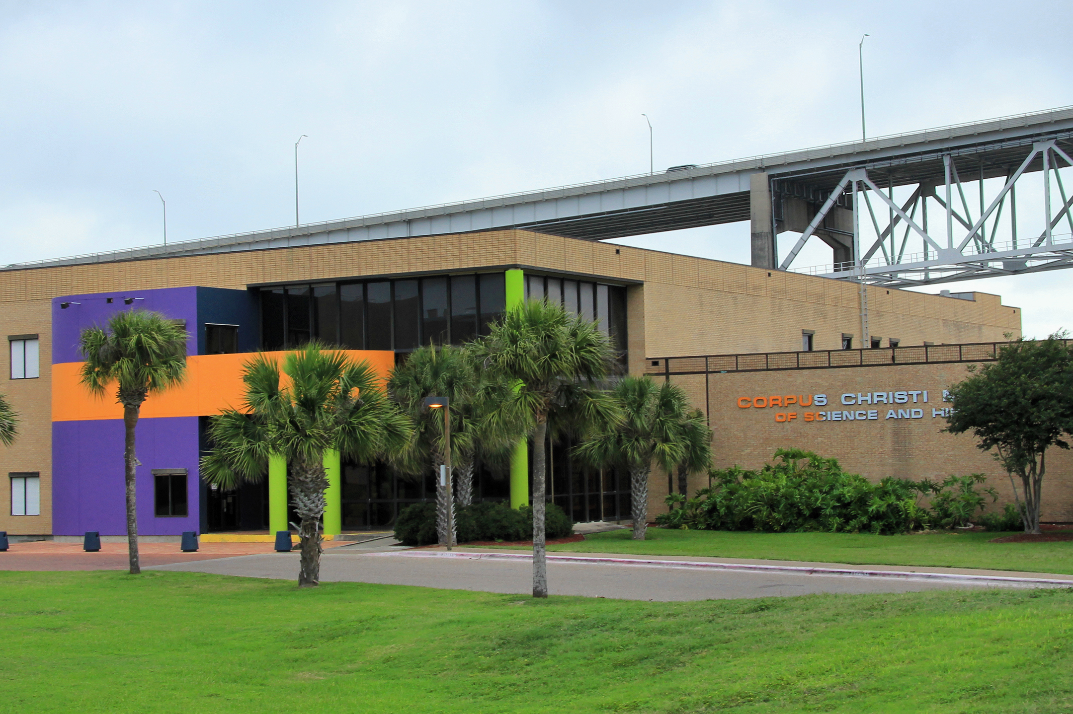
The Corpus Christi Museum of Science and History is a science and history museum in Corpus Christi, Texas, near Corpus Christi Harbor Bridge and the waterfront. It was established in 1957. Among its many displays covering an area of over 40,000 square feet are many artifacts found in the wreck of the Spanish ship '' San Estaban'', including the world's oldest mariner's astrolabe An astrolabe (; ; ) is an astronomy, astronomical list of astronomical instruments, instrument dating to ancient times. It serves as a star chart and Model#Physical model, physical model of the visible celestial sphere, half-dome of the sky. It ... with a confirmed date of 1554. An extension to the museum opened in May 1990 to house the ''Shipwreck!'' exhibition. References External linksOfficial site Science museums in Texas History museums in Texas Buildings and structures in Corpus Christi, Texas Museums established in 1957 1957 establishments in Texas Museums in Nueces County, Texas To ... [...More Info...] [...Related Items...] OR: [Wikipedia] [Google] [Baidu] |
Global Positioning System
The Global Positioning System (GPS) is a satellite-based hyperbolic navigation system owned by the United States Space Force and operated by Mission Delta 31. It is one of the global navigation satellite systems (GNSS) that provide geolocation and time information to a GPS receiver anywhere on or near the Earth where there is an unobstructed line of sight to four or more GPS satellites. It does not require the user to transmit any data, and operates independently of any telephone or Internet reception, though these technologies can enhance the usefulness of the GPS positioning information. It provides critical positioning capabilities to military, civil, and commercial users around the world. Although the United States government created, controls, and maintains the GPS system, it is freely accessible to anyone with a GPS receiver. Overview The GPS project was started by the U.S. Department of Defense in 1973. The first prototype spacecraft was launched in 1978 an ... [...More Info...] [...Related Items...] OR: [Wikipedia] [Google] [Baidu] |
Sextant
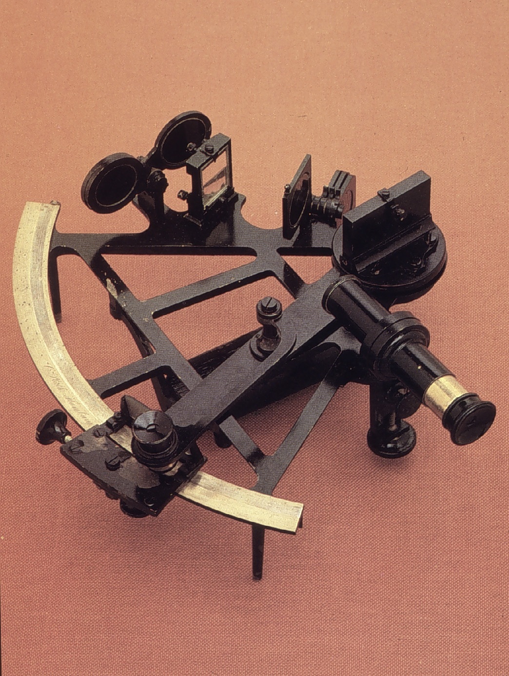
A sextant is a doubly reflecting navigation instrument that measures the angular distance between two visible objects. The primary use of a sextant is to measure the angle between an astronomical object and the horizon for the purposes of celestial navigation. The estimation of this angle, the altitude, is known as ''sighting'' or ''shooting'' the object, or ''taking a sight''. The angle, and the time when it was measured, can be used to calculate a position line on a nautical or aeronautical chart—for example, sighting the Sun at noon or Polaris at night (in the Northern Hemisphere) to estimate latitude (with sight reduction). Sighting the height of a landmark can give a measure of ''distance off'' and, held horizontally, a sextant can measure angles between objects for a position on a chart. A sextant can also be used to measure the lunar distance between the moon and another celestial object (such as a star or planet) in order to determine Greenwich Mean Time and hence ... [...More Info...] [...Related Items...] OR: [Wikipedia] [Google] [Baidu] |
Davis Quadrant
The backstaff is a navigational instrument that was used to measure the altitude of a celestial body, in particular the Sun or Moon. When observing the Sun, users kept the Sun to their back (hence the name) and observed the shadow cast by the upper vane on a horizon vane. It was invented by the English navigator John Davis, who described it in his book ''Seaman's Secrets'' in 1594. Types of backstaffs Backstaff is the name given to any instrument that measures the altitude of the sun by the projection of a shadow. It appears that the idea for measuring the sun's altitude using back observations originated with Thomas Harriot. Many types of instruments evolved from the cross-staff that can be classified as backstaffs. Only the Davis quadrant remains dominant in the history of navigation instruments. Indeed, the Davis quadrant is essentially synonymous with backstaff. However, Davis was neither the first nor the last to design such an instrument and others are considered here ... [...More Info...] [...Related Items...] OR: [Wikipedia] [Google] [Baidu] |
Quadrant (instrument)
A quadrant is an instrument used to measure angles up to 90°. Different versions of this instrument could be used to calculate various readings, such as longitude, latitude, and time of day. It was first proposed by Ptolemy as a better kind of astrolabe. Several different variations of the instrument were later produced by medieval Muslim astronomers. Mural quadrants were important astronomical instruments in 18th-century European observatories, establishing a use for positional astronomy. Etymology The term ''quadrant'', meaning one fourth, refers to the fact that early versions of the instrument were derived from astrolabes. The quadrant condensed the workings of the astrolabe into an area one fourth the size of the astrolabe face; it was essentially a quarter of an astrolabe. History During Rigvedic times in ancient India, quadrants called 'Tureeyam's were used to measure the extent of a great solar eclipse. The use of a Tureeyam for observing a solar eclipse by Ri ... [...More Info...] [...Related Items...] OR: [Wikipedia] [Google] [Baidu] |


