|
Mali I Thatë
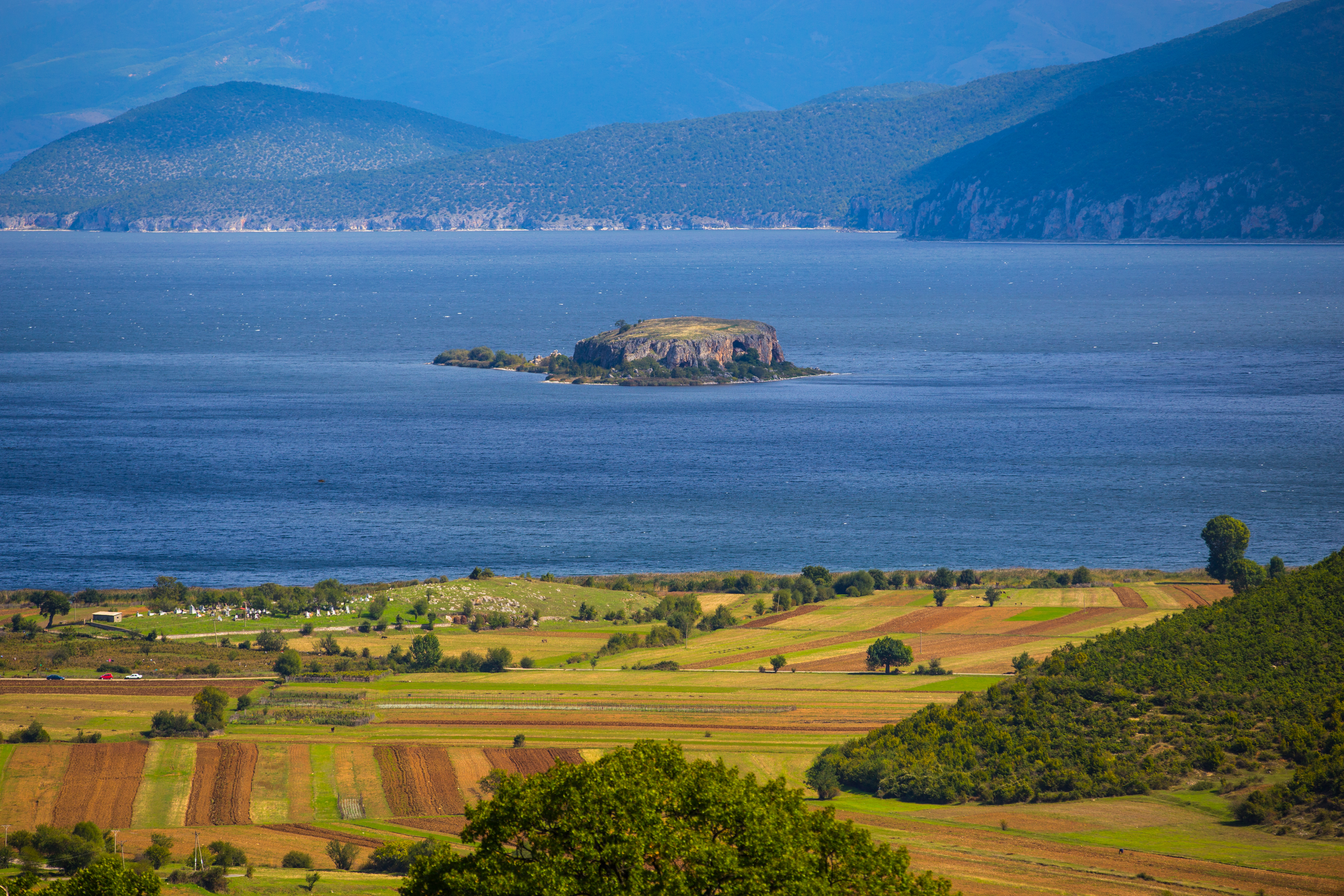
Mali i Thatë (, ''Suva Gora''; ) is a mountain in southeast Albania; with a part of it being in the southwest of North Macedonia (known with the name Galičica and declared a National Park) with the highest altitude of 2287 meters. Geography It borders Lake Prespa in the east, Lake Ohrid in northwest and overlooks the city of Pogradec to the west. It stretches 25 km from north to south and is 8 km wide in its central part. Mali i Thatë highest peak is Pllaja e Pusit (meaning "Well's plateau") and it reaches an altitude of above sea level. It is found within Albania, close to the Macedonian border. From this high peak, among several mountains of Albania, both Ohrid Lake and Prespa Lake can be seen as well as the third highest peak in North Macedonia, Baba Mountain or Pelister Mountain (2601 m). The mountain has an anticlinal shape and is almost completely composed of mesozoic limestone formations."Fjalori Enciklopedik Shqiptar", by Akademia e Shkencave e RPSSH, Ti ... [...More Info...] [...Related Items...] OR: [Wikipedia] [Google] [Baidu] |
Maja E Thatë
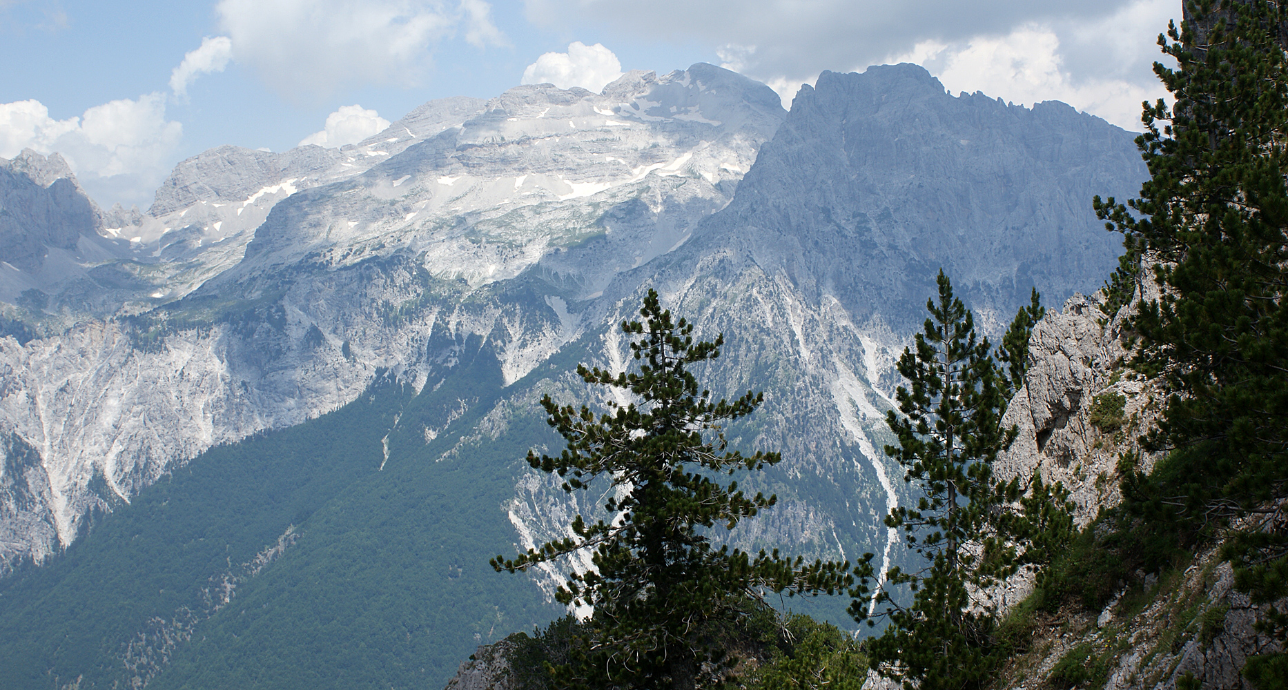
Maja e Thatë () is a mountain peak of the Albanian Alps (Accursed Mountains) in Albania.Military topographic map of Albania (1:25 000): K-34-52-D-a (M. JEZERCES) It is located within Valbonë Valley National Park, roughly northwest of Valbonë and rises more than above the village. The mountain's southern and western lower slopes are relatively rich in beech and pine forests, while the higher slopes consist of very steep dolomite and limestone rock walls, suitable for mountaineering and rock climbing. Overview Maja e Thatë has an elevation of and is located northwest of Valbonë village, in the district of Tropojë, Kukës county, in Albania. It lies within the massif of Kolata, in the eastern part of the Albanian Alps (Accursed Mountains) range. Maja e Thatë rises above the village of Valbonë by more than , but being surrounded by higher peaks within its massif and because high-altitude mountain passes connect it with them, Maja e Thatë's topographic prominence is ... [...More Info...] [...Related Items...] OR: [Wikipedia] [Google] [Baidu] |
Ohrid Lake
Lake Ohrid is a lake which straddles the mountainous border between the southwestern part of North Macedonia and eastern Albania. It is one of Europe's deepest and oldest lakes, with a unique aquatic ecosystem of worldwide importance, with more than 200 endemic species. North Macedonia's side of Lake Ohrid was declared a World Heritage Site by UNESCO in 1979, with the site being extended to also include the cultural and historic area of Ohrid in 1980. In 2010, NASA named one of Titan's lakes after it. In 2014, the Ohrid-Prespa Transboundary Reserve between Albania and North Macedonia was added to UNESCO's World Network of Biosphere Reserves. Albania's side of Lake Ohrid was also designated UNESCO world heritage status in 2019. North Macedonia's portion was designated as a protected Ramsar site in 2021, passing all nine criteria for proclamation.Ministry of Environment and Physical Planning (2021)Ramsar Information Sheet: Lake Ohrid. Ramsar Secretariat, Gland, Switzerland. In ... [...More Info...] [...Related Items...] OR: [Wikipedia] [Google] [Baidu] |
Mountains Of Albania
Albania is mostly mountainous, with the first alpine regions forming towards the end of the Jurassic, Jurassic period. During the Cenozoic, Cenozoic era, the malformation of the ''Albanides'' accelerated, causing the subterranean landscape to take its present form. The average altitude of the country is , almost three times that of Europe. Its highest summits are situated in the Accursed Mountains, Albanian Alps and the eastern mountain range, with Korab (mountain), Korab being the highest peak, at above sea level. The country's geography is unique due to its location and varied relief, with landscapes ranging from Mediterranean Basin, mediterranean in the west to a more Geographical midpoint of Europe, continental influence in the east and mountainous terrain in the interior and east. This combination of plains, hills and mountains has resulted in a diverse range of geographical features, extending horizontally and vertically. However, this complexity has made regionalization ch ... [...More Info...] [...Related Items...] OR: [Wikipedia] [Google] [Baidu] |
List Of Mountains In Albania
Albania is mostly mountainous, with the first alpine regions forming towards the end of the Jurassic period. During the Cenozoic era, the malformation of the ''Albanides'' accelerated, causing the subterranean landscape to take its present form. The average altitude of the country is , almost three times that of Europe. Its highest summits are situated in the Albanian Alps and the eastern mountain range, with Korab being the highest peak, at above sea level. The country's geography is unique due to its location and varied relief, with landscapes ranging from mediterranean in the west to a more continental influence in the east and mountainous terrain in the interior and east. This combination of plains, hills and mountains has resulted in a diverse range of geographical features, extending horizontally and vertically. However, this complexity has made regionalization challenging, as different authors have used alternating criteria and methods. In the 1920s, Herbert Louis propo ... [...More Info...] [...Related Items...] OR: [Wikipedia] [Google] [Baidu] |
Prespa National Park (Albania)
Prespa National Park () is a List of national parks of Albania, national park situated in southeastern Albania on the border triangle shared with Greece and North Macedonia. At approximately , the park encompasses the country's sections of the Prespa Lake, Great and Small Prespa Lake. It is considerably characterised by high mountains, narrow islands, vast freshwater wetlands, salt marshes, meadows, reed beds and dense forests. History Established to protect the natural and cultural heritage of the region, the park is included in the European Green Belt and the World Network of Biosphere Reserves under the UNESCO Man and Biosphere Programme. Albania's section of Great Prespa Lake, Great Prespa is recognised as a wetland of international importance by designation under the Ramsar Convention and further as an Important Bird Area, Important Bird and Important Plant Area, Plant Area. Both lakes are essentially situated between 850 and 900 metres elevation Metres above the Adriati ... [...More Info...] [...Related Items...] OR: [Wikipedia] [Google] [Baidu] |
Spiro Bellkameni
Spiro Bellkameni (1885-1912) was an Albanian kachak, revolutionary and activist of the Albanian National Awakening. He led one of the most important bands during the Albanian revolts of the 1900-1910s. Bellkameni's band operated around south-eastern Albania and worked closely with other Albanian revolutionary groups in the region, particularly that of Sali Butka's. Life Born in Bellkameni, in the Manastir Vilayet of the Ottoman Empire in 1885 he was a close associate of Themistokli Gërmenji and Mihal Grameno. In 1906 he was a member of Bajo Topulli's band that assassinated the Greek Orthodox bishop of Korçë Photios as retribution for the assassination of Kristo Negovani, which was instigated by Photios. In March of 1911, Spiro returned from exile to the village of Butkë near Kolonjë, where he spent some time with the çeta of fellow Albanian revolutionary Sali Butka. In order to grow the revolutionary movement, Butka organised the formation of a separate çeta detachm ... [...More Info...] [...Related Items...] OR: [Wikipedia] [Google] [Baidu] |
Albanian Revolt Of 1911
The Malissori uprising or the Albanian revolt of 1911 was one of many Albanians, Albanian revolts in the Ottoman Empire and lasted from 24 March 1911 until 4 August 1911 in the region of Malësia (also spelled Malissori). Background The main headquarters of the rebels were in Podgorica and King Nikola provided weapons for the insurgents. King Nicholas promised to support Malësor with arms and to provide a shelter to their families before the revolt began. Although both king Nicholas I of Montenegro, Nikola and prince Danilo, Crown Prince of Montenegro, Danilo were assuring Ottoman ambassador that they are observing "the strictest neutrality" it was obvious that Kingdom of Montenegro was involved in this revolt. General Janko Vukotić, Vukotić organized passing out the weapon to the rebels. Nikola's strategy was to stimulate unrest in northern Albania and north-western Kosovo to the point where he could intervene and annex more territory for Montenegro. Most of contemporary ... [...More Info...] [...Related Items...] OR: [Wikipedia] [Google] [Baidu] |
Mesozoic
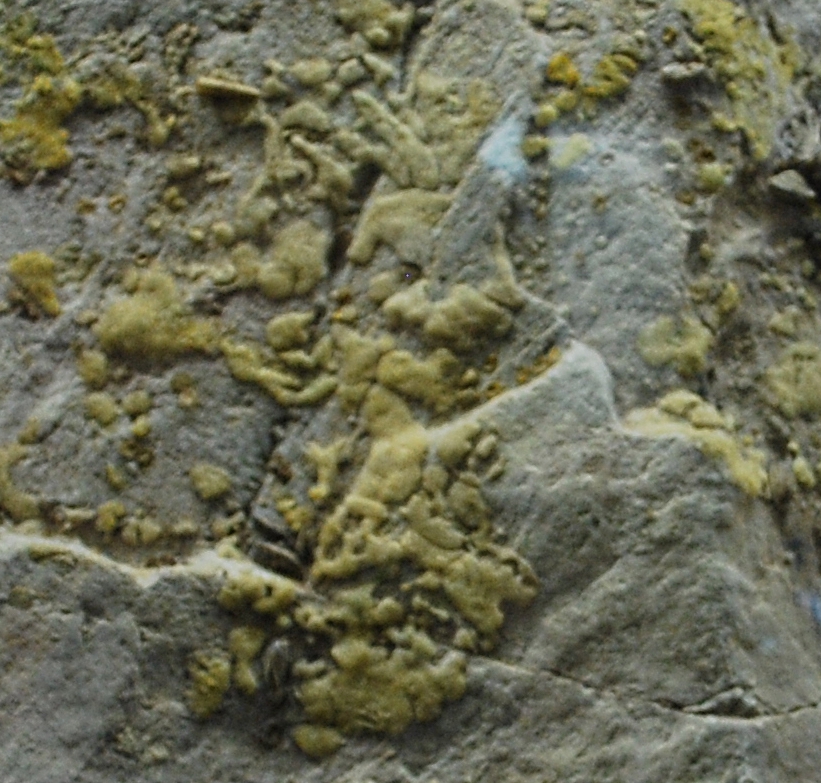
The Mesozoic Era is the Era (geology), era of Earth's Geologic time scale, geological history, lasting from about , comprising the Triassic, Jurassic and Cretaceous Period (geology), Periods. It is characterized by the dominance of archosaurian reptiles such as the dinosaurs, and of Gymnosperm, gymnosperms such as cycads, ginkgoaceae and Araucariaceae, araucarian conifers; a hot Greenhouse and icehouse earth, greenhouse climate; and the tectonic break-up of Pangaea. The Mesozoic is the middle of the three eras since Cambrian explosion, complex life evolved: the Paleozoic, the Mesozoic, and the Cenozoic. The era began in the wake of the Permian–Triassic extinction event, the largest mass extinction in Earth's history, and ended with the Cretaceous–Paleogene extinction event, another mass extinction whose victims included the non-avian dinosaurs, Pterosaur, pterosaurs, Mosasaur, mosasaurs, and Plesiosaur, plesiosaurs. The Mesozoic was a time of significant tectonic, climatic, an ... [...More Info...] [...Related Items...] OR: [Wikipedia] [Google] [Baidu] |
Baba Mountain (North Macedonia)
Baba (; or Baba Mountain, ), also known by the name of its highest peak, Pelister (), is a mountain in North Macedonia. The Pelister peak (2601 metres, or 8533 feet) overlooks the city of Bitola. Baba is the third highest mountain in North Macedonia. Other peaks besides Pelister are Dva Groba (2514 metres), Veternica (2420 metres), Musa (2350 metres), Ržana (2334 meters), Široka (2218 metres), Kozji Kamen (2199 metres), Griva (2198 metres) and Golema Čuka (2188 metres) in North Macedonia, and Belavoda (2.179 meters), Kirko. The Baba massif splits up the rivers in the region, so that they either flow towards the Adriatic Sea. Pelister National Park's flora include the five-needle pine molika (''Pinus peuce'') - a unique species of tertiary age being present on only a few mountains in the Balkan Peninsula. Fauna in the area include: bears, roe deer, wolves, chamois, deer, wild boars, rabbits, several species of eagles, partridges, redbilled jackdaws, and the endemic Macedonian P ... [...More Info...] [...Related Items...] OR: [Wikipedia] [Google] [Baidu] |
Prespa Lake
The Lake Prespa is located on the tripoint of North Macedonia, Albania and Greece. It is a system of two lakes separated by an isthmus: the Great Prespa Lake, divided between the three countries, and the Little Prespa Lake, mostly within Greece. They are the highest tectonic lakes in the Balkans, at an elevation of . The area contains three national parks: Galičica National Park in North Macedonia, Prespa National Park in Albania, and Prespa National Park in Greece. The largest town in the region is Resen in North Macedonia. In 2014, Ohrid-Prespa Transboundary Biosphere Reserve between Albania and North Macedonia was added to UNESCO's World Network of Biosphere Reserves. Geography The Great Prespa Lake (, ''Prespansko Ezero'', , , ''Megáli Préspa'') has the total surface of . The largest part of it, belongs to North Macedonia; to Albania; and to Greece. To the south, the Little Prespa Lake (Greek: Μικρή Πρέσπα, ''Mikri Prespa''; Albanian: ''Prespa e Vog ... [...More Info...] [...Related Items...] OR: [Wikipedia] [Google] [Baidu] |
Accursed Mountains
The Accursed Mountains (; sh-Latn-Cyrl, Prokletije, Проклетије, separator=" / ", ; both translated as "Cursed Mountains"), also known as the Albanian Alps (; sh-Latn-Cyrl, Albanski Alpi, Албански Алпи, separator=" / ", link=no), is a mountain range in coastal Southeast Europe adjacent to the Adriatic Sea. It is the southernmost subrange of the Dinaric Alps range (Dinarides), extending from northern Albania to western Kosovo and northeastern Montenegro. Maja Jezercë, standing at , is the highest point of the Accursed Mountains and of all Dinaric Alps, and the List of mountains in Albania, fifth highest peak in Albania. The range includes the mountain Zla Kolata, which, at , is the tallest mountain in Montenegro. The range also includes the mountain Gjeravica, which, at , is the second tallest mountain in Kosovo. One of the southernmost glaciers, glacial masses in Europe was discovered in the Albanian part of the range in 2009. Name The origin of the nam ... [...More Info...] [...Related Items...] OR: [Wikipedia] [Google] [Baidu] |


