|
List Of Possible Impact Structures On Earth
This is a list of possible impact structures on Earth. More than 130 geophysical features on the surface of the Earth have been proposed as candidate sites for impact events by appearing several times in the literature and/or being endorsed by the Impact Field Studies Group (IFSG) and/or Expert Database on Earth Impact Structures (EDEIS). For the purposes of this list and the List of impact craters on Earth, the terminology of "confirmed" as defined by the Earth Impact Database (EID) is considered authoritative. List of possible impact structures The following tables list geological features on Earth that some individuals have associated with impact events, but for which there is currently no confirming scientific evidence in the peer-reviewed literature. In order for a structure to be confirmed as an impact crater, it must meet a stringent set of well-established criteria. Some proposed impact structures are likely to eventually be confirmed, whereas others are likely to be s ... [...More Info...] [...Related Items...] OR: [Wikipedia] [Google] [Baidu] |
Impact Event
An impact event is a collision between astronomical objects causing measurable effects. Impact events have physical consequences and have been found to regularly occur in planetary systems, though the most frequent involve asteroids, comets or meteoroids and have minimal effect. When large objects impact terrestrial planets such as the Earth, there can be significant physical and biospheric consequences, though atmospheres mitigate many surface impacts through atmospheric entry. Impact craters and structures are dominant landforms on many of the Solar System's solid objects and present the strongest empirical evidence for their frequency and scale. Impact events appear to have played a significant role in the evolution of the Solar System since its formation. Major impact events have significantly shaped Earth's history, and have been implicated in the formation of the Earth–Moon system. Impact events also appear to have played a significant role in the evolutionary hi ... [...More Info...] [...Related Items...] OR: [Wikipedia] [Google] [Baidu] |
Aorounga Crater
Aorounga is an eroded meteorite impact crater in Chad, Africa. The exposed remnant of the crater is in diameter and its age is estimated to be less than 345 million years ( Carboniferous or younger).VINCENT P.M., BEAUVILAIN A., 1996. Découverte d'un nouveau cratère d'impact météoritique en Afrique : l'astroblème de Gweni-Fada (Ennedi, Sahara du Tchad). C. R. Acad. Sci. Paris, t. 323, série II a, pp. 987-997 Description An outer and an inner ring (11 and 7 km, respectively) rise about 100 m above the mean level of the surrounding plain (see topographic map). Both aforementioned rings are separated by a relatively flat depression of uniform width. A possible central hill, maybe an uplift structure, of 1.5 km is almost centrally located in the depression. The crater is accompanied by two nearby circular features revealed by Space Shuttle SIR-C radar. These may be related impact craters, and if correct, Aorounga may be part of a crater chain A crater chain is a line of ... [...More Info...] [...Related Items...] OR: [Wikipedia] [Google] [Baidu] |
Bangui Magnetic Anomaly
The Bangui magnetic anomaly is a local variation in the Earth's magnetic field centered at Bangui, the capital of Central African Republic. The magnetic anomaly is roughly elliptical, about , and covers most of the country, making it one of the "largest and most intense crustal magnetic anomalies on the African continent". The anomaly was discovered in the late 1950s, explored in the 1970s, and named in 1982. Its origin remains unclear. History In 1962, Raymond Godivier and Lucien Le Donche reported on a magnetic anomaly in Central African Republic, which they identified by analyzing their surface magnetic activity data of 1956. These results were confirmed and built upon by the high-altitude aeromagnetic surveys carried out by the US Naval Oceanographic Office, as well as by the satellite measurements conducted in 1964 with Cosmos 49 and in the 1970s with the Orbiting Geophysical Observatory at altitudes. This data was combined in 1973 and yielded a spatial map of Earth's mag ... [...More Info...] [...Related Items...] OR: [Wikipedia] [Google] [Baidu] |
Bajo Hondo Structure
The Bajo, Bajonese, Bajonesian, or Wajo, Wajonese ( bug, ᨈᨚ ᨓᨍᨚ, To Wajo; pey, Badjo; nl, Badjo, ) are the indigenous Indonesian ethnic group native to the Bajo Island of Lesser Sunda Islands (''Nusa Tenggara'') in Indonesia. These ethnic group can be found all across the Flores Sea to the northeastern Bali Sea, and some have established permanent settlements in the southern of Sulawesi where they are locally known as the Wajo Bugis due to their close historical relation with the Bugis ethnic group. Ethnonym The ethnonym of Bajo people is an endonym which referring to their native origin in the Bajo Island of Lesser Sunda Islands (''Nusa Tenggara''). The term later adopted in the southern Sulawesi language of Bugis as ᨅᨍᨚ, which literally means " hewood", referring to the material for making boats that are often used by the Bajo ethnic group to travel the sea across the Flores Sea region. In English, these ethnic group sometimes also known colloquially ... [...More Info...] [...Related Items...] OR: [Wikipedia] [Google] [Baidu] |
Argentina
Argentina (), officially the Argentine Republic ( es, link=no, República Argentina), is a country in the southern half of South America. Argentina covers an area of , making it the second-largest country in South America after Brazil, the fourth-largest country in the Americas, and the eighth-largest country in the world. It shares the bulk of the Southern Cone with Chile to the west, and is also bordered by Bolivia and Paraguay to the north, Brazil to the northeast, Uruguay and the South Atlantic Ocean to the east, and the Drake Passage to the south. Argentina is a federal state subdivided into twenty-three provinces, and one autonomous city, which is the federal capital and largest city of the nation, Buenos Aires. The provinces and the capital have their own constitutions, but exist under a federal system. Argentina claims sovereignty over the Falkland Islands, South Georgia and the South Sandwich Islands, and a part of Antarctica. The earliest recorded human presen ... [...More Info...] [...Related Items...] OR: [Wikipedia] [Google] [Baidu] |
Bajada Del Diablo Craters
Bajada or La Bajada are derived from Spanish, meaning "the descent", and may refer to: People * Emilio Bajada (born 1914), Italian Mathematician * Toni Bajada (16th century), a Maltese spy * Clint Bajada (born 1982), Maltese TV and radio personality * Roderick Bajada (born 1983), Maltese footballer * Shaun Bajada (born 1983), Maltese footballer Places * La Bajada, Catamarca, Argentina * La Bajada, San Luis, Argentina * La Bajada, New Mexico, US * La Bajada, an escarpment of the Caja del Rio Caja del Rio (Spanish: " box of the river") is a dissected plateau, of volcanic origin, which covers approximately 84,000 acres of land in northern Santa Fe County, New Mexico, United States. The region is also known as the Caja, Caja del Rio Pl ..., New Mexico, US * La Bajada, Dallas, Texas, US Other * Bajada (festival) a festival common to the Canary islands * Bajada (geography), a compound alluvial fan {{disambiguation, surname, geo ... [...More Info...] [...Related Items...] OR: [Wikipedia] [Google] [Baidu] |
Spain
, image_flag = Bandera de España.svg , image_coat = Escudo de España (mazonado).svg , national_motto = ''Plus ultra'' (Latin)(English: "Further Beyond") , national_anthem = (English: "Royal March") , image_map = , map_caption = , image_map2 = , capital = Madrid , coordinates = , largest_city = Madrid , languages_type = Official language , languages = Spanish , ethnic_groups = , ethnic_groups_year = , ethnic_groups_ref = , religion = , religion_ref = , religion_year = 2020 , demonym = , government_type = Unitary parliamentary constitutional monarchy , leader_title1 = Monarch , leader_name1 = Felipe VI , leader_title2 = Prime Minister , leader_name2 = Pedro Sánchez , legislature = C ... [...More Info...] [...Related Items...] OR: [Wikipedia] [Google] [Baidu] |
Azuara Impact Structure
The Azuara impact structure is a structural feature of about diameter,Mikheeva, 2017 located in northeastern Spain, roughly south of Zaragoza. The name is attributed to the small town of Azuara located near the center of the structure. The first hint to a possible impact origin was given by Wolfgang Hammann as early as 1980, and the first field evidence was provided by Johannes Fiebag in the early eighties. In 1985, Ernstson et al. published the occurrence of shock metamorphism, and Azuara was established (Grieve & Shoemaker 1994, Hodge 1994, Norton 2002Grieve R. A. F. and Shoemaker E. M. (1994) The record of past impacts on Earth. In Hazards Due to Comets and Asteroids, edited by T. Gehrels. Space Science Series Tucson, Arizona, USA: Univ. Arizona Press. pp. 417-462Hodge P. (1994) Meteorite craters and impact structures of the Earth. Cambridge, UK: Cambridge University Press. 124 p."Norton, O.R. (2002) The Cambridge Encyclopedia of Meteorites" as an authentic impact structure ... [...More Info...] [...Related Items...] OR: [Wikipedia] [Google] [Baidu] |
Niger
) , official_languages = , languages_type = National languagesRépublique du Niger, "Loi n° 2001-037 du 31 décembre 2001 fixant les modalités de promotion et de développement des langues nationales." L'aménagement linguistique dans le monde (accessed 21 September 2016) , languages = , religion_ref = , religion_year = 2012 , religion = , demonym = Nigerien , capital = Niamey , coordinates = , largest_city = Niamey , government_type = Unitary state, Unitary Semi-presidential s ... [...More Info...] [...Related Items...] OR: [Wikipedia] [Google] [Baidu] |
Arlit Structure
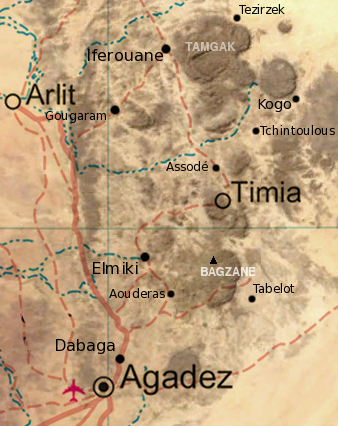
Arlit is an industrial town and capital of the Arlit Department of the Agadez Region of northern-central Niger, built between the Sahara Desert and the eastern edge of the Aïr Mountains. It is 200 km south by road from the border with Algeria. As of 2011, the commune had a total population of 112,432 people. Uranium industry Founded in 1969 following the discovery of uranium, it has grown around the mining industry, developed by the French government. Two large uranium mines, at Arlit and nearby Akouta, are exploited by open top strip mining. One open pit mine was built in 1971 by the National Mining Company of Niger, SOMAIR. The Second open pit mine, as well as a third underground mine, was built by the French Compagnie Minière d'Akouta (or COMINAK). All the ore from both is now processed and transported by a French company Orano Cycle, a holding of the Orano group, itself a state owned operation of the French ''Commissariat à l'énergie atomique'' (CEA). The s ... [...More Info...] [...Related Items...] OR: [Wikipedia] [Google] [Baidu] |
Kazakhstan
Kazakhstan, officially the Republic of Kazakhstan, is a transcontinental country located mainly in Central Asia and partly in Eastern Europe. It borders Russia to the north and west, China to the east, Kyrgyzstan to the southeast, Uzbekistan to the south, and Turkmenistan to the southwest, with a coastline along the Caspian Sea. Its capital is Astana, known as Nur-Sultan from 2019 to 2022. Almaty, Kazakhstan's largest city, was the country's capital until 1997. Kazakhstan is the world's largest landlocked country, the largest and northernmost Muslim-majority country by land area, and the ninth-largest country in the world. It has a population of 19 million people, and one of the lowest population densities in the world, at fewer than 6 people per square kilometre (15 people per square mile). The country dominates Central Asia economically and politically, generating 60 percent of the region's GDP, primarily through its oil and gas industry; it also has vast minera ... [...More Info...] [...Related Items...] OR: [Wikipedia] [Google] [Baidu] |


