|
List Of Heliports In Turkey ...
List of heliports References {{reflist, 2 Trabzon location not corrector External linksDirectorate General of Civil Aviation * Heliports Turkey Heliports A heliport is a small airport suitable for use by helicopters and some other vertical lift aircraft. Designated heliports typically contain one or more touchdown and liftoff areas and may also have limited facilities such as fuel or hangars. I ... [...More Info...] [...Related Items...] OR: [Wikipedia] [Google] [Baidu] |
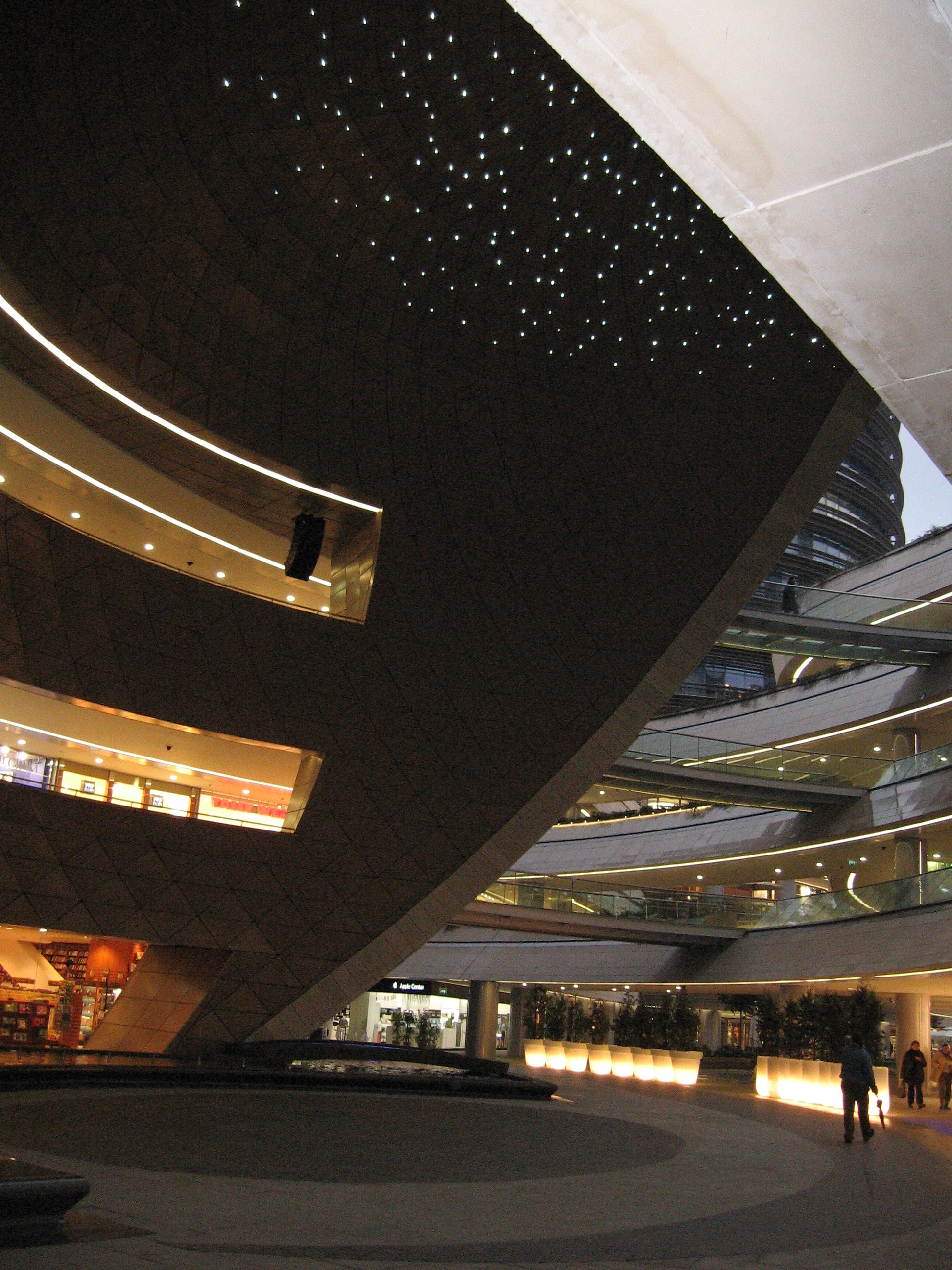
Kanyon Shopping Mall
Kanyon (meaning Canyon in Turkish) is a multi-purpose complex located on the Büyükdere Avenue in the Levent business district of Istanbul, Turkey. Opened on 6 June 2006, it unites a 160-store shopping mall (covering an area of 37,500 m2), a 30-floor office tower (26 floors of which rise above street level) and a 22-floor residential block with 179 residential apartments into a complex undulating around a dramatic architectural “canyon”. The total construction area of the project is 250,000 m2, with 30,000 m2 of rentable office area, 37,500 m2 of rentable retail area, 180 residential flats, 160 stores, 9 theater halls with a capacity of 1,600 spectators, and a parking facility for 2,300 vehicles. Each floor of the office tower has a total usable office space of 1,167 m2. The complex rises on an area of 29,427 m2. Development Kanyon is a joint venture of the Eczacıbaşı Group and İŞGYO of Turkey. It was designed by The Jerde Partnership of Los Angeles, USA, who collaborat ... [...More Info...] [...Related Items...] OR: [Wikipedia] [Google] [Baidu] |
Istanbul Hezarfen Airfield
Hezarfen Airfield ( tr, Hezarfen Havaalanı) is a privately owned airport for general aviation in the Çatalca district of Istanbul, Turkey. One of the four airports in Istanbul, it is named after Hezârfen Ahmet Çelebi, a legendary Ottoman aviator, who flew across the Bosporus in the 17th century, as told by a contemporary traveler Evliya Çelebi. The airfield is on a peninsula surrounded by Lake Büyükçekmece to the south and by the motorway to the north. It is west of Istanbul. Since 1992, it has served as the first internationally acknowledged private airport in Turkey. Its asphalt runway is long and wide. There are four taxiways parallel to the runway, a concrete ramp, and another paved one. It also has a motocross circuit, a long model airplane field, and a heliport. Hezarfen Hobbyland The airfield, called also "Hezarfen Hobbyland", offers facilities for model aircraft flying, model car racing, motocross racing, drag racing (cars and motorcycles), car an ... [...More Info...] [...Related Items...] OR: [Wikipedia] [Google] [Baidu] |
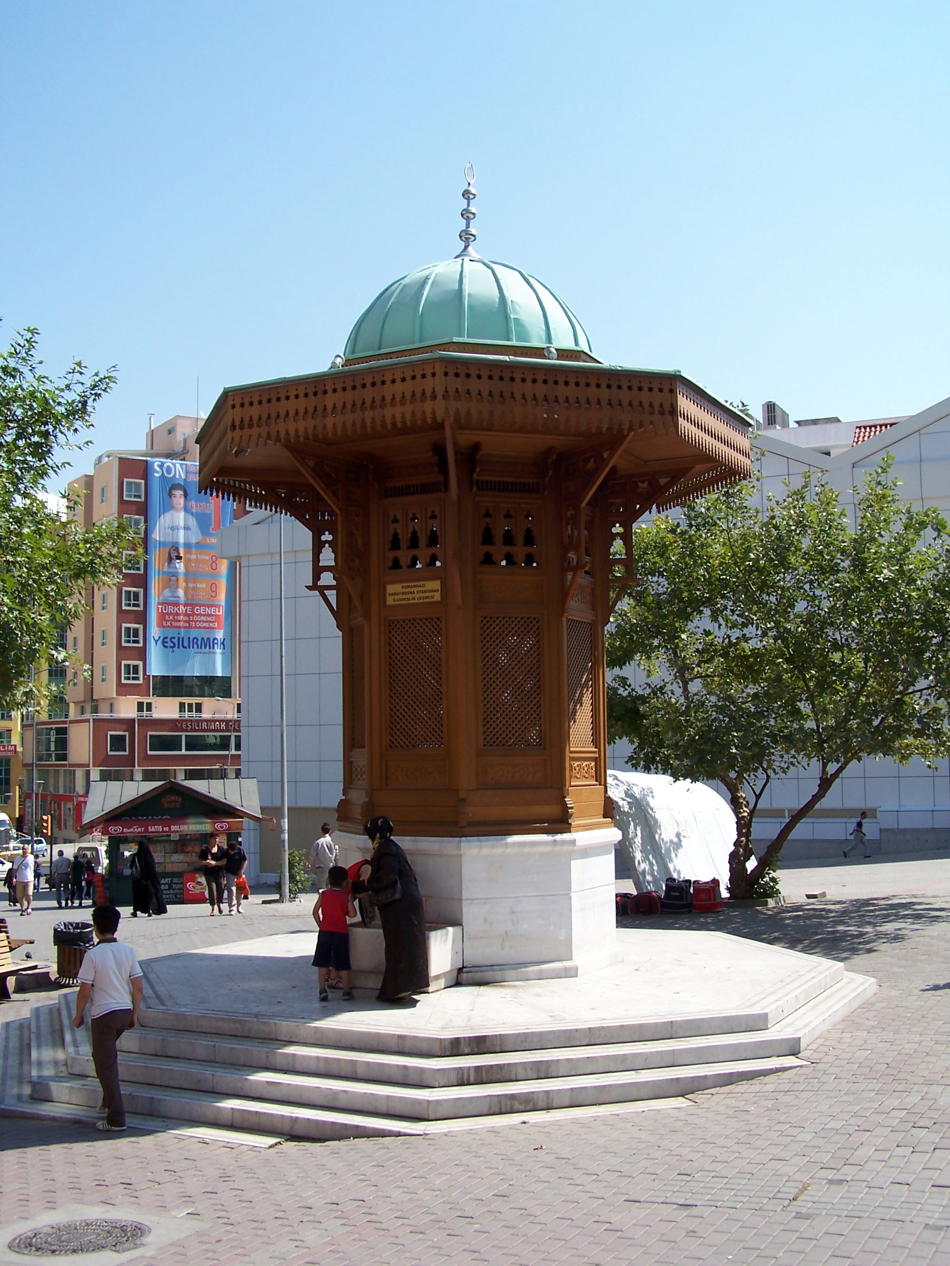
Osmangazi, Bursa
Osmangazi is one of the central metropolitan districts of the city of Bursa in Bursa Province, as well as the fourth largest overall municipality in Turkey. The municipality has a population of approximately 778,843 as of 2012. On its own, it would be the 28th largest city in Turkey. The district has been shaped by several civilizations: Rome, Byzantines, Seljuqians, and Ottomans. The first marks of the Ottoman Empire exist within Osmangazi where it extended from the foot of Uludağ to the plain of Bursa. Within the boundaries of Osmangazi, approximately 1800 registered historical buildings exist. History It was stated that there were various settlements in Bursa and its surroundings by 4000 B.C. But the certain information related to the region belongs to 700 B.C. Homer called the region Mysia. There are two villages that are ancient Mysia settlements: Misi (Gümüştepe) and Misebolu. The region is called Phrygia in historical geography. It is known that Cimmerians, fleeing f ... [...More Info...] [...Related Items...] OR: [Wikipedia] [Google] [Baidu] |
Konya Province
Konya Province ( tr, ), in southwest Central Anatolia, is the largest province of Turkey. The Province, provincial Capital (political), capital is the city of Konya. Its traffic code is 42. The Kızılören solar power plant in Konya will be able to produce 22.5 megawatts of electricity over an area of 430,000 square meters. Demographics In 2011 the Konya Metropolitan Municipality had a population close to 1.1 million, out of the 2 million in the Konya Province (76.2% of the population in Konya Province lives in the city, while the remainder live in the villages, sub-districts and districts.) Language census Official first language results (1927-1965) Divisions The province of Konya is divided into thirty-one Districts of Turkey, districts three of which (Meram, Selçuklu and Karatay, Konya, Karatay) form part of Konya, Konya city. The following districts are located in the Mediterranean Region: Ahırlı, Beyşehir, Bozkır, Derebucak, Hadim, Hüyük, Konya, Hüyük, ... [...More Info...] [...Related Items...] OR: [Wikipedia] [Google] [Baidu] |
Selçuklu
Selçuklu is a town and district of Konya Province in the Central Anatolia region of Turkey. Selçuklu is one of the central districts of Konya along with the districts of Karatay and Meram Meram is a town and district of Konya Province in the Central Anatolia region of Turkey. Meram is one of the central districts of Konya along with the districts of Karatay and Selçuklu. According to 2000 census, population of the district is 267, .... According to 2000 census, population of the district is 348,329 of which 327,627 live in the urban center of Selçuklu. Places to see The Konya Tropical Butterfly Garden, opened in 2015, is a major tourist attraction. Gallery Altınapa-Stausee westlich von Konya mit Ruine (siehe roten Pfeil).jpg, Altınapa Reservoir, western are of Selçuklu with the Altınapa Han (see red arrow) Dokuzun Hanı; Blick nach Norden; Selçuklu, Konya.jpg, Dokuzun Hanı; view to the nord. Horuzlu Han in Konya, Ansicht von Süd.jpg, Entrance of Horuzlu Han; vi ... [...More Info...] [...Related Items...] OR: [Wikipedia] [Google] [Baidu] |
Afyonkarahisar Province
Afyonkarahisar Province ( tr, ), also called more simply Afyon Province, is a province in western Turkey. Adjacent provinces are Kütahya to the northwest, Uşak to the west, Denizli to the southwest, Burdur to the south, Isparta to the southeast, Konya to the east, and Eskişehir to the north. The provincial capital is Afyonkarahisar. It covers an area of 14,230 km², and the population is about 744,179 as of 2021. Districts Afyonkarahisar province is divided into 18 districts: *Afyonkarahisar *Başmakçı * Bayat *Bolvadin *Çay *Çobanlar *Dazkırı *Dinar *Emirdağ *Evciler *Hocalar *İhsaniye * İscehisar *Kızılören *Sandıklı *Sinanpaşa * Sultandağı * Şuhut Population The population of Afyonkarahisar Province is majority Turkish and Muslim of the Sunni sect. Health Air pollution Air pollution is the contamination of air due to the presence of substances in the atmosphere that are harmful to the health of humans and other living being ... [...More Info...] [...Related Items...] OR: [Wikipedia] [Google] [Baidu] |
Afyonkarahisar
Afyonkarahisar (, tr, afyon "poppy, opium", ''kara'' "black", ''hisar'' "fortress") is a city in western Turkey, the capital of Afyon Province. Afyon is in the mountainous countryside inland from the Aegean coast, south-west of Ankara along the Akarçay River. In Turkey, Afyonkarahisar stands out as a capital city of hot springs and spas, an important junction of railway, highway and air traffic in West-Turkey, and the place where independence was won. In addition, Afyonkarahisar is one of the top leading provinces in agriculture, globally renowned for its marble and is the world's largest producer of pharmaceutical opium. Etymology The name Afyon Kara Hisar (literally ''opium black castle'' in Turkish), since opium was widely grown here and there is a castle on a black rock. Also known simply as Afyon. Older spellings include Karahisar-i Sahip, Afium-Kara-hissar and Afyon Karahisar. The city was known as Afyon (opium), until the name was changed to Afyonkarahisar by the Turki ... [...More Info...] [...Related Items...] OR: [Wikipedia] [Google] [Baidu] |
Konak, İzmir
Konak is a district of İzmir Province in Turkey. It is the most densely populated of the eleven main urban districts of İzmir, and has historically acted as the administrative and economic core of the city. Situated in an area that roughly corresponds to the geographic center of İzmir, Konak extends for along the southern coastline of the Gulf of İzmir. A long panhandle that the district area draws in the direction of the southwest, on the other hand, also covers a large rural area, mostly covered with mountains and forests, and two isolated villages. Konak district area neighbors the district areas of Bornova to the east, Balçova to the west and Buca and Gaziemir to the south, all of which are also among İzmir's metropolitan districts. Konak center is connected to other districts of İzmir and beyond by a dense network of roads and railroads, as well as by a subway line currently being largely extended and by ferry services to Karşıyaka. Konak is a very active hub of i ... [...More Info...] [...Related Items...] OR: [Wikipedia] [Google] [Baidu] |
Muğla Province
Muğla Province ( tr, , ) is a province of Turkey, at the country's south-western corner, on the Aegean Sea. Its seat is Muğla, about inland, while some of Turkey's largest holiday resorts, such as Bodrum, Ölüdeniz, Marmaris and Fethiye, are on the coast in Muğla. Etymology The original name of Muğla is open to debate. Various sources refer to the city as Mogola, Mobella or Mobolia. Geography At , Muğla's coastline is the longest among the Provinces of Turkey and longer than many countries' coastlines, (even without taking any small islands into account). Important is the Datça Peninsula. As well as the sea, Muğla has two large lakes, Lake Bafa in the district of Milas and Lake Köyceğiz. The landscape consists of pot-shaped small plains surrounded by mountains, formed by depressions in the Neogene. These include the plain of the city of Muğla itself, Yeşilyurt, Ula, Gülağzı, Yerkesik, Akkaya, and Yenice). Until the recent building of highways, transport fr ... [...More Info...] [...Related Items...] OR: [Wikipedia] [Google] [Baidu] |
Bodrum
Bodrum () is a port city in Muğla Province, southwestern Turkey, at the entrance to the Gulf of Gökova. Its population was 35,795 at the 2012 census, with a total of 136,317 inhabitants residing within the district's borders. Known in ancient times as Halicarnassus, the city was once home to the Mausoleum at Halicarnassus, also known as the tomb of Mausolus, one of the Seven Wonders of the Ancient World. The city was founded by Dorian Greeks. It later fell under Persian rule and became the capital city of the satrapy of Caria. Mausolus ruled Caria from here, and after his death in 353 BC, his wife Artemisia built a tomb, called the Mausoleum, for him. Macedonian forces laid siege to the city and captured it in 334 BCE. After Alexander's death, the city passed to successive Hellenistic rulers and was briefly an independent kingdom until 129 BCE, when it came under Roman rule. A series of natural disasters and repeated pirate attacks wreaked havoc on the area, and the city lost ... [...More Info...] [...Related Items...] OR: [Wikipedia] [Google] [Baidu] |
Kartal
Kartal is a district of Istanbul, Turkey, located on the Asian side of the city, on the coast of the Marmara Sea between Maltepe and Pendik. Despite being far from the city centre, Kartal is heavily populated (total population of 541,209) (2008 census). The total land area is 147,000 m2, which includes some countryside areas inland. The district's neighbours are Maltepe to the west, Sultanbeyli and Sancaktepe to the north and Pendik to the east. Inland from the coast, the land rises sharply up to the hills Yakacık and Aydos, the latter of which is the highest point in Istanbul. History Kartal ('eagle' in Turkish, by folk etymology) was a fishing village on the shore of the Marmara Sea during the Byzantine Empire, called Kartalimen or Kartalimin in Greek, and was founded at the beginning of the 6th century. In the 11th century, the town was conquered by the ruler of the Seljuks, Suleyman Shah. In 1329, Kartal became part of the Ottoman Empire, the Byzantines re-took the c ... [...More Info...] [...Related Items...] OR: [Wikipedia] [Google] [Baidu] |


.jpg)
