|
List Of Ismaili Castles
List of the strongholds or dar al-hijra of the Nizari Ismaili state in Persia (Iran) and Syria. Most of the Persian Ismaili castles were in the Alborz mountains, in the regions of Daylaman (particularly, in Alamut and Rudbar; north of modern-day Qazvin) and Quhistan (south of Khurasan), as well as in Qumis. Most of the Syrian Ismaili castles were in Jabal Bahra' (Syrian Coastal Mountain Range). According to Juzjani, before the Mongol invasion the Nizaris possessed 70 forts in Quhistan and 35 in Alamut. Overall, they probably had 250 castles. The Ismaili fortresses in Rudbar of Alamut had been built on rocky heights and were equipped to withstand long sieges; they had storehouses with high capacities and elaborate water supply infrastructure such as cisterns, qanats, and canals. Persia Syria The strongholds in Jabal Bahra' were known as the "Castles of the ''da'wa''" ( ''qilāʿ al-daʿwah''). See also *Nizari Ismaili state *History of Nizari Ismailism *List of castles ... [...More Info...] [...Related Items...] OR: [Wikipedia] [Google] [Baidu] |
Alamut
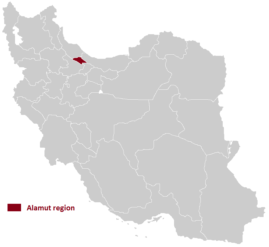
Alamut ( fa, الموت) is a region in Iran including western and eastern parts in the western edge of the Alborz (Elburz) range, between the dry and barren plain of Qazvin in the south and the densely forested slopes of the Mazandaran province in the north. Starting from Qazvin toward Alamut, passing through the first range of hills, curvatures, forms, are significant themes in nature's composition of this area. The famous Ismaili castle of Alamut and numerous others are in this area, which served as the heartland of the state founded by Hassan-i Sabbah. According to some sources, the majority of people in northern Qazvin (Alamut) are Tats who speak a dialect of the Tati language.گونههای زبانی تاتی، دونالد استیلو، ۱۹۸۱ However, other sources claim that the majority of people in Alamut are Mazanderani or Gilaks who speak a dialect of the Mazanderani language or Gilaki language. According to some linguists, the term ‘Tati’ was used ... [...More Info...] [...Related Items...] OR: [Wikipedia] [Google] [Baidu] |
Alamut Castle
Alamut ( fa, الموت, meaning "eagle's nest") is a ruined mountain fortress located in the Alamut region in the South Caspian province of Qazvin near the Masoudabad region in Iran, approximately 200 km (130 mi) from present-day Tehran. In 1090 AD, the Alamut Castle, a mountain fortress in present-day Iran, came into the possession of Hassan-i Sabbah, a champion of the Nizari Ismaili cause. Until 1256, Alamut functioned as the headquarters of the Nizari Ismaili state, which included a series of strategic strongholds scattered throughout Persia and Syria, with each stronghold being surrounded by swathes of hostile territory. Alamut, which is the most famous of these strongholds, was thought impregnable to any military attack and was fabled for its heavenly gardens, library, and laboratories where philosophers, scientists, and theologians could debate in intellectual freedom. ited in /en.wikipedia.org/w/index.php?oldid=833771876">ited_in_[//en.wikipedia.org/w/ind ... [...More Info...] [...Related Items...] OR: [Wikipedia] [Google] [Baidu] |
Maymun-Diz
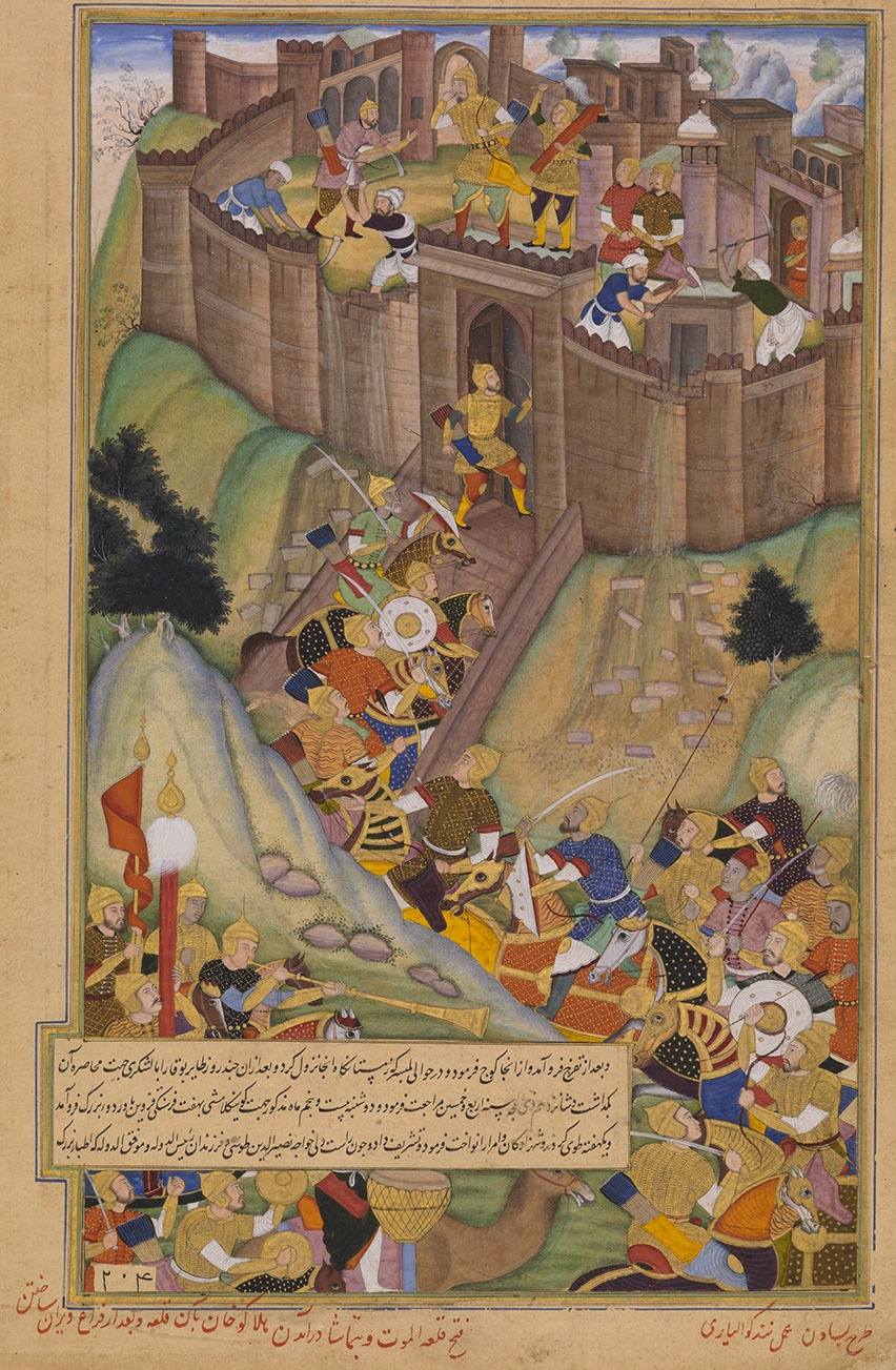
Maymūn-Diz ( fa, میمون دز) was a major fortress of the Nizari Ismailis of the Alamut Period described in historical records. It has been variously identified with the Alamut Castle, Navizar Shah Castle, Shirkuh Castle, Shahrak Castle, and Shams Kalayeh Cave. Recently, Enayatollah Majidi located it on top of Mount Shatan ( ''Kūh-e Shātān''; ) near Khoshk Chal. The fortress was surrendered by Imam Rukn al-Din Khurshah, who was residing there, to the invading Mongols under Hulagu Khan and was subsequently demolished. This was followed by surrender of Alamut and almost all other strongholds and the disestablishment of the Nizari state. History The date of the (beginning of the) construction by the Nizari Ismailis is variously given as 1097 (per ''Jami' al-tawarikh''), 1103 (per '' Zubdat al-Tawarikh''), and during the Imamate of Ala al-Din Muhammad (1211–1255) (per '' Tarikh-i Jahangushay''). The fortress was on a great spur of rock rising almost vertically fro ... [...More Info...] [...Related Items...] OR: [Wikipedia] [Google] [Baidu] |
Ghale Rud Khan
Ghale is an indigenous group of Nepal. The Ghale speak Ghale language Ghale is a Tibeto-Burman language of Nepal. It belongs to the group of Ghale languages. The dialects of Ghale have limited intelligibility: (south) Barpak, Kyaura, Laprak, (north) Khorla, Uiya, Jagat, Philim, Nyak Dialects '' Ethnologue'' divid .... References External links *http://www.ghale.org *http://www.nepal.com/languages/ *http://globalrecordings.net/language/4100 *http://www.language-archives.org/item/oai:ethnologue.com:ghe *http://globalrecordings.net/language/10195 Indigenous peoples of Nepal {{Asia-ethno-group-stub ... [...More Info...] [...Related Items...] OR: [Wikipedia] [Google] [Baidu] |
Rudkhan Castle
Rudkhan Castle ( fa, قلعه رودخان, glk, رودخان دژ); also Roodkhan Castle, is a brick and stone medieval fortress in Iran that was built by the Talysh people to defend against the Arab invaders during the Muslim conquest of Persia. With the fall of the Sasanian Empire, this area became a defensive position against the Arabs in the then-newly established Tabarestan. Located 25 km southwest of Fuman city north of Iran in Gilan province, it is a military complex which was constructed during the Sasanian era (224-651), and later rebuilt in 1096 by the Nizari Isma'ilis for use by the Assassins. The castle is built on two tips of a mount, with an area of . Its architects made use of natural mountainous features in the construction of the fort. The Rudkhan Castle River originates in the surrounding heights and flows from south to north. After crossing a mountainous winding route with dense forests, the first thing that one notices about the castle is its big entran ... [...More Info...] [...Related Items...] OR: [Wikipedia] [Google] [Baidu] |
Kiya Buzurg-Ummid
Kiyā Buzurg-Ummīd ( fa, کیا بزرگ امید; died 1138) was a '' dāʿī'' and the second ruler (''da'i'') of the Nizari Isma'ili State, ruling Alamut Castle from 1124 to 1138 CE (or 518—532 AH). He was of Daylami origin from the region of Rudbar. Career Prior to ruling the Nizari Isma'ilis, Buzurg Ummid captured Lambsar Castle for the Assassins and ruled it as commander for over twenty years. As the ruler of Alamut On 25 Rabīʿ II 518 (11 June 1124), a day before death of Ḥassan-i Ṣabbaḥ, Ḥassan appointed him his successor. He generally followed the policies of Ḥassan-i Ṣabbaḥ and enforced the Sharia strictly. In his early reign the Isma'ili hold was expanded in particular in Eshkevar and Taleghan. As opposed to Hassan Sabbah, who is depicted as a revolutionary leader, the Ismaili sources depict Buzurg-Ummid as an administrator and a chivalrous lord (e.g. the story of him protecting his old enemy, emir Yaran-Qush Bazdar of Qazvin and his followers, ... [...More Info...] [...Related Items...] OR: [Wikipedia] [Google] [Baidu] |
Lambesar 2000
Lambsar ( fa, لمبسر, also pronounced Lamsar), Lamasar, Lambasar, Lambesar () or Lomasar () was probably the largest and the most fortified of the Ismaili castles. The fortress is located in the central Alburz mountains, south of the Caspian Sea, about 120 km from present-day Tehran, Iran. Lambsar is to the northeast of Razmian village (the central district of Roodbar e Shahrestan). Kiya Buzurg Ummid (died 1138) captured the castle from Rasamuj and rebuilt it into a major stronghold using local labour. He was appointed by Hassan-i Sabbah (died 1124) as its governor. Only ruins remain of this magnificent fortress today. Very deep valleys surrounding the fortress make it impossible to access from the East and West sides. The North and South fronts are the only possible ways to get into the fortress. Although the slope of the mountain with a difference of 150m on both levels is stretched from north to south with a length of 480m, the castle is more than 190m in width. ... [...More Info...] [...Related Items...] OR: [Wikipedia] [Google] [Baidu] |
Lambsar Castle
Lambsar ( fa, لمبسر, also pronounced Lamsar), Lamasar, Lambasar, Lambesar () or Lomasar () was probably the largest and the most fortified of the Ismaili castles. The fortress is located in the central Alburz mountains, south of the Caspian Sea, about 120 km from present-day Tehran, Iran. Lambsar is to the northeast of Razmian village (the central district of Roodbar e Shahrestan). Kiya Buzurg Ummid (died 1138) captured the castle from Rasamuj and rebuilt it into a major stronghold using local labour. He was appointed by Hassan-i Sabbah (died 1124) as its governor. Only ruins remain of this magnificent fortress today. Very deep valleys surrounding the fortress make it impossible to access from the East and West sides. The North and South fronts are the only possible ways to get into the fortress. Although the slope of the mountain with a difference of 150m on both levels is stretched from north to south with a length of 480m, the castle is more than 190m in width. Th ... [...More Info...] [...Related Items...] OR: [Wikipedia] [Google] [Baidu] |
Kashmar
Kashmar () ( fa, کاشمر, also Romanized as ''Kāshmar''; formerly ''Keshmar'', '' Torshīz'' or ''Soltanabad'') is a city and the capital of Kashmar County, in Razavi Khorasan Province, Iran. Kashmar is located near the river Shesh Taraz in the western part of the province, and south of the province's capital Mashhad, in Iran, from east to Bardaskan, west to Torbat-e Heydarieh, north to Nishapur, south to Gonabad. Until two centuries ago, this city was named Torshiz (). At the 2006 census, its population was 81,527, in 21,947 families. Historical legends Kashmar is a city with ancient history and many legendary stories Among the historical legends are about the Cypress of Kashmar. Cypress of Kashmar The Cypress of Kashmar is a mythical cypress tree of legendary beauty and gargantuan dimensions. It is said to have sprung from a branch brought by Zoroaster from Paradise and to have stood in today's Kashmar in northeastern Iran and to have been planted by Zoroa ... [...More Info...] [...Related Items...] OR: [Wikipedia] [Google] [Baidu] |
Atashgah Castle2021 , a Ca ...
Atashgah or Ateshgah ( fa, آتشگاه) may refer to: * Fire temple, a Zoroastrian worship place * Atashgah, Alborz, a village in Iran * Atashgah, Ardabil, a village in Iran * Atashgah-e Jadid, a village in Ardabil Province, Iran * Atashgah, Chaharmahal and Bakhtiari, a village in Iran * Ateshgah, Gilan, a village in Iran * Ateshgah-e Bozorg, a village in Kohgiluyeh and Boyer-Ahmad Province, Iran * Atashgah of Isfahan, a tower-like construction located in Iran *Ateshgah of Baku, also known as ''Fire Temple of Baku'', is a museum now in Baku Azerbaijan * Atashgah of Tbilisi, also known as ''Fire Temple of Tbilisi'', is a museum now in Tbilisi Georgia *Atashgah Castle, a castle in the city of Kashmar *Atashgah Manmade-Cave The Atashgah Manmade-Cave or Atashgah Cave is located 20 km northwest of Kashmar city, Razavi Khorasan province, Iran and the cave has two entrance passages. See also * Atashgah Castle Atashgah Castle ( fa, قلعه آتشگاه) is a castle ... [...More Info...] [...Related Items...] OR: [Wikipedia] [Google] [Baidu] |


.jpg)
