|
List Of Azerbaijani Exonyms
This article lists Azerbaijani language, Azerbaijani exonyms. An exonym is a Toponymy, place name, used by non-natives of that place, that differs from the official or native name for that place. This article attempts to give all known Azerbaijani language, Azerbaijani Turkish exonyms for all major cities and regions as well as some smaller towns that are historically or geographically important. Azerbaijani Turkish has a wealth of exonyms in areas beyond the current borders of Azerbaijan notably those that were once part of Turkic Empires and its vassals and tributaries or within the Azerbaijani Turkish, or a Turkic peoples, Turkic sphere of cultural or economic influence. In addition, Azerbaijani Turkish renders the names of other cities in a phonetic Azerbaijani Turkish spelling, e.g., Chicago as ''Çikaqo'' or Manchester as ''Mançester''. As these forms are not commonly used in Azerbaijani Turkish, there is not a systematic attempt to include them here. Cities are groupe ... [...More Info...] [...Related Items...] OR: [Wikipedia] [Google] [Baidu] |
Azerbaijani Language
Azerbaijani () or Azeri (), also referred to as Azeri Turkic or Azeri Turkish, is a Turkic language from the Oghuz sub-branch spoken primarily by the Azerbaijani people, who live mainly in the Republic of Azerbaijan where the North Azerbaijani variety is spoken, and in the Azerbaijan region of Iran, where the South Azerbaijani variety is spoken. Although there is a very high degree of mutual intelligibility between both forms of Azerbaijani, there are significant differences in phonology, lexicon, morphology, syntax, and sources of loanwords. North Azerbaijani has official status in the Republic of Azerbaijan and Dagestan (a federal subject of Russia), but South Azerbaijani does not have official status in Iran, where the majority of Azerbaijani people live. It is also spoken to lesser varying degrees in Azerbaijani communities of Georgia and Turkey and by diaspora communities, primarily in Europe and North America. Both Azerbaijani varieties are members of the Oghuz b ... [...More Info...] [...Related Items...] OR: [Wikipedia] [Google] [Baidu] |
Ghazni
Ghazni ( prs, غزنی, ps, غزني), historically known as Ghaznain () or Ghazna (), also transliterated as Ghuznee, and anciently known as Alexandria in Opiana ( gr, Αλεξάνδρεια Ωπιανή), is a city in southeastern Afghanistan with a population of around 190,000 people. The city is strategically located along Highway 1, which has served as the main road between Kabul and Kandahar for thousands of years. Situated on a plateau at 2,219 metres (7,280 ft) above sea level, the city is south of Kabul and is the capital of Ghazni Province. Ghazni Citadel, the Minarets of Ghazni, the Palace of Sultan Mas'ud III, and several other cultural heritage sites have brought travelers and archeologists to the city for centuries. During the pre-Islamic period, the area was inhabited by various tribes who practiced different religions including Zoroastrianism, Buddhism and Hinduism. Arab Muslims introduced Islam to Ghazni in the 7th century and were followed in the 9th ... [...More Info...] [...Related Items...] OR: [Wikipedia] [Google] [Baidu] |
Panjshir Province
Panjshir (Dari: , literally "Five Lions," also spelled as Panjsher) is one of the thirty-four provinces of Afghanistan, located in the northeastern part of the country containing the Panjshir Valley. The province is divided into seven districts and contains 512 villages. As of 2021, the population of Panjshir province was about 173,000. Bazarak serves as the provincial capital. Panjshir became an independent province from neighboring Parwan Province in 2004. It is bordered by Baghlan and Takhar in the north, Badakhshan and Nuristan in the east, Laghman and Kapisa in the south, and Parwan in the west. History The territory was ruled by the Khanate of Bukhara between the early 16th century and the mid-18th century. The Parwan region, including the later Panjshir, was conquered by Ahmad Shah Durrani, and officially accepted as a part of the Durrani Empire, by Murad Beg of Bukhara, after a treaty of friendship was signed in or about 1750. The rule of the Durranis was followed ... [...More Info...] [...Related Items...] OR: [Wikipedia] [Google] [Baidu] |
Oruzgan
Uruzgan (Dari), also spelled as Urozgan or Oruzgan, is one of the thirty-four provinces of Afghanistan. Uruzgan is located in the center of the country. The population is 436,079, and the province is mostly a tribal society. Tarinkot serves as the capital of the province. In 2004, the new Daykundi Province was carved out of an area in the north. Uruzgan borders the provinces of Kandahar, Daykundi, Ghazni, Zabul, and Helmand. Geography Uruzgan province is located in southern Afghanistan, bordering Zabul and Kandahar to the south, Helmand to the southwest, Daykundi to the north, and Ghazni to the east. Uruzgan covers an area of . Much of the province is mountainous or semi-mountainous terrain, while the rest of the area is made up of flat land. History The Arabs were first to arrive in Uruzgan in the 7th century when they brought Islam to the region followed by the Saffarids who conquered the place in the 9th centur [...More Info...] [...Related Items...] OR: [Wikipedia] [Google] [Baidu] |
Musa Qala
; "Fortress of Moses") is a town and the district centre of Musa Qala District in Helmand Province, Afghanistan. It is located at and at an altitude of 1,043 m in the valley of Musa Qala River in the central western part of the district. Its population has been reported in the British press to be both 2,000 and 20,000. It is in a desolate area, populated by native Pashtun tribes.Rahmani, Waliullah (23 March 2006) "Helmand Province and the Afghan Insurgency" ''Terrorism Monitor'' 4(6): pp. 3-5, p.4 Climate With virtually no rainfall during the year, Musa Qala features a |
Morghab, Afghanistan
Bala Murghab (Persian/ ps, بالامرغاب) is a city in the Badghis Province of northwestern Afghanistan, located on the Murghab River. It is the district center for the Bala Murghab District. Bala Murghab is the largest city of Badghis Province, while Bala Murghab District, with a population of 109,381, is also the most populous district of the province. Close to Bala Murghab lie the ruins of the medieval city Marw al-Rudh, the historical capital of the medieval region of Gharjistan. Throughout the War in Afghanistan, it was heavily contested by the Taliban and Afghan National Security Forces. The city was captured by the Taliban during the 2021 Taliban offensive. History Marw al-Rudh was a major medieval city in the Gharjistan region at the location of the modern city of Bala Murghab. The Abbasid-era geographers report that Marw al-Rudh was the center of a flourishing agricultural region in Khorasan, at the site where the Murghab River leaves the mountains and enters the ste ... [...More Info...] [...Related Items...] OR: [Wikipedia] [Google] [Baidu] |
Meymaneh
Maymana (Persian/ Uzbek/Pashto: میمنه) is the capital city of Faryab Province in northwestern Afghanistan, near the Turkmenistan border. It is approximately northwest of the country's capital Kabul, and is located on the Maymana River, which is a tributary of the Murghab River. The population of Maymana was 149,040 in 2015, making it one of the largest cities of northwestern Afghanistan. On 14 August 2021, Maymana was seized by Taliban fighters, becoming the twenty-second provincial capital to be captured by the Taliban as part of the wider 2021 Taliban offensive. As of January 2022, however, clashes between Taliban and resistance fighters and protests have been reported in the city. Location Maymana is located at the northern foot of the Torkestan Range at an elevation of on the old terrace of the Qeysar or Maymana River, which is a right tributary of the Murghab River. The Maymana River branches off of the Band-e Turkistan River 50 km south of the city. The highlan ... [...More Info...] [...Related Items...] OR: [Wikipedia] [Google] [Baidu] |
Mazari Sharif
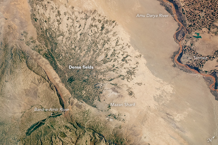
, official_name = , settlement_type = City , image_skyline = , pushpin_map = Afghanistan#Bactria#West Asia , pushpin_label = Mazar-i-Sharif , pushpin_label_position = bottom , pushpin_mapsize = , pushpin_relief = yes , pushpin_map_caption = Location in Afghanistan , coordinates = , subdivision_type = Country , subdivision_name = Afghanistan , subdivision_type1 = Province , subdivision_type2 = District , subdivision_name1 = Balkh Province , subdivision_name2 = Mazar-i-Sharif District , established_title = , established_date = , leader_title = Mayor , leader_name = Abdullhaq Khurami , area_total_km2 = , area_land_km2 ... [...More Info...] [...Related Items...] OR: [Wikipedia] [Google] [Baidu] |
Kunduz
, native_name_lang = prs , other_name = , settlement_type = City , image_skyline = Kunduz River valley.jpg , imagesize = 300 , image_alt = , image_caption = , image_flag = , flag_size = , flag_alt = , flag_border = , flag_link = , image_seal = , seal_size = , seal_alt = , seal_link = , seal_type = , image_shield = , shield_size = , shield_alt = , shield_link = , image_blank_emblem = , blank_emblem_type = , blank_emblem_size = , blank_emblem_alt = , blank_emblem_link = , etymology = , nickname = , nicknames = , motto = , mottoes = , anthem = , image_map = , m ... [...More Info...] [...Related Items...] OR: [Wikipedia] [Google] [Baidu] |
Kandahar
Kandahar (; Kandahār, , Qandahār) is a List of cities in Afghanistan, city in Afghanistan, located in the south of the country on the Arghandab River, at an elevation of . It is Afghanistan's second largest city after Kabul, with a population of about 614,118. It is the capital of Kandahar Province as well as the de facto capital of the Taliban, formally known as the Islamic Emirate of Afghanistan. It also happens to be the centre of the larger cultural region called Loy Kandahar. In 1709, Mirwais Hotak made the region an independent kingdom and turned Kandahar into the capital of the Hotak dynasty. In 1747, Ahmad Shah Durrani, founder of the Durrani dynasty, made Kandahar the capital of the Durrani Empire, Afghan Empire. Historically this province is considered as important political area for Afghanistan revelations. Kandahar is one of the most culturally significant cities of the Pashtun people, Pashtuns and has been their traditional seat of power for more than 300 years. ... [...More Info...] [...Related Items...] OR: [Wikipedia] [Google] [Baidu] |
Jalalabad
Jalalabad (; Dari/ ps, جلالآباد, ) is the fifth-largest city of Afghanistan. It has a population of about 356,274, and serves as the capital of Nangarhar Province in the eastern part of the country, about from the capital Kabul. Jalalabad is located at the junction of the Kabul River and the Kunar River in a plateau to the south of the Hindu Kush mountains. It is linked by the Kabul-Jalalabad Road to the west and Peshawar in Khyber Pakhtunkhwa, Pakistan, to the east through Torkham and the Khyber Pass. Jalalabad is a leading center of social and trade activity because of its proximity with the Torkham border checkpoint and border crossing, away. Major industries include papermaking, as well as agricultural products including oranges, lemon, rice, and sugarcane, helped by its warm climate. It hosts Afghanistan's second largest educational institute, Nangarhar University. For centuries the city has been favored by Afghan kings and it is a cultural significance in Afg ... [...More Info...] [...Related Items...] OR: [Wikipedia] [Google] [Baidu] |
Islam Qala
Islām Qala (Persian/Pashto: اسلام قلعه, also ''Eslām Qalʿeh''), known historically as Kafir Qala, is a border town in the western Herat province of Afghanistan, near the Afghanistan–Iran border. It is the official entry by land from neighboring Taybad, Iran. Islam Qala is part of the Kohsan District in Herat Province and is linked to the city of Herat via the Islam Qala-Herat Highway. It plays an important role when it comes to the economy of Afghanistan because a substantial volume of trade between Afghanistan and other countries passes through this town. AH1 passes through the town, part of the Asian Highway Network leading from Tokyo, Japan to west of Istanbul where it connects to the E80 which reaches to Lisbon. The town has a population of about 16,408. The Afghan Border Police (ABP) secures the border while the regular Afghan National Police are in charge of all other law enforcement activities. The Afghan Armed Forces also have a small base at Islam Qala. ... [...More Info...] [...Related Items...] OR: [Wikipedia] [Google] [Baidu] |


