|
List Of Schools In The Australian Capital Territory
This is a list of schools in the Australian Capital Territory (ACT), which houses Australia's capital city, Canberra. The Territory's education system consists of primary schools, which accommodate students from Kindergarten to Year 6, high schools, which accommodate students from Years 7 to 10, and secondary colleges, which are specialist Year 11–12 institutions. As a result of development in newer areas and mergers in existing areas, some schools accommodate more than one of the above year ranges. Certificates are awarded on the basis of continuous assessment of students' progress at the end of years 10 and 12 by the ACT Education Directorate. While the Jervis Bay Territory is an internal territory of Australia, separate to the ACT, many of its government departments (including education) is managed by the ACT government. It has a single primary school, which has been added to this list. Public schools Primary schools (K–6) Includes Early Childhood Schools (K–2) and K� ... [...More Info...] [...Related Items...] OR: [Wikipedia] [Google] [Baidu] |
Australian Capital Territory
The Australian Capital Territory (ACT), known as the Federal Capital Territory until 1938, is an internal States and territories of Australia, territory of Australia. Canberra, the capital city of Australia, is situated within the territory, and is the territory's primate city. It is located in southeastern Australian mainland as an enclave and exclave, enclave surrounded by the state of New South Wales (NSW). Exclaved from NSW after Federation of Australia, federation as the seat of government for the new nation, the territory hosts Parliament House, Canberra, parliament house, High Court of Australia and the head offices of many Australian Government agencies. On 1 January 1901, Federation of Australia, federation of the colonies of Australia was achieved. Section 125 of the new Constitution of Australia, Australian Constitution provided that land, situated in New South Wales and at least from Sydney, would be ceded to the new Government of Australia, federal government. Foll ... [...More Info...] [...Related Items...] OR: [Wikipedia] [Google] [Baidu] |
Chisholm, Australian Capital Territory
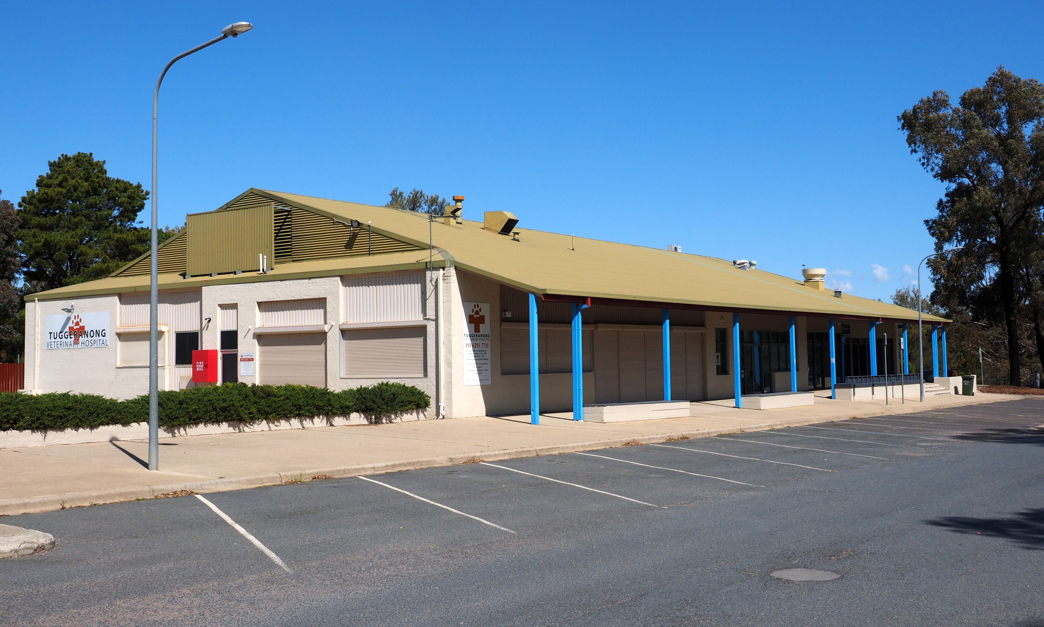
Chisholm ( ) is a suburb in the Canberra, Australia district of Tuggeranong (district), Tuggeranong, named after Caroline Chisholm. It was gazetted on 5 August 1975, and streets are named after notable women. It is nearby suburbs of Gilmore, Australian Capital Territory, Gilmore, Fadden, Australian Capital Territory, Fadden, and Richardson, Australian Capital Territory, Richardson. It is bounded by Isabella Drive, and the Monaro Highway. Chisholm and Gilmore are separated by Simpsons Hill, which provides some wilderness with walking tracks over it, popular for walking dogs. Demographics At the , Chisholm had a population of 5,268 people. The median age of people in Chisholm was 37 years, compared to a median age of 35 for Canberra. The median weekly personal income for people aged 15 years and over in Chisholm in 2021 was $1,088, compared to the ACT median of $1,203, while the median weekly household income was $2,292. In 2021, the median monthly housing loan repayment in Chis ... [...More Info...] [...Related Items...] OR: [Wikipedia] [Google] [Baidu] |
Forrest, Australian Capital Territory
Forrest (Postcodes in Australia, postcode: 2603) is a suburb of Canberra, Australian Capital Territory, Australia. Forrest is named after John Forrest, Sir John Forrest, an explorer, legislator, Federalism in Australia, federalist, Premier of Western Australia, and one of the fathers of the Australian Constitution. Streets in Forrest are named after explorers and governors. According to the Australian Bureau of Statistics Forrest is the second most Socio-Economic advantaged location in Australia after the neighbouring suburb of Barton, Australian Capital Territory, Barton. Forrest is one of the few suburbs in Canberra built to the original Canberra plans. It contains many circular and geometric patterns in its streets and can be quite confusing to drive in. Forrest was renamed from the earlier suburb Blandfordia (the name of Blandfordia, the Christmas Bell) and gazetted as a suburb in 1928. South Blandfordia became part of the new suburb of Griffith, Australian Capital Territory ... [...More Info...] [...Related Items...] OR: [Wikipedia] [Google] [Baidu] |
Florey, Australian Capital Territory
Florey () is a residential suburb of the Belconnen district of Canberra, located within the Australian Capital Territory, Australia. Florey was gazetted on 5 August 1975 and most houses were constructed in the mid-1980s. The suburb itself is named after Howard Florey, Baron Florey, who shared the Nobel Prize in Physiology or Medicine in 1945 for his role in the extraction of penicillin. The streets of Florey are named after Australian scientists. Location Florey is one of the closest suburb to the Belconnen Town Centre (other than the suburb of Belconnen itself), and has its own shopping centre, on the corner of Kesteven Street and Ratcliffe Crescent. The shopping centre displays a bronze plaque explaining the significance of Lord Florey's life and work. Original Land Use Before housing commenced, Florey was approximately 250 hectares of undulating open paddocks with very few trees. Much of the area was used for sheep agistment. The area drains into and faces Ginninde ... [...More Info...] [...Related Items...] OR: [Wikipedia] [Google] [Baidu] |
Farrer, Australian Capital Territory
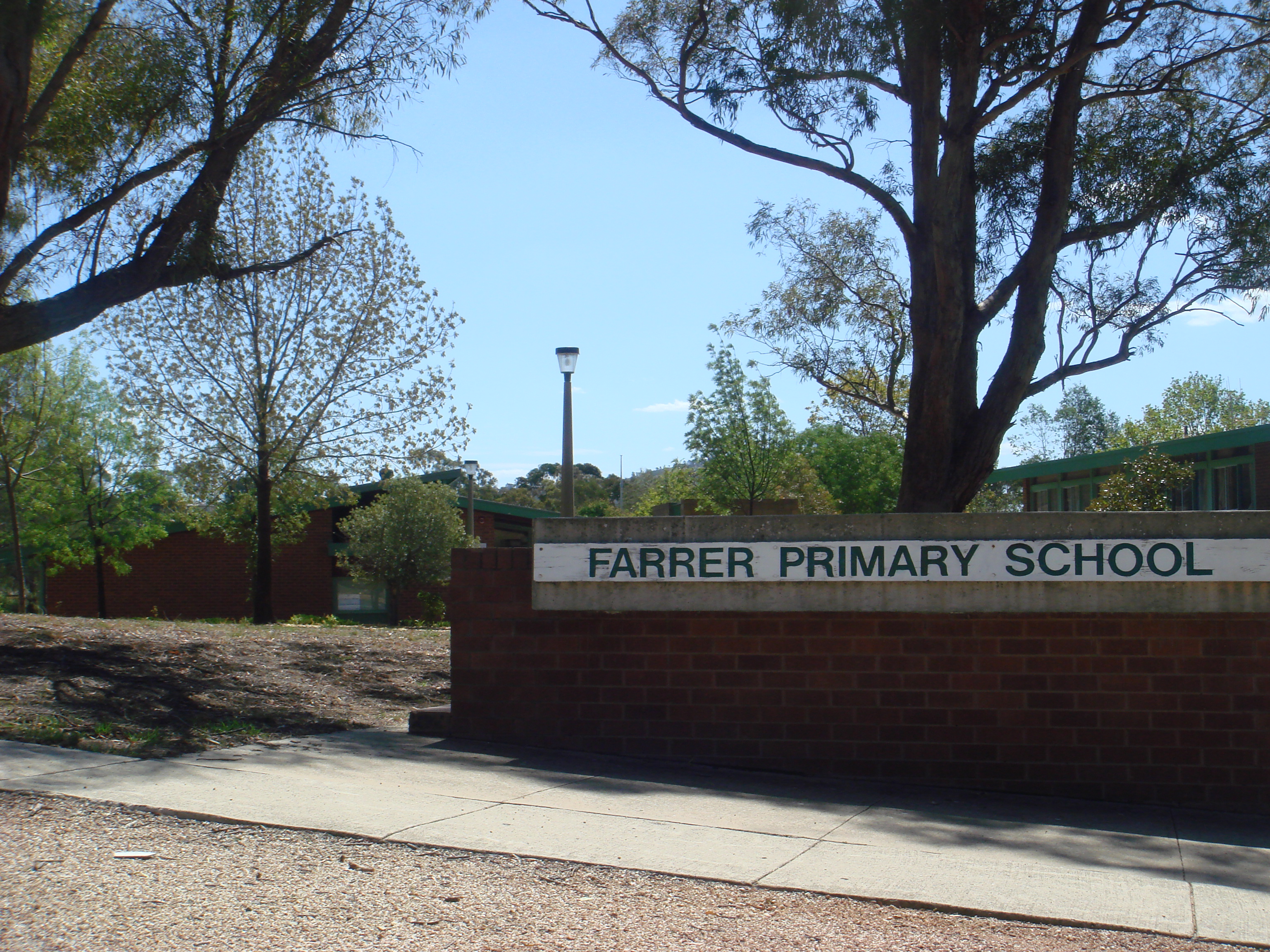
Farrer is a suburb in the Canberra, Australia district of Woden Valley (district), Woden. The postcode is 2607. Name origin Named for William James Farrer (1845–1906), who was a wheat-breeding pioneer, many of whose experiments were conducted at Lambrigg (house), Lambrigg near Tharwa, Australian Capital Territory, Tharwa. The suburb's streets are named after agriculturalists, except for Lambrigg Street, which was the name of Farrer's property in Tharwa. Location It is next to the suburbs of Torrens, Mawson, Isaacs and the Tuggeranong suburb of Wanniassa, Australian Capital Territory, Wanniassa. It is bordered by Beasley Street, Athllon Drive, and Yamba Drive. Located in this suburb iFarrer Primary Schooland neighbourhood oval, a Croatian Catholic parish centre, the Serbian Orthodox Church of St sava, St Sava, a small shopping centre, the Long Gully scout hall and the Goodwin Village for elderly citizens. General information Farrer is a relatively large suburb for Canberra, ... [...More Info...] [...Related Items...] OR: [Wikipedia] [Google] [Baidu] |
Fadden, Australian Capital Territory
Fadden is a suburb in the Canberra, Australia district of Tuggeranong. The postcode is 2904. The suburb is named after Sir Arthur Fadden, Prime Minister of Australia briefly in 1941. It was gazetted on 5 August 1975. Its streets are named after Queensland politicians. It is surrounded by Macarthur, Gowrie and Wanniassa. It is bounded by Erindale Drive, the Wanniassa Hills Nature Reserve, Fadden Pine Plantation and Sternberg Crescent. Demographics At the , Fadden had a population of 3,006 people. The median age of people in Fadden was 43 years, an increase from 35 in 2001, compared to a median age of 35 for the ACT. The median weekly individual income for Fadden in 2021 was $1,415, up from 1,197 in 2016, $1,054 in 2011, $819 in 2006 and $600–$699 in 2001, compared to $1,203 for the ACT. The median weekly household income was $3,302 up from $1,509 in 2006. In 2021, the median monthly housing loan repayment in Fadden was $2,383, up from $1,517 in 2006. The residents of Fadd ... [...More Info...] [...Related Items...] OR: [Wikipedia] [Google] [Baidu] |
Evatt, Australian Capital Territory
Evatt () is a suburb in the Belconnen district of Canberra, located within the Australian Capital Territory, Australia. Evatt lies between the suburbs of McKellar, Belconnen, Florey, Melba and Spence. The suburb is named after Herbert Vere Evatt (1894–1965), a Justice of the High Court and Leader of the Opposition in the 1950s. The suburb was gazetted on 2 November 1972. Streets in the suburb are named after people associated with parliament, and law professionals. Evatt has three neighbourhood ovals: Evatt Neighbourhood Oval, adjacent to Evatt Primary School; South West Evatt Oval, and St. Monica's Primary School oval. Evatt is bordered by Copland Drive, Owen Dixon Drive, William Webb Drive and Ginninderra Drive. Education The first school in the area used the building of the original Ginninderra Anglican church of St Paul situated at the corner block marked by the current Copland Drive, Moynihan Street, and Sharwood Crescent (opposite the current St Monica's church ... [...More Info...] [...Related Items...] OR: [Wikipedia] [Google] [Baidu] |
Duffy, Australian Capital Territory
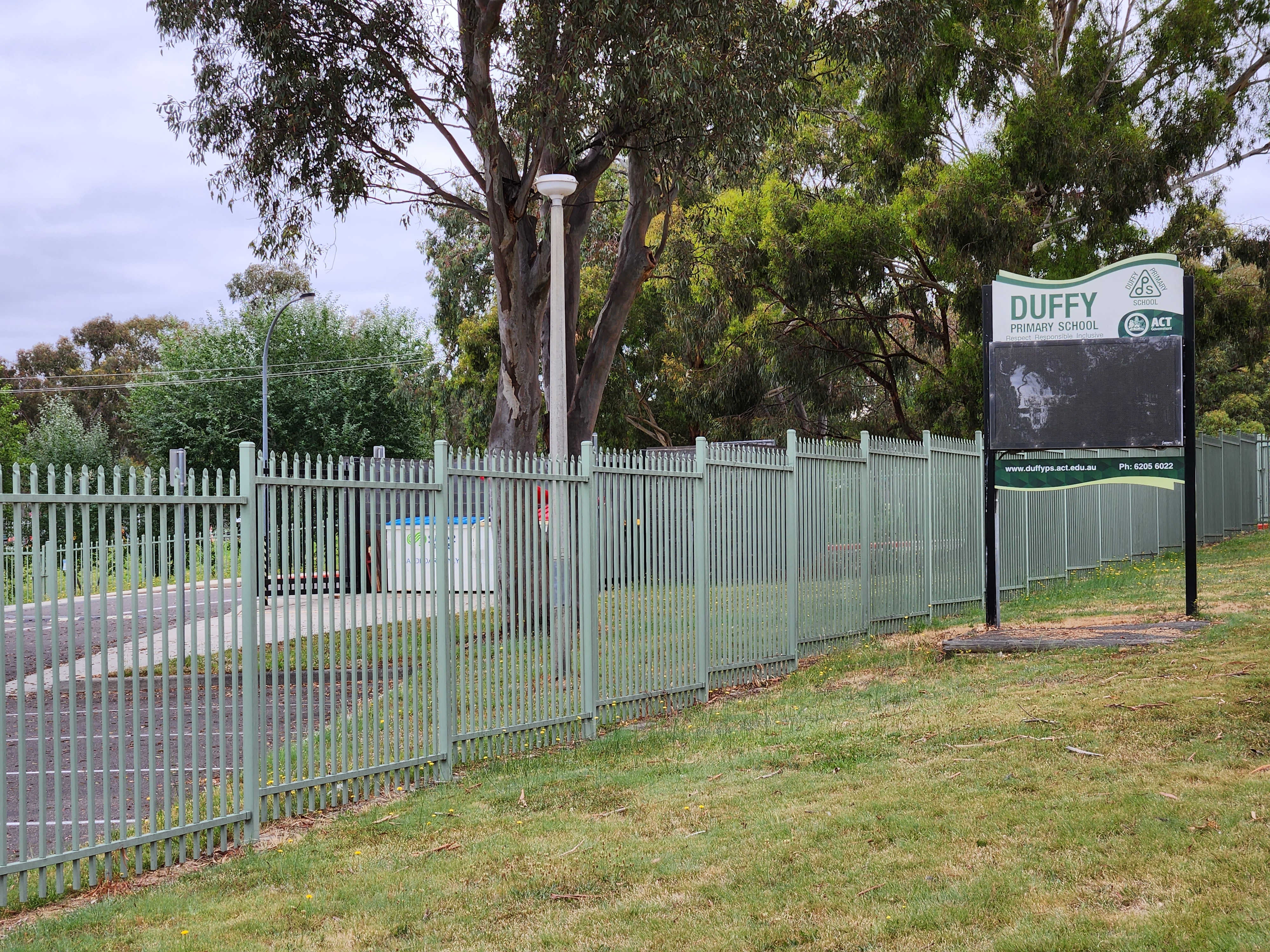
Duffy (postcode: 2611) is a suburb of Canberra, Australian Capital Territory, Australia, located in the district of Weston Creek. Duffy was named in honour of Charles Gavan Duffy (1816–1903), the 8th Premier of Victoria. Streets in the suburb of Duffy are named after Australian dams and reservoirs. History Duffy was gazetted as a placename on 2 July 1970. The Canberra bushfires of 2003 destroyed about 200 Duffy homes and the local petrol station. Duffy was the suburb that received the most damage in the fires. Narrabundah Hill, which borders the western edge of Duffy, is managed by ACT Forests and had contained a mature pine plantation before the fires. , work was under way to plant a new plantation on the hill and surrounding areas. Demographics At the , Duffy had a population of 3,395 people. Duffy residents had a median age of 39 compared to a Canberra median of 35. The median weekly personal income for people aged 15 years and over was A$1,251 a week, compared to a ... [...More Info...] [...Related Items...] OR: [Wikipedia] [Google] [Baidu] |
Woden Valley
Woden Valley () is a district in the Australian Capital Territory in Australia. The district is subdivided into divisions (suburbs), sections and blocks. The name of Woden Valley is taken from the name of a nearby homestead owned by James Murray who named the homestead in October 1837 after the Old English god of wisdom, Woden. He named it this as he was to spend his life in the pursuit of wisdom. However, historian Harold Koch considers that the name may have its origins in the Aboriginal word for possum, either ''wadyan'' or ''wadhan'', influenced in interpretation by the term known to English speakers of 'Woden'. In 1964 it was the first satellite city to be built, separate from the district of Canberra Central. It has its own shopping centre, employment opportunities and accommodation with twelve suburbs arranged around the Woden Town Centre. At the , the population of the district was . Establishment and governance Following the transfer of land from the Government of ... [...More Info...] [...Related Items...] OR: [Wikipedia] [Google] [Baidu] |
Curtin, Australian Capital Territory
Curtin () is a suburb in Canberra, Australia, part of the Woden Valley (district), Woden Valley district; its postcode is 2605. Curtin is named after John Curtin, Australian Prime Minister between 1941 and 1945. Its streets are named after state premiers. It is next to the suburbs of Yarralumla, Australian Capital Territory, Yarralumla, Deakin, Australian Capital Territory, Deakin, Hughes, Australian Capital Territory, Hughes, Lyons, Australian Capital Territory, Lyons and Weston, Australian Capital Territory, Weston. It is bounded by the Cotter Road, Tuggeranong Parkway, Yarra Glen (Canberra), Yarra Glen and a green strip between it and Lyons to the south. Curtin shopping centre offers the following services: Coles supermarket, post office, newsagent, bank, real estate agent, chemist, hairdresser, barber, travel agent, optometrist, florist, bakery, greengrocer, and coffee shops. Of note is the Curtin Milk Bar which was the longest running cafe in the area. Its style and operat ... [...More Info...] [...Related Items...] OR: [Wikipedia] [Google] [Baidu] |
Charnwood, Australian Capital Territory
Charnwood () is a suburb in the Belconnen district of Canberra located within the Australian Capital Territory, Australia. Design Charnwood's estate design was based on the Radburn principle. Under this design, houses were to face common parkland, with the suburb's streets servicing garages situated at the rear of the houses. The design failed in its application, however, as home owners built fences around the "park side" of their blocks, effectively screening the houses away from the common parkland. This created long, narrow, fenced walkways, with poor lighting and no neighbourhood surveillance. The original design for the network of pathways was to make it possible to walk from any point in the suburb to any other without directly crossing a road; pedestrian bridges can be used to cross the few major streets within the suburb. Charnwood is the location of the Charnwood centre shopping area which serves surrounding suburbs. The shopping centre includes several fast food outl ... [...More Info...] [...Related Items...] OR: [Wikipedia] [Google] [Baidu] |
Molonglo Valley
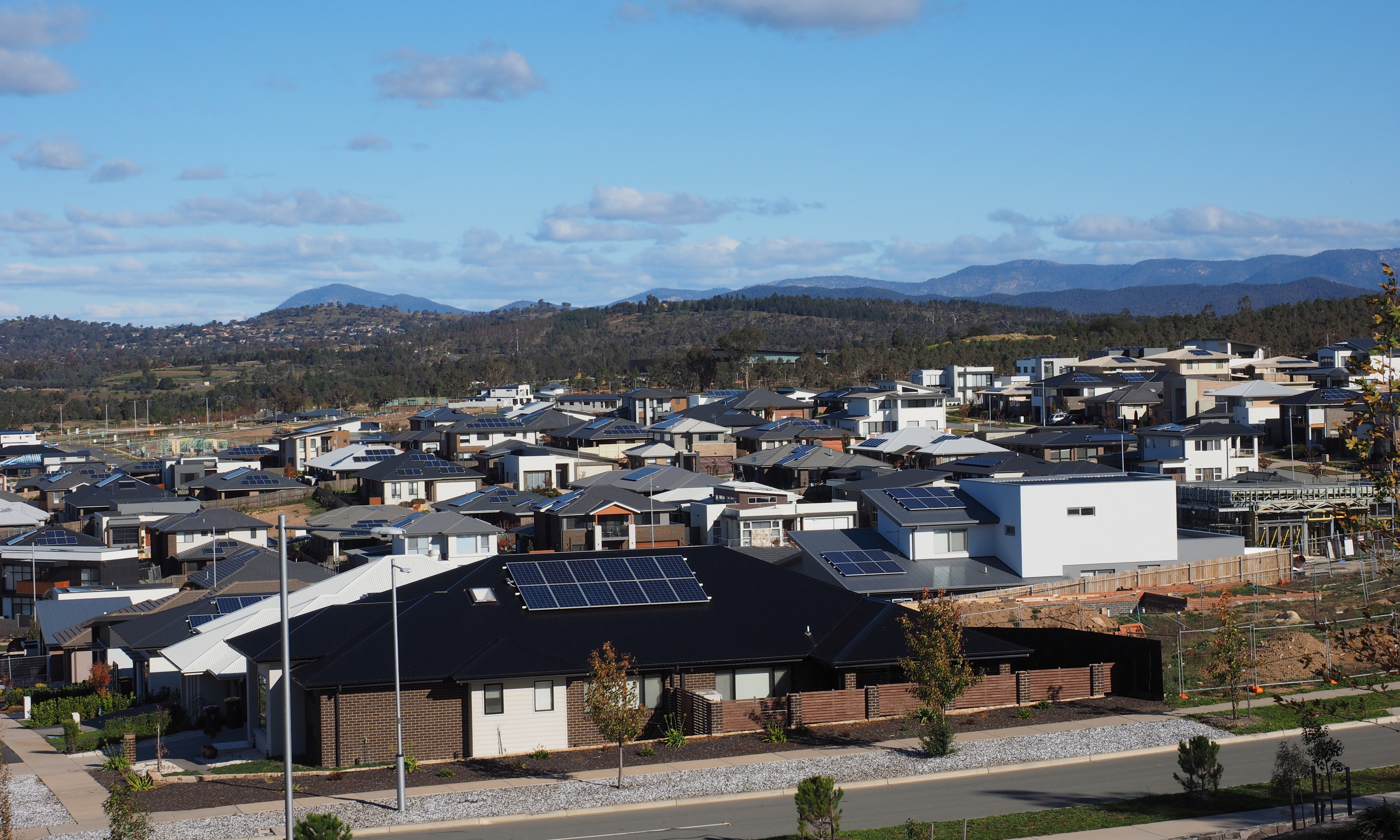
Molonglo Valley is a district in the Australian Capital Territory in Australia. The district is subdivided into divisions (suburbs), sections and blocks and is the newest district of the ACT. The district is planned to consist of thirteen suburbs, planned to contain dwellings, with an expected population of between and . To be developed in three stages over more than ten years, the district will contain a principal town centre and a secondary group centre, with residential suburbs located to the south and north of the Molonglo River; located to the west of Lake Burley Griffin. The name ''Molonglo'' is derived from an Aboriginal expression meaning "the sound of thunder". At the , the population of the district was 11,435, an increase from 4,578 in 2016. Establishment and governance The traditional custodians of the district are the indigenous people of the Ngunnawal tribe. Following the transfer of land from the Government of New South Wales to the Commonwealth Governme ... [...More Info...] [...Related Items...] OR: [Wikipedia] [Google] [Baidu] |


