|
List Of Regions Of China
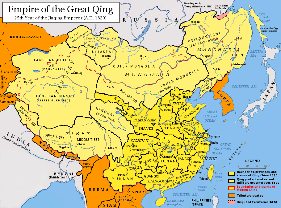
This is a list of traditional top-level regions of China. People's Republic of China Statistical regions This is a list of the 34 provincial-level divisions of the People's Republic of China grouped by its former greater administrative areas from 1949 to 1952. Other kinds of statistics Economic regions PLA military regions See also * Administrative divisions of China * List of ecoregions in China * Northern and southern China * Physiographic macroregions of China * Regional discrimination in China * History of the administrative divisions of China (1912–1949) The history of the administrative divisions of China is covered in the following articles: * Ancient Chinese states (before 221 ) * Administrative divisions of the Tang dynasty (618-907) * Administrative divisions of the Liao dynasty (916-1125) * ... {{DEFAULTSORT:Regions of China * Geography of China by region China geography-related lists China history-related lists< ... [...More Info...] [...Related Items...] OR: [Wikipedia] [Google] [Baidu] |
Administrative Divisions Of China
The administrative divisions of China have consisted of several levels since 1412, due to mainland China's large population and geographical area. In the People's Republic of China, the constitution provides for three levels of government. However in practice, there are five levels of local government; the provincial (province, autonomous region, municipality, and special administrative region), prefecture, county, township, and village. Since the 17th century, provincial boundaries in mainland China have remained largely static. Major changes since then have been the reorganization of provinces in the northeast after the establishment of the People's Republic of China in 1949 and the formation of autonomous regions, based on Soviet ethnic policies. The provinces serve an important cultural role in China, as people tend to identify with their native province. Levels The Constitution of the People's Republic of China provides for three levels: the provincial, the county le ... [...More Info...] [...Related Items...] OR: [Wikipedia] [Google] [Baidu] |
Huangpu District, Shanghai
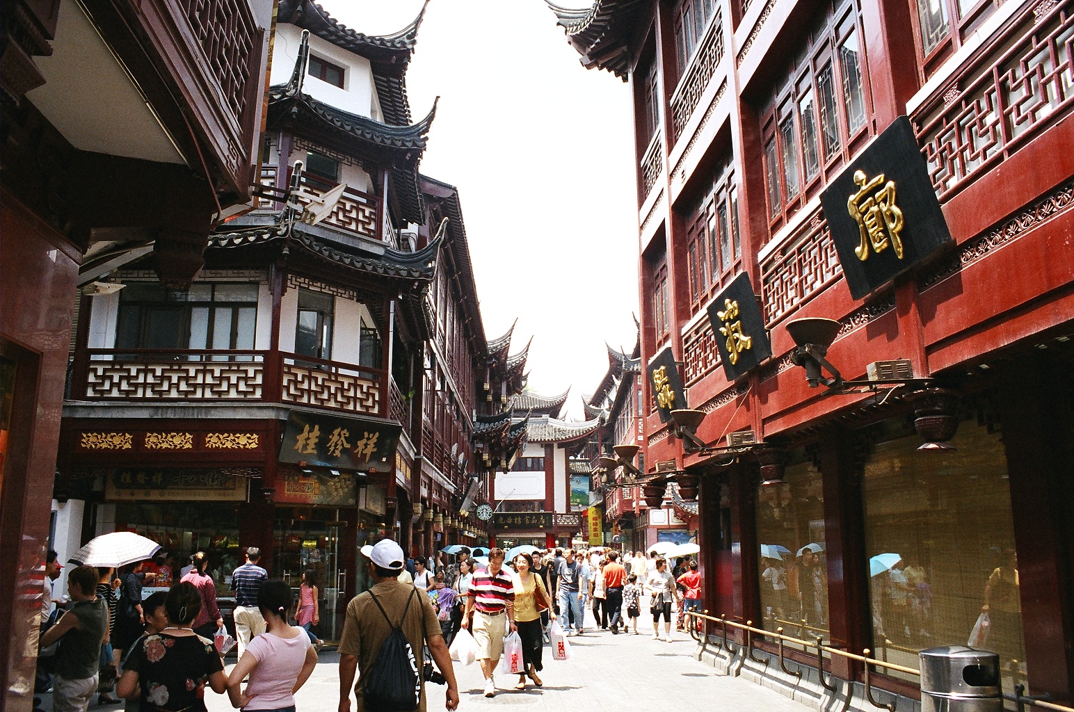
Huangpu District () makes up the eastern part of Shanghai's traditional urban core and is today the most central of Shanghai's 16 districts. Huangpu district is the seat of municipal government, includes key attractions such as The Bund (Shanghai), The Bund and the Old City God Temple of Shanghai, City God Temple, as well as popular shopping districts such as Nanjing Road (Shanghai), Nanjing Road, Huaihai Road, and Xintiandi. The Huangpu District is one of the most densely populated urban districts in the world. Location The Huangpu District is located in central Shanghai, People's Republic of China on the left bank (i.e., west or north bank) of Huangpu River, after which the district is named. It is opposite to Pudong and is bounded by Suzhou Creek to the north. Today's Huangpu District is sometimes referred to as "new Huangpu" to distinguish it from the pre-merger Huangpu District which existed before 2000. In 2000, the pre-merger Huangpu and Nanshi District, Shanghai, Nanshi ... [...More Info...] [...Related Items...] OR: [Wikipedia] [Google] [Baidu] |
Jiangxi
; Gan: ) , translit_lang1_type2 = , translit_lang1_info2 = , translit_lang1_type3 = , translit_lang1_info3 = , image_map = Jiangxi in China (+all claims hatched).svg , mapsize = 275px , map_caption = Location of Jiangxi in China , coordinates = , subdivision_type = Country , subdivision_name = China , named_for = Jiangnanxi Circuit () , seat_type = Capital , seat = Nanchang , seat1_type = Largest city , seat1 = Ganzhou , parts_type = Divisions , parts_style = para , p1 = 11 prefectures , p2 = 99 counties , p3 = 1549 townships , government_type = Province , governing_body = Jiangxi Provincial People's Congress , leader_title = Party Secretary , leader_name = Yin Hong , leader_title1 = Congress chairman , leader_name1 = Yin Hong , leader_title2 = Governor ... [...More Info...] [...Related Items...] OR: [Wikipedia] [Google] [Baidu] |
Zhongxing New Village
Zhongxing New Village, sometimes rendered as Chunghsing New Village is an urban village located in Nantou City, Nantou County, Taiwan (ROC) and was the seat of government of Taiwan Province until the abolition of the Taiwan Provincial Government in 2018. The term ''zhōngxīng'' is from a Chinese legend (), referring to the restoration of the Xia dynasty by king Shao Kang, an allusion to the ROC government taking back mainland China. It is a planned town with a population of 25,549 as of February 2010. With all the buildings owned by the government, development is strictly controlled and carefully planned. History Taipei, the temporary capital and the seat of government of the Republic of China (Taiwan), was also the capital of Taiwan Province from September 1945 until 1956. Ground was broken on the village on 4 November 1955, and branches of the government began moving on 5 July 1956. The provincial government held its first meeting at Zhongxing New Village on 27 November 19 ... [...More Info...] [...Related Items...] OR: [Wikipedia] [Google] [Baidu] |
Taipei
, nickname = The City of Azaleas , image_map = , map_caption = , pushpin_map = Taiwan#Asia#Pacific Ocean#Earth , coordinates = , subdivision_type = Country , subdivision_name = Taiwan , established_title = Settled , established_date = 1709 , established_title1 = Renamed Taihoku , established_date1 = 17 April 1895 , established_title2 = Provincial city (Taiwan), Provincial city status , established_date2 = 25 October 1945 , established_title3 = Retreat of the government of the Republic of China to Taiwan, Provisional national capital , established_date3 = 7 December 1949 , established_title4 = Reconstituted as a Yuan-controlled municipality , established_date4 = 1 July 1967 , capital_type = City seat , capital = Xinyi District, Taipei, Xinyi District , largest_settlement ... [...More Info...] [...Related Items...] OR: [Wikipedia] [Google] [Baidu] |
Taiwan Province, People's Republic Of China
Taiwan Province refers to a notional administrative division claimed by the People's Republic of China. The PRC constitution asserts Taiwan as part of its territories, although the PRC has never controlled Taiwan since the PRC's establishment in 1949. The territory of the claimed province, including the entire island of Taiwan, is in actuality administered by the Republic of China (ROC) but is not coextensive with the smaller Taiwan Province of the ROC. The political status of Taiwan is complex. Following the Chinese Civil War, the PRC considers itself the successor state of the pre-1949 ROC and the sole legitimate government of "China" since its founding on 1October 1949, and claims Taiwan and the Penghu Islands as part of its territory under the One China principle. However, the PRC has never administered Taiwan: the Taiwan Area, including all of the territory claimed by PRC as a province, has been continuously administered by the government of the Republic of Chi ... [...More Info...] [...Related Items...] OR: [Wikipedia] [Google] [Baidu] |
Kinmen
Kinmen, alternatively known as Quemoy, is a group of islands governed as a county by the Republic of China (Taiwan), only east from the city of Xiamen in Fujian, located at the southeastern coast of the People's Republic of China, from which they are separated by Xiamen Bay. Kinmen is also located west from the closest shoreline of the island of Taiwan across the Taiwan Strait. The county consists of the major island of Kinmen along with several surrounding islets, as well as Wuqiu Township remotely located northeast from the rest of the county., United States National Geospatial-Intelligence Agency Kinmen is one of two counties that constitute Fuchien Province; the other is Lienchiang County (Matsu). Kinmen's strategic location in the Taiwan Strait has caused numerous confrontations, making it a visible embodiment of political change on cross-strait relations. In August 1958, Kinmen was heavily bombarded by the People's Liberation Army during the Second Taiwa ... [...More Info...] [...Related Items...] OR: [Wikipedia] [Google] [Baidu] |
Fuzhou
Fuzhou is the capital of Fujian, China. The city lies between the Min River (Fujian), Min River estuary to the south and the city of Ningde to the north. Together, Fuzhou and Ningde make up the Eastern Min, Mindong linguistic and cultural region. Fuzhou's population was 8,291,268 as of the 2020 Chinese census. Like other prefecture-level city, prefecture-level cities in China, its administrative area contains both urban and rural areas: in 2020, 72.49% of inhabitants (6,010,242) were urban, while 27.51% (2,281,026) were rural. As of 31 December 2018, the total population was estimated at 7,740,000 whom 4,665,000 lived in the built-up (''or metro'') area made of five urban districts plus Minhou County. In 2015, Fuzhou was ranked as the 10th fastest growing metropolitan area in the world by Brookings Institution. Fuzhou is listed as No. 20 in the China Integrated City Index 2016's total ranking, a study conducted by the National Development and Reform Commission. Fuzhou is also ... [...More Info...] [...Related Items...] OR: [Wikipedia] [Google] [Baidu] |
Fujian
Fujian is a provinces of China, province in East China, southeastern China. Fujian is bordered by Zhejiang to the north, Jiangxi to the west, Guangdong to the south, and the Taiwan Strait to the east. Its capital is Fuzhou and its largest prefecture city by population is Quanzhou, with other notable cities including the port city of Xiamen and Zhangzhou. Fujian is located on the west coast of the Taiwan Strait as the closest province geographically and culturally to Taiwan; as a result of the Chinese Civil War, a small portion of historical Fujian is administered by Taiwan, romanized as Fuchien Province, Republic of China, Fuchien. While the population predominantly identifies as Han Chinese, Han, it is one of China's most culturally and linguistically diverse provinces. The dialects of the language group Min Chinese are most commonly spoken within the province, including the Fuzhou dialect and Eastern Min of Northeastern Fujian province and various Southern Min and Hokkien dial ... [...More Info...] [...Related Items...] OR: [Wikipedia] [Google] [Baidu] |
Hefei
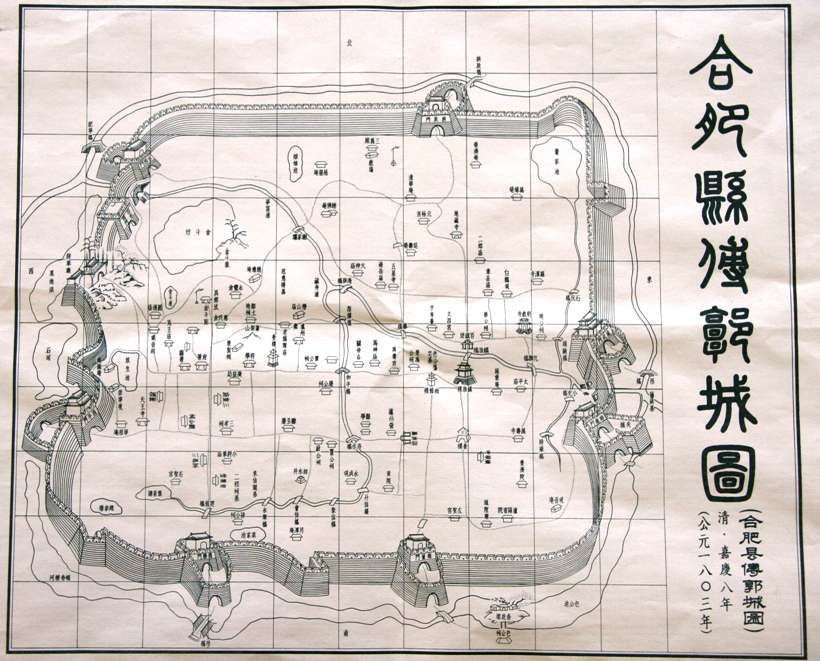
Hefei is the Capital city, capital of Anhui, China. A prefecture-level city, it is the political, economic, and cultural center of Anhui. Its population was 9,369,881 as of the 2020 census. Its built-up (or ''metro'') area is made up of four urban districts plus Feidong, Feixi and Changfeng counties being urbanized, and was home to 7,754,481 inhabitants. Located in the central portion of the province, it borders Huainan to the north, Chuzhou to the northeast, Wuhu to the southeast, Tongling to the south, Anqing to the southwest and Lu'an to the west. A natural hub of communications, Hefei is situated to the north of Chao Lake and stands on a low saddle crossing the northeastern extension of the Dabie Mountains, which forms the divide between the Huai River, Huai and Yangtze rivers. The present-day city dates from the Song dynasty. Before World War II, Hefei remained essentially an administrative centre and the regional market for the fertile plain to the south. It has gone thro ... [...More Info...] [...Related Items...] OR: [Wikipedia] [Google] [Baidu] |
Anhui
Anhui is an inland Provinces of China, province located in East China. Its provincial capital and largest city is Hefei. The province is located across the basins of the Yangtze and Huai rivers, bordering Jiangsu and Zhejiang to the east, Jiangxi to the south, Hubei and Henan to the west, and Shandong to the north. With a population of 61 million, Anhui is the 9th most populous province in China. It is the 22nd largest Chinese province based on area, and the 12th most densely populated region of all 34 Chinese provincial regions. Anhui's population is mostly composed of Han Chinese. Languages spoken within the province include Lower Yangtze Mandarin, Wu Chinese, Wu, Huizhou Chinese, Hui, Gan Chinese, Gan and small portion of Central Plains Mandarin. The name "Anhui" derives from the names of two cities: Anqing and Huizhou, Anhui, Huizhou (now Huangshan City). The abbreviation for Anhui is , corresponding to the historical , and is also used to refer to the Wan River and Mount Ti ... [...More Info...] [...Related Items...] OR: [Wikipedia] [Google] [Baidu] |
Hangzhou
Hangzhou, , Standard Mandarin pronunciation: ; formerly romanized as Hangchow is a sub-provincial city in East China and the capital of Zhejiang province. With a population of 13 million, the municipality comprises ten districts, two counties, and one county-level city in northwestern Zhejiang. It is situated at the head of Hangzhou Bay and the estuary of the Qiantang River. Established as a county seat in 221 BC, Hangzhou later served as the capital of the Wuyue Kingdom (923–997) and the Southern Song dynasty (1138–1276). The city has three UNESCO World Heritage Sites, which are the West Lake Cultural Landscape, the Grand Canal, and the Archaeological Ruins of Liangzhu City. Hangzhou is designated as a sub-provincial city. Hangzhou ranked ninth in GDP among mainland Chinese cities and 14th according to the Global Innovation Index. The city hosts the headquarters of Alibaba Group, Ant Group, DeepSeek, Geely, and NetEase. According to the Nature Index, it ... [...More Info...] [...Related Items...] OR: [Wikipedia] [Google] [Baidu] |


