|
List Of Locations In The Somerset Levels
The following is a list of locations in the Somerset Levels, England. Settlements * Aller, Somerset * Alhampton * Andersea * Athelney * Baltonsborough * Banwell * Barrow (North/South) * Bawdrip * Berrow * Biddisham * Blackford, near Wedmore * Bleadon * Bourton * Brent Knoll * Bridgwater * Burnham-on-Sea * Burrowbridge * Burtle * Butleigh * Catcott * Catsham * Claverham * Chapel Allerton * Cheddar * Chilton Polden * Cocklake * Cossington * Curry Rivel * Dunball * Draycott * Drayton * Edington * Foddington * Glastonbury * Greinton * Highbridge * Huish Episcopi * Huntspill (East/West) * Ilchester * Langport * Long Load * Lovington * Lympsham * Mark * Meare * Midelney * Middlezoy * Moorlinch * Muchelney * Nailsea * North Curry * Northmoor Green * Nythe * Oath * Othery * Pathe * Pawlett * Pedwell * Podimore * Puriton * Rackley * Rooks Bridge * Shapwick * Sharpham * Somerton * Southway * Stathe * Stawell * Steart * Sticklinch * Stoke St Gregory * Street ... [...More Info...] [...Related Items...] OR: [Wikipedia] [Google] [Baidu] |
Somerset Levels
The Somerset Levels are a coastal plain and wetland area of Somerset, England, running south from the Mendips to the Blackdown Hills. The Somerset Levels have an area of about and are bisected by the Polden Hills; the areas to the south are drained by the River Parrett, and the areas to the north by the rivers Axe and Brue. The Mendip Hills separate the Somerset Levels from the North Somerset Levels. The Somerset Levels consist of marine clay "levels" along the coast and inland peat-based "moors"; agriculturally, about 70 per cent is used as grassland and the rest is arable. Willow and teazel are grown commercially and peat is extracted. A Palaeolithic flint tool found in West Sedgemoor is the earliest indication of human presence in the area. The Neolithic people exploited the reed swamps for their natural resources and started to construct wooden trackways, including the world's oldest known timber trackway, the Post Track, dating from about 3800 BC. The Levels were ... [...More Info...] [...Related Items...] OR: [Wikipedia] [Google] [Baidu] |
Burrowbridge
Burrowbridge is a village and civil parish in Somerset, England, situated on the River Parrett and A361 road in the Somerset West and Taunton district, on the edge of the Somerset Levels. It is located south east of Bridgwater, and has a population of 508. History The name probably comes from the Old English ''buruh'' (fortified hill) and brycg (bridge). In the village is Burrow Mump, an ancient earthwork now owned by the National Trust, presented by Major A.C. Barrett in 1946 as a war memorial. Burrow Mump is also known as St Michael's Borough or Tutteyate. It is a natural hill of Triassic sandstone capped by Keuper marl. Excavations showed evidence of a 12th-century masonry building on the top of the hill. The first recorded writing mentioning this site is from William of Worcestre about 1480 when he referred to it as Myghell-borough. A medieval church dedicated to St Michael from at least the mid 15th century formed a sanctuary for royalist troops in 1645. The ruins visib ... [...More Info...] [...Related Items...] OR: [Wikipedia] [Google] [Baidu] |
Draycott, Somerset
Draycott is a village in Somerset, England, neighbouring the village of Cheddar on the southern edge of the Mendip Hills Area of Outstanding Natural Beauty. It is now the larger village in the civil parish of Rodney Stoke. History There is some evidence of occupation of the site in the Iron Age including an unfinished earthwork enclosure on the hill above Draycott. The village was listed in the Domesday Book of 1086 as ''Draicote'', meaning 'The dray shelter' from the Old English ''dragan'' and ''cot''. Another derivation is from the Brythonic from Tre meaning settlement and Coet meanings woods. Geography Close to the village is the Draycott Sleights nature reserve which has been designated as a Site of Special Scientific Interest. Halesland Airfield is situated just to the north of the village and is home to the Mendip Gliding Club. Draycott is still a major strawberry producer and the now-disused railway line that ran through the village was called the Strawberry Line. ... [...More Info...] [...Related Items...] OR: [Wikipedia] [Google] [Baidu] |
Dunball
Dunball is a small hamlet west of the village of Puriton and close to the town of Bridgwater, Somerset, England. Just north of Dunball is Down End which is the site of Down End Castle a motte-and-bailey castle, which has been designated as a Scheduled Ancient Monument. Located on the A38, adjacent to Junction 23 of the M5 motorway, it hosts a wharf on the River Parrett, created in 1844 by Bridgwater coal merchants, which is the only part of the Port of Bridgwater still in commercial use today. Dunball also has a small industrial estate, built on the site of the Royal Ordnance Factory's hostel blocks; and a hotel. The wharf was formerly linked to the Bristol and Exeter Railway by a rail track which crossed the A38, on the right hand side of the hotel. The link was built in 1876 by coal merchants, and was originally operated as a horse-drawn tramway. It was removed during the Beeching Axe and Dunball also lost its railway station on 5 October 1964, which had opened in 1873. Th ... [...More Info...] [...Related Items...] OR: [Wikipedia] [Google] [Baidu] |
Curry Rivel
Curry Rivel is a village and civil parish in Somerset, England, situated west of Somerton and east of Taunton in the South Somerset district. The parish has a population of 2,148. The parish includes the hamlet of Burton Pynsent. History The site of a Roman house has been discovered south of Fairview House. The site is on the Heritage at Risk Register due to ploughing. The unusual name Curry Rivel, comes from the Celtic word , meaning boundary and ''Rivel'' from its 12th century landlord Sir Richard Revel. In 1237 the king granted Henry de l'Orti a licence to empark his woods in Curry Rivel separating it from the control of the foresters of Castle Neroche. Curry Rivel was part of the hundred of Abdick and Bulstone. Notable structures Earnshill House was built in 1725 by John Strachan for Henry Combe, a prominent Bristol merchant. Burton Pynsent House was built around 1756 for William Pitt, after he inherited the estate from Sir William Pynsent, 2nd Baronet. It form ... [...More Info...] [...Related Items...] OR: [Wikipedia] [Google] [Baidu] |
Cossington, Somerset
Cossington is a village and civil parish close to Woolavington and north of Bridgwater, in the Sedgemoor district in Somerset, England. The village lies on the north side of the Polden Hills. History It was probably part of the ancient Polden estate of Glastonbury Abbey. The abbey retained an interest as chief lord of the manor until 1508. The parish of Cossington was part of the Whitley Hundred. Cossington railway station was a station on the Bridgwater branch of the Somerset and Dorset Joint Railway, which opened in 1890 and closed in 1952. Cossington had a Penny Post service under Bridgwater in 1830. The post office closed in March 2007. Governance The parish council has responsibility for local issues, including setting an annual precept (local rate) to cover the council's operating costs and producing annual accounts for public scrutiny. The parish council evaluates local planning applications and works with the local police, district council officers, and neighbourh ... [...More Info...] [...Related Items...] OR: [Wikipedia] [Google] [Baidu] |
Cocklake
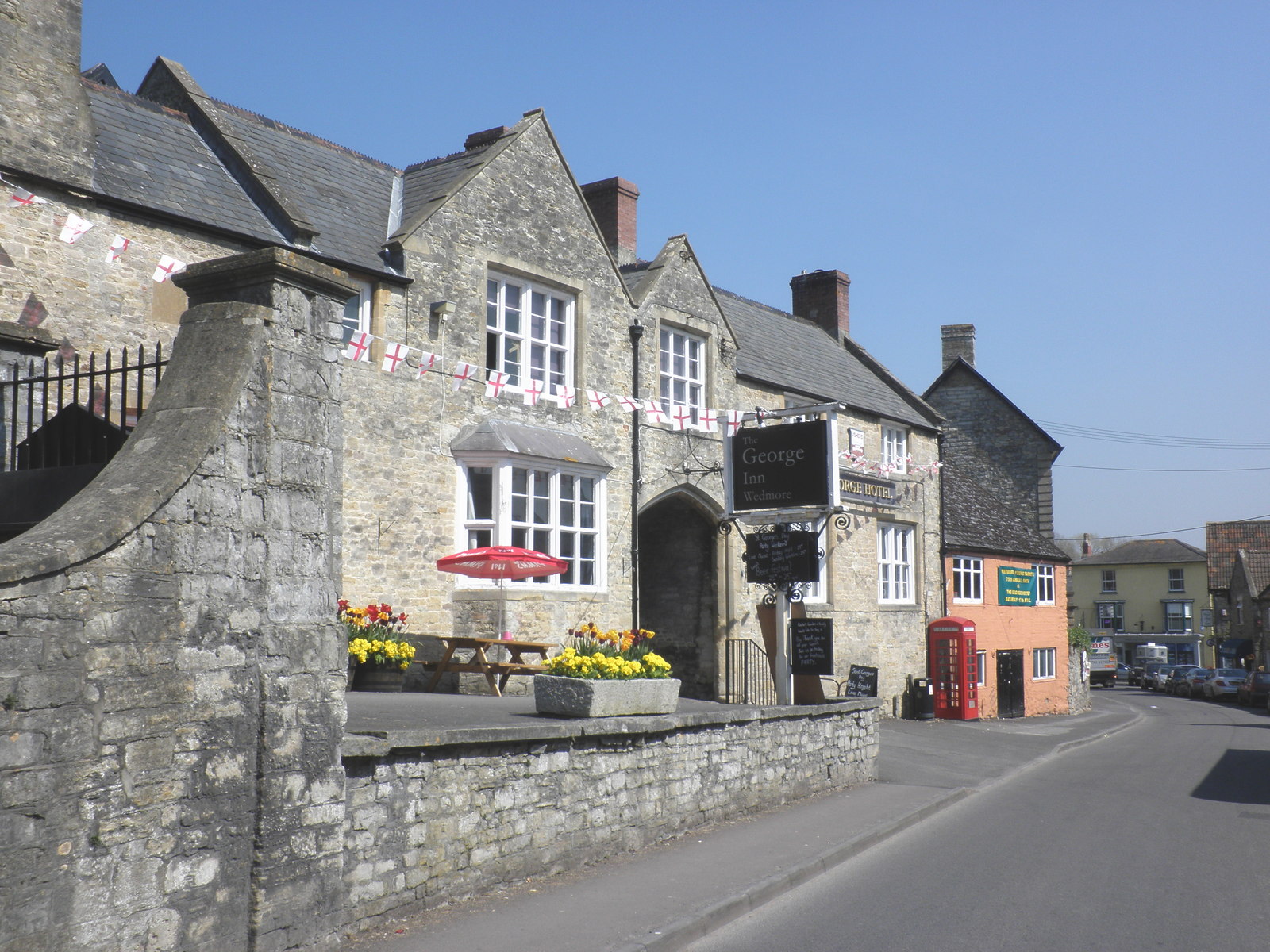
Wedmore is a large village and civil parish in the county of Somerset, England. It is situated on raised ground, in the Somerset Levels between the River Axe and River Brue, often called the Isle of Wedmore. It forms part of Sedgemoor district. The parish consists of three main villages: Wedmore, Blackford and Theale, with the 17 hamlets of Bagley, Blakeway, Clewer, Crickham, Cocklake, Heath House, Latcham, Little Ireland, Middle Stoughton, Mudgley, Panborough, Sand, Stoughton Cross, Washbrook, West End, West Ham and West Stoughton. The parish of Wedmore has a population of 3,318 according to the 2011 census. Its facilities include a medical and dental practice, pharmacy, butcher's, a village store with off licence, three pubs, restaurant, café and several other local shops. It is south of Cheddar, west of the city of Wells and north west of Glastonbury. Etymology The name ''Wedmore'' in Old English is thought to mean "hunting lodge" or "hunting moor"; there was a Saxon ... [...More Info...] [...Related Items...] OR: [Wikipedia] [Google] [Baidu] |
Chilton Polden
Chilton Polden is a rural village and civil parish, situated close to Edington on the Somerset Levels to the north of the Polden Hills in the Sedgemoor district of Somerset, England. History The name of the village is thought to derive from its position on limestone and from the hill on which part of the parish lies. The form ''Chelton upon Poledowne'' is found in 1664. The Polden estate was given to Glastonbury Abbey by Æthelheard of Wessex in 729. Chilton Priory (also known as Stradling's Folly) was originally built as a folly, and subsequently enlarged to become a country house. The tower and wing at the rear were built in 1838, for William Stradling. Stradling also incorporated various pieces of buildings and archaeological relics from around the county, especially materials from a Roman Villa at Chedzoy. The upper windows, battlements and grotesque heads came from a demolished castle at Enmore and the pinnacles from an old church tower at Langport. The staircase tur ... [...More Info...] [...Related Items...] OR: [Wikipedia] [Google] [Baidu] |
Cheddar, Somerset
Cheddar is a large village and civil parish in the Sedgemoor district of the English county of Somerset. It is situated on the southern edge of the Mendip Hills, north-west of Wells, south-east of Weston-super-Mare and south-west of Bristol. The civil parish includes the hamlets of Nyland and Bradley Cross. The parish had a population of 5,755 in 2011 and an acreage of as of 1961. Cheddar Gorge, on the northern edge of the village, is the largest gorge in the United Kingdom and includes several show caves, including Gough's Cave. The gorge has been a centre of human settlement since Neolithic times including a Saxon palace. It has a temperate climate and provides a unique geological and biological environment that has been recognised by the designation of several Sites of Special Scientific Interest. It is also the site of several limestone quarries. The village gave its name to Cheddar cheese and has been a centre for strawberry growing. The crop was formerly trans ... [...More Info...] [...Related Items...] OR: [Wikipedia] [Google] [Baidu] |
Chapel Allerton
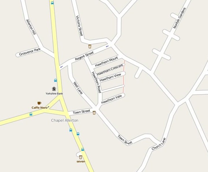
Chapel Allerton is an inner suburb of north-east Leeds, West Yorkshire, England, from the city centre. It sits within the Chapel Allerton ward of Leeds City Council and had a population of 18,206 and 23,536 at the 2001 and 2011 census respectively. The area was also listed in the 2018 ''Sunday Times'' report on Best Places to Live in northern England. Location The region within the Chapel Allerton ward generally considered to be Chapel Allerton is bounded by Potternewton Lane to the south, Scott Hall Road to the west and Gledhow Valley Road to the north-east. Surrounding districts include Moortown, Meanwood, Roundhay, Gledhow, Chapeltown and Harehills. Chapel Allerton is on Harrogate Road, which, before the building of the A61 Scott Hall Road, was the main road from Leeds to Harrogate. The centre in terms of activity is Stainbeck Corner, at the junction of Stainbeck Lane, Harrogate Road and Town Street, which is also the key place on 19th century maps of the villag ... [...More Info...] [...Related Items...] OR: [Wikipedia] [Google] [Baidu] |
Claverham
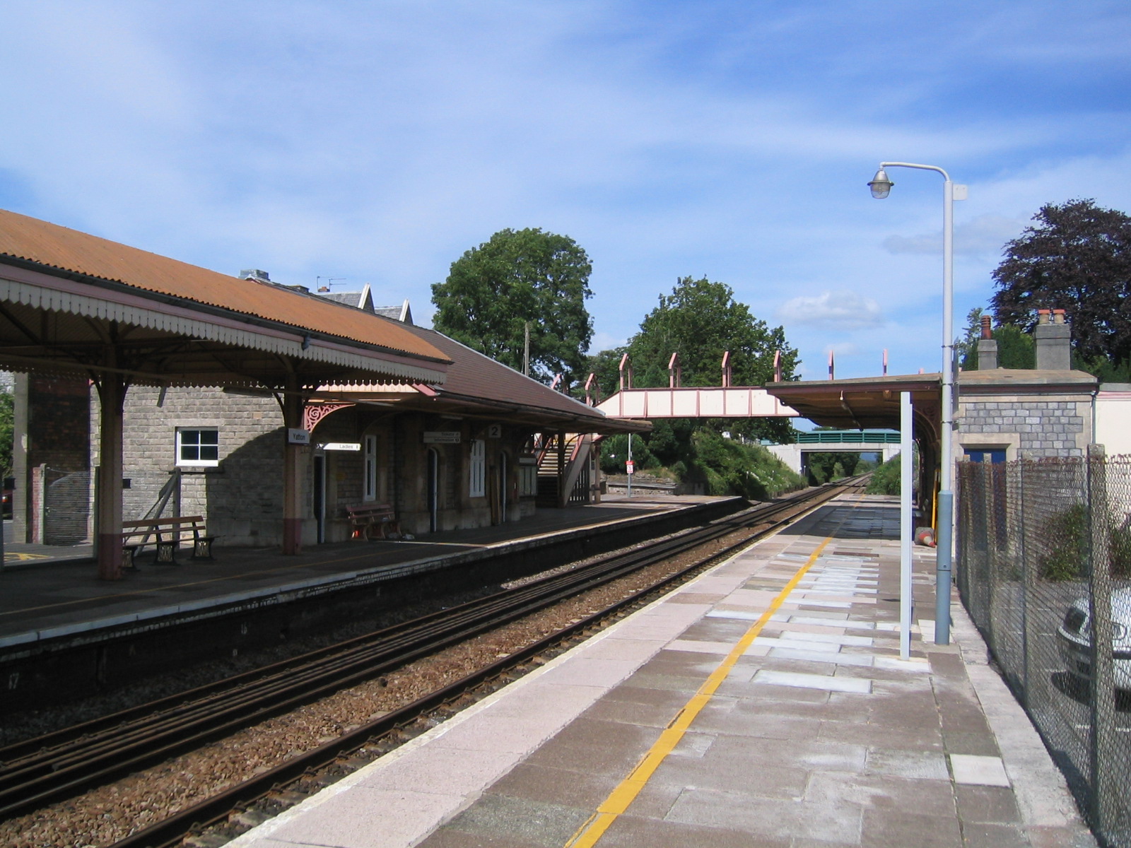
Yatton is a village and civil parish within the unitary authority of North Somerset, which falls within the ceremonial county of Somerset, England. It is located south-west of Bristol. Its population in 2011 was 7,552. The parish includes Claverham, a small village which was originally a farming hamlet. The origins of the village and its name are unclear; however, there is evidence of Iron Age hill fort and a Roman villa in the area. The arrival of the railway in the 19th century and more recent road building have led to expansion of the village with Yatton now acting as a home to many commuters, while also supporting manufacturing industry and commerce. The village is located on the North Somerset Levels, where the low-lying land, a mixture of peat, estuarine alluvium and low hills of sand and gravel, is crossed by a myriad of watercourses, providing a habitat for several scarce species. St Mary's Church dates from the 14th century and there are a range of other places of wor ... [...More Info...] [...Related Items...] OR: [Wikipedia] [Google] [Baidu] |


