|
L'Etivaz
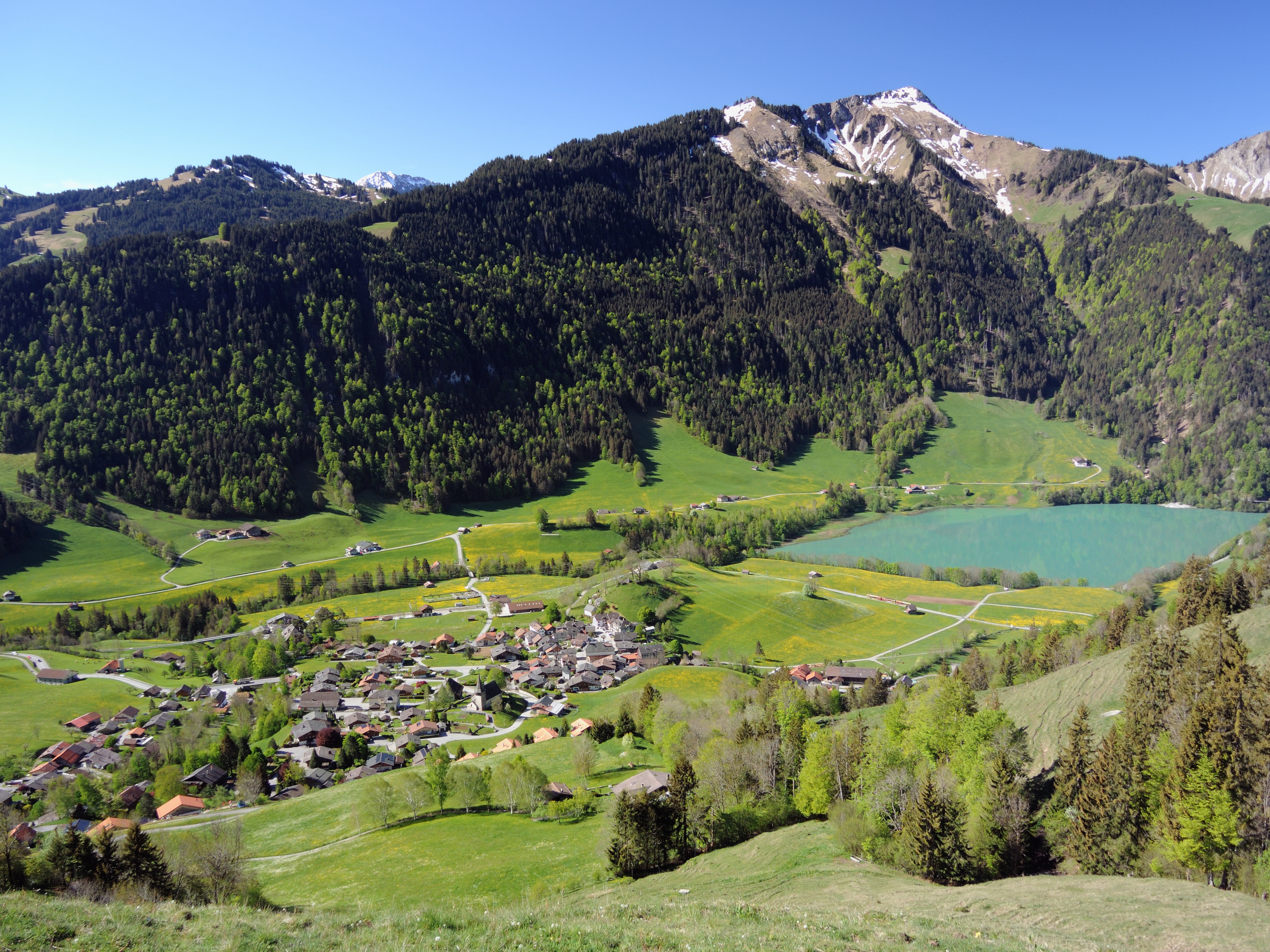
L'Étivaz is a hard Swiss cheese made from raw cow's milk. It is classified as a Swiss-type or Alpine cheese, and is very similar to Gruyère (cheese), Gruyère surchoix in taste. Its place of origin, L'Etivaz, is a hamlet in the southwestern Swiss Alps, just under the Col des Mosses in the canton of Vaud. It has about 150 inhabitants. The cheese is made in the communes of Château-d'Œx, Rougemont, Switzerland, Rougemont, Rossinière, Ormont-Dessous, Ormont-Dessus, Leysin, Corbeyrier, Villeneuve, Vaud, Villeneuve, Ollon and Bex. History In the 1930s, a group of 76 Gruyère producing families felt that government regulations were allowing cheesemakers to compromise the qualities that made good Gruyère so special. They withdrew from the government's Gruyère program, and "created" their own cheese - L'Etivaz - named for the village around which they all lived. They founded a cooperative in 1932, and the first cheese cellars were built in 1934. [...More Info...] [...Related Items...] OR: [Wikipedia] [Google] [Baidu] |
Ormont-Dessous
Ormont-Dessous is a municipality of the canton of Vaud in Switzerland, located in the district of Aigle. History Ormont-Dessous is first mentioned in 1200 as ''Ormont''. In 1564 it was mentioned as ''Bas-Ormont''. The German name ''Ormund'' is no longer used. Geography Ormont-Dessous has an area, , of . Of this area, or 38.9% is used for agricultural purposes, while or 45.4% is forested. Of the rest of the land, or 3.2% is settled (buildings or roads), or 2.0% is either rivers or lakes and or 10.5% is unproductive land.Swiss Federal Statistical Office-Land Use Statistics 2009 data accessed 25 March 2010 Of the built up area, housing and buildings made up 1.3% and transportation infrastructure made up 1.7%. Out of the forested land, 37.8% o ... [...More Info...] [...Related Items...] OR: [Wikipedia] [Google] [Baidu] |
Appellation D'origine Protégée (Switzerland)
The protected designation of origin (PDO) is a type of geographical indication of the European Union and the United Kingdom aimed at preserving the designations of origin of food-related products. The designation was created in 1992 and its main purpose is to designate products that have been produced, processed and developed in a specific geographical area, using the recognized know-how of local producers and ingredients from the region concerned. The list below also shows other geographical indications. Features The characteristics of the products protected are essentially linked to their terroir. The European or UK PDO logo, of which the use is compulsory, documents this link. European Regulation 510/2006 of 20 March 2006 acknowledges a priority to establish a community protection system that ensures equal conditions of competition between producers. This European Regulation is intended to guarantee the reputation of regional products, adapt existing national protections t ... [...More Info...] [...Related Items...] OR: [Wikipedia] [Google] [Baidu] |
Appellation D'origine Contrôlée
An appellation is a legally defined and protected geographical indication primarily used to identify where the grapes for a wine were grown, although other types of food often have appellations as well. Restrictions other than geographical boundaries, such as what grapes may be grown, maximum grape yields, alcohol level, and other quality factors may also apply before an appellation name may legally appear on a wine bottle label. The rules that govern appellations are dependent on the country in which the wine was produced. History The tradition of wine appellation is very old. The oldest references are to be found in the Bible, where ''wine of Samaria'', ''wine of Carmel'', ''wine of Jezreel'', or ''wine of Helbon'' are mentioned. This tradition of appellation continued throughout the Antiquity and the Middle Ages, though without any officially sanctioned rules. Historically, the world's first exclusive (protected) vineyard zone was introduced in Chianti, Italy in 1716 a ... [...More Info...] [...Related Items...] OR: [Wikipedia] [Google] [Baidu] |
Cooperative
A cooperative (also known as co-operative, co-op, or coop) is "an autonomous association of persons united voluntarily to meet their common economic, social and cultural needs and aspirations through a jointly owned and democratically-controlled enterprise".Statement on the Cooperative Identity. '' International Cooperative Alliance.'' Cooperatives are democratically controlled by their members, with each member having one vote in electing the board of directors. Cooperatives may include: * es owned and managed by the people who cons ... [...More Info...] [...Related Items...] OR: [Wikipedia] [Google] [Baidu] |
Ollon
Ollon is a municipality in the district of Aigle in the canton of Vaud in Switzerland, sited in the foothills of the mountains to the south-east of the Lake of Geneva. The old German language name ''Olun'' is no longer used. History Ollon is first mentioned in 1018 as ''Aulonum'' though there is some debate about whether this refers to another settlement. In 1025-32 it was mentioned as ''Olonum''. Saint-Triphon The village of Saint-Triphon is situated on three hills overlooking the Rhone valley. It was first mentioned in 1332 as ''Triphonis Sancti''. Archeological finds include items from the Middle Neolithic to the Roman era, including an Early Bronze Age necropolis and a Late Bronze Age smelter for copper processing. On the hill ''Le Lessus'' stands a high square tower, probably from the 13th Century. The tower was partially destroyed in 1476. Foundations indicate that the tower was reached by a walkway. Nearby, the remains of a romanesque chapel from the 12th Cen ... [...More Info...] [...Related Items...] OR: [Wikipedia] [Google] [Baidu] |
Villeneuve, Vaud
Villeneuve () is a municipality of the canton of Vaud in Switzerland, located in the district of Aigle. As of December 2018, it had a population of 5771. Geography Villeneuve has an area, , of . Of this area, or 26.7% is used for agricultural purposes, while or 55.2% is forested. Of the rest of the land, or 8.2% is settled (buildings or roads), or 0.5% is either rivers or lakes and or 9.6% is unproductive land.Swiss Federal Statistical Office-Land Use Statistics 2009 data accessed 25 March 2010 Of the built up area, industrial buildings made up 1.5% of the total area while housing and buildings made up 1.9% and transportation infrastructure made up 2.8%. Power and water infrastructure as well as other special developed areas made up 1.7% of th ... [...More Info...] [...Related Items...] OR: [Wikipedia] [Google] [Baidu] |
Corbeyrier
Corbeyrier is a municipality in Switzerland in the canton of Vaud, located in the district of Aigle. It became a municipality in 1718.Amtliches Gemeindeverzeichnis der Schweiz published by the Swiss Federal Statistical Office . Retrieved 14 January 2010 History Corbeyrier is first mentioned in 1261 as ''de Cubiriaco''.Geography Corbeyrier has an area, , of . Of this area, or 36.2% is used for agricultural purposes, while or 54.4% is forested. Of the rest of the land, or 2.3% is settled (buildings or roads), or 0.3% is either rivers or lakes and or 6.9% is unproductive land.[...More Info...] [...Related Items...] OR: [Wikipedia] [Google] [Baidu] |
Leysin
Leysin is a municipality of the canton of Vaud in the Aigle district of Switzerland. It is first mentioned around 1231–32 as ''Leissins'', in 1352 as ''Leisins''. Located in the Vaud Alps, Leysin is a sunny alpine resort village at the eastern end of Lake Geneva in proximity to Montreux, Lausanne, and Geneva. In earlier years, Leysin was known for its TB sanatorias; today it is most famous for spectacular Alpine views across the Rhône Valley towards the Dents du Midi and year-round mountain sports and recreational facilities. The village of Leysin and hamlet of Veyges are a designated part of the Inventory of Swiss Heritage Sites. Geography Leysin has an area, , of . Of this area, or 34.9% is used for agricultural purposes, while or 37.2% is forested. Of the rest of the land, or 7.7% is settled (buildings or roads), or 0.2% is either rivers or lakes and or 19.8% is unproductive land. [...More Info...] [...Related Items...] OR: [Wikipedia] [Google] [Baidu] |
Ormont-Dessus
Ormont-Dessus is a municipality of the canton of Vaud in Switzerland, located in the district of Aigle. History Ormont-Dessus is first mentioned in 1200 as ''Ormont''. The German name of ''Ormund'' is no longer used. Geography Ormont-Dessus has an area, , of . Of this area, or 33.5% is used for agricultural purposes, while or 32.9% is forested. Of the rest of the land, or 3.6% is settled (buildings or roads), or 0.6% is either rivers or lakes and or 29.4% is unproductive land.Swiss Federal Statistical Office-Land Use Statistics 2009 data accessed 25 March 2010 Of the built up area, housing and buildings made up 1.8% and transportation infrastructure made up 1.5%. Out of the forested land, 27.0% of the total land area is heavily forested and ... [...More Info...] [...Related Items...] OR: [Wikipedia] [Google] [Baidu] |
Rossinière
Rossinière is a municipality in the Riviera-Pays-d'Enhaut district of the canton of Vaud in Switzerland. History Rossinière is first mentioned in 1155 as ''La Ransonery''. Geography Rossinière has an area, , of . Of this area, or 38.2% is used for agricultural purposes, while or 49.6% is forested. Of the rest of the land, or 2.7% is settled (buildings or roads), or 1.7% is either rivers or lakes and or 7.8% is unproductive land.Swiss Federal Statistical Office-Land Use Statistics 2009 data accessed 25 March 2010 Of the built up area, housing and buildings made up 0.8% and transportation infrastructure made up 1.7%. Out of the forested land, 43.2% of the total land area is heavily forested and 3.9% is covered with orchards or small cluste ... [...More Info...] [...Related Items...] OR: [Wikipedia] [Google] [Baidu] |
.jpg)


