|
Issyk-Kul Lake
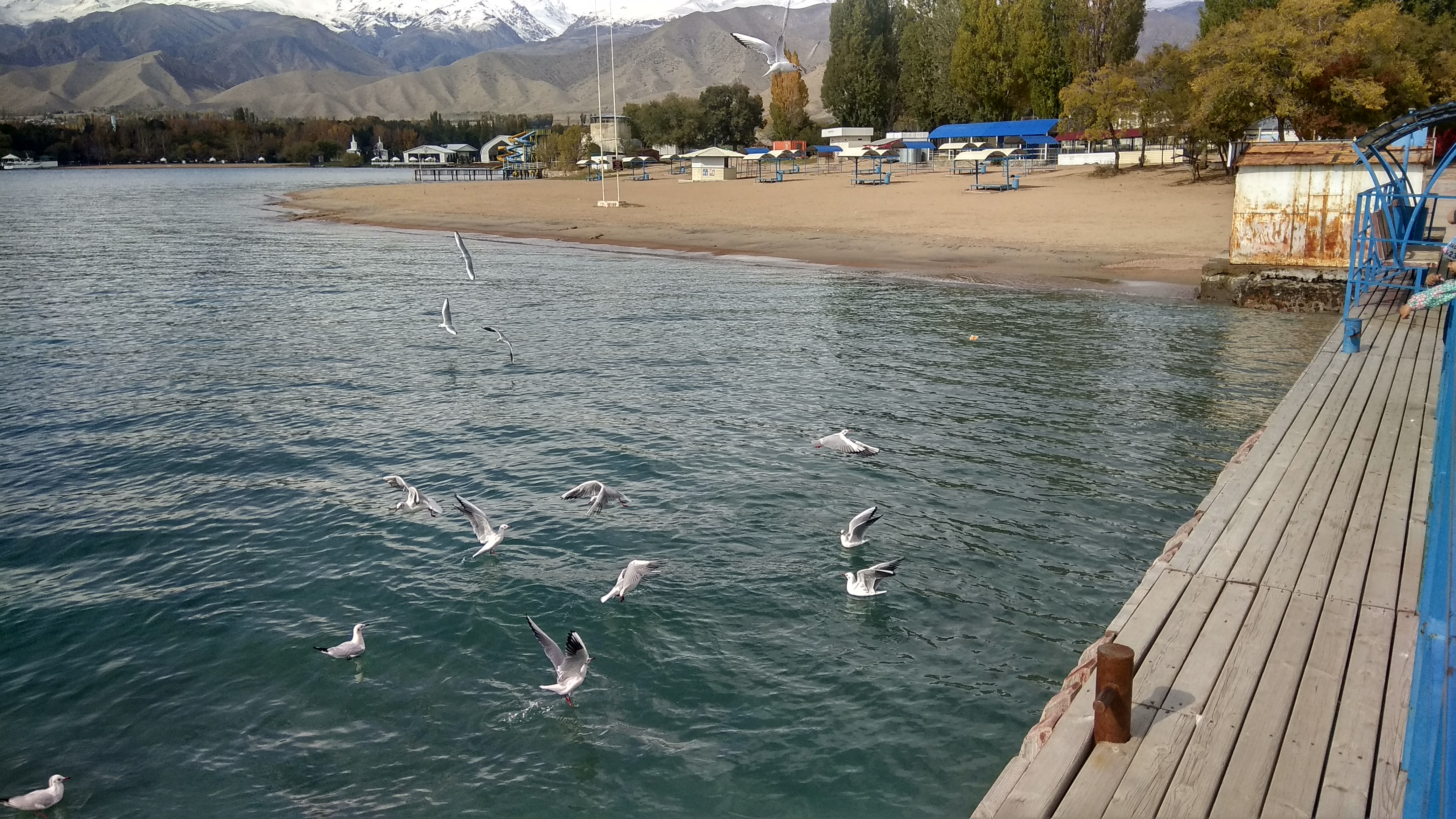
Issyk-Kul () or Ysyk-Köl (, ; ) is an endorheic saline lake in the western Tianshan Mountains in eastern Kyrgyzstan, just south of a dividing range separating Kyrgyzstan from Kazakhstan. It is the List of lakes by depth, eighth-deepest lake in the world, the List of lakes by volume, eleventh-largest lake in the world by volume (though not in surface area), the deepest lake whose deepest point is above sea level (939 meters or 3,080 feet), and the third-largest saline lake. Although it is located at a lofty elevation of and subject to severe cold during winter, it rarely freezes over due to high salinity, hence its name, which in the Kyrgyz language means "warm lake". The lake is a Ramsar Convention, Ramsar site of globally significant biodiversity and forms part of the Issyk-Kul Biosphere Reserve. Geography Issyk-Kul Lake is long, up to wide and its surface area is . It is the second-largest mountain lake in the world behind Lake Titicaca in South America. It is at an altitud ... [...More Info...] [...Related Items...] OR: [Wikipedia] [Google] [Baidu] |
Ancient Lake
An ancient lake is a lake that has consistently carried water for more than one million years. Twelve of the 20 ancient lakes have existed for more than 2.6 million years, the full Quaternary period. Ancient lakes continue to persist due to plate tectonics in an active rift zone. This active rift zone creates lakes that are extremely deep and difficult to naturally fill with sediment. Due to the prolonged life of ancient lakes, they serve as models for isolated evolutionary traits and speciation. Most of the world's bodies of water are less than 18,000 years old. There are only 20 ancient lakes over 1 million years old. Lake Baikal is often considered the oldest, as clear evidence shows that it is 25–30 million years old. Lake Zaysan may be even older, of Cretaceous origin and at least 66 million years old (most likely around 70 million years), but its exact age is controversial and labeled with some uncertainty. Another contender for oldest is Lake Maracaibo, estimated to be ... [...More Info...] [...Related Items...] OR: [Wikipedia] [Google] [Baidu] |
Salinity
Salinity () is the saltiness or amount of salt (chemistry), salt dissolved in a body of water, called saline water (see also soil salinity). It is usually measured in g/L or g/kg (grams of salt per liter/kilogram of water; the latter is dimensionless and equal to per mille, ‰). Salinity is an important factor in determining many aspects of the chemistry of natural waters and of biological processes within it, and is a state function, thermodynamic state variable that, along with temperature and pressure, governs physical characteristics like the density and heat capacity of the water. A contour line of constant salinity is called an ''isohaline'', or sometimes ''isohale''. Definitions Salinity in rivers, lakes, and the ocean is conceptually simple, but technically challenging to define and measure precisely. Conceptually the salinity is the quantity of dissolved salt content of the water. Salts are compounds like sodium chloride, magnesium sulfate, potassium nitrate, and sod ... [...More Info...] [...Related Items...] OR: [Wikipedia] [Google] [Baidu] |
Doklady Akademii Nauk SSSR
The ''Proceedings of the USSR Academy of Sciences'' (, ''Doklady Akademii Nauk SSSR'' (''DAN SSSR''), ) was a Soviet journal that was dedicated to publishing original, academic research papers in physics, mathematics, chemistry, geology, and biology. It was first published in 1933 and ended in 1992 with volume 322, issue 3. Today, it is continued by ''Doklady Akademii Nauk'' (), which began publication in 1992. The journal is also known as the ''Proceedings of the Russian Academy of Sciences (RAS)''. ''Doklady'' has had a complicated publication and translation history. A number of translation journals exist which publish selected articles from the original by subject section; these are listed below. The journal is indexed in Russian Science Citation Index. History The Russian Academy of Sciences dates from 1724, with a continuous series of variously named publications dating from 1726. ''Doklady Akademii Nauk SSSR-Comptes Rendus de l'Académie des Sciences de l'URSS, Seriya ... [...More Info...] [...Related Items...] OR: [Wikipedia] [Google] [Baidu] |
Lake
A lake is often a naturally occurring, relatively large and fixed body of water on or near the Earth's surface. It is localized in a basin or interconnected basins surrounded by dry land. Lakes lie completely on land and are separate from the ocean, although they may be connected with the ocean by rivers. Lakes, as with other bodies of water, are part of the water cycle, the processes by which water moves around the Earth. Most lakes are fresh water and account for almost all the world's surface freshwater, but some are salt lakes with salinities even higher than that of seawater. Lakes vary significantly in surface area and volume of water. Lakes are typically larger and deeper than ponds, which are also water-filled basins on land, although there are no official definitions or scientific criteria distinguishing the two. Lakes are also distinct from lagoons, which are generally shallow tidal pools dammed by sandbars or other material at coastal regions of ocean ... [...More Info...] [...Related Items...] OR: [Wikipedia] [Google] [Baidu] |
Monohydrocalcite
Monohydrocalcite is a mineral that is a hydrous form of calcium carbonate, CaCO3·H2O. It was formerly also known by the name hydrocalcite, which is now discredited by the IMA. It is a trigonal mineral which is white when pure. Monohydrocalcite is not a common rock-forming mineral, but is frequently associated with other calcium and magnesium carbonate minerals, such as calcite, aragonite, lansfordite, and nesquehonite. Monohydrocalcite has been observed in air conditioning systems, and in moonmilk deposits in caves, both probably formed from spray of carbonate rich fluids. It is well known in Robe on the Limestone Coast of South Australia as a component of beach sands of Lake Fellmongery and Lake Butler, where it is believed to be formed from algal spume. Other lacustrine deposits include Lake Issyk-Kul, Kyrgyzstan, Lake Kivu, Democratic Republic of the Congo, and Solar Lake, Sinai. It has been reported as a significant component of the decomposition of ikaite in th ... [...More Info...] [...Related Items...] OR: [Wikipedia] [Google] [Baidu] |
Chu River
The Chu is a river in northern Kyrgyzstan and southern Kazakhstan. Of its total length of ,Чу (река) the first 115 kilometres are in Kyrgyzstan, then for 221 kilometres the river serves as the border between Kyrgyzstan and Kazakhstan and the last 731 kilometres are in Kazakhstan. It is one of the longest s in Kyrgyzstan and in Kazakhstan. It has a of . The |
Hot Springs
A hot spring, hydrothermal spring, or geothermal spring is a Spring (hydrology), spring produced by the emergence of Geothermal activity, geothermally heated groundwater onto the surface of the Earth. The groundwater is heated either by shallow bodies of magma (molten rock) or by circulation through fault (geology), faults to hot rock deep in the Earth's crust. Hot spring water often contains large amounts of dissolved minerals. The chemistry of hot springs ranges from acid sulfate springs with a pH as low as 0.8, to alkaline chloride springs saturated with silica, to bicarbonate springs saturated with carbon dioxide and carbonate minerals. Some springs also contain abundant dissolved iron. The minerals brought to the surface in hot springs often feed communities of extremophiles, microorganisms adapted to extreme conditions, and it is possible that life on Earth had its origin in hot springs. Humans have made use of hot springs for bathing, relaxation, or medical therapy for th ... [...More Info...] [...Related Items...] OR: [Wikipedia] [Google] [Baidu] |
Tüp (river)
The Tüp ( ''Tüp'', ''Tyup'') is a river in Tüp District and Ak-Suu District of Issyk-Kul Region of Kyrgyzstan. It rises on north slopes of Teskey Ala-Too Range, takes in several tributaries from the Kungey Alatau and flows into lake Issyk-Kul. With its length of the Tüp is the longest river of the Issyk-Kul basin. The basin area is , the second largest of the rivers entering Issyk-Kul. References Rivers of Kyrgyzstan Tributaries of Issyk-Kul {{Kyrgyzstan-river-stub ... [...More Info...] [...Related Items...] OR: [Wikipedia] [Google] [Baidu] |
Jyrgalang (river)
The Jyrgalang () is a river in Kyrgyzstan. It takes its rise on the north slopes of Teskey Ala-Too range and flows into Issyk-Kul Issyk-Kul () or Ysyk-Köl (, ; ) is an endorheic saline lake in the western Tianshan Mountains in eastern Kyrgyzstan, just south of a dividing range separating Kyrgyzstan from Kazakhstan. It is the eighth-deepest lake in the world, the eleve ... lake. The villages Jyrgalang and Ak-Suu are located near the river. With its , the river is second longest river of the Issyk-Kul basin. Average annual discharge is . The maximum flow is and the minimum - . The river's catchment area of is the largest among rivers feeding Issyk-Kul. References Rivers of Kyrgyzstan Tian Shan Tributaries of Issyk-Kul {{Kyrgyzstan-river-stub ... [...More Info...] [...Related Items...] OR: [Wikipedia] [Google] [Baidu] |
List Of Rivers Of The Issyk-Kul
This list of rivers of Issyk Kul includes rivers draining into lake Issyk-Kul in Kyrgyzstan Kyrgyzstan, officially the Kyrgyz Republic, is a landlocked country in Central Asia lying in the Tian Shan and Pamir Mountains, Pamir mountain ranges. Bishkek is the Capital city, capital and List of cities in Kyrgyzstan, largest city. Kyrgyz .... It is reported that the basin of Issyk-Kul encounter 1,976 river and streams with a total length of 7,139 km. Of them, 1,842 streams are shorter than 10 km with a total length of 4,241 km (or 59%), and 106 streams range from 10 to 25 km in length totaling 1,708 km (or 24%). There are 24 small rivers with length varying between 25 and 50 km (the total is 853 km or 12%), and 3 medium-size rivers (51–100 km ) with a total length of 217 km (4%). Finally, there is only one comparatively large Tyup river with a length of 120 km, which is 1% of total length. Overall, 118 streams and rivers flow ... [...More Info...] [...Related Items...] OR: [Wikipedia] [Google] [Baidu] |
South America
South America is a continent entirely in the Western Hemisphere and mostly in the Southern Hemisphere, with a considerably smaller portion in the Northern Hemisphere. It can also be described as the southern Subregion#Americas, subregion of the Americas. South America is bordered on the west by the Pacific Ocean, on the north and east by the Atlantic Ocean, and to the south by the Drake Passage; North America and the Caribbean Sea lie to the northwest. The continent includes twelve sovereign states: Argentina, Bolivia, Brazil, Chile, Colombia, Ecuador, Guyana, Paraguay, Peru, Suriname, Uruguay, and Venezuela; two dependent territory, dependent territories: the Falkland Islands and South Georgia and the South Sandwich Islands; and one administrative division, internal territory: French Guiana. The Dutch Caribbean ABC islands (Leeward Antilles), ABC islands (Aruba, Bonaire, and Curaçao) and Trinidad and Tobago are geologically located on the South-American continental shel ... [...More Info...] [...Related Items...] OR: [Wikipedia] [Google] [Baidu] |
Lake Titicaca
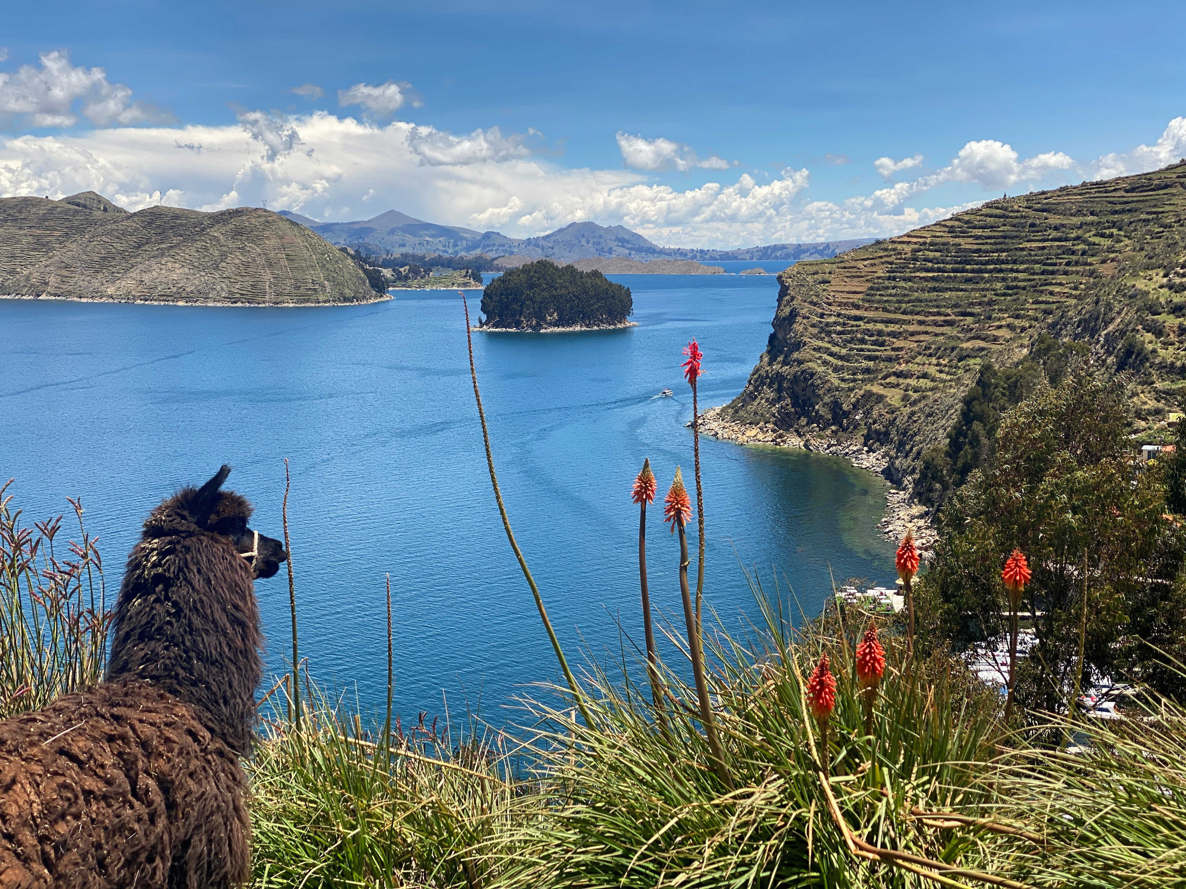
Lake Titicaca (; ; ) is a large freshwater lake in the Andes mountains on the border of Bolivia and Peru. It is often called the highest navigable lake in the world. Titicaca is the largest lake in South America, both in terms of the volume of water and surface area.Grove, M. J., P. A. Baker, S. L. Cross, C. A. Rigsby and G. O. Seltzer 2003 Application of Strontium Isotopes to Understanding the Hydrology and Paleohydrology of the Altiplano, Bolivia-Peru. ''Palaeogeography, Palaeoclimatology, Palaeoecology'' 194:281-297. It has a surface elevation of . Overview The lake is located at the northern end of the endorheic Altiplano basin high in the Andes on the border of Peru and Bolivia. The western part of the lake lies within the Puno Region of Peru, and the eastern side is located in the Bolivian La Paz Department (Bolivia), La Paz Department. The lake consists of two nearly separate subbasins connected by the Strait of Tiquina, which is across at the narrowest point. The lar ... [...More Info...] [...Related Items...] OR: [Wikipedia] [Google] [Baidu] |


