|
Issyk-Kul
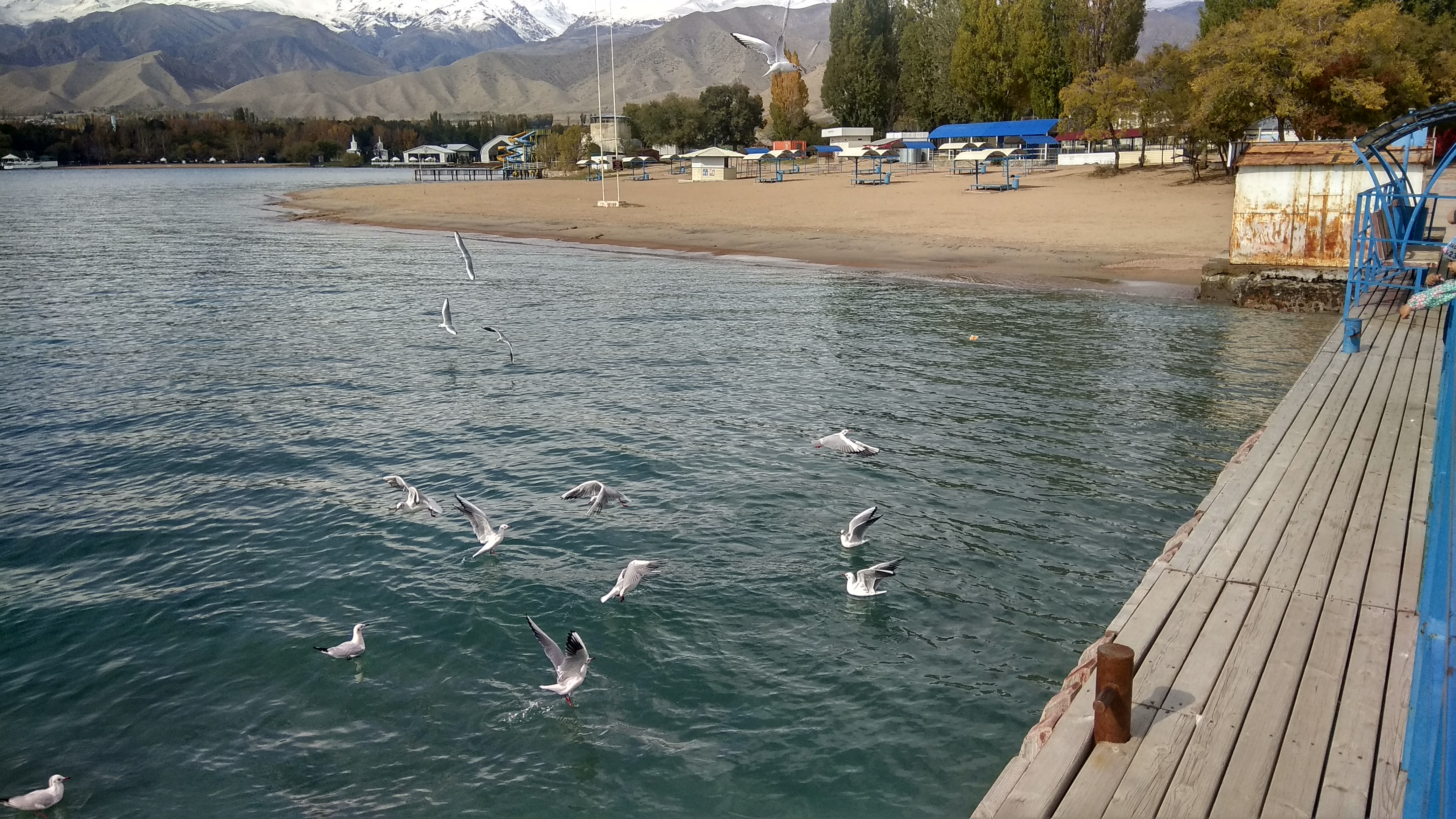
Issyk-Kul () or Ysyk-Köl (, ; ) is an endorheic saline lake in the western Tianshan Mountains in eastern Kyrgyzstan, just south of a dividing range separating Kyrgyzstan from Kazakhstan. It is the eighth-deepest lake in the world, the eleventh-largest lake in the world by volume (though not in surface area), the deepest lake whose deepest point is above sea level (939 meters or 3,080 feet), and the third-largest saline lake. Although it is located at a lofty elevation of and subject to severe cold during winter, it rarely freezes over due to high salinity, hence its name, which in the Kyrgyz language means "warm lake". The lake is a Ramsar site of globally significant biodiversity and forms part of the Issyk-Kul Biosphere Reserve. Geography Issyk-Kul Lake is long, up to wide and its surface area is . It is the second-largest mountain lake in the world behind Lake Titicaca in South America. It is at an altitude of and reaches in depth. About 118 rivers and streams f ... [...More Info...] [...Related Items...] OR: [Wikipedia] [Google] [Baidu] |
Kyrgyzstan
Kyrgyzstan, officially the Kyrgyz Republic, is a landlocked country in Central Asia lying in the Tian Shan and Pamir Mountains, Pamir mountain ranges. Bishkek is the Capital city, capital and List of cities in Kyrgyzstan, largest city. Kyrgyzstan is bordered by Kazakhstan to the Kazakhstan–Kyrgyzstan border, north, Uzbekistan to the Kyrgyzstan–Uzbekistan border, west, Tajikistan to the Kyrgyzstan–Tajikistan border, south, and China to the China–Kyrgyzstan border, east and southeast. Ethnic Kyrgyz people, Kyrgyz make up the majority of the country's over 7 million people, followed by significant minorities of Uzbeks and Russians. Kyrgyzstan's history spans a variety of cultures and empires. Although geographically isolated by its highly mountainous terrain, Kyrgyzstan has been at the crossroads of several great civilizations as part of the Silk Road along with other commercial routes. Inhabited by a succession of tribes and clans, Kyrgyzstan has periodically fallen unde ... [...More Info...] [...Related Items...] OR: [Wikipedia] [Google] [Baidu] |
Karakol
Karakol (; , ), formerly Przhevalsk ( rus, Пржевальск, p=pr̩ʐɨˈvalʲsk), is the fourth-largest city in Kyrgyzstan, near the eastern tip of Lake Issyk-Kul, about from the Kyrgyzstan–China border and from the capital Bishkek. It is the administrative capital of Issyk-Kul Region. Its area is , and its resident population was 84,351 in 2021 (both including Pristan'-Przheval'sk). To the north, on highway A363, is Tüp, and to the southwest Jeti-Ögüz resort. History A Russian military outpost founded on 1 July 1869, Karakol grew in the 19th century after explorers came to map the peaks and valleys separating Kyrgyzstan from China. In the 1880s Karakol's population surged with an influx of Dungans, Chinese Muslims fleeing warfare in China. In 1888, the Russian explorer Nikolay Przhevalsky died in Karakol of typhoid, while preparing for an expedition to Tibet. By order of Tsar Alexander III on 23 March 1889 the city was renamed Przhevalsk in the explorer's hon ... [...More Info...] [...Related Items...] OR: [Wikipedia] [Google] [Baidu] |
List Of Rivers Of The Issyk-Kul
This list of rivers of Issyk Kul includes rivers draining into lake Issyk-Kul in Kyrgyzstan Kyrgyzstan, officially the Kyrgyz Republic, is a landlocked country in Central Asia lying in the Tian Shan and Pamir Mountains, Pamir mountain ranges. Bishkek is the Capital city, capital and List of cities in Kyrgyzstan, largest city. Kyrgyz .... It is reported that the basin of Issyk-Kul encounter 1,976 river and streams with a total length of 7,139 km. Of them, 1,842 streams are shorter than 10 km with a total length of 4,241 km (or 59%), and 106 streams range from 10 to 25 km in length totaling 1,708 km (or 24%). There are 24 small rivers with length varying between 25 and 50 km (the total is 853 km or 12%), and 3 medium-size rivers (51–100 km ) with a total length of 217 km (4%). Finally, there is only one comparatively large Tyup river with a length of 120 km, which is 1% of total length. Overall, 118 streams and rivers flow ... [...More Info...] [...Related Items...] OR: [Wikipedia] [Google] [Baidu] |
Cholpon-Ata
Cholpon-Ata is a resort town on the northern shore of Lake Issyk-Kul in Kyrgyzstan with a population of 14,237 (2021). It is the administrative center of the Issyk-Kul District of Issyk-Kul Region; this district occupies most of the lake's north shore. To the west along highway A363 is Tamchy and to the east is Bosteri. The town contains numerous large and small sanatoria, hotels and guesthouses to accommodate the many visitors who descend upon the lake in summer. During the Soviet era it was much frequented by vacationers brought here in organized mass tours from other parts of the USSR. Holidaymakers now usually visit on their own or in small groups and originate mainly from Kyrgyzstan, Kazakhstan, Uzbekistan and Russia with some tourists from other countries. Attracting more demanding foreign tourists will require upgrading of the existing facilities, but the location is certainly attractive. The view of the imposing alpine ranges of the Tian Shan across the lake is impr ... [...More Info...] [...Related Items...] OR: [Wikipedia] [Google] [Baidu] |
Balykchy
Balykchy () is a town at the western end of Lake Issyk-Kul in Kyrgyzstan, at an elevation of about 1,900 metres. Its area is , and its resident population was 42,875 in 2021 (both including Orto-Tokoy). A major industrial and transport centre (wool and crop processing, lake shipping, rail terminal, and road junction) during the Soviet era, it lost most of its economic base after the collapse of the Soviet Union and the closure of virtually all of its industrial facilities. The main road from Bishkek, the capital of Kyrgyzstan, to China, a part of the ancient Great Silk Road, passes through Balykchy before it starts its long and arduous way across the alpine ranges of Naryn Province in central Kyrgyzstan to the Chinese border at Torugart Pass. Plans for the rail road from the Chinese border to Balykchy, where the line from Bishkek currently ends, are under discussion. Two other roads go around the north and south sides of Issyk Kul to Karakol and then around the east end of the ... [...More Info...] [...Related Items...] OR: [Wikipedia] [Google] [Baidu] |
Tüp (river)
The Tüp ( ''Tüp'', ''Tyup'') is a river in Tüp District and Ak-Suu District of Issyk-Kul Region of Kyrgyzstan. It rises on north slopes of Teskey Ala-Too Range, takes in several tributaries from the Kungey Alatau and flows into lake Issyk-Kul. With its length of the Tüp is the longest river of the Issyk-Kul basin. The basin area is , the second largest of the rivers entering Issyk-Kul. References Rivers of Kyrgyzstan Tributaries of Issyk-Kul {{Kyrgyzstan-river-stub ... [...More Info...] [...Related Items...] OR: [Wikipedia] [Google] [Baidu] |
Jyrgalang (river)
The Jyrgalang () is a river in Kyrgyzstan. It takes its rise on the north slopes of Teskey Ala-Too range and flows into Issyk-Kul Issyk-Kul () or Ysyk-Köl (, ; ) is an endorheic saline lake in the western Tianshan Mountains in eastern Kyrgyzstan, just south of a dividing range separating Kyrgyzstan from Kazakhstan. It is the eighth-deepest lake in the world, the eleve ... lake. The villages Jyrgalang and Ak-Suu are located near the river. With its , the river is second longest river of the Issyk-Kul basin. Average annual discharge is . The maximum flow is and the minimum - . The river's catchment area of is the largest among rivers feeding Issyk-Kul. References Rivers of Kyrgyzstan Tian Shan Tributaries of Issyk-Kul {{Kyrgyzstan-river-stub ... [...More Info...] [...Related Items...] OR: [Wikipedia] [Google] [Baidu] |
Teskey Ala-Too Range
The Teskey Alatoo (, ), often still known by its Russian language, Russian name Terskey Alatau (), is a mountain range in the Tian Shan mountains in Kyrgyzstan. It stretches south and southeast of Lake Issyk-Kul, from the river Joon-Aryk near Kochkor in the west to the far northeastern part of Kyrgyzstan. The length of the range is 354 km and its width is 40 km. Its highest peak is Karakol Peak (5,216 m). Another high peak is Boris Yeltsin Peak (5,168 m). Geology Teskey Alatoo is composed of granites and granodiorites of Caledonian orogeny, Caledonian, and granites, metamorphic schists, quartzites, sandstones, and limestones of Paleozoic. References External links * Issyk-Kul Region, * Mountain ranges of Kyrgyzstan Mountain ranges of the Tian Shan {{IssykKul-geo-stub ... [...More Info...] [...Related Items...] OR: [Wikipedia] [Google] [Baidu] |
Tianshan Mountains
The Tian Shan, also known as the Tengri Tagh or Tengir-Too, meaning the "Mountains of God/Heaven", is a large system of mountain ranges in Central Asia. The highest peak is Jengish Chokusu at high and located in Kyrgyzstan. Its lowest point is at the Turpan Depression, which is below sea level. The Tian Shan is sacred in Tengrism. Its second-highest peak is known as Khan Tengri, which can be translated as "Lord of the Spirits". At the 2013 Conference on World Heritage, the eastern portion of Tian Shan in western China's Xinjiang Region was listed as a World Heritage Site. The western portion in Kyrgyzstan, Kazakhstan, and Uzbekistan was then listed in 2016. Geography Tian Shan with the ancient Silk Road The Tian Shan range is located north and west of the Taklamakan Desert and directly north of the Tarim Basin. It straddles the border regions of Kazakhstan, Kyrgyzstan, Uzbekistan and Xinjiang in Northwest China. To the south, it connects with the Pamir Mountains, while ... [...More Info...] [...Related Items...] OR: [Wikipedia] [Google] [Baidu] |
List Of Lakes By Depth
These articles lists the world's deepest lakes. Lakes ranked by maximum depth ''This list contains all lakes whose maximum depth is reliably known to exceed '' Geologically, the Caspian Sea, like the Black and Mediterranean seas, is a remnant of the ancient Tethys Ocean. The deepest area is oceanic rather than continental crust. However, it is generally regarded by geographers as a large endorheic salt lake. Of these registered lakes; 10 have a deepest point above the sea level. These are: Issyk-Kul, Crater Lake, Quesnel, Sarez, Toba, Tahoe, Kivu, Nahuel Huapi, Van and Poso. Lakes ranked by mean depth Mean depth can be a more useful indicator than maximum depth for many ecological purposes. Unfortunately, accurate mean depth figures are only available for well-studied lakes, as they must be calculated by dividing the lake's volume by its surface area. A reliable volume figure requires a bathymetric survey. Therefore, mean depth figures are not available for many ... [...More Info...] [...Related Items...] OR: [Wikipedia] [Google] [Baidu] |
Monohydrocalcite
Monohydrocalcite is a mineral that is a hydrous form of calcium carbonate, CaCO3·H2O. It was formerly also known by the name hydrocalcite, which is now discredited by the IMA. It is a trigonal mineral which is white when pure. Monohydrocalcite is not a common rock-forming mineral, but is frequently associated with other calcium and magnesium carbonate minerals, such as calcite, aragonite, lansfordite, and nesquehonite. Monohydrocalcite has been observed in air conditioning systems, and in moonmilk deposits in caves, both probably formed from spray of carbonate rich fluids. It is well known in Robe on the Limestone Coast of South Australia as a component of beach sands of Lake Fellmongery and Lake Butler, where it is believed to be formed from algal spume. Other lacustrine deposits include Lake Issyk-Kul, Kyrgyzstan, Lake Kivu, Democratic Republic of the Congo, and Solar Lake, Sinai. It has been reported as a significant component of the decomposition of ikaite in th ... [...More Info...] [...Related Items...] OR: [Wikipedia] [Google] [Baidu] |
Chu River
The Chu is a river in northern Kyrgyzstan and southern Kazakhstan. Of its total length of ,Чу (река) the first 115 kilometres are in Kyrgyzstan, then for 221 kilometres the river serves as the border between Kyrgyzstan and Kazakhstan and the last 731 kilometres are in Kazakhstan. It is one of the longest s in Kyrgyzstan and in Kazakhstan. It has a of . The |


