|
Induced Demand
In economics, induced demand – related to latent demand and generated demandSchneider, Benjamin (September 6, 2018"CityLab University: Induced Demand"'' CityLab'' – is the phenomenon whereby an increase in supply results in a decline in price and an increase in consumption. In other words, as a good or service becomes more readily available and mass produced, its price goes down and consumers are more likely to buy it, meaning that the quantity demanded subsequently increases. This is consistent with the economic model of supply and demand. In transportation planning, induced demand, also called "induced traffic" or consumption of road capacity, has become important in the debate over the expansion of transportation systems, and is often used as an argument against increasing roadway traffic capacity as a cure for congestion. Induced traffic may be a contributing factor to urban sprawl. City planner Jeff Speck has called induced demand "the great intellectual black ho ... [...More Info...] [...Related Items...] OR: [Wikipedia] [Google] [Baidu] |
Queensboro Bridge
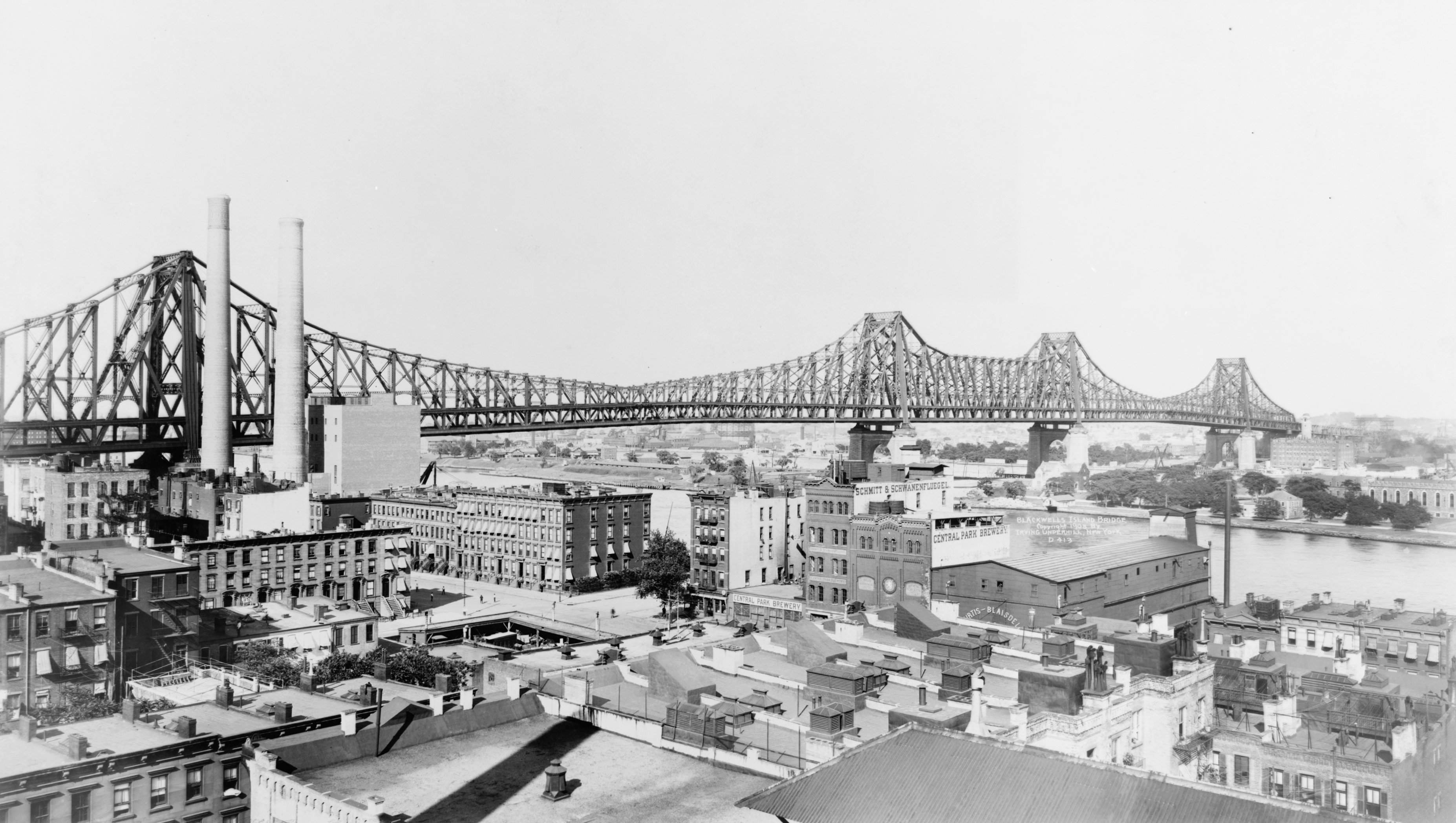
The Queensboro Bridge, officially the Ed Koch Queensboro Bridge, is a cantilever bridge over the East River in New York City. Completed in 1909, it connects the Long Island City neighborhood in the borough of Queens with the Midtown Manhattan, East Midtown and Upper East Side neighborhoods in Manhattan, passing over Roosevelt Island. Because the western end of the bridge connects to 59th Street (Manhattan), 59th Street in Manhattan, it is also called the 59th Street Bridge. The bridge consists of five steel spans measuring long; including approaches, its total length is . The Queensboro Bridge carries New York State Route 25 (NY 25), which terminates at the bridge's western end in Manhattan. The bridge has two levels: an upper level with a pair of two-lane roadways, and a lower level with four vehicular lanes flanked by a walkway and a bike lane. The western leg of the Queensboro Bridge is paralleled on its northern side by the Roosevelt Island Tramway. The bridge is one of ... [...More Info...] [...Related Items...] OR: [Wikipedia] [Google] [Baidu] |
Traffic Congestion
Traffic congestion is a condition in transport that is characterized by slower speeds, longer trip times, and increased vehicular queueing. Traffic congestion on urban road networks has increased substantially since the 1950s, resulting in many of the roads becoming obsolete. When traffic demand is great enough that the interaction between vehicles slows the traffic stream, this results in congestion. While congestion is a possibility for any mode of transportation, this article will focus on automobile congestion on public roads. Mathematically, traffic is modeled as a flow through a fixed point on the route, analogously to fluid dynamics. As demand approaches the capacity of a road (or of the intersections along the road), extreme traffic congestion sets in. When vehicles are fully stopped for periods of time, this is known as a traffic jam or (informally) a traffic snarl-up or a tailback. Drivers can become frustrated and engage in road rage. Drivers and driver-focused r ... [...More Info...] [...Related Items...] OR: [Wikipedia] [Google] [Baidu] |
Southern California Association Of Governments
The Southern California Association of Governments (SCAG) is the metropolitan planning organization (MPO) of six of the ten counties in Southern California, serving Imperial County, Los Angeles County, Orange County, Riverside County, San Bernardino County, and Ventura County. San Diego County's MPO is the San Diego Association of Governments, which is an unrelated agency. SCAG is the largest MPO in the United States, representing over 18.5 million people in an area covering over . As the designated MPO, SCAG is mandated by the federal government to research and draw up plans for transportation, growth management, hazardous waste management, and air quality. Additional mandates exist at the state level Governance SCAG's policy direction is guided by the 86-member official governing board known as the Regional Council. The Regional Council is composed of 67 Districts that include an elected representative of one or more cities of approximately equal population levels that ha ... [...More Info...] [...Related Items...] OR: [Wikipedia] [Google] [Baidu] |
Southern California
Southern California (commonly shortened to SoCal) is a geographic and Cultural area, cultural List of regions of California, region that generally comprises the southern portion of the U.S. state of California. Its densely populated coastal region includes Greater Los Angeles (the second-most populous urban agglomeration in the United States) and San Diego County (the second-most populous county in California). The region generally contains ten of California's 58 counties: Los Angeles County, California, Los Angeles, San Diego County, California, San Diego, Orange County, California, Orange, Riverside County, California, Riverside, San Bernardino County, California, San Bernardino, Kern County, California, Kern, Ventura County, California, Ventura, Santa Barbara County, California, Santa Barbara, San Luis Obispo County, California, San Luis Obispo, and Imperial County, California, Imperial counties. Although geographically smaller than Northern California in land area, Southern ... [...More Info...] [...Related Items...] OR: [Wikipedia] [Google] [Baidu] |
A1 Road (Great Britain)
The A1, also known as the Great North Road, is the longest numbered road in the United Kingdom, at . It connects Greater London, London, the capital of England, with Edinburgh, the capital of Scotland. The numbering system for A-roads, devised in the early 1920s, was based around patterns of roads radiating from two hubs at London and Edinburgh. The first number in the system, A1, was given to the most important part of that system: the road from London to Edinburgh, joining the two central points of the system and linking two of the UK's mainland capital cities. It passes through or near north London, Hatfield, Hertfordshire, Hatfield, Stevenage, Baldock, Biggleswade, Peterborough, Stamford, Lincolnshire, Stamford, Grantham, Newark-on-Trent, Retford, Doncaster, Pontefract, York, Wetherby, Ripon, Darlington, Durham, England, Durham, Gateshead, Newcastle upon Tyne, Morpeth, Northumberland, Morpeth, Alnwick, Berwick-upon-Tweed, Dunbar, Haddington, East Lothian, Haddington, Muss ... [...More Info...] [...Related Items...] OR: [Wikipedia] [Google] [Baidu] |
Verrazano Narrows Bridge
The Verrazzano-Narrows Bridge ( ; also referred to as the Narrows Bridge, the Verrazzano Bridge, and simply the Verrazzano) is a suspension bridge connecting the boroughs of Staten Island and Brooklyn in New York City, United States. It spans the Narrows, a body of water linking the relatively enclosed New York Harbor with Lower New York Bay and the Atlantic Ocean. It is the only fixed crossing of the Narrows. The double-deck bridge carries 13 lanes of Interstate 278: seven on the upper level and six on the lower level. The span is named for Giovanni da Verrazzano, who in 1524 was the first European explorer to enter New York Harbor and the Hudson River. Engineer David B. Steinman proposed a bridge across the Narrows in the late 1920s, but plans were deferred over the next twenty years. A 1920s attempt to build a Staten Island Tunnel was aborted, as was a 1930s plan for vehicular tubes underneath the Narrows. Discussion of a tunnel resurfaced in the mid-1930s and early 1940s, ... [...More Info...] [...Related Items...] OR: [Wikipedia] [Google] [Baidu] |
Throgs Neck Bridge
The Throgs Neck Bridge is a suspension bridge in New York City, carrying six lanes of Interstate 295 (New York), Interstate 295 (I-295) over the East River where it meets the Long Island Sound. The bridge connects the Throggs Neck section of the Bronx with the Bay Terrace, Queens, Bay Terrace section of Queens. Opened on January 11, 1961, it is the newest bridge across the East River and was built to relieve traffic on the Bronx–Whitestone Bridge, to the west. The Throgs Neck Bridge is also the easternmost crossing of the East River. Due to this and its proximity to Interstate 95 in New York, I-95, it is the closest route from Long Island to New Jersey via the George Washington Bridge, as well as points north. The Throgs Neck Bridge is owned by the government of New York City and operated by the Triborough Bridge and Tunnel Authority (TBTA), an affiliate agency of the Metropolitan Transportation Authority (MTA). Description The Throgs Neck Bridge is a six lane suspension ... [...More Info...] [...Related Items...] OR: [Wikipedia] [Google] [Baidu] |
East River
The East River is a saltwater Estuary, tidal estuary or strait in New York City. The waterway, which is not a river despite its name, connects Upper New York Bay on its south end to Long Island Sound on its north end. It separates Long Island, with the boroughs of Brooklyn and Queens, from Manhattan Island, and from the Bronx on the North American mainland. The East River forms the eastern boundary of Manhattan Island, whereas the island's western boundary is formed by the Hudson River.Hodges, Godfrey. "East RIver" in Jackson, pp.393–93 Because of its connection to Long Island Sound, it was once also known as the ''Sound River''. The tidal strait changes its direction of flow regularly, and is subject to strong fluctuations in its current, which are accentuated by its narrowness and variety of depths. The waterway is navigable for its entire length of , and was historically the center of maritime activities in the city. Formation and description Technically a Ria, drowned va ... [...More Info...] [...Related Items...] OR: [Wikipedia] [Google] [Baidu] |
Brooklyn–Battery Tunnel
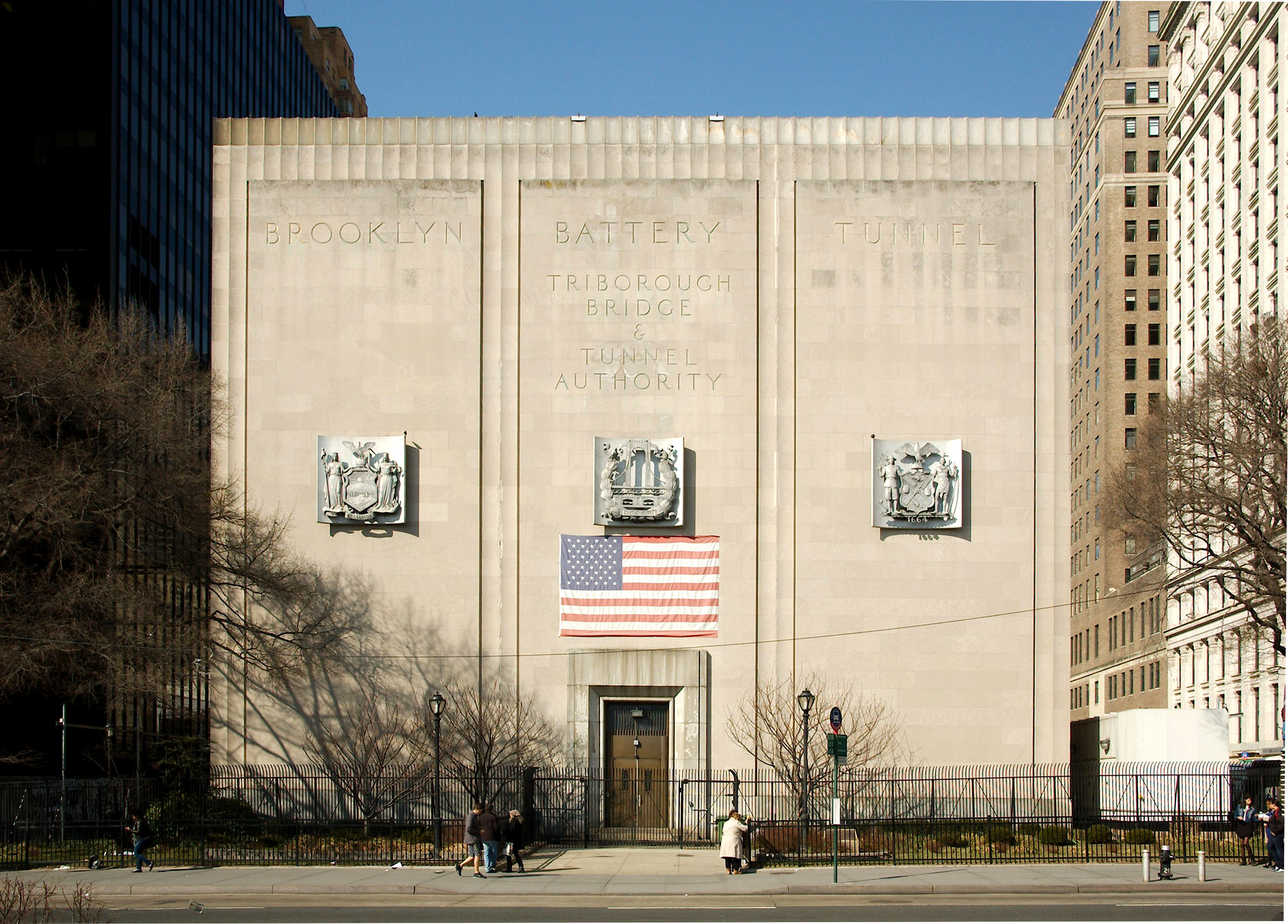
The Hugh L. Carey Tunnel, commonly referred to as the Brooklyn–Battery Tunnel, Battery Tunnel or Battery Park Tunnel, is a toll road, tolled tunnel in New York City that connects Red Hook, Brooklyn, Red Hook in Brooklyn with The Battery (Manhattan), the Battery in Manhattan. The tunnel consists of twin tubes that each carry two traffic lanes under the mouth of the East River. Although it passes just offshore of Governors Island, the tunnel does not provide vehicular access to the island. With a length of , it is the longest continuous underwater vehicular tunnel in North America. Plans for the Brooklyn–Battery Tunnel date back to the 1920s. Official plans to build the tunnel were submitted in 1930 but were initially not carried out. The New York City Tunnel Authority, created in 1936, was tasked with constructing the tunnel. After unsuccessful attempts to secure federal funds, New York City Parks Commissioner Robert Moses proposed a Brooklyn–Battery Bridge. However, the ... [...More Info...] [...Related Items...] OR: [Wikipedia] [Google] [Baidu] |


