|
History Of Canterbury Region
The history of the Canterbury Region of the South Island of New Zealand dates back to settlement by Māori people in about the 14th century. Pre-1840 Māori period Probably no more than 500 Māori were living in Canterbury by the time European settlement began in the 1840s. They were members of the Ngāi Tahu tribe, which occupied much of the South Island, remnants of a population that may have numbered between 3,000 and 4,000 people at the beginning of the 19th century. Decimated by civil war from 1810 to 1815, they were almost exterminated between 1830 and 1832 in attacks by the northern Ngāti Toa, led by Te Rauparaha. Early Moa-hunters The earliest settlers of Canterbury appear to have been the people called the Moa-hunters, arriving in about the 14th century near the time of the traditional discovery of the South Island by Rākaihautū. Traces of the presence of these people are found in camp and burial sites near river mouths, the northern valleys of Banks Peninsula and ... [...More Info...] [...Related Items...] OR: [Wikipedia] [Google] [Baidu] |
South Island
The South Island ( , 'the waters of Pounamu, Greenstone') is the largest of the three major islands of New Zealand by surface area, the others being the smaller but more populous North Island and Stewart Island. It is bordered to the north by Cook Strait, to the west by the Tasman Sea, to the south by the Foveaux Strait and Southern Ocean, and to the east by the Pacific Ocean. The South Island covers , making it the List of islands by area, world's 12th-largest island, constituting 56% of New Zealand's land area. At low altitudes, it has an oceanic climate. The most populous cities are Christchurch, Dunedin, Nelson, New Zealand, Nelson and Invercargill. Prior to European settlement, Te Waipounamu was sparsely populated by three major iwi – Kāi Tahu, Kāti Māmoe, and the historical Waitaha (South Island iwi), Waitaha – with major settlements including in Kaiapoi Pā near modern-day Christchurch. During the Musket Wars expanding iwi colonised Te Tau Ihu Māori, Te Tau Ihu, ... [...More Info...] [...Related Items...] OR: [Wikipedia] [Google] [Baidu] |
Phormium
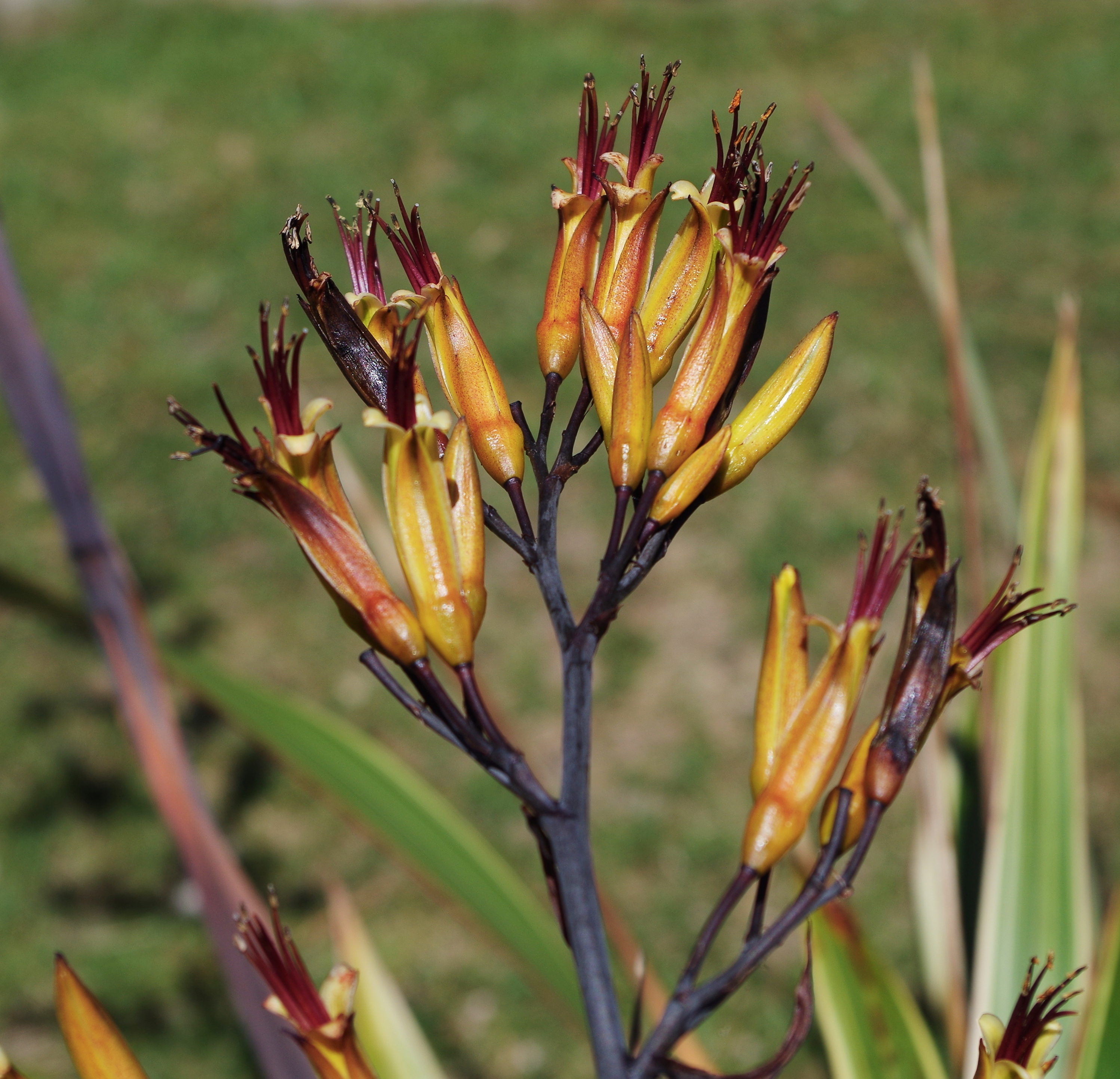
''Phormium'' is a genus of two plant species in the family Asphodelaceae. One species is endemic to New Zealand and the other is native to New Zealand and Norfolk Island. The two species are widely known in New Zealand as flax or their Māori language, Māori names ''wharariki'' and ''harakeke'' respectively'','' and elsewhere as New Zealand flax or flax lily, but they are not closely related to the Northern Hemisphere's flax (''Linum usitatissimum''), which is native to the region extending from the eastern Mediterranean to India and has been used by humans since 30,000 B.C. Taxonomy Monocot classification has undergone significant revision in the past decade, and recent classification systems (including the Angiosperm Phylogeny Group) have found ''Phormium'' to be closely related to daylilies (''Hemerocallis''), placing it in family (biology), family Asphodelaceae, subfamily Hemerocallidoideae. ''Phormium'' formerly belonged to the family (biology), family Agavaceae and many c ... [...More Info...] [...Related Items...] OR: [Wikipedia] [Google] [Baidu] |
Wellington Harbour
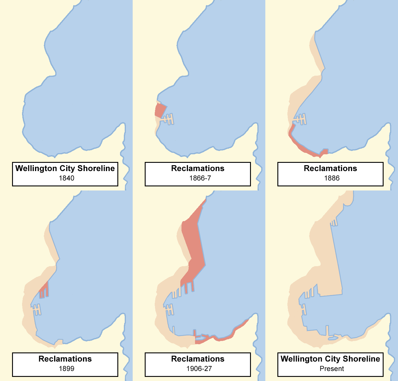
Wellington Harbour ( ), officially called Wellington Harbour / Port Nicholson, is a large natural harbour on the southern tip of New Zealand's North Island. The harbour entrance is from Cook Strait. Central Wellington is located on parts of the western and southern sides of the harbour, and the suburban area of Lower Hutt is to the north and east. The harbour area bounded by a line between Pencarrow Head to Petone foreshore, was officially named Port Nicholson until it assumed its current dual name in 1984. Toponymy The earliest known Māori name for the area, ''Te Upoko-o-te-Ika-a-Māui'', is derived from Māori legend and translates literally as "the head of Māui's fish". ''Te Whanganui-a-Tara'', another Māori name for the area, translates literally as "the great harbour of Tara". It is believed to refer to Tara, a son of the Polynesian explorer Whātonga, who was sent down from the Māhia Peninsula by his father to explore southern lands for their people to se ... [...More Info...] [...Related Items...] OR: [Wikipedia] [Google] [Baidu] |
Poverty Bay
Poverty Bay (Māori language, Māori: ''Tūranganui-a-Kiwa''), officially named Tūranganui-a-Kiwa / Poverty Bay, is the largest of several small bays on the east coast of New Zealand's North Island to the north of Hawke Bay. It stretches for from Young Nick's Head in the southwest to Tuaheni Point in the northeast. The city of Gisborne, New Zealand, Gisborne is located on the northern shore of the bay and the small settlement of Muriwai, Gisborne, Muriwai is located at the bay's southern end. The name is often used by extension to refer to the entire area surrounding the city of Gisborne. Poverty Bay is the home of the Māori people, Māori iwi (tribes) Te Aitanga-a-Māhaki, Rongowhakaata and Ngai Tamanuhiri, Ngāi Tāmanuhiri. History The first European known to have set foot in New Zealand, Captain James Cook of , did so here on 7 October 1769, at which time the bay was known as Teoneroa ("the long beach"). This first landing led to the death of local Māori man Te Maro dur ... [...More Info...] [...Related Items...] OR: [Wikipedia] [Google] [Baidu] |
Southland, New Zealand
Southland () is New Zealand's southernmost Regions of New Zealand, region. It consists of the southwestern portion of the South Island and includes Stewart Island. Southland is bordered by the culturally similar Otago, Otago Region to the north and east, and the West Coast Region in the extreme northwest. The region covers over 3.1 million hectares and spans 3,613 km of coastline. , Southland has a population of 103,900, making it the eleventh-most-populous New Zealand region, and the second-most sparsely populated. Approximately half of the region's population lives in Invercargill, Southland's only city. The earliest inhabitants of Southland were Māori people, Māori of the Waitaha (South Island iwi), Waitaha iwi, followed later by Kāti Māmoe and Kāi Tahu. Early European arrivals were Seal hunting, sealers and Whaling, whalers, and by the 1830s, Kāi Tahu had built a thriving industry supplying whaling vessels, looked after whalers and settlers in need, and had b ... [...More Info...] [...Related Items...] OR: [Wikipedia] [Google] [Baidu] |
Otago
Otago (, ; ) is a regions of New Zealand, region of New Zealand located in the southern half of the South Island and administered by the Otago Regional Council. It has an area of approximately , making it the country's second largest local government region. Its population was The name "Otago" is the local Māori language#South Island dialects, southern Māori dialect pronunciation of "Otakou, Ōtākou", the name of the Māori village near the entrance to Otago Harbour. The exact meaning of the term is disputed, with common translations being "isolated village" and "place of red earth", the latter referring to the reddish-ochre clay that is common in the area around Dunedin. "Otago" is also the old name of the European settlement on the harbour, established by the Weller Brothers in 1831, which lies close to Otakou. The upper harbour later became the focus of the Otago Association, an offshoot of the Free Church of Scotland (1843–1900), Free Church of Scotland, notable for ... [...More Info...] [...Related Items...] OR: [Wikipedia] [Google] [Baidu] |
Ngāti Mamoe
Iwi () are the largest social units in New Zealand Māori society. In Māori, roughly means or , and is often translated as "tribe". The word is both singular and plural in the Māori language, and is typically pluralised as such in English. groups trace their ancestry to the original Polynesian migrants who, according to tradition, arrived from Hawaiki. Some cluster into larger groupings that are based on (genealogical tradition) and known as (literally , with reference to the original migration voyages). These super-groupings are generally symbolic rather than logistical. In pre-European times, most Māori were allied to relatively small groups in the form of () and (). Each contains a number of ; among the of the Ngāti Whātua iwi, for example, are Te Uri-o-Hau, Te Roroa, Te Taoū, and Ngāti Whātua-o-Ōrākei. Māori use the word ''rohe'' for the territory or boundaries of iwi. In modern-day New Zealand, can exercise significant political power in the manageme ... [...More Info...] [...Related Items...] OR: [Wikipedia] [Google] [Baidu] |


