|
Grumbald's Ash Hundred
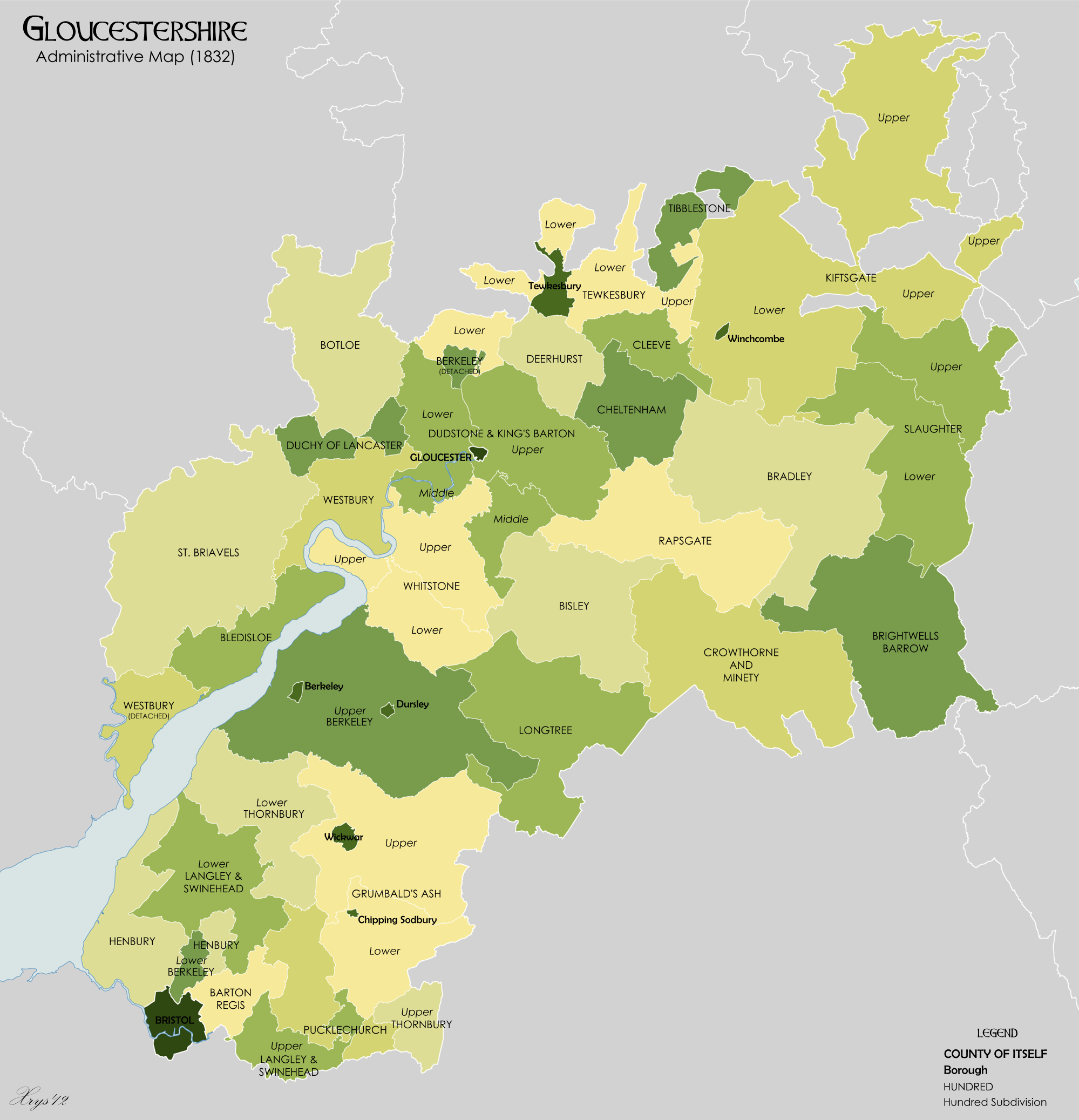
Grumbald's Ash Hundred (also spelled Grumbold's Ash) was a subdivision of the county of Gloucestershire, England. Hundreds originated in the late Saxon period and lasted as administrative divisions until the 19th century. It has been reported that the court was originally held under an Ash tree situated in Doddington parish, although this location would not be consistent with the previous split of hundred. Its name survives in the Grumbolds Ash with Avening electoral ward of Cotswold district council. The hundred was divided into Upper and Lower divisions and comprised a total of 20 ancient parishes in the southeastern corner of the county. The Lower division comprised Acton Turville, Chipping Sodbury, Little Sodbury, Old Sodbury, Tormarton, West Littleton, Dyrham & Hinton, Wapley & Codrington and Dodington; the Upper division comprised Alderley, Badminton, Boxwell & Leighterton, Charfield, Didmarton, Hawkesbury, Hillesley, Horton, Oldbury-on-the-Hill, Tortworth and Wickwar ... [...More Info...] [...Related Items...] OR: [Wikipedia] [Google] [Baidu] |
Gloucestershire 1832 Map
Gloucestershire ( abbreviated Glos) is a county in South West England. The county comprises part of the Cotswold Hills, part of the flat fertile valley of the River Severn and the entire Forest of Dean. The county town is the city of Gloucester and other principal towns and villages include Cheltenham, Cirencester, Kingswood, Bradley Stoke, Stroud, Thornbury, Yate, Tewkesbury, Bishop's Cleeve, Churchdown, Brockworth, Winchcombe, Dursley, Cam, Berkeley, Wotton-under-Edge, Tetbury, Moreton-in-Marsh, Fairford, Lechlade, Northleach, Stow-on-the-Wold, Chipping Campden, Bourton-on-the-Water, Stonehouse, Nailsworth, Minchinhampton, Painswick, Winterbourne, Frampton Cotterell, Coleford, Cinderford, Lydney and Rodborough and Cainscross that are within Stroud's urban area. Gloucestershire borders Herefordshire to the north-west, Worcestershire to the north, Warwickshire to the north-east, Oxfordshire to the east, Wiltshire to the south, Bristol ... [...More Info...] [...Related Items...] OR: [Wikipedia] [Google] [Baidu] |
Hinton, South Gloucestershire
Hinton is a village in South Gloucestershire, England. It is one mile north of Dyrham and forms part of the civil parish of Dyrham and Hinton. The Bull is the local pub. Battle of Deorham The Battle of Deorham (577 C.E.) was fought between West Saxons and Britons on Hinton Hill to the east of the village. It was a key moment in the isolation (on land, at least) of the Britons of the South West Peninsula from the Britons of what would become Wales Wales ( cy, Cymru ) is a Countries of the United Kingdom, country that is part of the United Kingdom. It is bordered by England to the Wales–England border, east, the Irish Sea to the north and west, the Celtic Sea to the south west and the .... References External links Villages in South Gloucestershire District {{SouthGloucestershire-geo-stub ... [...More Info...] [...Related Items...] OR: [Wikipedia] [Google] [Baidu] |
Tortworth
Tortworth is a small village and civil parish, near Thornbury in Gloucestershire, England. It has a population of 147 as of 2011. It lies on the B4509 road, which crosses the M5 motorway to the west of Tortworth. History In the Domesday Book of 1086 the manor is recorded as held by Turstin FitzRolf. Tortworth is noted for its ancient chestnut tree in St. Leonard's churchyard, which became known as the "Great Chestnut of Tortworth" as early as 1150. This tree measured 51 feet in circumference at 6 feet from the ground in 1720. The tree is one of fifty Great British Trees, selected in 2002 by The Tree Council to commemorate the Queen's Golden Jubilee. Geography The Tortworth inlier is the most complete section of "Silurian" rocks in the Bristol and South Gloucestershire area. Old red sandstone is most dominant. Notable landmarks The civil parish contains Tortworth Court. It was formerly the home of the Earls of Ducie, but is now run as a hotel. Tortworth Rectory, was part o ... [...More Info...] [...Related Items...] OR: [Wikipedia] [Google] [Baidu] |
Oldbury-on-the-Hill
Oldbury-on-the-Hill is a small village and former civil parish in Gloucestershire, England, ninety-three miles west of London and less than north of the village of Didmarton. History Oldbury-on-the-Hill has been inhabited since prehistoric times, and Nan Tow's Tump, a round barrow beside the A46 road, is a Bronze Age earthwork and archaeological site. The tree-grown barrow is about thirty metres in diameter and three metres high. The name refers to Nan Tow, said to have been a local witch who was buried upright in the barrow. The parishes of Oldbury-on-the-Hill and Didmarton were together surrounded on all sides by the parish of Hawkesbury and the county boundary with Wiltshire, which is taken to suggest that they were anciently part of Hawkesbury.Barrow, Julia, & Brooks, Nicholas, ''St Wulfstan and His World'' (Ashgate Publishing, 2005, )pp. 158-159online at books.google.co.uk (accessed 13 April 2008) The Domesday Book of 1086 calls the village Aldeberie. Before 1066 ... [...More Info...] [...Related Items...] OR: [Wikipedia] [Google] [Baidu] |
Horton, Gloucestershire
Horton is a village on the Cotswold Edge, in Gloucestershire, England. It is about north of Chipping Sodbury. The nearest settlement is Little Sodbury, about away; Hawkesbury Upton and Dunkirk are both miles away. It is a linear settlement built on the slopes of a steep hill. The name ''Horton'' is a common one in England. It normally derives from Old English ''horu'' 'dirt' and ''tūn'' 'settlement, farm, estate', presumably meaning 'farm on muddy soil', but the historical forms of this Horton vary, including the Domesday ''Horedone'', ''Hortune'' from 1167, and the 1291 form ''Heorton'', the latter of which could point to Old English ''heort'' 'stag'. Horton Court is a manor house, now in the ownership of the National Trust and is a Grade I listed building. The estate is reputed to have at one time been owned by one of King Harold's sons. The oldest part of the house was built as a rectory by Robert de Beaufeu, who was rector of Horton and prebendary of Salisbury. The No ... [...More Info...] [...Related Items...] OR: [Wikipedia] [Google] [Baidu] |
Hillesley
Hillesley is a village in Gloucestershire, England. It was transferred from the county of Avon in 1991 and is now in Stroud District. The village forms part of the civil parish of Hillesley and Tresham. It is close to the Cotswold Edge, near the Cotswold Way and about south of the town of Wotton under Edge (). Until the 1980s the name of the village was spelt Hillsley. In 972, Hillesley was recorded as ''Hildeslei'' (meaning "clearing belonging to Hild"), a tything of the parish of Hawkesbury. The village remained in the parish of Hawkesbury until the boundary changes of 1991. In the Domesday Book of 1086 it is recorded as held by Turstin FitzRolf. Pevsner Pevsner or Pevzner is a Jewish surname. Notable people with the surname include: * Aihud Pevsner (1925–2018), American physicist * Antoine Pevsner (1886–1962), Russian sculptor, brother of Naum Gabo * David Pevsner, American actor, singer, dan ... notes the following buildings: The local church is St Giles – it was ... [...More Info...] [...Related Items...] OR: [Wikipedia] [Google] [Baidu] |
Hawkesbury, Gloucestershire
Hawkesbury is a hamlet consisting of a few cottages around a triangular green. It is also the name of a civil parish in the South Gloucestershire unitary authority in England in which Hawkesbury itself lies, it is located west of Hawkesbury Upton, off the A46 road. The civil parish includes Hawkesbury itself, the larger village of Hawkesbury Upton and the hamlets of Dunkirk, Petty France and Little Badminton. According to the 2001 census the parish had a population of 1,235, increasing to 1,263 at the 2011 census. Prior to 1991 what is now the Hillesley and Tresham parish in Stroud District formed the northern part of the parish. The village is in 'Cotswold Edge' electoral ward. This ward starts at ''Hawkesbury'' in the north and stretches south to Tormarton. The total population of this parish taken from the 2011 census was 3,381. The Cotswold Way passes by the two settlements. There is a monument (the 'Somerset Monument') on the Cotswold Edge at . The monument was er ... [...More Info...] [...Related Items...] OR: [Wikipedia] [Google] [Baidu] |
Didmarton
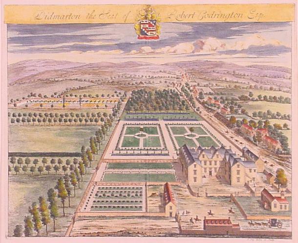
Didmarton is a village and civil parish in Gloucestershire, England. It lies in the Cotswold District, about southwest of Tetbury. The parish is on the county borders with South Gloucestershire (to the southwest) and Wiltshire (to the south and southeast). Since 25 March 1883, the civil parish has included the former parish of Oldbury-on-the-Hill. History A military survey of Didmarton in 1522 shows that it was then a very small village, overshadowed by the neighbouring Oldbury-on-the-Hill. In the 16th century, the manor of Didmarton was owned by the Seacole family. In 1571, Simon Codrington married Agnes, daughter and co-heiress of Richard Seacole, and the estate thus passed to their son Robert Codrington. It was sold to Charles Somerset, 4th Duke of Beaufort, in about 1750, but has had a succession of other owners since then. Together with Oldbury, the parish was subject to enclosure in 1829. According to ''The National Gazetteer of Great Britain and Ireland'' (1868): ... [...More Info...] [...Related Items...] OR: [Wikipedia] [Google] [Baidu] |
Charfield
Charfield is a village and civil parish in Gloucestershire, England, south-west of Wotton-under-Edge near the Little Avon River and the villages of Falfield and Cromhall. The parish includes the hamlet of Churchend. Village Charfield is a medium-sized village of about 2,500 residents with three pubs, the Pear Tree, Railway Tavern and The Plough Inn, a convenience store with Post Office and two churches. There are six main housing areas. Farm Lees, Longs View, Manor Lane and Woodlands have existed for some time. Two new housing developments were built in 2018-2019: St James Mews, opposite St John's Church, and Charfield Village, at the eastern end of the village near the Renishaw PLC site. The primary school has around 250 students. The Church of St James, in Churchend, dates from the 13th century and is a grade I listed building. Governance An electoral ward with the same name exists. This ward starts in the east in Charfield and then stretches west to Falfield. The ward's pop ... [...More Info...] [...Related Items...] OR: [Wikipedia] [Google] [Baidu] |
Leighterton
Leighterton is a village in rural Gloucestershire off the A46. It sits within the civil parish of Boxwell with Leighterton, 4.25 miles west-southwest of Tetbury, towards the southern end of the Cotswolds AONB. Situated in the Cotswold hills, it is 175 metres above sea level. Historically, it was situated within the hundred of Grumbald's Ash. The village's parish church, dedicated to St Andrew, is a Grade II* listed building. Originally built in the 13th century and with a porch dating from the 14th century, it underwent a restoration in 1877. The patronage of the church formerly belonged to Walsingham Priory and Gloucester Abbey, later passing to the Huntley family of Boxwell Court. There are over a dozen listed buildings within the village built with Cotswold limestone, including the 19th century Royal Oak pub and former village hall. A long barrow, located just outside the village, is listed as a scheduled monument. An example of a Cotswold-Severn megalithic chamber ... [...More Info...] [...Related Items...] OR: [Wikipedia] [Google] [Baidu] |
Boxwell
Boxwell is a hamlet in Gloucestershire Gloucestershire ( abbreviated Glos) is a county in South West England. The county comprises part of the Cotswold Hills, part of the flat fertile valley of the River Severn and the entire Forest of Dean. The county town is the city of Gl ..., England, near the village of Leighterton Boxwell Court is a Grade II* listed manor house from the 15th or 16th century. References Villages in Gloucestershire {{Gloucestershire-geo-stub ... [...More Info...] [...Related Items...] OR: [Wikipedia] [Google] [Baidu] |
Badminton, Gloucestershire
Badminton is a village and civil parish in Gloucestershire, England. It consists of Great Badminton and Little Badminton. History In 1612 Edward Somerset, 4th Earl of Worcester, bought from Nicholas Boteler his manors of Great and Little Badminton, called ''Madmintune'' in the Domesday Book while one century earlier the name ''Badimyncgtun'' was recorded, held by that family since 1275. Badminton House The village houses the Duke of Beaufort's residence, Badminton House, which has been the principal seat of the Somerset family since the late 17th century. Badminton House also gives its name to the sport of badminton. Amenities The village has a small shop which also serves as a post office. Transport The village is located close to the A46 and A433, the B4040 passes south of it. The next motorway junction is Tormarton Interchange between A46 and M4. The former railway station in nearby Acton Turville closed in 1968, but the line is still active. The nearest railw ... [...More Info...] [...Related Items...] OR: [Wikipedia] [Google] [Baidu] |


