|
Geography Of The Alps
The Alps form a large mountain range dominating Central Europe, including parts of Italy, France, Switzerland, Liechtenstein, Austria, Slovenia, Germany and Hungary. This article describes the delimitation of the Alps as a whole and of subdivisions of the range, follows the course of the main chain of the Alps and discusses the lakes and glaciers found in the region. Boundaries In some areas, such as the edge of the Po Basin, the edge of the Alps is unambiguous, but where the Alps border on other mountainous or hilly regions, the border may be harder to place. These neighbouring ranges include the Apennines, the Massif Central, the Jura, the Black Forest, the Bohemian Forest, the Carpathians, and the mountains of the Balkan Peninsula. The boundary between the Apennines and the Alps is usually taken to be the Colle di Cadibona, at 435 m above sea level, above Savona on the Italian coast. The Rhône forms a clear boundary between the tectonically-formed Alps and the lar ... [...More Info...] [...Related Items...] OR: [Wikipedia] [Google] [Baidu] [Amazon] |
Jura Mountains
The Jura Mountains ( ) are a sub-alpine mountain range a short distance north of the Western Alps and mainly demarcate a long part of the French–Swiss border. While the Jura range proper (" folded Jura", ) is located in France and Switzerland, the range continues northeastwards through northern Switzerland and Germany as the Table Jura ("not folded Jura", ), which is crossed by the High Rhine. Name The mountain range gives its name to the French department of Jura, the Swiss canton of Jura, the Jurassic period of the geologic timescale, and the Montes Jura of the Moon. It is first attested as ''mons Iura'' in book one of Julius Caesar's '' Commentarii de Bello Gallico''. Strabo uses a Greek masculine form ("through the Jura mountains", ) in his ''Geographica'' (4.6.11). Based on suggestions by Ferdinand de Saussure, early celticists such as Georges Dottin tried to establish an etymon "iura-, iuri" as a Celtic word for mountains, with similar putative etymologies ... [...More Info...] [...Related Items...] OR: [Wikipedia] [Google] [Baidu] [Amazon] |
Rhine (river)
The Rhine ( ) is one of the major rivers in Europe. The river begins in the Swiss canton of Graubünden in the southeastern Swiss Alps. It forms part of the Swiss-Liechtenstein border, then part of the Swiss-Austrian border. From Lake Constance downstream, it forms part of the Swiss-German border. After that the Rhine defines much of the Franco-German border. It then flows in a mostly northerly direction through the German Rhineland. Finally, the Rhine turns to flow predominantly west to enter the Netherlands, eventually emptying into the North Sea. It drains an area of 185,000 km2. Its name derives from the Gaulish ''Rēnos''. There are two German states named after the river, North Rhine-Westphalia and Rhineland-Palatinate, in addition to several districts (e.g. Rhein-Sieg). The departments of Bas-Rhin and Haut-Rhin in Alsace (France) are also named after the river. Some adjacent towns are named after it, such as Rheinau, Stein am Rhein, Rheineck, Rheinfelden ... [...More Info...] [...Related Items...] OR: [Wikipedia] [Google] [Baidu] [Amazon] |
Lake Neuchâtel
Lake Neuchâtel ( ; ; ) is a lake primarily in Romandy, the French-speaking part of Switzerland. The lake lies mainly in the canton of Neuchâtel, but is also shared by the cantons of Vaud, Fribourg, and Bern. It comprises one of the lakes in the Three Lakes Region (French: ''Pays des Trois-Lacs'', German: ''Drei-Seen-Land''), along with lakes Biel/Bienne and Morat/Murten. With a surface of , Lake Neuchâtel is the largest lake located entirely in Switzerland and the 59th largest lake in Europe. It is long and at its widest. Its surface is above sea level, and the maximum depth is . The total water volume is . The lake's drainage area is approximately and its culminating point is Le Chasseron at . In comparison to the Lake Geneva region, the Lake Neuchatel shoreline has experienced significant economic development with the completion of the regional motorway network. It is also known to have housed a Celtic agglomeration on pile-dwellings called La Tène and which gives ... [...More Info...] [...Related Items...] OR: [Wikipedia] [Google] [Baidu] [Amazon] |
Lake Geneva
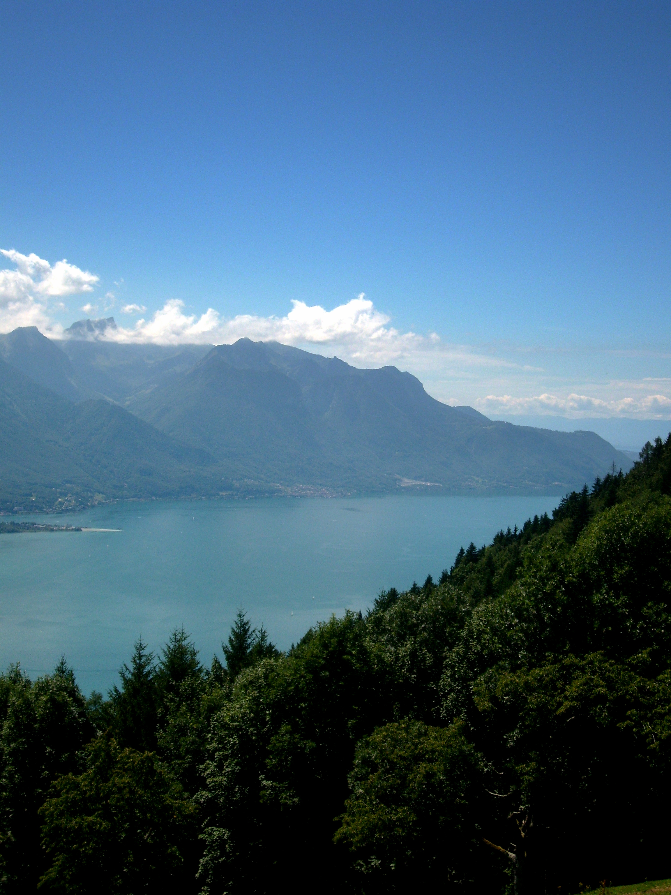
Lake Geneva is a deep lake on the north side of the Alps, shared between Switzerland and France. It is one of the List of largest lakes of Europe, largest lakes in Western Europe and the largest on the course of the Rhône. Sixty percent () of the lake belongs to Switzerland (the cantons of Vaud, Canton of Geneva, Geneva and Valais) and forty percent () to France (the department of Haute-Savoie). Name While the exact origins of the name are unknown, the name was in use during the time of Julius Caesar. comes from Ancient Greek () meaning "port's lake". In Medieval Latin it was known as , although this name was also used for Lausonius Lacus, a town or district on the lake, or ; the equivalent in Old French was . Following the rise of Geneva it became (translated into English as ''Lake Geneva''), but was the common name on all local maps and is the customary name in the French language. In contemporary English language, English, the name ''Lake Geneva'' has become predo ... [...More Info...] [...Related Items...] OR: [Wikipedia] [Google] [Baidu] [Amazon] |
Lyon
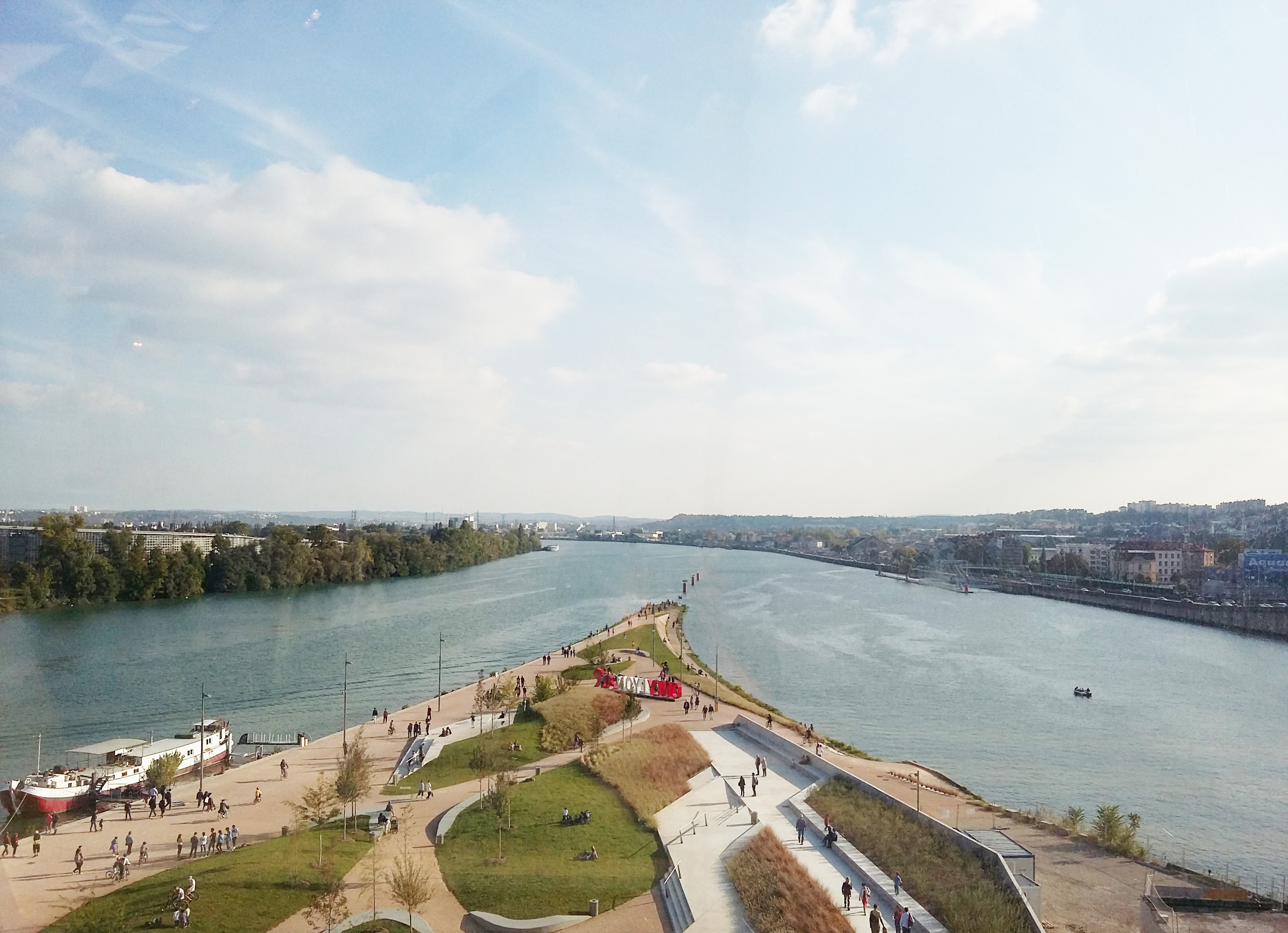
Lyon (Franco-Provençal: ''Liyon'') is a city in France. It is located at the confluence of the rivers Rhône and Saône, to the northwest of the French Alps, southeast of Paris, north of Marseille, southwest of Geneva, Switzerland, northeast of Saint-Étienne. The City of Lyon is the List of communes in France with over 20,000 inhabitants, third-largest city in France with a population of 522,250 at the Jan. 2021 census within its small municipal territory of , but together with its suburbs and exurbs the Lyon Functional area (France), metropolitan area had a population of 2,308,818 that same year, the second largest in France. Lyon and 58 suburban municipalities have formed since 2015 the Lyon Metropolis, Metropolis of Lyon, a directly elected metropolitan authority now in charge of most urban issues, with a population of 1,424,069 in 2021. Lyon is the Prefectures in France, prefecture of the Auvergne-Rhône-Alpes Regions of France, region and seat of the Departmental co ... [...More Info...] [...Related Items...] OR: [Wikipedia] [Google] [Baidu] [Amazon] |
Volcanism
Volcanism, vulcanism, volcanicity, or volcanic activity is the phenomenon where solids, liquids, gases, and their mixtures erupt to the surface of a solid-surface astronomical body such as a planet or a moon. It is caused by the presence of a heat source, usually internally generated, inside the body; the heat is generated by various processes, such as radioactive decay or tidal heating. This heat partially melts solid material in the body or turns material into gas. The mobilized material rises through the body's interior and may break through the solid surface. Causes For volcanism to occur, the temperature of the mantle must have risen to about half its melting point. At this point, the mantle's viscosity will have dropped to about 1021 Pascal-seconds. When large scale melting occurs, the viscosity rapidly falls to 103 Pascal-seconds or even less, increasing the heat transport rate a million-fold. The occurrence of volcanism is partially due to the fact that melted materi ... [...More Info...] [...Related Items...] OR: [Wikipedia] [Google] [Baidu] [Amazon] |
Tectonic
Tectonics ( via Latin ) are the processes that result in the structure and properties of the Earth's crust and its evolution through time. The field of ''planetary tectonics'' extends the concept to other planets and moons. These processes include those of mountain-building, the growth and behavior of the strong, old cores of continents known as cratons, and the ways in which the relatively rigid plates that constitute the Earth's outer shell interact with each other. Principles of tectonics also provide a framework for understanding the earthquake and volcanic belts that directly affect much of the global population. Tectonic studies are important as guides for economic geologists searching for fossil fuels and ore deposits of metallic and nonmetallic resources. An understanding of tectonic principles can help geomorphologists to explain erosion patterns and other Earth-surface features. Main types of tectonic regime Extensional tectonics Extensional tectonic ... [...More Info...] [...Related Items...] OR: [Wikipedia] [Google] [Baidu] [Amazon] |
Rhône (river)
The Rhône ( , ; Occitan: ''Ròse''; Arpitan: ''Rôno'') is a major river in France and Switzerland, rising in the Alps and flowing west and south through Lake Geneva and Southeastern France before discharging into the Mediterranean Sea (Gulf of Lion). At Arles, near its mouth, the river divides into the Great Rhône () and the Little Rhône (). The resulting delta forms the Camargue region. The river's source is the Rhône Glacier, at the east edge of the Swiss canton of Valais. The glacier is part of the Saint-Gotthard Massif, which gives rise to three other major rivers: the Reuss, Rhine and Ticino. The Rhône is, with the Po and the Nile, one of the three Mediterranean rivers with the largest water discharge. Etymology The name ''Rhône'' continues the Latin name (Greek ) in Greco-Roman geography. The Gaulish name of the river was or (from a PIE root *''ret-'' "to run, roll" frequently found in river names). Names in other languages include ; ; ; ; ; and . Th ... [...More Info...] [...Related Items...] OR: [Wikipedia] [Google] [Baidu] [Amazon] |
Savona
Savona (; ) is a seaport and (municipality) in the west part of the northern Italian region of Liguria, and the capital of the Province of Savona. Facing the Ligurian Sea, Savona is the main center of the Riviera di Ponente (the western section of the Italian Riviera). One of the most celebrated former inhabitants of Savona was the navigator Christopher Columbus, who farmed land in the area while chronicling his journeys. 'Columbus's house', a cottage situated in the Savona hills, lay between vegetable crops and fruit trees. It is one of several residences in Liguria associated with Columbus. History Inhabited in ancient times by Ligures tribes, it came under Ancient Rome, Roman influence in 180 BC, after the Punic wars in which the city had been allied to Carthage. After the fall of the Western Roman Empire, it passed under Lombards, Lombard rule in 641 AD (being destroyed in the attack), after a short period as an Ostrogothic Kingdom, Ostrogoth and then Byzantine Empir ... [...More Info...] [...Related Items...] OR: [Wikipedia] [Google] [Baidu] [Amazon] |
Colle Di Cadibona
Colle di Cadibona - - is a mountain pass between Savona and Altare in the Ligurian Alps, delineating the boundary with the Apennine Mountains. It is also known as ''Bocchetta di Altare''. On the south-eastern side of the Alps Godovič Pass (Slovenia Slovenia, officially the Republic of Slovenia, is a country in Central Europe. It borders Italy to the west, Austria to the north, Hungary to the northeast, Croatia to the south and southeast, and a short (46.6 km) coastline within the Adriati ...) conventionally represents the opposite end of the Alpine range. References {{DEFAULTSORT:Colle di Cadibona Cadibona Province of Savona Cadibona Cadibona ... [...More Info...] [...Related Items...] OR: [Wikipedia] [Google] [Baidu] [Amazon] |
Balkan Peninsula
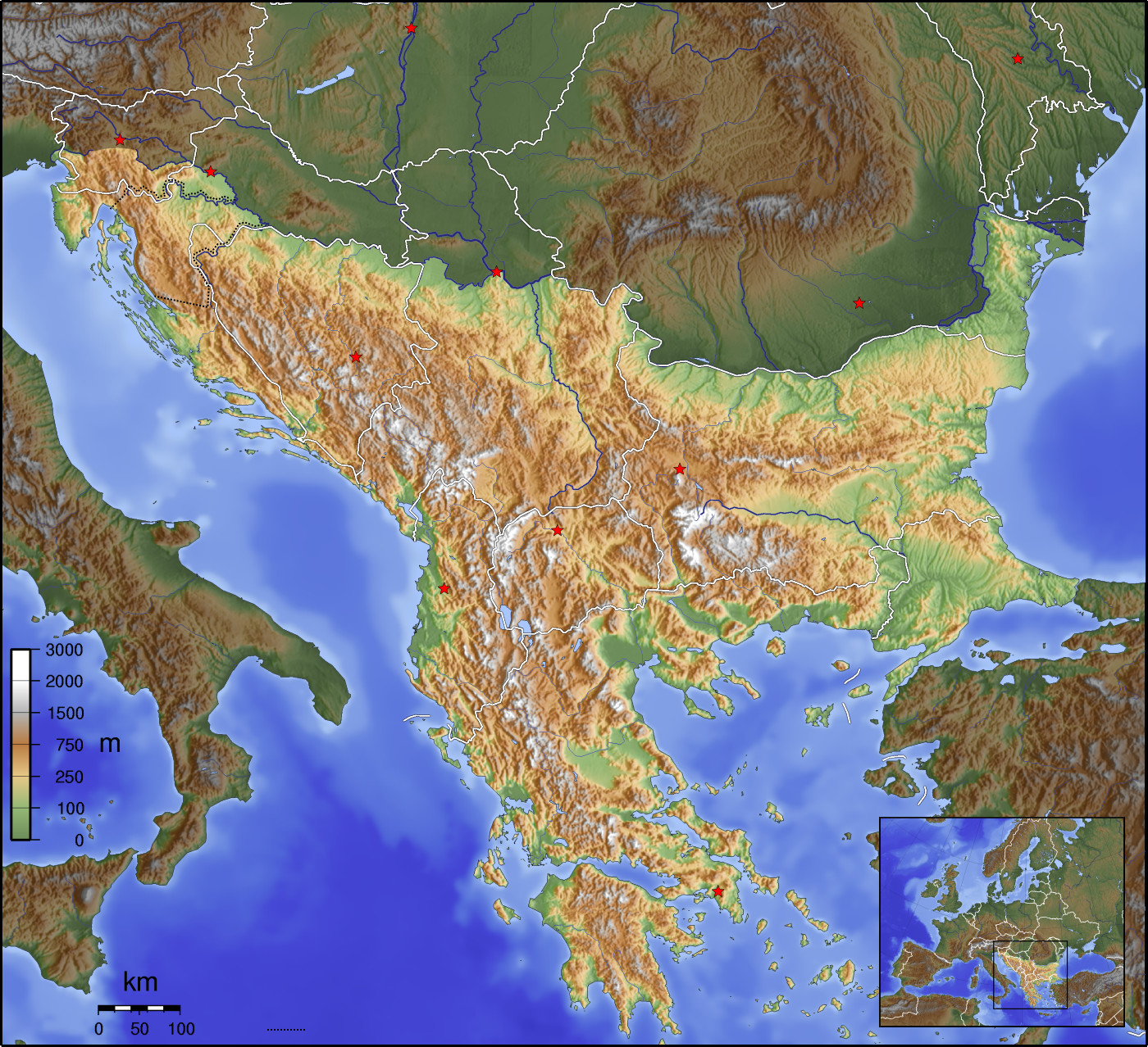
The Balkans ( , ), corresponding partially with the Balkan Peninsula, is a geographical area in southeastern Europe with various geographical and historical definitions. The region takes its name from the Balkan Mountains that stretch throughout the whole of Bulgaria. The Balkan Peninsula is bordered by the Adriatic Sea in the northwest, the Ionian Sea in the southwest, the Aegean Sea in the south, the Turkish straits in the east, and the Black Sea in the northeast. The northern border of the peninsula is variously defined. The highest point of the Balkans is Musala, , in the Rila mountain range, Bulgaria. The concept of the Balkan Peninsula was created by the German geographer August Zeune in 1808, who mistakenly considered the Balkan Mountains the dominant mountain system of southeastern Europe spanning from the Adriatic Sea to the Black Sea. In the 19th century the term ''Balkan Peninsula'' was a synonym for Rumelia, the parts of Europe that were provinces of the Ottoman E ... [...More Info...] [...Related Items...] OR: [Wikipedia] [Google] [Baidu] [Amazon] |


