|
Experimental Archaeology
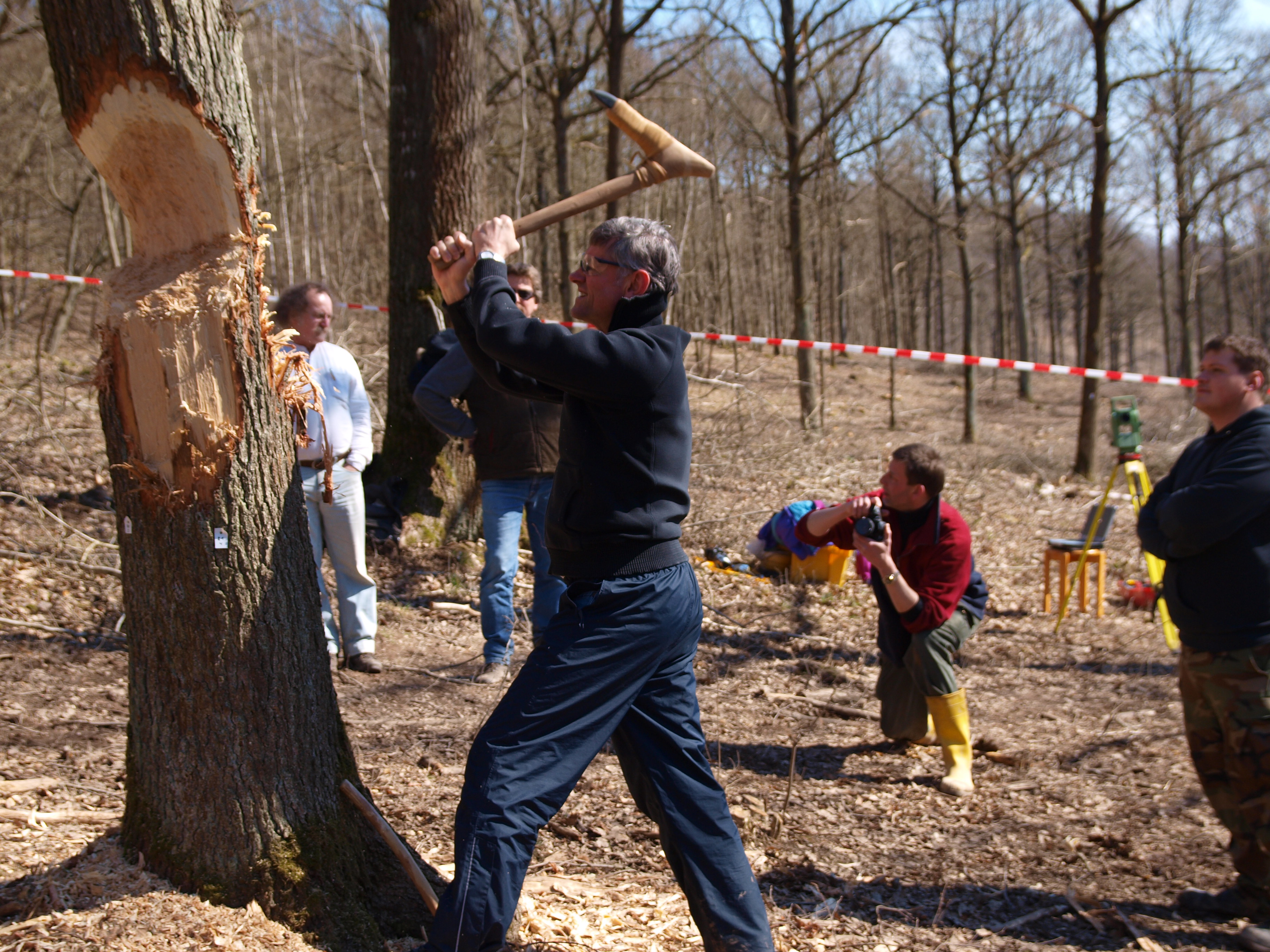
Experimental archaeology (also called experiment archaeology) is a field of study which attempts to generate and test archaeological Hypothesis, hypotheses, usually by replicating or approximating the feasibility of ancient cultures performing various tasks or feats. It employs a number of methods, techniques, analyses, and approaches, based upon Archaeology, archaeological source material such as ancient structures or Artifact (archaeology), artifacts. It is distinct from uses of primitive technology without any concern for archaeological or historical study. Living history and historical reenactment, which are generally undertaken as hobbies, are non-archaeological counterparts of this academic discipline. One of the main forms of experimental archaeology is the creation of copies of historical structures using only historically accurate technologies. This is sometimes known as reconstruction archaeology or reconstructional archaeology; however, reconstruction implies an exact ... [...More Info...] [...Related Items...] OR: [Wikipedia] [Google] [Baidu] |
Anglo-Saxons
The Anglo-Saxons, in some contexts simply called Saxons or the English, were a Cultural identity, cultural group who spoke Old English and inhabited much of what is now England and south-eastern Scotland in the Early Middle Ages. They traced their origins to Germanic peoples, Germanic settlers who became one of the most important cultural groups in Britain by the 5th century. The Anglo-Saxon period in Britain is considered to have started by about 450 and ended in 1066, with the Norman conquest of England, Norman Conquest. Although the details of Anglo-Saxon settlement of Britain, their early settlement and History of Anglo-Saxon England, political development are not clear, by the 8th century an Anglo-Saxon cultural identity which was generally called had developed out of the interaction of these settlers with the existing Romano-British culture. By 1066, most of the people of what is now England spoke Old English, and were considered English. Viking and Norman invasions chang ... [...More Info...] [...Related Items...] OR: [Wikipedia] [Google] [Baidu] |
Salisbury Plain
Salisbury Plain is a chalk plateau in southern England covering . It is part of a system of chalk downlands throughout eastern and southern England formed by the rocks of the Chalk Group and largely lies within the county of Wiltshire, but stretches into Hampshire. The plain is famous for its rich archaeology, including Stonehenge, one of England's best known landmarks. Large areas are given over to military training; thus, the sparsely populated plain is the biggest remaining area of calcareous grassland in northwest Europe. Additionally, the plain has arable land, and a few small areas of beech trees and coniferous woodland. Its highest point is Easton Hill. A large amount of land is set aside for military use as Salisbury Plain Training Area. Physical geography The boundaries of Salisbury Plain have never been truly defined, and there is some difference of opinion as to its exact area. The river valleys surrounding it, and other downland, downs and plains beyond them loo ... [...More Info...] [...Related Items...] OR: [Wikipedia] [Google] [Baidu] |
Pembrokeshire
Pembrokeshire ( ; ) is a Principal areas of Wales, county in the South West Wales, south-west of Wales. It is bordered by Carmarthenshire to the east, Ceredigion to the northeast, and otherwise by the sea. Haverfordwest is the largest town and administrative headquarters of Pembrokeshire County Council. The county is generally sparsely populated and rural, with an area of and a population of 123,400. After Haverfordwest, the largest settlements are Milford Haven (13,907), Pembroke Dock (9,753), and Pembroke, Pembrokeshire, Pembroke (7,552). St Davids (1,841) is a city, the smallest by population in the UK. Welsh language, Welsh is spoken by 17.2 percent of the population, and for Landsker Line, historic reasons is more widely spoken in the north of the county than in the south. Pembrokeshire's coast is its most dramatic geographic feature, created by the complex geology of the area. It is a varied landscape which includes high sea cliffs, wide sandy beaches, the large natural ... [...More Info...] [...Related Items...] OR: [Wikipedia] [Google] [Baidu] |
Stonehenge
Stonehenge is a prehistoric Megalith, megalithic structure on Salisbury Plain in Wiltshire, England, west of Amesbury. It consists of an outer ring of vertical sarsen standing stones, each around high, wide, and weighing around 25 tons, topped by connecting horizontal lintel stones, held in place with mortise and tenon joints, a feature unique among contemporary monuments. Inside is a ring of smaller bluestones. Inside these are free-standing trilithons, two bulkier vertical sarsens joined by one lintel. The whole monument, now ruinous, is aligned towards the sunrise on the summer solstice and sunset on the winter solstice. The stones are set within Earthwork (archaeology), earthworks in the middle of the densest complex of Neolithic British Isles, Neolithic and Bronze Age Britain, Bronze Age monuments in England, including several hundred ''tumuli'' (burial mounds). Stonehenge was constructed in several phases beginning about 3100 BC and continuing until about 1600 B ... [...More Info...] [...Related Items...] OR: [Wikipedia] [Google] [Baidu] |
South America
South America is a continent entirely in the Western Hemisphere and mostly in the Southern Hemisphere, with a considerably smaller portion in the Northern Hemisphere. It can also be described as the southern Subregion#Americas, subregion of the Americas. South America is bordered on the west by the Pacific Ocean, on the north and east by the Atlantic Ocean, and to the south by the Drake Passage; North America and the Caribbean Sea lie to the northwest. The continent includes twelve sovereign states: Argentina, Bolivia, Brazil, Chile, Colombia, Ecuador, Guyana, Paraguay, Peru, Suriname, Uruguay, and Venezuela; two dependent territory, dependent territories: the Falkland Islands and South Georgia and the South Sandwich Islands; and one administrative division, internal territory: French Guiana. The Dutch Caribbean ABC islands (Leeward Antilles), ABC islands (Aruba, Bonaire, and Curaçao) and Trinidad and Tobago are geologically located on the South-American continental shel ... [...More Info...] [...Related Items...] OR: [Wikipedia] [Google] [Baidu] |
Polynesia
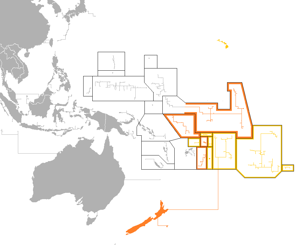
Polynesia ( , ) is a subregion of Oceania, made up of more than 1,000 islands scattered over the central and southern Pacific Ocean. The indigenous people who inhabit the islands of Polynesia are called Polynesians. They have many things in common, including Polynesian languages, linguistic relations, Polynesian culture, cultural practices, and Tradition, traditional beliefs. In centuries past, they had a strong shared tradition of sailing and Polynesian navigation, using stars to navigate at night. The term was first used in 1756 by the French writer Charles de Brosses, who originally applied it to all the list of islands in the Pacific Ocean, islands of the Pacific. In 1831, Jules Dumont d'Urville proposed a narrower definition during a lecture at the Société de Géographie of Paris. By tradition, the islands located in the South Seas, southern Pacific have also often been called the South Sea Islands, and their inhabitants have been called South Sea Islanders. The Hawai ... [...More Info...] [...Related Items...] OR: [Wikipedia] [Google] [Baidu] |
Peru
Peru, officially the Republic of Peru, is a country in western South America. It is bordered in the north by Ecuador and Colombia, in the east by Brazil, in the southeast by Bolivia, in the south by Chile, and in the south and west by the Pacific Ocean. Peru is a Megadiverse countries, megadiverse country, with habitats ranging from the arid plains of the Pacific coastal region in the west, to the peaks of the Andes mountains extending from the north to the southeast of the country, to the tropical Amazon basin rainforest in the east with the Amazon River. Peru has Demographics of Peru, a population of over 32 million, and its capital and largest city is Lima. At , Peru is the List of countries and dependencies by area, 19th largest country in the world, and the List of South American countries by area, third largest in South America. Pre-Columbian Peru, Peruvian territory was home to Andean civilizations, several cultures during the ancient and medieval periods, and has one o ... [...More Info...] [...Related Items...] OR: [Wikipedia] [Google] [Baidu] |
Thor Heyerdahl
Thor Heyerdahl KStJ (; 6 October 1914 – 18 April 2002) was a Norwegian adventurer and Ethnography, ethnographer with a background in biology with specialization in zoology, botany and geography. Heyerdahl is notable for his Kon-Tiki expedition, ''Kon-Tiki'' expedition in 1947, in which he drifted 8,000 km (5,000 mi) across the Pacific Ocean in a primitive hand-built raft from South America to the Tuamotus, Tuamotu Islands. The expedition was supposed to demonstrate that the legendary sun-worshiping red-haired, bearded, and white-skinned "Tiki people" from South America drifted and colonized Polynesia first, before actual Polynesian peoples. His hyperdiffusionist ideas on ancient cultures had been widely rejected by the scientific community, even before the expedition. Heyerdahl made other voyages to demonstrate the possibility of contact between widely separated ancient peoples, notably the ''Ra II'' expedition of 1970, when he sailed from the West Africa, west coas ... [...More Info...] [...Related Items...] OR: [Wikipedia] [Google] [Baidu] |
Balsa
''Ochroma pyramidale'', commonly known as balsa, is a large, fast-growing tree native to the Americas. It is the sole member of the genus ''Ochroma'', and is classified in the subfamily Bombacoideae of the mallow family Malvaceae. The tree is famous for its wide usage in woodworking, due to its softness and its high strength compared to its low density. The name ''balsa'' is the Spanish word for "raft" and the Portuguese word for ferry. A deciduous angiosperm, ''Ochroma pyramidale'' can grow up to 30 m tall, and is classified as a hardwood despite the wood itself being very soft; it is the softest commercial hardwood and is widely used because of its light weight. Balsa trees grow extremely fast, often up to 27 metres in 10–15 years, and do not usually live beyond 30 to 40 years. In terms of volume (as opposed to height) they may be the fastest growing tree known; Streets mentions one individual which grew tall and diameter at breast height during a period of fifteen mo ... [...More Info...] [...Related Items...] OR: [Wikipedia] [Google] [Baidu] |
Kon-Tiki Expedition
The ''Kon-Tiki'' expedition was a 1947 journey by raft across the Pacific Ocean from South America to the Polynesian islands, led by Norwegian explorer and writer Thor Heyerdahl. The raft was named ''Kon-Tiki'' after the Inca god Viracocha, for whom "Kon-Tiki" was said to be an old name. Heyerdahl's book on the expedition was entitled '' The Kon-Tiki Expedition: By Raft Across the South Seas''. A 1950 documentary film won the Academy Award for Best Documentary Feature. A 2012 dramatized feature film was nominated for the Academy Award for Best Foreign Language Film. The ''Kon-Tiki'' expedition was funded by private loans, along with donations of equipment from the United States Army. Heyerdahl and a small team went to Peru, where, with the help of dockyard facilities provided by the Peruvian authorities, they constructed the raft out of balsa logs and other native materials in an indigenous style as recorded in illustrations by Spanish conquistadores. The trip began on April ... [...More Info...] [...Related Items...] OR: [Wikipedia] [Google] [Baidu] |
Viking Age
The Viking Age (about ) was the period during the Middle Ages when Norsemen known as Vikings undertook large-scale raiding, colonising, conquest, and trading throughout Europe and reached North America. The Viking Age applies not only to their homeland of Scandinavia but also to any place significantly settled by North Germanic peoples, Scandinavians during the period. Although few of the Scandinavians of the Viking Age were Vikings in the sense of being engaged in piracy, they are often referred to as ''Vikings'' as well as ''Norsemen''. Voyaging by sea from their homelands in Denmark, Norway, and Sweden, the Norse people settled in the Viking activity in the British Isles, British Isles, History of Ireland (800–1169), Ireland, the Faroe Islands, Settlement of Iceland, Iceland, Norse settlements in Greenland, Greenland, History of Normandy, Normandy, and the Baltic Sea, Baltic coast and along the Trade route from the Varangians to the Greeks, Dnieper and Volga trade rout ... [...More Info...] [...Related Items...] OR: [Wikipedia] [Google] [Baidu] |


