|
Evolution Of The Portuguese Empire
This article is a comprehensive list of all possessions of the Portuguese Empire. Europe Portuguese founded factories in various places in Europe, with a purely commerce-focused strategy, different from the other continents. * Antwerp – factory * Bruges – factory * Chios – factory (founded in 1499 – ?) * Venice – factory (c. 1508) Africa Portuguese presence in Africa started in 1415 with the conquest of Ceuta and is generally viewed as ending in 1975, with the independence of its later colonies, although the present autonomous region of Madeira is located in the African Plate, some 650 km (360 mi) off the North African coast, Madeira belongs and has always belonged ethnically, culturally, economically and politically to Europe, some 955 km (583 mi) from the European mainland. * Angola/Portuguese West Africa: colony (1575–1589); crown colony (1589–1951); overseas province (1951–1971); state (1971–1975). Independence in 1975. ** Santo Ant ... [...More Info...] [...Related Items...] OR: [Wikipedia] [Google] [Baidu] |
Portuguese Cape Verde
Cape Verde was a colony of the Portuguese Empire from the initial settlement of the Cape Verde Islands in 1462 until the independence of Cape Verde in 1975. History 15th century The islands of Cape Verde were discovered in 1460-62 by Prince Henry the Navigator (Son of King John I) and Antonio Noli, in the service of Henry's relative King Afonso V. The southeastern islands, including the largest island Santiago, were discovered in 1460 by António de Noli and Diogo Gomes. The remaining northwestern islands São Nicolau, São Vicente and Santo Antão were discovered in 1461 or 1462 by Diogo Afonso.Valor simbólico do centro histórico da Praia Lourenço Conceição Gomes, Universidade Portucalense, 2008 There is no evidence of human settlement on Cape Verde prior to the arrival of the Portuguese. [...More Info...] [...Related Items...] OR: [Wikipedia] [Google] [Baidu] |
Fort Saint Anthony
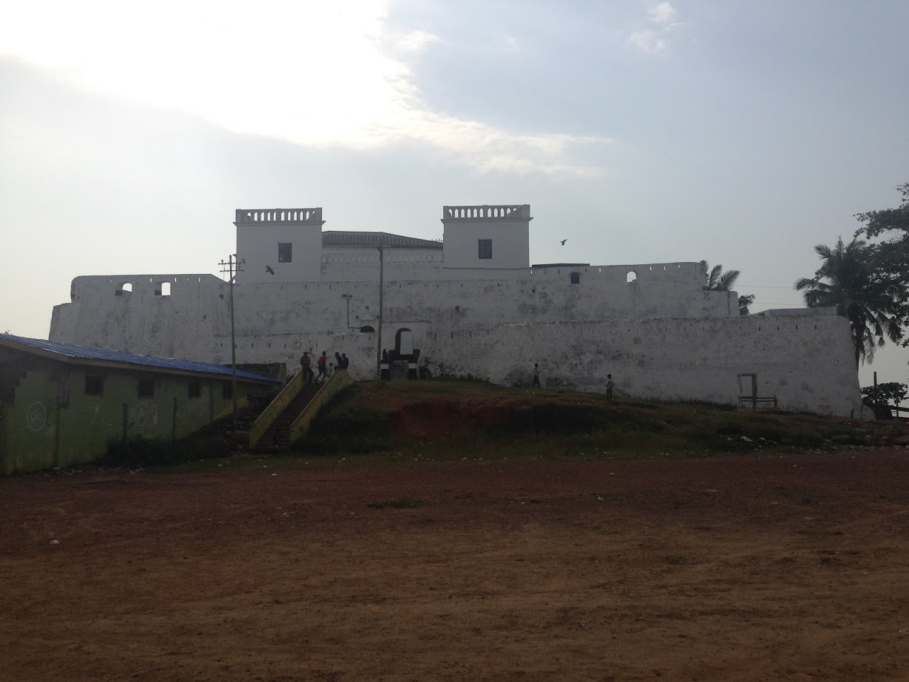
Fort Saint Anthony (Portuguese language, Portuguese: ''Forte de Santo António''; Dutch language, Dutch: ''Fort Sint Anthony'') was a fort built by the Portuguese people, Portuguese in 1515 near the town of Axim, in what is now Ghana. In 1642, the Dutch captured the fort and subsequently made it part of the Dutch Gold Coast. The Dutch expanded the fort considerably before they Anglo-Dutch Treaties of 1870–71, turned it over, with the rest of their colony, to the British in 1872. The fort is now the property of the Ghanaian state and is open to the public. As the westernmost fort of the Dutch possessions, Fort Saint Anthony was the first fort encountered by Dutch traders, and the place where provisions and fresh water were taken in. Fort Saint Anthony remained an important fort in the Dutch possessions, with its commandant serving as senior commissioner (Dutch: ''oppercommies'') in the Colonial Council in Elmina, together with the commandant of Fort Nassau (Ghana), Fort Nassau at ... [...More Info...] [...Related Items...] OR: [Wikipedia] [Google] [Baidu] |
Axim
Axim is a coastal town and the capital of Nzema East Municipal district, a district in Western Region of South Ghana. Axim lies 64 kilometers west of the port city of Sekondi-Takoradi in the Western Region, west of Cape Three Points. Axim has a 2013 settlement population of 27,719 people. History This area was occupied by the Nzema people. The Portuguese arrived by the early 16th century as traders. They built a prominent seaside fort, Fort Santo Antonio, in 1515. They exported some Africans as slaves to Europe and the Americas. Between 1642 and 1872, the fort was expanded and altered by the Dutch, who "ruled" during that period. The fort, now property of Ghana, is open to the public. Off-shore are some picturesque islands, including one with a lighthouse. Axim structure The town of Axim is divided into two parts: Upper Axim and Lower Axim. Fort Santo Antonio lies roughly on the division between the two parts, but closest to the centre of Upper Axim, the original Eur ... [...More Info...] [...Related Items...] OR: [Wikipedia] [Google] [Baidu] |
Accra
Accra (; or ''Gaga''; ; Ewe: Gɛ; ) is the capital and largest city of Ghana, located on the southern coast at the Gulf of Guinea, which is part of the Atlantic Ocean. As of 2021 census, the Accra Metropolitan District, , had a population of 284,124 inhabitants, and the larger Greater Accra Region, , had a population of 5,455,692 inhabitants. In common usage, the name "Accra" often refers to the territory of the Accra Metropolitan District as it existed before 2008, when it covered .Sum of the land areas of Accra Metropolitan District, Ablekuma Central Municipal District, Ablekuma North Municipal District, Ablekuma West Municipal District, Ayawaso Central Municipal District, Ayawaso East Municipal District, Ayawaso North Municipal District, Ayawaso West Municipal District, Korle Klottey Municipal District, Krowor Municipal District, La Dade Kotopon Municipal District, La Dadekotopon Municipal District, Ledzokuku Municipal District, and Okaikwei North Municipal District, Okaiko ... [...More Info...] [...Related Items...] OR: [Wikipedia] [Google] [Baidu] |
Dutch Gold Coast
The Dutch Gold Coast or Dutch Guinea, officially Dutch possessions on the Coast of Guinea (Dutch language, Dutch: ''Nederlandse Bezittingen ter Kuste van Guinea'') was a portion of contemporary Ghana that was gradually colonized by the Dutch (ethnic group), Dutch, beginning in 1612. The Dutch began trading in the area around 1598, joining the Portuguese which had a trading post there since the late 1400s. Eventually, the Dutch Gold Coast became the most important Dutch colony in West Africa after Battle of Elmina (1637), Fort Elmina was captured from the Portugal, Portuguese in 1637, but fell into disarray after the abolition of slavery timeline, abolition of the slave trade in the early 19th century. On 6 April 1872, the Dutch Gold Coast was, in accordance with the Anglo-Dutch Treaties of 1870–71, ceded to the United Kingdom. History The Dutch settle on the Gold Coast The Portuguese were the first Europeans to arrive in contemporary Ghana. By 1471, they had reached the area ... [...More Info...] [...Related Items...] OR: [Wikipedia] [Google] [Baidu] |
Portuguese Gold Coast
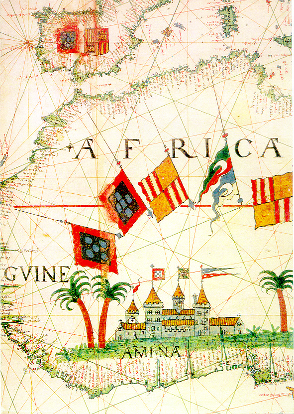
The Portuguese Gold Coast was a Portuguese colony on the West African Gold Coast (present-day Ghana) along the Gulf of Guinea. From their seat of power at the fortress of São Jorge da Mina (established in 1482 and located in modern Elmina), the Portuguese commanded a vast internal slave trade, creating a slave network that would expand after the end of Portuguese colonialism in the region. The primary export of the colony was gold, which was obtained through barter with the local population. Portuguese presence along the Gold Coast increased seamanship and trade in the Gulf, introduced American crops (such as maize and cassava) into the African agricultural landscape, and made Portuguese an enduring language of trade in the area. The colony was officially incorporated into Dutch territory in 1642. History Portuguese arrival on the Gold Coast In 1471, Portuguese explorers encountered fishing villages rich with ivory and gold along the Atlantic coast of modern-day Ghan ... [...More Info...] [...Related Items...] OR: [Wikipedia] [Google] [Baidu] |
Kunta Kinteh Island
Kunta Kinteh Island, formerly called James Island and St Andrew's Island, is an island in the Gambia River, from the river mouth and near Juffureh in the Republic of the Gambia. Fort James is located on the island. It is less than 3.2 km (2 miles) from Albreda on the river's northern bank. As an important historical site in the West African slave trade, it is listed as a UNESCO World Heritage Site, together with related sites including a ruined Portuguese chapel and a colonial warehouse in Albreda, the ''Maurel Frères Building'' in Juffureh, and Fort Bullen and Six-Gun Battery, which are located at the mouth of the Gambia River. History The first record of European interaction with the island is in May 1456, when a Portuguese expedition led by Italian explorers Alvise Cadamosto and Antoniotto Usodimare moored off the island. They buried one of their sailors, named Andrew, on the island, giving it its first European name—St Andrew's Island. Diogo Gomes also anch ... [...More Info...] [...Related Items...] OR: [Wikipedia] [Google] [Baidu] |
Gambia
The Gambia, officially the Republic of The Gambia, is a country in West Africa. Geographically, The Gambia is the List of African countries by area, smallest country in continental Africa; it is surrounded by Senegal on all sides except for the western part, which is bordered by the Atlantic Ocean.Hoare, Ben. (2002) ''The Kingfisher A–Z Encyclopedia'', Kingfisher Publications. p. 11. . Its territory is on both sides of the lower reaches of the Gambia River, which flows through the centre of the country and empties into the Atlantic. The national namesake river demarcates the elongated shape of the country, which has an area of and a population of 2,769,075 people in 2024 which is a 47% population increase from 2013. The capital city is Banjul, which has the most extensive metropolitan area in the country. The second and third-largest cities are Serekunda and Brikama. Arab Muslims, Arab Muslim merchants traded with indigenous West Africans in The Gambia throughout the 9th ... [...More Info...] [...Related Items...] OR: [Wikipedia] [Google] [Baidu] |
German South-West Africa
German South West Africa () was a colony of the German Empire from 1884 until 1915, though Germany did not officially recognise its loss of this territory until the 1919 Treaty of Versailles. German rule over this territory was punctuated by numerous rebellions by its native African peoples, which culminated in a campaign of German reprisals from 1904 to 1908 known as the Herero and Nama genocide. In 1915, during World War I, German South West Africa was invaded by the Western Allies in the form of South African and British forces. After the war its administration was taken over by the Union of South Africa (part of the British Empire) and the territory was administered as South West Africa under a League of Nations mandate. It became independent as Namibia on 21 March 1990. Early settlements Initial European contact with the areas which would become German South West Africa came from traders and sailors, starting in January 1486 when Portuguese explorer Diogo Cão, ... [...More Info...] [...Related Items...] OR: [Wikipedia] [Google] [Baidu] |
Fort Mocusso
A fortification (also called a fort, fortress, fastness, or stronghold) is a military construction designed for the defense of territories in warfare, and is used to establish rule in a region during peacetime. The term is derived from Latin ("strong") and ("to make"). From very early history to modern times, defensive walls have often been necessary for cities to survive in an ever-changing world of invasion and conquest. Some settlements in the Indus Valley Civilization were the first small cities to be fortified. In ancient Greece, large cyclopean stone walls fitted without mortar had been built in Mycenaean Greece, such as the ancient site of Mycenae. A Greek '' phrourion'' was a fortified collection of buildings used as a military garrison, and is the equivalent of the Roman castellum or fortress. These constructions mainly served the purpose of a watch tower, to guard certain roads, passes, and borders. Though smaller than a real fortress, they acted as a border gu ... [...More Info...] [...Related Items...] OR: [Wikipedia] [Google] [Baidu] |
Boma, Democratic Republic Of The Congo
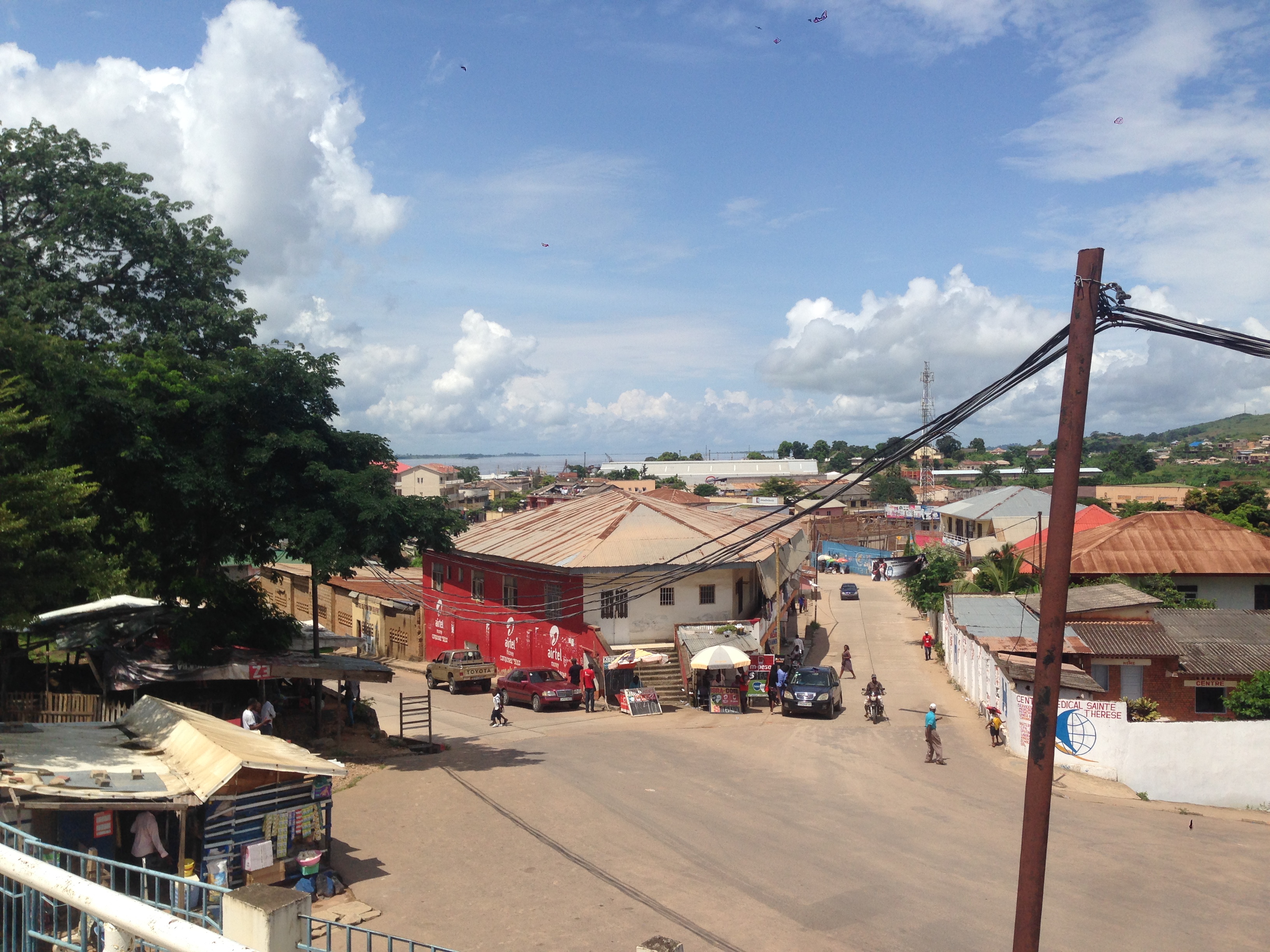
Boma is a port town on the Congo River, some upstream from the Atlantic Ocean, in the Kongo Central, Kongo Central Province of the Democratic Republic of the Congo (DRC), adjacent to the Angola–Democratic Republic of the Congo border, border with Angola. It had an estimated population of 162,521 in 2012. Boma was the capital city of the Congo Free State and Belgian Congo (the modern Democratic Republic of the Congo) from 1 May 1886 to 1923, when the capital was moved to Léopoldville (since renamed Kinshasa). The port handles exports of tropical timber, bananas, Cocoa bean, cocoa, and Arecaceae, palm products. History Boma was founded by European merchants in the 16th century as an entrepôt, including for the History of slavery, slave trade. Trade was chiefly in the hands of Dutch merchants, but British, French and Portuguese firms also had factories there. No European power exercised sovereignty, though claims were from time to time put forward by Portugal. British exp ... [...More Info...] [...Related Items...] OR: [Wikipedia] [Google] [Baidu] |


