|
Engineers' Club Building
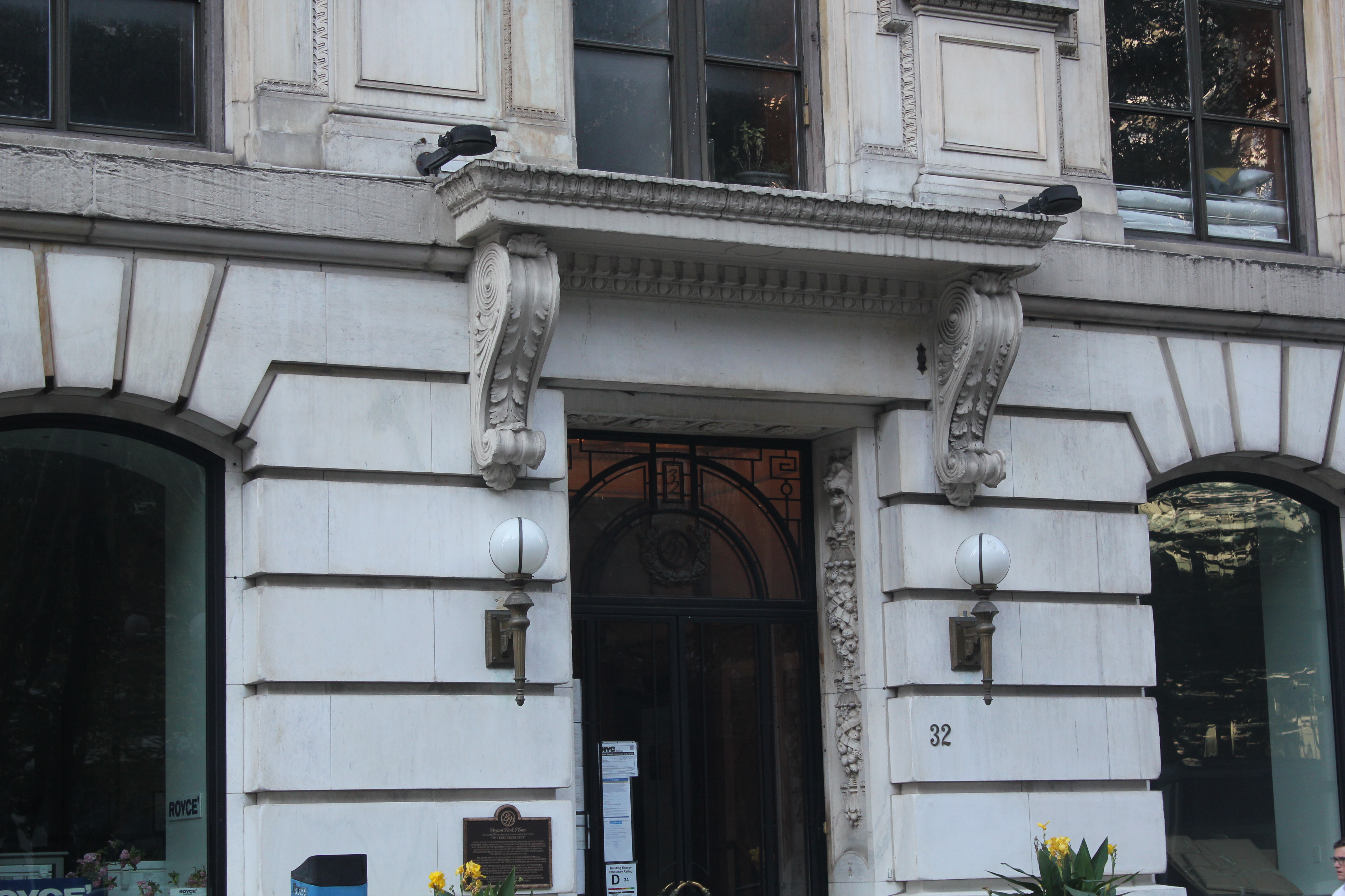
The Engineers' Club Building, also known as Bryant Park Place, is a residential building at 32 West 40th Street in the Midtown Manhattan neighborhood of New York City, New York. Located on the southern edge of Bryant Park, it was constructed in 1907 along with the adjoining Engineering Societies' Building. It served as the clubhouse of the Engineers' Club, a social organization formed in 1888. The building was designed by Henry D. Whitfield and Beverly S. King, of the firm Whitfield & King, in the Renaissance Revival architecture, neo-Renaissance style. The building's facade is divided into three horizontal sections. The lowest three stories comprise a base of light-colored stone, including a colonnade with Corinthian order, Corinthian-style Capital (architecture), capitals. Above that is a seven-story shaft with a brick facade and stone quoins. The top of the building has a double-height loggia and a cornice with modillions. Inside, the building contained accommodations for the ... [...More Info...] [...Related Items...] OR: [Wikipedia] [Google] [Baidu] |
Manhattan
Manhattan ( ) is the most densely populated and geographically smallest of the Boroughs of New York City, five boroughs of New York City. Coextensive with New York County, Manhattan is the County statistics of the United States#Smallest, largest, and average area per state and territory, smallest county by area in the U.S. state of New York (state), New York. Located almost entirely on Manhattan Island near the southern tip of the state, Manhattan constitutes the center of the Northeast megalopolis and the urban core of the New York metropolitan area. Manhattan serves as New York City's Economy of New York City, economic and Government of New York City, administrative center and has been described as the cultural, financial, Media in New York City, media, and show business, entertainment capital of the world. Present-day Manhattan was originally part of Lenape territory. European settlement began with the establishment of a trading post by Dutch colonization of the Americas, D ... [...More Info...] [...Related Items...] OR: [Wikipedia] [Google] [Baidu] |
Andrew Carnegie
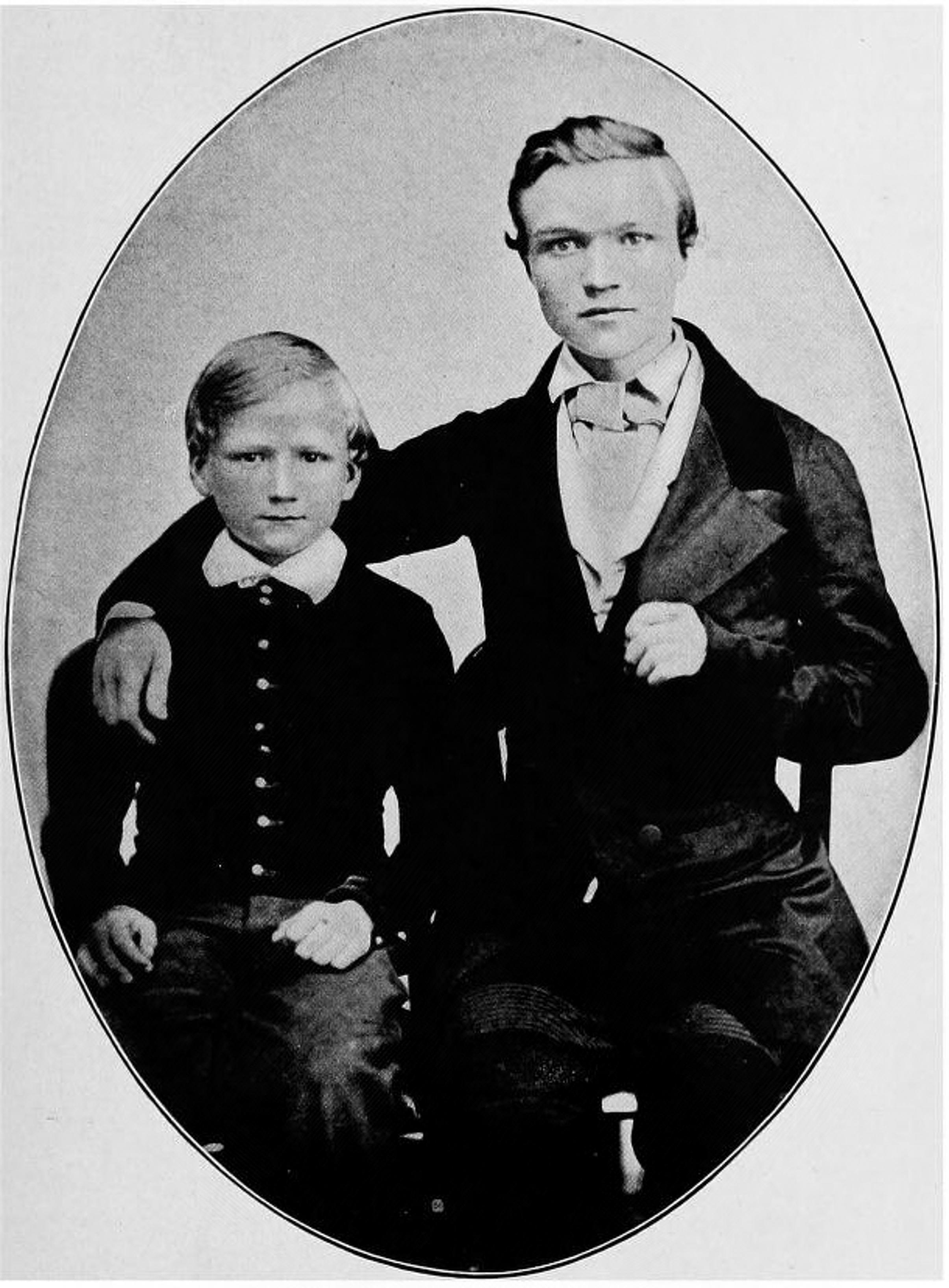
Andrew Carnegie ( , ; November 25, 1835August 11, 1919) was a Scottish-American industrialist and philanthropist. Carnegie led the expansion of the History of the iron and steel industry in the United States, American steel industry in the late-19th century and became one of the List of richest Americans in history, richest Americans in history. He became a leading philanthropist in the United States, Great Britain, and the British Empire. During the last 18 years of his life, he gave away around $350 million (equivalent to $ billion in ), almost 90 percent of his fortune, to charities, foundations and universities. His 1889 article proclaiming "The Gospel of Wealth" called on the rich to use their wealth to improve society, expressed support for progressive taxation and an Inheritance tax, estate tax, and stimulated a wave of philanthropy. Carnegie was born in Dunfermline, Scotland. He immigrated to what is now Pittsburgh, Pennsylvania, United States with his parents in 1848 ... [...More Info...] [...Related Items...] OR: [Wikipedia] [Google] [Baidu] |
Haskins & Sells Building
Haskins may refer to: * Haskins (surname) * Haskins, Iowa, U.S. * Haskins, Ohio, U.S. * Haskins Laboratories, non-profit researcher See also * Haskin (other) Haskin may refer to: * Haskin (crater), lunar impact crater * Haskin (surname) * Haskin Smith (fl. 1872–1876), American politician See also * Haskins (other) {{dab, given name ... * Hoskins (other) {{disambig, surname, geo ... [...More Info...] [...Related Items...] OR: [Wikipedia] [Google] [Baidu] |
452 Fifth Avenue
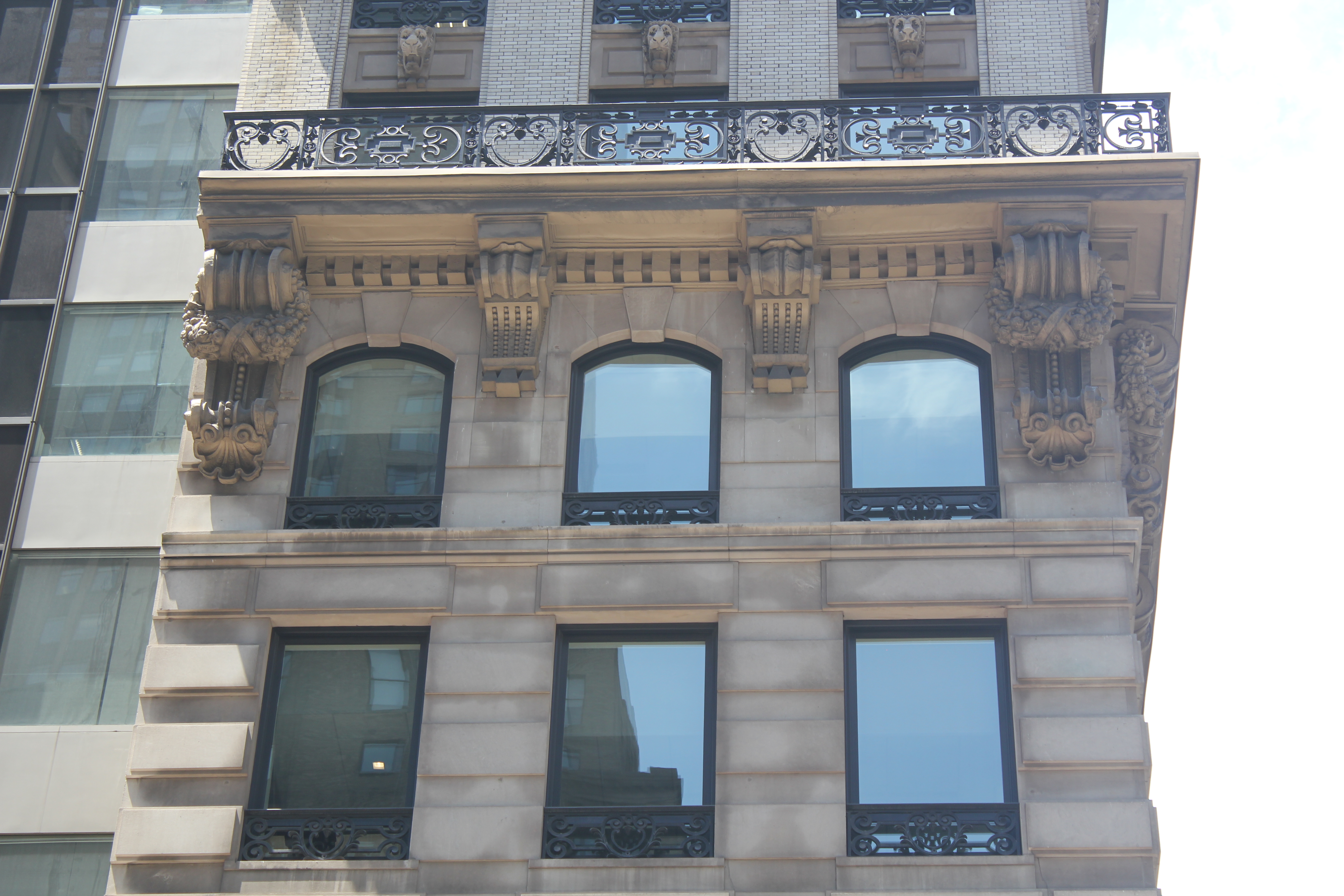
452 Fifth Avenue (also the HSBC Tower and 10 Bryant Park; formerly the Republic National Bank Building) is an office building at the southwest corner of Fifth Avenue and 40th Street in the Midtown Manhattan neighborhood of New York City. The building primarily consists of the 30-story, HSBC Tower, completed in late 1985 and designed by Attia & Perkins. The 10-story Knox Building, a Beaux-Arts office building designed in 1902 by John H. Duncan, is preserved at the base of the skyscraper. 452 Fifth Avenue faces Bryant Park immediately to the north. The HSBC Tower is designed with a glass facade, which curves around the Knox Building to the north; a similar curved tower across Fifth Avenue was never built. The Knox Building's facade remains largely as it was originally designed, with decorated limestone cladding, a cornice above the sixth floor, and a mansard roof. The Knox Building is a New York City designated landmark and is on the National Register of Historic Places. Int ... [...More Info...] [...Related Items...] OR: [Wikipedia] [Google] [Baidu] |
The Bryant
The Bryant is a residential building at 16 West 40th Street, south of Bryant Park, in Midtown Manhattan, New York City, developed by HFZ Capital Group and designed by the firm of architect David Chipperfield. The building topped out in 2016, and construction ended in 2018. History The city first approved plans for the building in 2007. HFZ announced Chipperfield's role as architect in 2015, in the same press release that disclosed the development's name. The announcement also disclosed that the building would have both condominiums and a luxury hotel. The site formerly held a parking lot, and constituted the final undeveloped plot on Bryant Park. The developers of the nearby Bryant Park Hotel sued HFZ over the use of the name "The Bryant". Architecture HFZ solicited plans from architectural firms including Morris Adjmi and Spivak Architects before settling on Chipperfield. The facade is made of precast, polished concrete, a choice Chipperfield made so that the structure would ... [...More Info...] [...Related Items...] OR: [Wikipedia] [Google] [Baidu] |
Sixth Avenue
Sixth Avenue, also known as Avenue of the Americas, is a major thoroughfare in the New York City borough of Manhattan. The avenue is commercial for much of its length, and traffic runs northbound, or uptown. Sixth Avenue begins four blocks below Canal Street (Manhattan), Canal Street, at Franklin Street in Tribeca, where the northbound Church Street (Manhattan), Church Street divides into Sixth Avenue to the left and the local continuation of Church Street to the right, which then ends at Canal Street. From this beginning, Sixth Avenue traverses SoHo and Greenwich Village, roughly divides Chelsea, Manhattan, Chelsea from the Flatiron District and NoMad, passes through the Garment District, Manhattan, Garment District and skirts the edge of the Theater District, Manhattan, Theater District while passing through Midtown Manhattan. Although it is officially named "Avenue of the Americas", this name is seldom used by New Yorkers., p.24 Sixth Avenue's northern end is at Central Pa ... [...More Info...] [...Related Items...] OR: [Wikipedia] [Google] [Baidu] |
Fifth Avenue
Fifth Avenue is a major thoroughfare in the borough (New York City), borough of Manhattan in New York City. The avenue runs south from 143rd Street (Manhattan), West 143rd Street in Harlem to Washington Square Park in Greenwich Village. The section in Midtown Manhattan is one of the most expensive List of shopping streets and districts by city, shopping streets in the world. Fifth Avenue carries Bidirectional traffic, two-way traffic between 135th Street (Manhattan), 143rd and 135th Streets, and one-way traffic southbound for the rest of its route. The entire avenue carried two-way traffic until 1966. From 124th Street (Manhattan), 124th to 120th Streets, Fifth Avenue is interrupted by Marcus Garvey Park, with southbound traffic diverted around the park via Mount Morris Park West and northbound to Madison Avenue. Most of the avenue has a bus lane, but no bike lane. Fifth Avenue is the traditional route for many celebratory parades in New York City and is closed to automobile tr ... [...More Info...] [...Related Items...] OR: [Wikipedia] [Google] [Baidu] |
Frontage
Frontage is the boundary between a plot of land or a building and the road onto which the plot or building fronts. Frontage may also refer to the full length of this boundary. This length is considered especially important for certain types of commercial and retail real estate, in applying zoning bylaws and property tax. In the case of contiguous buildings individual frontages are usually measured to the middle of any party wall. In some parts of the United States, particularly New England and Montana, a frontage road is one which runs parallel to a major road or highway, and is intended primarily for local access to and egress from those properties which line it. A "river frontage" or "ocean frontage" is the length of a plot of land that faces directly onto a river or ocean respectively. Consequently, the amount of such frontage may affect the value of the plot. See also * Façade A façade or facade (; ) is generally the front part or exterior of a building. It ... [...More Info...] [...Related Items...] OR: [Wikipedia] [Google] [Baidu] |
Land Lot
In real estate, a land lot or plot of land is a tract or parcel of land owned or meant to be owned by some owner(s). A plot is essentially considered a parcel of real property in some countries or immovable property (meaning practically the same thing) in other countries. Possible owners of a plot can be one or more persons or another legal entity, such as a company, corporation, organization, government, or Trust company, trust. A common form of ownership of a plot is called fee simple in some countries. A small area of land that is empty except for a paved surface or similar improvement, typically all used for the same purpose or in the same state is also often called a plot. Examples are a paved car park or a cultivated garden plot. This article covers plots (more commonly called lots in some countries) as defined parcels of land meant to be owned as units by an owner(s). Like most other types of property, lots or plots owned by private parties are subject to a periodic pro ... [...More Info...] [...Related Items...] OR: [Wikipedia] [Google] [Baidu] |
New York City Department Of City Planning
The Department of City Planning (DCP) is the department of the government of New York City responsible for setting the framework of city's physical and socioeconomic planning. The department is responsible for land use and environmental review, preparing plans and policies, and providing information to and advising the Mayor of New York City, Borough presidents, the New York City Council, Community Boards and other local government bodies on issues relating to the macro-scale development of the city. The department is responsible for changes in New York City's city map, purchase and sale of city-owned real estate and office space and of the designation of landmark and historic district status. Its regulations are compiled in title 62 of the '' New York City Rules''. The most recent Director of City Planning Marisa Lago resigned in December, 2021 following her confirmation as Under Secretary for International Trade at the United States Department of Commerce. __TOC__ City Plan ... [...More Info...] [...Related Items...] OR: [Wikipedia] [Google] [Baidu] |
40th Street (Manhattan)
The borough of Manhattan in New York City contains 214 numbered east–west streets ranging from 1st to 228th, the majority of them designated in the Commissioners' Plan of 1811. These streets do not run exactly east–west, because the grid plan is aligned with the Hudson River, rather than with the cardinal directions. Thus, the majority of the Manhattan grid's "west" is approximately 29 degrees north of true west; the angle differs above 155th Street, where the grid initially ended. The grid now covers the length of the island from 14th Street north. All numbered streets carry an East or West prefix – for example, East 10th Street or West 10th Street – which is demarcated at Broadway below 8th Street, and at Fifth Avenue at 8th Street and above. The numbered streets carry crosstown traffic. In general, but with numerous exceptions, even-numbered streets are one-way eastbound and odd-numbered streets are one-way westbound. Most wider streets, and a few of the n ... [...More Info...] [...Related Items...] OR: [Wikipedia] [Google] [Baidu] |
New York City Landmarks Preservation Commission
The New York City Landmarks Preservation Commission (LPC) is the Government of New York City, New York City agency charged with administering the city's Historic preservation, Landmarks Preservation Law. The LPC is responsible for protecting New York City's architecturally, historically, and culturally significant buildings and sites by granting them landmark or historic district status, and regulating them after designation. It is the largest municipal preservation agency in the nation. , the LPC has designated Lists of New York City landmarks, more than 37,800 landmark properties in all Boroughs of New York City, five boroughs. Most of these are concentrated in historic districts, although there are over a thousand individual landmarks, as well as numerous interior and New York City scenic landmarks, scenic landmarks. Mayor Robert F. Wagner Jr. first organized a preservation committee in 1961, and the following year, created the LPC. The LPC's power was greatly strengthened af ... [...More Info...] [...Related Items...] OR: [Wikipedia] [Google] [Baidu] |


