|
Couva
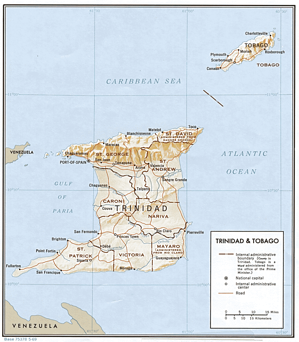
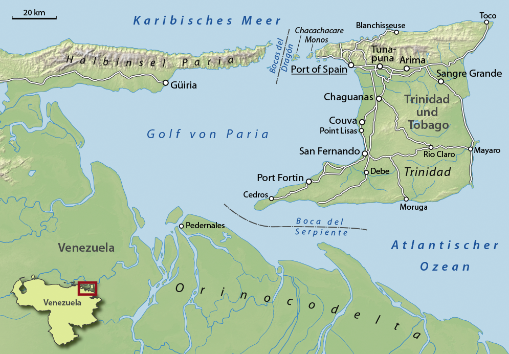
Couva is an urban town (48,858 in 2011 census) in west-central Trinidad, south of Port of Spain and Chaguanas and north of San Fernando, Trinidad and Tobago, San Fernando and Point Fortin. It is the capital and main urban centre of Couva–Tabaquite–Talparo, and the Greater Couva area includes the Point Lisas Industrial Estate and the Port of Point Lisas. It is one of the fastest-growing towns in the country. Couva's southern boundary is at the village of California, Trinidad and Tobago, California & Point Lisas, and to the north Couva stretches to McBean (both on the Trinidad Southern Main Road). To the east of Couva is Preysal. To the west of Couva is the road to Waterloo and Carli Bay, which are located on the Gulf of Paria. Couva was part of the Caroni County. Couva is considered a major power base for the United National Congress (UNC), whose headquarters was previously located here. History The first British map of Trinidad, made in 1797 after the island was José Mar ... [...More Info...] [...Related Items...] OR: [Wikipedia] [Google] [Baidu] |
Couva–Tabaquite–Talparo
Couva–Tabaquite–Talparo is one of the nine regions of Trinidad and Tobago, and one of the five regions which form the Gulf of Paria coastline on Trinidad's West Coast. Its regional capital and commercial center is Couva. Couva–Tabaquite–Talparo is the third-largest of Trinidad and Tobago's nine regions, with an area of . As of 2011, the population was 178,410. The region is the second-most populous and fourth-least-densely populated region in Trinidad with . Couva–Tabaquite–Talparo is bordered by the Gulf of Paria to the west, the Borough of Chaguanas to the north-west, Tunapuna–Piarco region to the north, Sangre Grande and Rio Claro–Mayaro to the east, Princes Town to the south and the City of San Fernando to the south-west. The region is directly adjacent to the Venezuelan state of Monagas to west separated by the Gulf of Paria. Geography Couva–Tabaquite–Talparo is Trinidad and Tobago's third largest region in area after Sangre Grande and Rio Claro–Maya ... [...More Info...] [...Related Items...] OR: [Wikipedia] [Google] [Baidu] |
Couva North (parliamentary Constituency)
Couva North is a parliamentary electoral district in the town of Couva. Couva North consists of the northern part of Couva. It came into effect in time for the 1976 Trinidad and Tobago general election. Members of Parliament This constituency has elected the following members of the House of Representatives of Trinidad and Tobago: Election results Elections in the 2020s Elections in the 2010s See also Couva South Couva South is a parliamentary electoral district in the town of Couva. Couva South consists of the southern part of Couva. It came into effect in time for the 1976 Trinidad and Tobago general election. Members of Parliament This constituency ... References {{Use dmy dates, date = July 2020 Couva ... [...More Info...] [...Related Items...] OR: [Wikipedia] [Google] [Baidu] |
Couva South (parliamentary Constituency)
Couva South is a parliamentary electoral district in the town of Couva. Couva South consists of the southern part of Couva. It came into effect in time for the 1976 Trinidad and Tobago general election. Members of Parliament This constituency has elected the following members of the House of Representatives of Trinidad and Tobago: Election results Elections in the 2020s Elections in the 2010s See also Couva North Couva North is a parliamentary electoral district in the town of Couva. Couva North consists of the northern part of Couva. It came into effect in time for the 1976 Trinidad and Tobago general election. Members of Parliament This constituency ha ... References {{Use dmy dates, date = July 2020 Couva ... [...More Info...] [...Related Items...] OR: [Wikipedia] [Google] [Baidu] |
Caroni County
Caroni County was a historic county of Trinidad and Tobago. It occupies in the west central part of the island of Trinidad, the larger island in the Republic of Trinidad and Tobago. It lies south and southwest of Saint George County, west of Nariva County and north of Victoria County. To the west it is bounded by the Gulf of Paria. County Caroni includes the towns of Chaguanas, the largest town (by population) in the country and Couva, the capital of the Couva–Tabaquite–Talparo region. Administratively it is divided between the Borough of Chaguanas, the Region of Couva–Tabaquite–Talparo and the Region of Tunapuna–Piarco. The county was divided into four Wards: Chaguanas, Couva, Cunupia and Montserrat. The major towns of County Caroni are Chaguanas and Couva. The port and industrial zone of Point Lisas is located in Caroni, and the region is also a site for agriculture. Caroni County, which takes its name from the Caroni River, stretches from the hills of the Centra ... [...More Info...] [...Related Items...] OR: [Wikipedia] [Google] [Baidu] |
Chaguanas
The Borough of Chaguanas is the largest municipality (83,489 at the 2011 census) and fastest-growing – Afra Raymond, 29 July 2004. – '''', 1 October 1998 town in . Located in west-central , south of Port ... [...More Info...] [...Related Items...] OR: [Wikipedia] [Google] [Baidu] |
Point Lisas
Point Lisas is a major industrial centre in Trinidad and Tobago and is host to the ''Point Lisas Industrial Estate'' and the ''Port of Point Lisas'', both of which are managed by Plipdeco (the Point Lisas Industrial Port Development Company). Point Lisas is located in Couva, Trinidad and Tobago and on the Gulf of Paria coastline. The ''Point Lisas Industrial Estate'' is home to a majority of the heavy industry in Trinidad and Tobago particularly in the downstream energy sector. Industries located there include a steel mill (owned by ArcelorMittal); numerous ammonia plants and methanol plants, melamine manufacturing plants, a urea manufacturing plant; a natural gas to liquids processing facility and it is the site of two power stations and a large reverse osmosis water desalination plant. Most of the industry located at Point Lisas is dependent on natural gas which is produced off the east coast of Trinidad and transported by pipeline across the island. ArcelorMittal Point Lisas ... [...More Info...] [...Related Items...] OR: [Wikipedia] [Google] [Baidu] |
California, Trinidad And Tobago
California is a neighbourhood located south of Downtown Couva, within the Couva–Tabaquite–Talparo regional corporation, Trinidad and Tobago. It is bordered on the west by the Point Lisas Industrial Estate and to the East by the University of Trinidad and Tobago (Point Lisas Campus). Dow Village and Esperanza Village are within California. Its football team are Central F.C. Central Football Club is a Trinidad and Tobago professional Association football, football club, based in California, Trinidad and Tobago, California, that plays in the TT Pro League. Founded in 2012, the ''Sharks'' were the 21st team to join the ... References Neighbourhoods in Trinidad and Tobago Couva {{Trinidad-geo-stub ... [...More Info...] [...Related Items...] OR: [Wikipedia] [Google] [Baidu] |
Trinidad And Tobago
Trinidad and Tobago (, ), officially the Republic of Trinidad and Tobago, is the southernmost island country in the Caribbean. Consisting of the main islands Trinidad and Tobago, and numerous much smaller islands, it is situated south of Grenada and off the coast of northeastern Venezuela. It shares maritime boundaries with Barbados to the northeast, Grenada to the northwest and Venezuela to the south and west. Trinidad and Tobago is generally considered to be part of the West Indies. The island country's capital is Port of Spain, while its largest and most populous city is San Fernando. The island of Trinidad was inhabited for centuries by Indigenous peoples before becoming a colony in the Spanish Empire, following the arrival of Christopher Columbus, in 1498. Spanish governor José María Chacón surrendered the island to a British fleet under the command of Sir Ralph Abercromby in 1797. Trinidad and Tobago were ceded to Britain in 1802 under the Treaty of Amiens as se ... [...More Info...] [...Related Items...] OR: [Wikipedia] [Google] [Baidu] |
Port Of Spain
Port of Spain (Spanish: ''Puerto España''), officially the City of Port of Spain (also stylized Port-of-Spain), is the capital of Trinidad and Tobago and the third largest municipality, after Chaguanas and San Fernando. The city has a municipal population of 37,074 (2011 census), an urban population of 81,142 (2011 estimate) and a transient daily population of 250,000. It is located on the Gulf of Paria, on the northwest coast of the island of Trinidad and is part of a larger conurbation stretching from Chaguaramas in the west to Arima in the east with an estimated population of 600,000. The city serves primarily as a retail and administrative centre and it has been the capital of the island since 1757. It is also an important financial services centre for the CaribbeanCIA World Factbook Trinidad an ... [...More Info...] [...Related Items...] OR: [Wikipedia] [Google] [Baidu] |
Gulf Of Paria
The Gulf of Paria ( ; es, Golfo de Paria) is a shallow (180 m at its deepest) semi-enclosed inland sea located between the island of Trinidad (Republic of Trinidad and Tobago) and the east coast of Venezuela. It separates the two countries by as little as 15 km at its narrowest and 120 km at its widest points. The tides within the Gulf are semi-diurnal in nature with a range of approximately 1m. The Gulf of Paria is considered to be one of the best natural harbors on the Atlantic coast of the Americas. The jurisdiction of the Gulf of Paria is split between Trinidad and Tobago and Venezuela with Trinidad and Tobago having control over approximately (37.7%) and Venezuela the remainder (62.3%). It was originally named the Gulf of the Whale ( es, Golfo de la Ballena) by Christopher Columbus, but the 19th-century whaling industry eliminated whales from the area and populations have never recovered. Cartographic sources of the late 18th century repeatedly refer to it a ... [...More Info...] [...Related Items...] OR: [Wikipedia] [Google] [Baidu] |
Point Fortin
Point Fortin, officially the Republic Borough of Point Fortin, the smallest Borough in Trinidad and Tobago is located in southwestern Trinidad, about southwest of San Fernando, in the historic county of Saint Patrick. After the discovery of petroleum in the area in 1906 the town grew into a major oil-producing centre. The town grew with the oil industry between the 1940s and 1980s, culminating in its elevation to borough status in 1980. After the end of the oil boom Point Fortin was hit hard by economic recession in the 1980s and the closure of its oil refinery. Construction of a Liquefied Natural Gas plant by Atlantic LNG in late 1990s boosted the economy. History and development At the beginning of the 20th century (before the discovery of oil), Point Fortin was an agricultural community with three distinct and separately owned cocoa and coconut estates. These estates were sparsely populated. Employment was provided for a small number of workers who depended on the estates f ... [...More Info...] [...Related Items...] OR: [Wikipedia] [Google] [Baidu] |
Indentured Servants
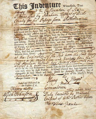
Indentured servitude is a form of labor in which a person is contracted to work without salary for a specific number of years. The contract, called an "indenture", may be entered "voluntarily" for purported eventual compensation or debt repayment, or it may be imposed as a judicial punishment. Historically, it has been used to pay for apprenticeships, typically when an apprentice agreed to work for free for a master tradesman to learn a trade (similar to a modern internship but for a fixed length of time, usually seven years or less). Later it was also used as a way for a person to pay the cost of transportation to colonies in the Americas. Like any loan, an indenture could be sold; most employers had to depend on middlemen to recruit and transport the workers so indentures (indentured workers) were commonly bought and sold when they arrived at their destinations. Like prices of slaves, their price went up or down depending on supply and demand. When the indenture (loan) was paid ... [...More Info...] [...Related Items...] OR: [Wikipedia] [Google] [Baidu] |

_(cropped).jpg)


