|
Community Boards In New Zealand
In New Zealand, community boards are governed by the provisions of Part 4 of the Local Government Act 2002 and can be created, or dissolved by territorial authorities, 40 out of 78 of which have 111 boards. In addition Auckland has 21 local boards and some councils have Community Committees. Under the Local Electoral Act 2001, Boards must have at least four members but not more than twelve. At least four must be elected members, but up to half can be appointed by the council. Their purpose is to: * represent and act as an advocate for the interests of the community; * consider and report on any matter referred to it by their council, and any issues of interest to the community board; * make an annual submission to their council on expenditure; * maintain an overview of services provided by their council within the community; and * communicate with community organisations and special interest groups in the community, and undertake any other responsibilities delegated by their c ... [...More Info...] [...Related Items...] OR: [Wikipedia] [Google] [Baidu] |
New Zealand
New Zealand ( mi, Aotearoa ) is an island country in the southwestern Pacific Ocean. It consists of two main landmasses—the North Island () and the South Island ()—and over 700 smaller islands. It is the sixth-largest island country by area, covering . New Zealand is about east of Australia across the Tasman Sea and south of the islands of New Caledonia, Fiji, and Tonga. The country's varied topography and sharp mountain peaks, including the Southern Alps, owe much to tectonic uplift and volcanic eruptions. New Zealand's capital city is Wellington, and its most populous city is Auckland. The islands of New Zealand were the last large habitable land to be settled by humans. Between about 1280 and 1350, Polynesians began to settle in the islands and then developed a distinctive Māori culture. In 1642, the Dutch explorer Abel Tasman became the first European to sight and record New Zealand. In 1840, representatives of the United Kingdom and Māori chiefs ... [...More Info...] [...Related Items...] OR: [Wikipedia] [Google] [Baidu] |
Mercury Bay
Mercury Bay is a large V-shaped bay on the eastern coast of the Coromandel Peninsula on the North Island of New Zealand. It was named by the English navigator Captain James Cook during his exploratory expeditions. It was first named ''Te-Whanganui-a-Hei'', the great bay of Hei, by the Māori. On 9 November 1769 Cook landed on the shores of the bay to observe a Transit of Mercury. In 1919 an area of land around Shakespeare Cliff was set aside, and a small memorial was constructed, based on the erroneous notion that it was the location of Cook's observations. But the actual site of Cook's landing and observation was the eastern end of Cook's Beach, near the Purangi estuary. A smaller memorial plinth was established there also. The brig ''Trial'' and the schooner ''Brothers'' were attacked by Māori on 20 August 1815 in Mercury Bay, when several sailors were killed. The bay was the resting place of HMS ''Buffalo'', a ship that transported passengers and prisoners to Australia tha ... [...More Info...] [...Related Items...] OR: [Wikipedia] [Google] [Baidu] |
Cambridge, New Zealand
Cambridge (Māori: ''Kemureti'') is a town in the Waipa District of the Waikato region of the North Island of New Zealand. Situated southeast of Hamilton, on the banks of the Waikato River, Cambridge is known as "The Town of Trees & Champions". The town has a population of , making it the largest town in the Waipa District, and the third largest urban area in the Waikato (after Hamilton and Taupo). Cambridge was a finalist in the 2017 and 2019 New Zealand's Most Beautiful Large Town awards, run by Keep New Zealand Beautiful. It was awarded the title New Zealand's Most Beautiful Large Town in October 2019. History Prior to the arrival of Europeans there were a number of Maori pā in the vicinity of what would become Cambridge. In the 1850s missionaries and farmers from Britain settled in the area and introduced modern farming practices to local Maori, helping them set up two flour mills and importing grinding wheels from England and France. During the 1850s, wheat was a profi ... [...More Info...] [...Related Items...] OR: [Wikipedia] [Google] [Baidu] |
Waipa District Council
Waipā District Council ( mi, Te Kaunihera ā-Rohe o Waipa) is the territorial authority for the Waipā District of New Zealand New Zealand ( mi, Aotearoa ) is an island country in the southwestern Pacific Ocean. It consists of two main landmasses—the North Island () and the South Island ()—and over 700 smaller islands. It is the sixth-largest island count .... The council consists of 14 elected members: the mayor of Waipā, , and 13 ward councillors. Composition Councillors * Mayor: * Cambridge Ward: Liz Stolwyk, Mike Pettit, Philip Coles, Roger Gordon, Grahame Webber * Te Awamutu Ward: Lou Brown, Andrew Brown, Hazel Barnes, Marcus Gower * Pirongia Ward: Clare St Pierre, Bruce Thomas * Maungatautari Ward: Elwyn Andree-Wiltens * Kakepuku Ward: Susan O'Regan Community boards * Cambridge Community Board: Sue Milner, Elise Badger, Jo Davies-Colley, Alana MacKay, Jim Goddin, Mike Montgomerie * Te Awamutu Community Board: Gary Derbyshire, Richard Hurrell, Ange ... [...More Info...] [...Related Items...] OR: [Wikipedia] [Google] [Baidu] |
Port Waikato
Port Waikato is on the south bank of the Waikato River at its outflow into the Tasman Sea, in northern New Zealand. Port Waikato is a well-known surfing and whitebaiting destination and a popular holiday spot. Fish can be caught off the rocks and surf beach, and off the sand dunes that border the river mouth. Flounder and mullet are also plentiful using drag nets. Port Waikato is a location where sedimentary rock formations of 65–85 million years' antiquity are found, and a Jurassic-period dinosaur fossil was found there. Weathertop footage from the Lord of the Rings was filmed in limestone outcrops just south of the town. The Port has a Wharf Store, established 1893, a take-away shop, café, campground, library, community hall, fire station, surf lifesaving club, yachting club and an active fishing club. A school camp was established near the town in the 1920s, which boasts a well-formed BMX track. Port Waikato also serves as a popular wedding destination. History Por ... [...More Info...] [...Related Items...] OR: [Wikipedia] [Google] [Baidu] |
Taupiri
Taupiri is a small town of about 500 people on the eastern bank of the Waikato River in the Waikato District of New Zealand. It is overlooked by Taupiri mountain, the sacred burial ground for the Waikato tribes of the Māori people, located just to the north. Taupiri is located near the northern end of the Waikato Basin immediately south of the junction of the Mangawara Stream (which drains the northern part of the basin) and the Waikato River. The Waikato River then flows northward through the Taupiri Gorge between the Hakarimata Range to the south and the Taupiri Range to the north, into the Lower Waikato. The North Island Main Trunk railway line runs through the town and the gorge, linking Huntly 8 kilometres to the north and Ngāruawāhia 7 kilometres to the south. also ran through the town until the Huntly Bypass opened in March 2020. Demographics Statistics New Zealand describes Taupiri as a rural settlement, which covers . Taupiri is part of the larger Taupiri-Lake ... [...More Info...] [...Related Items...] OR: [Wikipedia] [Google] [Baidu] |
Raglan, New Zealand
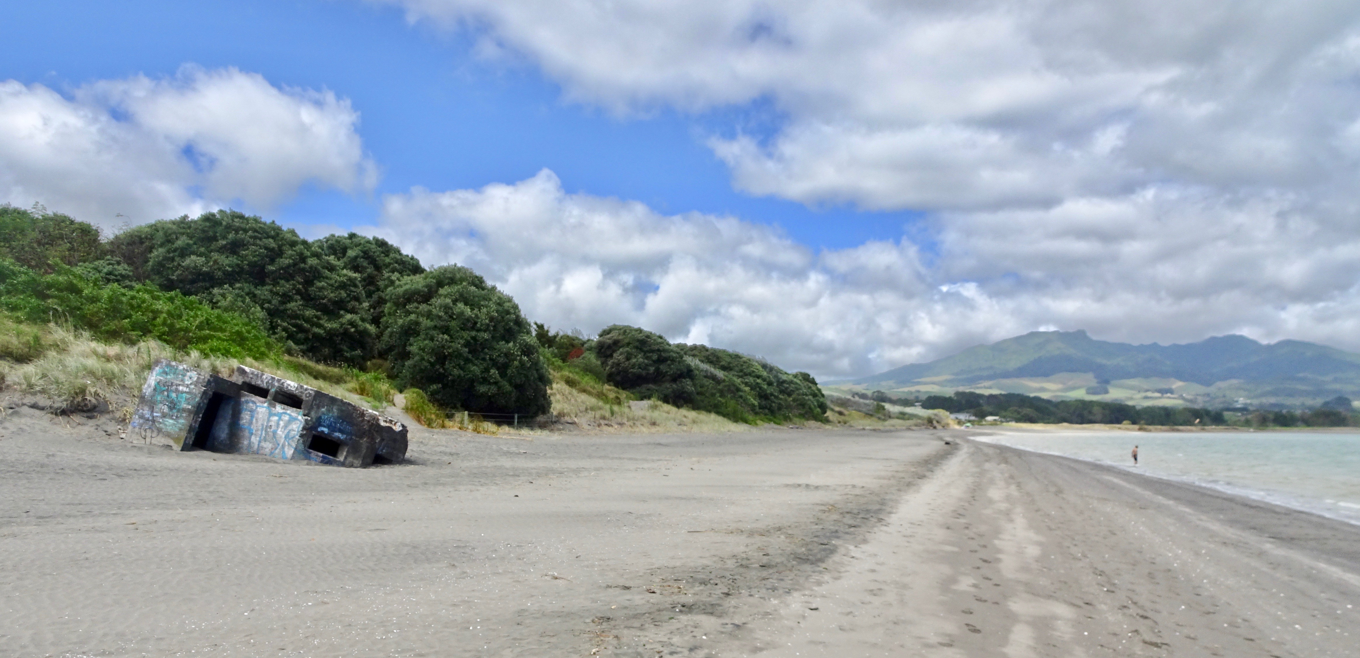
Raglan is a small beachside town located 48 km west of Hamilton, New Zealand on State Highway 23. It is known for its surfing, and volcanic black sand beaches. History The Ngāti Māhanga iwi occupied the area around Raglan in the late 18th century. There are at least 81 archaeological sites in the area, mainly near the coast. Limited radiocarbon dating puts the earliest sites at about 1400AD. The Māori people named the site ("the long pursuit"). One tradition says that Tainui priest, Rakataura, crossed Whāingaroa on his way to Kāwhia. Another says it was among the places the early Te Arawa explorer, Kahumatamomoe, with his nephew Īhenga, visited on their expedition from Maketū. The first Europeans to settle in the area, the Rev James and Mary Wallis, Wesleyan missionaries, were embraced and welcomed by local Māori in 1835. European settlement, including large scale conversion of land to pasture, began in the mid-1850s after a large sale of land by Chief Wirem ... [...More Info...] [...Related Items...] OR: [Wikipedia] [Google] [Baidu] |
Tuakau
Tuakau ( mi, Tūākau) is a town in the Waikato region at the foot of Bombay hills, formerly part of the Franklin district until 2010, when it became part of Waikato District in the North Island of New Zealand. The town serves to support local farming, and is the residence of many employees of New Zealand Steel at Glenbrook. Toponymy The place name is believed to be a geographical reference to the high bluff nearby that offers views down the Waikato river. In Māori the word can mean 'to stand' and 'river bank'. History and culture Pre-European history The area was first used as a trading centre for passing waka that would transport goods up and down the Waikato River. European settlement A flax mill was built in 1855. In 1863 war broke out because the British Crown forced the Waikato people out of their lands just south of the river and the New Zealand Government stationed in Tuakau Imperial troops brought over from Great Britain. To help defend the area the Alexandra Re ... [...More Info...] [...Related Items...] OR: [Wikipedia] [Google] [Baidu] |
Ngāruawāhia
Ngāruawāhia () is a town in the Waikato region of the North Island of New Zealand. It is located north-west of Hamilton at the confluence of the Waikato and Waipā Rivers, adjacent to the Hakarimata Range. Ngāruawāhia is in the Hamilton Urban Area, the fourth largest urban area in New Zealand. The location was once considered as a potential capital of New Zealand. Demographics Ngāaruawāhia covers and had an estimated population of as of with a population density of people per km2. Ngāruawāhia had slightly smaller boundaries in the 2018 Census, covering . It had a population of 6,621, an increase of 1,257 people (23.4%) since the 2013 census, and an increase of 1,287 people (24.1%) since the 2006 census. There were 1,962 households, comprising 3,234 males and 3,384 females, giving a sex ratio of 0.96 males per female, with 1,914 people (28.9%) aged under 15 years, 1,434 (21.7%) aged 15 to 29, 2,661 (40.2%) aged 30 to 64, and 606 (9.2%) aged 65 or older. Ethniciti ... [...More Info...] [...Related Items...] OR: [Wikipedia] [Google] [Baidu] |
Huntly, New Zealand
Huntly ( mi, Rahui-Pōkeka) (population ) is a town in the Waikato district and region of the North Island of New Zealand. It was on State Highway 1 (until Huntly bypass opened in March 2020), south of Auckland and north of Hamilton. It is situated on the North Island Main Trunk (NIMT) railway (served by Te Huia since 6 April 2021 at a rebuilt Raahui Pookeka-Huntly Station) and straddles the Waikato River. Huntly is within the Waikato District which is in the northern part of the Waikato region local government area. History and culture Originally settled by Māori, European migrants arrived in the area some time in the 1850s. The Huntly name was adopted in the 1870s when the postmaster named it after Huntly, Aberdeenshire in Scotland. He used an old 'Huntley Lodge' stamp to stamp mail from the early European settlement. The ''Lodge'' was later dropped and the spelling changed to also drop the additional 'e'. The railway from Auckland reached Huntly in 1877, when the Huntl ... [...More Info...] [...Related Items...] OR: [Wikipedia] [Google] [Baidu] |
Waikato District Council
Waikato District Council ( mi, Te Kaunihera ā-Rohe o Waikato) is the territorial authority for the Waikato District of New Zealand. The council is led by the mayor of Waikato The Mayor of Waikato officiates over the Waikato District of New Zealand's North Island. Jacqui Church is the current mayor. The previous mayor was Allan Sanson, a third generation farmer who had served on the council since 2001 and had been may ..., who is currently . There are also ward councillors. Composition Mayor Councillors * History The council was established in 1989, replacing Raglan County Council (established in 1876), Waikato County Council (established in 1876), Ngāruawāhia Borough Council (established in 1920), and Huntly Borough Council (established in 1931). References External links Official website {{coord, -37.6680745, 175.1487314, display=title Waikato District Politics of Waikato Territorial authorities of New Zealand ... [...More Info...] [...Related Items...] OR: [Wikipedia] [Google] [Baidu] |
Thames, New Zealand
Thames () ( mi, Pārāwai) is a town at the southwestern end of the Coromandel Peninsula in New Zealand's North Island. It is located on the Firth of Thames close to the mouth of the Waihou River. The town is the seat of the Thames-Coromandel (district), New Zealand, Thames-Coromandel District Council. The Māori people, Māori iwi are Ngāti Maru (Hauraki), Ngāti Maru, who are descendants of Marutuahu's son Te Ngako. Ngāti Maru is part of the Ngati Marutuahu confederation of tribes or better known as Hauraki Iwi. Thames had an estimated population of 15,000 in 1870, but this declined to 4,500 in 1881, and it has increased modestly since. It is still the biggest town on the Coromandel. Until 2016, a historical Oak, oak tree that was planted by Governor George Grey stood on the corner of Grey and Rolleston streets. Demographics Thames covers and had an estimated population of as of with a population density of people per km2. Thames had a population of 7,293 at the 2018 Ne ... [...More Info...] [...Related Items...] OR: [Wikipedia] [Google] [Baidu] |


