|
Ă–land
Öland (, ; ; sometimes written ''Oland'' internationally) is the second-largest Swedish island and the smallest of the traditional provinces of Sweden. Öland has an area of and is located in the Baltic Sea just off the coast of Småland. The island has over 26,000 inhabitants. It is separated from the mainland by the Kalmar Strait and connected to it by the Öland Bridge, which opened on 30 September 1972. The county seat Kalmar is on the mainland at the other end of the bridge and is an important commercial centre related to the Öland economy. The island's two municipalities are Borgholm and Mörbylånga named after their municipal seats. Much of the island is farmland, with fertile plains aided by the mild and sunny weather during summer. Öland does not have separate political representation at the national level, and is fully integrated into Sweden as part of Kalmar County. Administration The traditional provinces of Sweden no longer serve administrative or ... [...More Info...] [...Related Items...] OR: [Wikipedia] [Google] [Baidu] |
Ă–land Bridge
The Öland Bridge ( Swedish: ''Ölandsbron'') is a road bridge in Sweden that spans the Kalmar Strait, between Jutnabben in Kalmar on the mainland and Möllstorp in Algutsrum parish near Färjestaden on Öland in the Baltic Sea. It is a long beam bridge with a clear bridge width of . Maximum height , minimum height . The bridge is built of reinforced concrete in 155 spans, including the high bridge section in 6 spans of , and has a characteristic hump at its western end which was created to provide a vertical clearance of for shipping. The Öland Bridge is one of the longest in all of Europe (the longest one until completion of Vasco da Gama Bridge in 1998) and currently Sweden's longest bridge, if one only compares the bridge sections that are on Swedish territory (the Öresund Bridge, which is longer, is partly built on Danish territory). A little to the south of the western end of the bridge a small wooden pedestrian and bicycle bridge, around in length and connecti ... [...More Info...] [...Related Items...] OR: [Wikipedia] [Google] [Baidu] |
Ă–land County
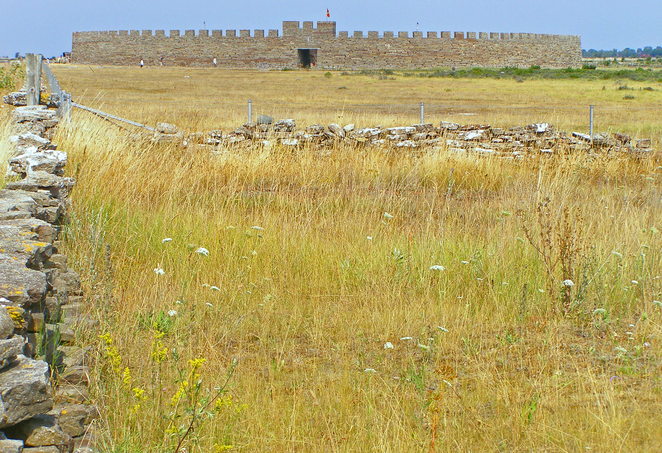
Öland County, or ''Ölands län'', was a county of Sweden, between 1819 and 1826. It consisted of the island of Öland, designating the historical province of Öland as its own county. A Governor resided briefly at Borgholm, but the island is today part of the Kalmar County. Some important historical sites in Öland County are: Borgholm Castle, Halltorps Estate, Eketorp fortress and the Gettlinge Gravefield. Much of Öland County's present day landscape known as the Stora Alvaret has been designated as a World Heritage Site. Governors * (1819–1821) * (1821–1826) See also * List of governors of Kalmar County * County Governors of Sweden References {{DEFAULTSORT:Oland Former counties of Sweden County A county () is a geographic region of a country used for administrative or other purposesL. Brookes (ed.) '' Chambers Dictionary''. Edinburgh: Chambers Harrap Publishers Ltd, 2005. in some nations. The term is derived from the Old French denoti ... 1820 ... [...More Info...] [...Related Items...] OR: [Wikipedia] [Google] [Baidu] |
Mörbylånga Municipality
Mörbylånga Municipality () is a Municipalities of Sweden, municipality in Kalmar County, in south-eastern Sweden, located on the island of Öland in the Baltic Sea. The seat is located in the town of Mörbylånga, while the largest town is Färjestaden. The present municipality, making up the southern part of Öland, was formed in 1974. The eighteen original entities (as of 1863) had during the nationwide subdivision reform of 1952 been regrouped into three larger units. ''Ottenby'' was amalgamated with Mörbylånga in 1967 and 1974 ''Torslunda'' was added. Mörbylånga Municipality contains several ancient remains, just like the northern Öland municipality of Borgholm Municipality, Borgholm. All in all, there are about 20 hillforts on Öland. The most notable in southern Öland is the fortress Eketorp. The southern parts of Öland contain certain wildlife areas. Many migratory birds halt here on their way north or south. Especially the southernmost outpost, the lighthouse ''L ... [...More Info...] [...Related Items...] OR: [Wikipedia] [Google] [Baidu] |
Kalmar County
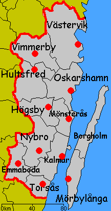
Kalmar County () is a Counties of Sweden, county or ''län'' in southern Sweden. It borders the counties of Kronoberg County, Kronoberg, Jönköping County, Jönköping, Blekinge County, Blekinge and Östergötland County, Östergötland. To the east in the Baltic Sea is the island Gotland County, Gotland. The counties are mainly administrative units. Geographically Kalmar County covers the eastern part in the Småland province, and the entire island of Öland. Culture Much of Öland's present day landscape known as the Stora Alvaret has been designated as a World Heritage Site by UNESCO. This southern part of Öland is known for a large number of rare species; early Paleolithic settlement at Alby, Öland, Alby; other prehistoric remains such as the Gettlinge Gravefield and Eketorp Fortress; and the Ottenby Nature Preserve. Administration Kalmar County was integrated with Kronoberg County until 1672. Blekinge County, Blekinge was a part of Kalmar County between 1680 and 168 ... [...More Info...] [...Related Items...] OR: [Wikipedia] [Google] [Baidu] |
Kalmar Strait
The Kalmar Strait () is a strait in the Baltic Sea, located between the Swedish island of Öland and the province of Småland of the Swedish mainland. The strait is about long and between and in width. There is a road bridge across the strait, the Öland Bridge, opened in September 1972. Prehistory The areas along the Kalmar Strait have a heritage of Neolithic and Bronze Age habitation. Moreover, Mesolithic people crossed the strait on an ice bridge in the early Holocene period as glaciers began to recede from Öland. A place where early Mesolithic settlement of the island of Öland occurred is Alby, whose people migrated across the Kalmar Strait approximately 6000 BC. They established one of the oldest known Mesolithic villages in Northern Europe The northern region of Europe has several definitions. A restrictive definition may describe northern Europe as being roughly north of the southern coast of the Baltic Sea, which is about 54th parallel north, 54°N, or m ... [...More Info...] [...Related Items...] OR: [Wikipedia] [Google] [Baidu] |
Borgholm Municipality
Borgholm Municipality () is a municipality in Kalmar County, south-eastern Sweden, constituting the northern half of the island of Öland in the Baltic Sea. The municipal seat is located in the city of Borgholm. Notable historic sites in this municipality are Borgholm Castle and Halltorps Estate. The local government reform in the 1970s saw the creation of two municipalities on the island of Öland. Borgholm Municipality is the northern of the two and consists of sixteen original (pre-1952) entities. The southern half of the island is made up of Mörbylånga Municipality. It is the birthplace of John Eke, A long distance runner who competed in the 1912 Olympics, He later competed for the Irish American Athletic Club in NYC Localities There are 5 urban areas (also called Tätort or localities) in Borgholm Municipality. In the table the localities are listed according to the size of the population as of December 31, 2005. The municipal seat is in bold characters. Sister ... [...More Info...] [...Related Items...] OR: [Wikipedia] [Google] [Baidu] |
Kalmar
Kalmar (, , ) is a city in the southeast of Sweden, situated by the Baltic Sea. It had 41,388 inhabitants in 2020 and is the seat of Kalmar Municipality. It is also the capital of Kalmar County, which comprises 12 municipalities with a total of 236,399 inhabitants (2015). Kalmar is the third largest urban area in the province and cultural region of SmĂĄland. From the thirteenth to the seventeenth centuries, Kalmar was one of Sweden's most important cities. Its name was until the second half of the nineteenth century spelled '' Calmar. '' Between 1602 and 1913 it was the episcopal see of Kalmar Diocese, with a bishop, and the Kalmar Cathedral from 1702 is an example of classicistic architecture. It became a fortified city, with the Kalmar Castle as the center. After the Treaty of Roskilde in 1658, Kalmar's importance diminished, until the industry sector was initiated in the 19th century. The city is home to parts of Linnaeus University. The city plays host to the Live at ... [...More Info...] [...Related Items...] OR: [Wikipedia] [Google] [Baidu] |
SmĂĄland
Småland () is a historical Provinces of Sweden, province () in southern Sweden. Småland borders Blekinge, Scania, Halland, Västergötland, Östergötland and the island Öland in the Baltic Sea. The name ''Småland'' literally means "small lands", referring to many small historic provinces from which it was composed. The Latinized form has been used in other languages. The highest point in Småland is Tomtabacken, at 377 metres (1,237 ft). In terms of total area, Småland is similar in size to Belgium and Israel. Administration Whilst the traditional provinces of Sweden no longer serve any governmental purpose ''per se'', they do retain historical and cultural importance. The province of Småland today is divided almost entirely into the three administrative Counties of Sweden, counties of Jönköping County, Jönköping, Kalmar County, Kalmar, and Kronoberg County, Kronoberg. Some few small portions of historic Småland are situated in Halland County, Halland and Öst ... [...More Info...] [...Related Items...] OR: [Wikipedia] [Google] [Baidu] |
Provinces Of Sweden
The 25 provinces of Sweden () are historical, geographical and cultural regions. They have no administrative function, but retain their own cultural identities, dialects and folklore. Several were administrative subdivisions until 1634, when they were replaced by the counties of Sweden (). Some were conquered later on from Denmark–Norway. Others, like the provinces of Finland, have been lost. In some cases, the county and province borders correspond almost exactly, as with Blekinge and Blekinge County. The island of Gotland is both a province, a county and a municipality (''kommun''). The only other province to share a name with a modern municipality is Härjedalen, though the borders are not quite the same. Administrative borders are subject to change – for example, several of today's counties were created in the 1990s – while the provincial borders have remained stable for centuries. All the provinces are also ceremonial duchies, but as such have no administrati ... [...More Info...] [...Related Items...] OR: [Wikipedia] [Google] [Baidu] |
Ă…land
Åland ( , ; ) is an Federacy, autonomous and Demilitarized zone, demilitarised region of Finland. Receiving its autonomy by a 1920 decision of the League of Nations, it is the smallest region of Finland by both area () and population (30,541), constituting 0.51% of Finland's land area and 0.54% of its population. Its only official language is Swedish language, Swedish and the capital city is Mariehamn. Åland is situated in an archipelago, called the Åland Islands, at the entrance to the Gulf of Bothnia in the Baltic Sea. It comprises Fasta Åland, on which 90% of the population resides, and about 6,500 Skerry, skerries and islands to its east, of which about 60–80 are inhabited. Fasta Åland is separated from the coast of Roslagen in Sweden by of open water to the west. In the east, the Åland archipelago is Geographic contiguity, contiguous with the Archipelago Sea, Finnish archipelago. Åland's only land border is located on the uninhabited skerry of Märket, which it ... [...More Info...] [...Related Items...] OR: [Wikipedia] [Google] [Baidu] |


