|
Oman–Yemen Border
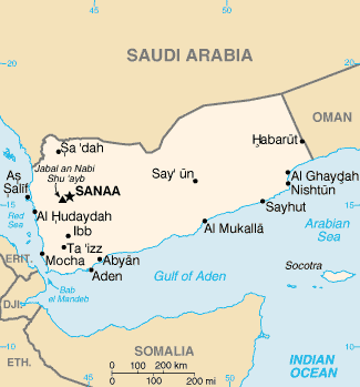
The Oman–Yemen border is 294 km (183 mi) in length and runs from the tripoint with Saudi Arabia in the north to the Arabian Sea in the south. Description The border consists essentially of a single straight line orientated NW-SE, from the Saudi tripoint down to the Arabian Sea coast at Ras Darbat Ali. The exception is a small triangular 'kink' roughly halfway along the boundary line, which juts into Yemen so as to include the town of Habarut within Oman. Topographically the border traverses the Rub' al Khali desert in the north and the Jabal Qamar in the Dhofar Mountains in the south. History The far east of what is today Yemen historically formed the Sultanate of Mahra, which became part of Britain's Aden Protectorate in 1866, though retaining a degree of autonomy. In this period Oman was under an informal British protectorate. Oman had asserted its rule over the south-western Dhofar region in 1829. A border between the Aden and Oman was not demarcated during ... [...More Info...] [...Related Items...] OR: [Wikipedia] [Google] [Baidu] |
