|
Niğde Province
Niğde Province () is a Provinces of Turkey, province in the southern part of Central Anatolia, Turkey. Its area is 7,234 km2, and its population is 365,419 (2022) of which 170,511 live in the city of Niğde. The population was 348,081 in 2000 and 305,861 in 1990. Neighbouring provinces are Kayseri Province, Kayseri, Adana Province, Adana, Mersin Province, Mersin, Konya Province, Konya, Aksaray Province, Aksaray and Nevşehir Province, Nevşehir. The province is surrounded on three sides by mountain ranges: the Taurus Mountains, Mount Hasan, and the Melendiz Mountains. Districts Niğde province is divided into 6 Districts of Turkey, districts (capital district in bold): * Altunhisar District, Altunhisar * Bor District, Niğde, Bor * Çamardı District, Çamardı * Çiftlik District, Çiftlik * Niğde District, Niğde * Ulukışla District, Ulukışla Some of the towns within these districts are Bademdere, Bahçeli, Niğde, Bahçeli, Çiftehan, Darboğaz, Fertek and Kemerhis ... [...More Info...] [...Related Items...] OR: [Wikipedia] [Google] [Baidu] |
Aladağlar National Park
The Aladağlar National Park (), established on April 21, 1995, is in southern Turkey. Its name, meaning Crimson Mountains, is said to have been given to it because of the rusty colour the mountains acquire towards sunset. A part of the Anti-Taurus Mountains, the national parks covers at an average elevation of above sea level spreading over parts of the districts of Yahyalı in Kayseri province, Çamardı in Niğde province and Aladağ in Adana province Adana Province () is a Provinces of Turkey, province and Metropolitan municipalities in Turkey, metropolitan municipality of Turkey located in central Cilicia. The administrative seat of the province is the city of Adana, home to 78.25% of the r .... The Aladağlar contains four climbable peaks that are higher than 3700m. The highest peak is Kızılkaya with a height of 3767m. Many lakes and waterfalls form here once the snow melts in early spring. File:Yelatan Aladağlar 01.jpg, Yelatan village Aladağlar References ... [...More Info...] [...Related Items...] OR: [Wikipedia] [Google] [Baidu] |
Altunhisar District
Altunhisar District is a district of the Niğde Province of Turkey. Its seat is the town of Altunhisar.İlçe Belediyesi Turkey Civil Administration Departments Inventory. Retrieved 1 March 2023. Its area is 552 km2, and its population is 11,558 (2022). Composition There are three in Altunhisar District: * * Karakapı * Keçikalesi T ...[...More Info...] [...Related Items...] OR: [Wikipedia] [Google] [Baidu] |
Anahita
Anahita is the Old Persian form of the name of an Iranian goddess and appears in complete and earlier form as ('), the Avestan name of an Indo-Iranian cosmological figure venerated as the divinity of "the Waters" ( Aban) and hence associated with fertility, healing and wisdom. There is also a temple named Anahita in Iran. Aredvi Sura Anahita is ''Ardwisur Anahid'' (اردویسور آناهید) in Middle and Modern Persian, and '' Anahit'' in Armenian. An iconic shrine sects of Aredvi Sura Anahita was, together with other shrine sects, "introduced apparently in the 4th century BCE and lasted until it was suppressed in the wake of an iconoclastic movement under the Sasanids.". The symbol of goddess Anahita is the Lotus flower. Lotus Festival (Persian: Jashn-e Nilupar) is an Iranian festival that is held on the end of the first week of July. Holding this festival at this time was probably based on the blooming of lotus flowers at the beginning of summer. The Greek and R ... [...More Info...] [...Related Items...] OR: [Wikipedia] [Google] [Baidu] |
Kemerhisar
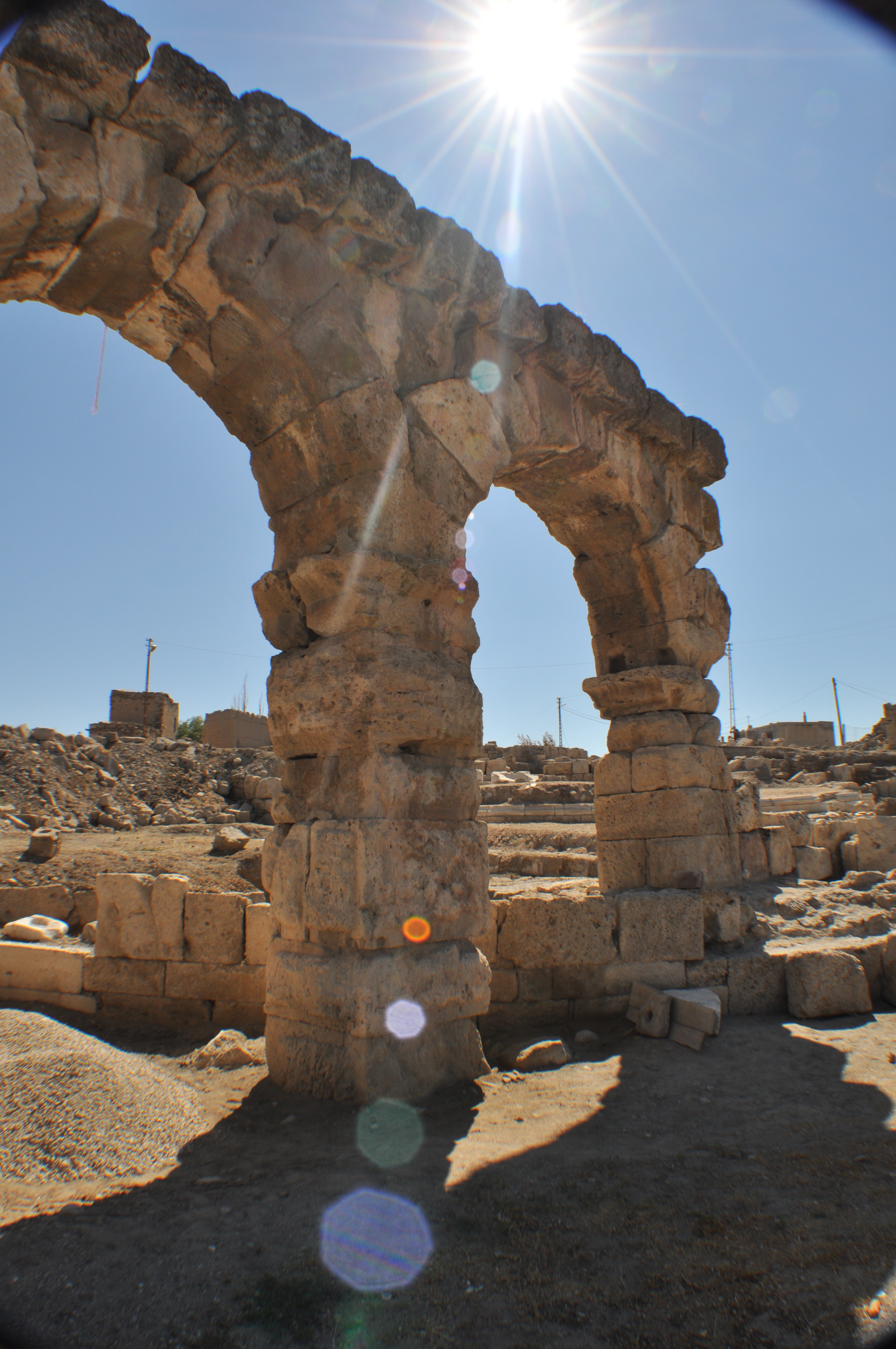
Kemerhisar is a town (''belde'') in the Bor District, Niğde, Bor District, Niğde Province, Turkey. Its population is 5,463 (2022). Geography The distance from Kemerhisar to Bor, Niğde, Bor is and to Niğde is . It is only west of Bahçeli, Niğde, Bahçeli, another town of Niğde. History The earliest name of Kemerhisar was ''Tuwanuwa''. It was an important Hittites, Hittite city on the way to Cilician Gates in Taurus Mountains, Toros Mountains. During the Hellenistic age, the name was Tyana. It was briefly the capital of Cappadocia#History, Cappadocia, the vassal of Roman Empire. Apollonius of Tyana, a contemporary of Christ, was born in Tyana. The town was an important settlement during Roman Empire domination and the aqueduct, which is the symbol of the town, had been constructed by the emperors Trajan and Hadrian. After the town was incorporated into the Seljuk Empire in the 11th century, the Turkish people, Turks called the city ''Kilisehisar'' (Churchfort). The n ... [...More Info...] [...Related Items...] OR: [Wikipedia] [Google] [Baidu] |
Fertek
Fertek is a neighbourhood of the city of Niğde in the Niğde Province, Turkey. Its population is 9,287 (2022). Before the 2013 reorganisation, it was a town (''belde''). It has a history going back to the 3rd century, starting with the settlement of Karamanlides. The town went through Byzantine, Seljuk, and Ottoman histories. History In Turkish, Arabic, and Persian, the word "Rum" refers to Rome and the Romans. Thus, the Greeks living in Fertek were referred to as Rum, by the Turks. Rum also implies the continuity of the ancient Roman Empire in the Byzantine millennium, as well as meaning "Romans of Asia Minor". However, the Greeks living in Fertek referred to themselves as "Karamanlides, meaning Greeks of Karaman. Karamanlides. Thus, in this article, the Greek Orthodox community, or Rum, is referred to as Karamanlides. Early history There is no strong evidence as to when exactly was Fertek settled. From the existence of the "underground city", the beginnings are traced t ... [...More Info...] [...Related Items...] OR: [Wikipedia] [Google] [Baidu] |
Darboğaz
Darboğaz is a village in Ulukışla District, Niğde Province, Turkey. Its population is 1,479 (2022). Before the 2013 reorganisation, it was a town (''belde''). Geography Darboğaz is a mountain town with an average altitude of . The highway distance to Ulukışla is , and to Niğde is . History There are no written sources of the deep history of the town. The vicinity was probably inhabited during the Byzantine Empire era. The town's earliest settlers were the members of a Turkmen tribe in the 17th century. According to legend, the tribe leader was playing tar, a musical instrument, and the earliest name of the settlement was tarbaz or tar player. (The legend, if true, may show an Azerbaijani origin of the tribe.) That name may be the source of the modern name, which also means "narrow pass". Darboğaz was declared a township in 1968. Economy The main economic activity is agriculture, especially cherry horticulture. The annual cherry production exceeds . Beekeepi ... [...More Info...] [...Related Items...] OR: [Wikipedia] [Google] [Baidu] |
Çiftehan
Çiftehan is a resort village in Ulukışla District, Niğde Province, Turkey. Its population is 958 (2022). Before the 2013 reorganisation, it was a town (''belde''). Geography Çiftehan is in the Toros Mountains at an altitude of about , north of the main passage of the mountain system known as Cilician Gates (). It is east of Ulukışla and south of Niğde. History A settlement in Cappadocia under the Roman Empire was named ''aquae calidae'' ('hot waters' after nearby thermal springs). The thermal baths were used in Roman times. The spa pools constructed by the Seljuk Turks The Seljuk dynasty, or Seljukids ( ; , ''Saljuqian'',) alternatively spelled as Saljuqids or Seljuk Turks, was an Oghuz Turks, Oghuz Turkic, Sunni Muslim dynasty that gradually became Persianate society, Persianate and contributed to Turco-Persi ... (11th century-13th century) survive. References {{DEFAULTSORT:Ciftehan Spa towns in Turkey Tourist attractions in Niğde Province Villages ... [...More Info...] [...Related Items...] OR: [Wikipedia] [Google] [Baidu] |
Bahçeli, Niğde
Bahçeli is a town (''belde'') in the Bor District, Niğde Province, Turkey. Its population is 2,179 (2022). Geography Bahçeli is very close to Kemerhisar, another town in Niğde Province. Distance to Kemerhisar is to Bor is and to Niğde is . History According to radiocarbon dating (14C) in Köşkhöyük tumulus within Bahçeli earliest settlement in Bahçeli may be as old as 5000 BC. The nearby town Kemerhisar was a major settlement named Tyana in ancient ages and Bahçeli was a part of Tyana. The most important relic from the Roman Empire domination is a big Roman bath. After the Roman period, the settlement lost its former glory. It was a village during the Medieval ages In the history of Europe, the Middle Ages or medieval period lasted approximately from the 5th to the late 15th centuries, similarly to the post-classical period of global history. It began with the fall of the Western Roman Empire and .... After 1954, it was declared township. Econo ... [...More Info...] [...Related Items...] OR: [Wikipedia] [Google] [Baidu] |
Bademdere
Bademdere is a village in Çamardı District, Niğde Province, Turkey. Its population is 1,042 (2022). Before the 2013 reorganisation, it was a town (''belde''). Geography The distance to Çamardı is and to Niğde is . The town is on the northern slopes of Taurus Mountains with an average altitude of . History The settlement was established in the 18th century by miners from Gümüşhane Province Gümüşhane Province ( Pontic Greek, Romeika: Αργυρούπολη) is a Provinces of Turkey, province in northern Turkey, bordering Bayburt Province, Bayburt to the east, Trabzon Province, Trabzon to the north, Giresun Province, Giresun and E ... in the Black Sea region who worked in mines in the Taurus Mountains. In 1972 the settlement was declared a township. References {{Authority control Villages in Çamardı District ... [...More Info...] [...Related Items...] OR: [Wikipedia] [Google] [Baidu] |
Ulukışla District
Ulukışla District is a district of the Niğde Province of Turkey. Its seat is the town of Ulukışla.İlçe Belediyesi Turkey Civil Administration Departments Inventory. Retrieved 1 March 2023. Its area is 1,375 km2, and its population is 18,983 (2022). Composition There is one in Ulukışla District: * Ulukışla There are 38 in Ulukışla District:[...More Info...] [...Related Items...] OR: [Wikipedia] [Google] [Baidu] |
Niğde District
Niğde District (also: ''Merkez'', meaning "central" in Turkish) is a district of the Niğde Province of Turkey. Its seat is the city of Niğde.İl Belediyesi Turkey Civil Administration Departments Inventory. Retrieved 1 March 2023. Its area is 2,223 km2, and its population is 236,793 (2022). Composition There are 16 in Niğde District: * Aktaş * Alay * |


