|
Lüderitz
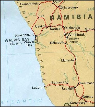
Lüderitz is a town in the ǁKaras Region of southern Namibia. It lies on one of the least hospitable coasts in Africa. It is a port developed around Robert Harbour and Shark Island. Lüderitz had a population of 16,125 people in 2023. The town is known for its colonial architecture, including some Art Nouveau work, and for wildlife including seals, penguins, flamingos and ostriches. It is also home to a museum and lies at the end of a decommissioned railway line to Keetmanshoop. The town is named after Adolf Lüderitz, founder of the German South West Africa colony. Economy and infrastructure The centre of Lüderitz' economic activity is the port, until the incorporation of the exclave Walvis Bay in 1994 the only suitable harbour on Namibia's coast. However, the harbour at Lüderitz has a comparatively shallow rock bottom, making it unusable for many modern ships. The recent addition of a new quay has allowed larger fishing vessels to dock at Lüderitz. The town has a ... [...More Info...] [...Related Items...] OR: [Wikipedia] [Google] [Baidu] |
Adolf Lüderitz
Franz Adolf Eduard Lüderitz (16 July 1834 – end of October 1886) was a German merchant and the founder of German South West Africa, Imperial Germany's first colony. The coastal town of Lüderitz, located in the ǁKaras Region of southern Namibia, is named after him. Early life Lüderitz was born on 16 July 1834 in the German city-state of Bremen to tobacco merchant Adolf Lüderitz and his wife Wilhelmine. He had one younger brother who later became his assistant. After graduating from school, Lüderitz attended the ''Handelsschule'' (Merchant's Gymnasium) in Bremen and then worked as an intern in his father's business. Between 1854 and 1859, he travelled among tobacco bourses in North America. He took up a position in Mexico, but the trader soon went bankrupt. He then bought a tobacco farm himself which was destroyed shortly thereafter during the Reform War. Bankrupt, he returned to Germany in 1859 and entered his father's business. His 1866 marriage to Emilie Louise ( ... [...More Info...] [...Related Items...] OR: [Wikipedia] [Google] [Baidu] |
ǁKaras Region
The ǁKharas Region (pronounced , with a lateral click, former name Karas Region, without the click) is the southernmost, largest, and least densely populated of the 14 regions of Namibia; its capital is Keetmanshoop. The name assigned to the region reflects the prominence of the Karas mountain range in its southern part. The ǁKharas region contains the municipality of Keetmanshoop, the towns Karasburg, Lüderitz and Oranjemund, and the self-governed villages Aroab, Berseba, Bethanie, Koës and Tses. ǁKharas' western border is the shores of the Atlantic Ocean. Its location in Namibia's south means that it shares a long border in the south and east with the Northern Cape Province of South Africa. Domestically, it borders only the Hardap Region, to the north. Politics As of 2020, ǁKharas had 56,352 registered voters. The name of this region was ''Karas Region'' (without the alveolar lateral click of the Khoekhoegowab language) since Namibian independence in 1990. I ... [...More Info...] [...Related Items...] OR: [Wikipedia] [Google] [Baidu] |
ǃNamiǂNûs Constituency
ǃNamiǂNûs (; until 2013 Lüderitz) is an electoral constituency in the ǁKaras Region of Namibia. It covers an area of and contains the major town of Lüderitz, after which the constituency was originally named. In 2011, it had a population of 13,859, down from 14,542 in 2001. the constituency had 9,670 registered voters. Politics ǃNamiǂNûs Constituency is traditionally a stronghold of the South West Africa People's Organization (SWAPO) party. In the 2004 regional elections, its candidate David Shoombe was elected with 4,135 of the 4,468 votes cast. In the 2010 regional elections, Jan Albertus Scholtz (SWAPO) won the constituency with 3,526 votes. His only challenger was Phyllicia Maree’ Hercules of the Rally for Democracy and Progress, who received 559 votes. In the 2015 regional elections Swapo won the constituency without any contesting opposition candidate. The 2020 regional election saw six candidates competing for the councillor position and was only narro ... [...More Info...] [...Related Items...] OR: [Wikipedia] [Google] [Baidu] |
German South West Africa
German South West Africa () was a colony of the German Empire from 1884 until 1915, though Germany did not officially recognise its loss of this territory until the 1919 Treaty of Versailles. German rule over this territory was punctuated by numerous rebellions by its native African peoples, which culminated in a campaign of German reprisals from 1904 to 1908 known as the Herero and Nama genocide. In 1915, during World War I, German South West Africa was invaded by the Western Allies in the form of South African and British forces. After the war its administration was taken over by the Union of South Africa (part of the British Empire) and the territory was administered as South West Africa under a League of Nations mandate. It became independent as Namibia on 21 March 1990. Early settlements Initial European contact with the areas which would become German South West Africa came from traders and sailors, starting in January 1486 when Portuguese explorer Diogo Cão, poss ... [...More Info...] [...Related Items...] OR: [Wikipedia] [Google] [Baidu] |
Art Nouveau
Art Nouveau ( ; ; ), Jugendstil and Sezessionstil in German, is an international style of art, architecture, and applied art, especially the decorative arts. It was often inspired by natural forms such as the sinuous curves of plants and flowers. Other characteristics of Art Nouveau were a sense of dynamism and movement, often given by asymmetry or whiplash lines, and the use of modern materials, particularly iron, glass, ceramics and later concrete, to create unusual forms and larger open spaces.Sembach, Klaus-Jürgen, ''L'Art Nouveau'' (2013), pp. 8–30 It was popular between 1890 and 1910 during the Belle Époque period, and was a reaction against the academicism, eclecticism and historicism of 19th century architecture and decorative art. One major objective of Art Nouveau was to break down the traditional distinction between fine arts (especially painting and sculpture) and applied arts. It was most widely used in interior design, graphic arts, furniture, glass ... [...More Info...] [...Related Items...] OR: [Wikipedia] [Google] [Baidu] |
Shark Island, Namibia
Shark Island () is a small peninsula adjacent to the coastal city of Lüderitz in Namibia. Its area is about . former island, Formerly an island, it became a peninsula from 1906 on by the creation of a wide land connection that doubled its former size. It had been formerly named Star Island by British Captain Alexander during his 1795 surveying expedition. Concentration camp The island was site of Shark Island concentration camp, Shark Island death camp. It was Namibia's first large-scale death camp. Close to 1,800 Nama prisoners arrived in September 1906, including Cornelius Frederiks, one of the strongest Nama military leaders. Shark Island has been called the "blueprint" for what the Nazism, Nazis would later perpetrate in the The Holocaust, Holocaust during World War II. Long before Adolf Hitler, Hitler or the Nazis, the Germans shipped the Nama people to a remote location, where they performed experiments on the Nama and worked them to death. References External links ... [...More Info...] [...Related Items...] OR: [Wikipedia] [Google] [Baidu] |
Constituencies Of Namibia
Each of the 14 regions of Namibia is further subdivided into Electoral district, electoral constituencies. The size of the constituencies varies with the size and population of each region. There are currently 121 constituencies in Namibia. The most populous constituency according to the 2011 census was Rundu Urban in the Kavango East region with 63,431 people; the least populous was Okatyali Constituency, Okatyali in the Oshana Region with 3,187 people. Local councillors are directly elected through secret ballots (regional elections) by the inhabitants of their constituencies. They occupy a constituency office in the main settlement of their district. However, once elected they keep their full-time job and are expected to run their constituencies after hours. Consequently, they receive allowances rather than salaries, although the remuneration does compare to a mid-range salaried position. Regional councillors are indirectly elected from and by the constituency councillors i ... [...More Info...] [...Related Items...] OR: [Wikipedia] [Google] [Baidu] |
Namibia
Namibia, officially the Republic of Namibia, is a country on the west coast of Southern Africa. Its borders include the Atlantic Ocean to the west, Angola and Zambia to the north, Botswana to the east and South Africa to the south; in the northeast, approximating a quadripoint, Zimbabwe lies less than 200 metres (660 feet) away along the Zambezi, Zambezi River near Kazungula, Zambia. Namibia's capital and largest city is Windhoek. Namibia is the driest country in sub-Saharan Africa, and has been inhabited since prehistoric times by the Khoekhoe, Khoi, San people, San, Damara people, Damara and Nama people. Around the 14th century, immigration, immigrating Bantu peoples arrived as part of the Bantu expansion. From 1600 the Ovambo people#History, Ovambo formed kingdoms, such as Ondonga and Oukwanyama. In 1884, the German Empire established rule over most of the territory, forming a colony known as German South West Africa. Between 1904 and 1908, German troops waged a punitive ... [...More Info...] [...Related Items...] OR: [Wikipedia] [Google] [Baidu] |
Quay
A wharf ( or wharfs), quay ( , also ), staith, or staithe is a structure on the shore of a harbour or on the bank of a river or canal where ships may dock to load and unload cargo or passengers. Such a structure includes one or more Berth (moorings), berths (Mooring (watercraft), mooring locations), and may also include piers, warehouses, or other facilities necessary for handling the ships. Wharves are often considered to be a series of docks at which boats are stationed. A marginal wharf is connected to the shore along its full length. Overview A wharf commonly comprises a fixed platform, often on deep foundation, pilings. Commercial ports may have warehouses that serve as interim storage: where it is sufficient a single wharf with a single berth constructed along the land adjacent to the water is normally used; where there is a need for more capacity multiple wharves, or perhaps a single large wharf with multiple berths, will instead be constructed, sometimes projecting ov ... [...More Info...] [...Related Items...] OR: [Wikipedia] [Google] [Baidu] |
Walvis Bay
Walvis Bay (; ; ) is a city in Namibia and the name of the bay on which it lies. It is the List of cities in Namibia, second largest city in Namibia and the largest coastal city in the country. The city covers an area of of land. The bay is a haven for sea vessels due to its natural deep-water harbour, protected by the Pelican Point sand spit, which is the only natural harbour of any size along the country's coast. Being rich in plankton and marine life, these waters also draw large numbers of southern right whales, attracting whalers and fishing vessels. A succession of colonists developed the location and resources of this strategic harbour settlement. The harbour's value about the sea route around the Cape of Good Hope had caught the attention of world powers since it was discovered by the outside world in 1485. The importance of the harbour, combined with its extreme isolation by land, explains the complicated political history of the town. For much of its history, Walvis ... [...More Info...] [...Related Items...] OR: [Wikipedia] [Google] [Baidu] |
Exclave
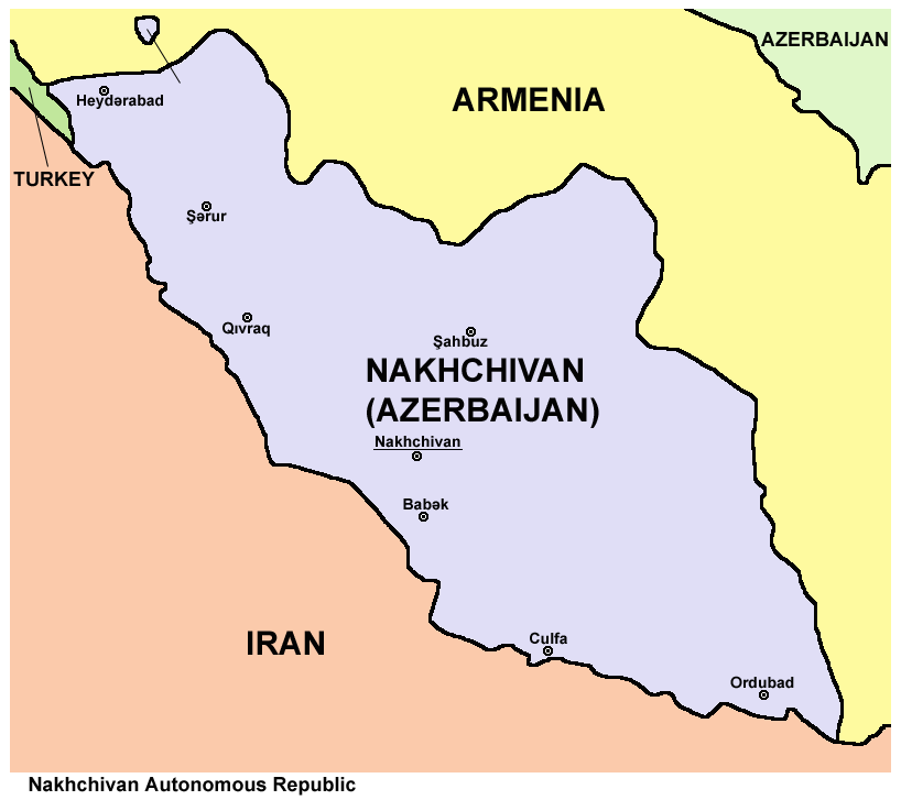
An enclave is a territory that is entirely surrounded by the territory of only one other state or entity. An enclave can be an independent territory or part of a larger one. Enclaves may also exist within territorial waters. ''Enclave'' is sometimes used improperly to denote a territory that is only partly surrounded by another state. Enclaves that are not part of a larger territory are not exclaves, for example Lesotho (enclaved by South Africa), and San Marino and Vatican City (both enclaved by Italy) are enclaved sovereign states. An exclave is a portion of a state or district geographically separated from the main part, by some surrounding alien territory. Many exclaves are also enclaves, but an exclave surrounded by the territory of more than one state is not an enclave. The Azerbaijani exclave of Nakhchivan is an example of an exclave that is not an enclave, as it borders Armenia, Iran, and Turkey. Semi-enclaves and semi-exclaves are areas that, except for possessing ... [...More Info...] [...Related Items...] OR: [Wikipedia] [Google] [Baidu] |
Waterfront (area)
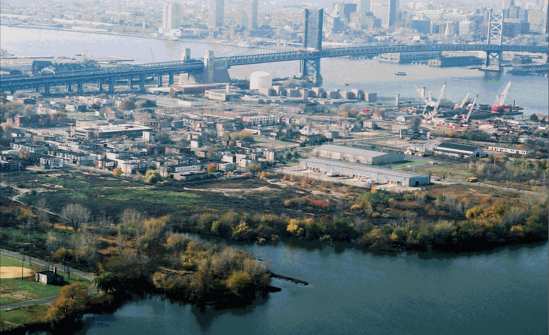
The waterfront area of a city or town is its maritime docks, dockland district, or the area alongside a body of water. List of examples Africa * Alexandria Corniche * V&A Waterfront Americas * Baltimore Inner Harbo * Detroit International Riverfront * Embarcadero (San Francisco) * Embarcadero (San Diego) * Puerto Madero * Toronto waterfront Asia * Central Harbourfront * Dubai Waterfront * Sabarmati Riverfront * Tel Aviv Port * Minato Mirai 21 * Mira Coral Bay * Odaiba Europe * Belgrade Waterfront * Bratislava Riverfront * Camden Waterfront * Dublin Docklands * HafenCity * Ipswich Waterfront * London Docklands * Port Vell * Ruoholahti * Valletta Waterfront Oceania * Auckland waterfront * Barangaroo * Circular Quay * Docklands, Victoria * Elizabeth Quay * South Bank Parklands See also *Esplanade References External links {{Authority control Docks (maritime) Cityscapes Waterfronts ... [...More Info...] [...Related Items...] OR: [Wikipedia] [Google] [Baidu] |


