|
Košice
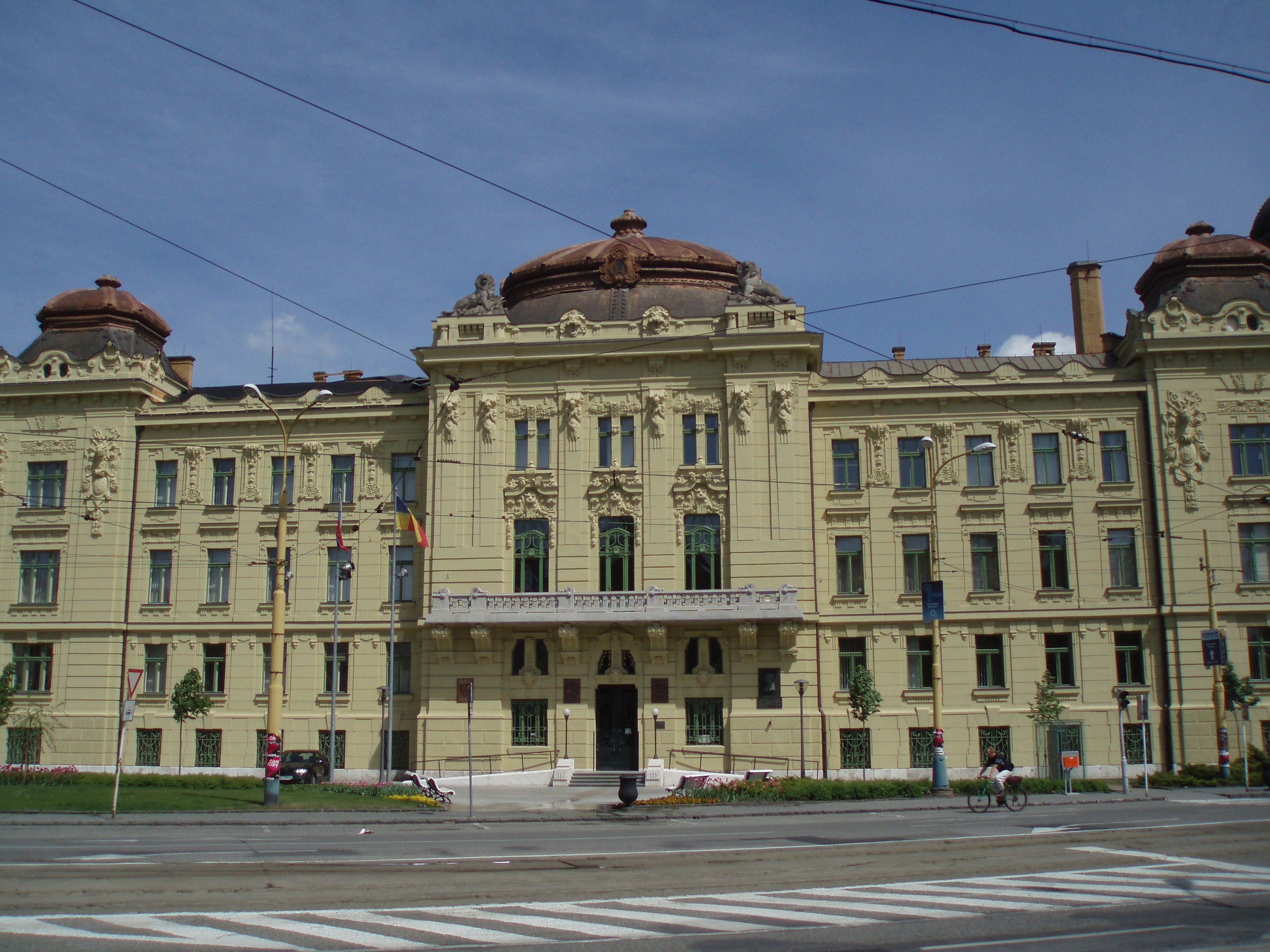
Košice is the largest city in eastern Slovakia. It is situated on the river Hornád at the eastern reaches of the Slovak Ore Mountains, near the border with Hungary. With a population of approximately 230,000, Košice is the second-largest city in Slovakia, after the capital Bratislava. Being the economic and cultural centre of eastern Slovakia, Košice is the seat of the Košice Region and Košice Self-governing Region, it belongs to the :sk:Košicko-prešovská aglomerácia, Košice-Prešov agglomeration, and is home to the Constitutional Court of Slovakia, Slovak Constitutional Court, three universities, various dioceses, and many museums, galleries, and theatres. In 2013, Košice was the European Capital of Culture, together with Marseille, France. Košice is an important industrial centre of Slovakia, and the U. S. Steel Košice, s.r.o., U.S. Steel Košice steel mill is the largest employer in the city. The town has extensive railway connections and an Košice Internationa ... [...More Info...] [...Related Items...] OR: [Wikipedia] [Google] [Baidu] |
Košice International Airport
Košice International Airport () is an international airport serving Košice, Slovakia. It is the second largest international airport in Slovakia. It is located to the south of St Elisabeth Cathedral, Metres above sea level, above sea level, covering an area of . It serves both scheduled and charter, domestic and international flights. Airport capacity is 800,000 passengers a year as of 2012. Košice Airport operates 6 direct flights to the following destinations - Prague (Ryanair), Warsaw Chopin Airport, Warsaw - Fryderyk Chopin Airport (LOT Polish Airlines, LOT Polish Airlines), Vienna (Austrian Airlines), London - to Luton Airport, London Luton Airport (Wizz Air) and London Stansted Airport, London-Stansted Airport (Ryanair), Liverpool (Ryanair). More than 300 destinations are available with a maximum of one change. On September 13, 2023, the airport announced the arrival of the new airline Swiss International Air Lines, which will operate a direct route from Košice to Zü ... [...More Info...] [...Related Items...] OR: [Wikipedia] [Google] [Baidu] |
List Of Cities And Towns In Slovakia
This is a list of cities and towns in Slovakia, called (singular ) in Slovak language, Slovak. Although is variously translated into English as "town" or "city", there is no such legal distinction in Slovakia. , there were 141 cities () in Slovakia. For German language, German and Hungarian language, Hungarian names of these towns, which are used by the respective ethnic minorities, see list of German exonyms for places in Slovakia and list of Hungarian exonyms for places in Slovakia. List {, class="wikitable nowrap sortable mw-datatable" , - ! rowspan=2 style="border-right: none;" class="unsortable" height=50px , ! rowspan=2 style="border-left: none;" , City or town ! rowspan=2 , District ! rowspan=2 , Region ! colspan=3 , Population , - ! 2019 !! 2001 !! Change , - , height=25px , , , Bratislava , , Bratislava Bratislava I, I, Bratislava II, II, Bratislava III, III, Bratislava IV, IV, Bratislava V, V , , , , , - , ... [...More Info...] [...Related Items...] OR: [Wikipedia] [Google] [Baidu] |
Slovakia
Slovakia, officially the Slovak Republic, is a landlocked country in Central Europe. It is bordered by Poland to the north, Ukraine to the east, Hungary to the south, Austria to the west, and the Czech Republic to the northwest. Slovakia's mostly mountainous territory spans about , hosting a population exceeding 5.4 million. The capital and largest city is Bratislava, while the second largest city is Košice. The Slavs arrived in the territory of the present-day Slovakia in the 5th and 6th centuries. From the late 6th century, parts of modern Slovakia were incorporated into the Pannonian Avars, Avar Khaghanate. In the 7th century, the Slavs played a significant role in the creation of Samo's Empire. When the Avar Khaghanate dissolved in the 9th century, the Slavs established the Principality of Nitra before it was annexed by the Great Moravia, Principality of Moravia, which later became Great Moravia. When Great Moravia fell in the 10th century, the territory was integrated i ... [...More Info...] [...Related Items...] OR: [Wikipedia] [Google] [Baidu] |
Košice Region
The Košice Region (, ; ; ) is one of the eight Slovak administrative regions. The region was first established in 1923 and its present borders were established in 1996. It consists of 11 districts ( okresy) and 440 municipalities, 17 of which have a town status. About one third of the region's population lives in the agglomeration of Košice, which is its main economic and cultural centre. Geography It is located in the southern part of eastern Slovakia and covers an area of 6,752 km2. The western part of the region is composed of the eastern part of the Slovak Ore Mountains, including its subdivisions: Slovak Karst, Slovak Paradise, Volovské vrchy, Čierna hora. The Hornád Basin is located in the northwest. The area between Slovak Ore Mountains and Slanské vrchy is covered by the Košice Basin, named after the city. The area east of Slanské vrchy is covered by the Eastern Slovak Lowland and there is a volcanic range, Vihorlat Mountains, in the northeast, c ... [...More Info...] [...Related Items...] OR: [Wikipedia] [Google] [Baidu] |
Košice IV
Košice IV () is a district in the Košice Region of eastern Slovakia, in the city of Košice Košice is the largest city in eastern Slovakia. It is situated on the river Hornád at the eastern reaches of the Slovak Ore Mountains, near the border with Hungary. With a population of approximately 230,000, Košice is the second-largest cit .... It is bordered by the Košice I, Košice II, Košice III and Košice-okolie districts. Until 1918, the district was mostly part of the Hungarian county of Abaúj-Torna. Demographics Boroughs References Districts of Košice Region Geography of Košice {{Košice-geo-stub ... [...More Info...] [...Related Items...] OR: [Wikipedia] [Google] [Baidu] |
Košice I
Košice I () is a district in the Košice Region of eastern Slovakia, in the city of Košice Košice is the largest city in eastern Slovakia. It is situated on the river Hornád at the eastern reaches of the Slovak Ore Mountains, near the border with Hungary. With a population of approximately 230,000, Košice is the second-largest cit .... It is bordered by the Košice II, Košice III, Košice IV and Košice-okolie districts. Until 1918, the district was part of the Hungarian county of Abaúj-Torna. Demographics Boroughs References Districts of Košice Region Geography of Košice {{Košice-geo-stub ... [...More Info...] [...Related Items...] OR: [Wikipedia] [Google] [Baidu] |
Košice Self-governing Region
The Košice Self-governing Region (, ''KSK'') or the Košice Higher Territorial Unit (Slovak: ''Košický vyšší územný celok'', ''KVÚC'') is one of Slovakia's eight "self-governing regions" whose territory is identical with that of the administrative Košice Region. The establishing session of the first Council of the Košice Self-governing Region was held on December 19, 2001, in the historical hall of former ''Župný dom'' (County House, today's East Slovak Gallery building) with the participation of 57 deputies elected in the first regional elections for the second level of self-government in Slovakia. Rudolf Bauer (a Christian democrat) was elected as the first president of the Košice Self-governing Region. His successor is Zdenko Trebuľa (a social democrat) elected for the president of the Košice Self-governing Region on December 10, 2005. He was inaugurated on January 9, 2006. The seat of the Košice Self-governing Region is a former military headquarters buil ... [...More Info...] [...Related Items...] OR: [Wikipedia] [Google] [Baidu] |
Košice III
Košice III () is a district in the Košice Region of eastern Slovakia, in the city of Košice. It is bordered by the Košice I Košice I () is a district in the Košice Region of eastern Slovakia, in the city of Košice Košice is the largest city in eastern Slovakia. It is situated on the river Hornád at the eastern reaches of the Slovak Ore Mountains, near the bord ..., Košice IV and Košice-okolie districts. Until 1918, the district was mostly part of the Hungarian county of Abaúj-Torna. Demographics Boroughs References Districts of Košice Region Geography of Košice {{Košice-geo-stub ... [...More Info...] [...Related Items...] OR: [Wikipedia] [Google] [Baidu] |
Košice II
Košice II () is a district in the Košice Region of eastern Slovakia, in the city of Košice. It is bordered by the Košice I Košice I () is a district in the Košice Region of eastern Slovakia, in the city of Košice Košice is the largest city in eastern Slovakia. It is situated on the river Hornád at the eastern reaches of the Slovak Ore Mountains, near the bord ..., Košice IV and Košice-okolie districts. Until 1920, the district was part of the Hungarian county of Abaúj-Torna. Demographics Boroughs References Districts of Košice Region Geography of Košice {{Košice-geo-stub ... [...More Info...] [...Related Items...] OR: [Wikipedia] [Google] [Baidu] |
St Michael Chapel
The Saint Michael Church () is a Gothic style church in Košice, Slovakia.St Michael Chapel from ''Visit Kosice'' retrieved 19 June 2013 Originally a chapel (), the building became officially a church after its reconstruction in 2006. History The Saint Michael Chapel was probably erected in the first half of the 14th century. It was built as a cemetery chapel inside the s in the place of the present-day park at Hlavná ulica (English: '' Main Street''). The lower part of the chapel was initially an |
Slovak Car Registration Plates
Vehicles registered in Slovakia were generally assigned to one of the districts (''okres'') and from 1997 until 2022, the license plate coding () generally consisted of seven characters and takes the form XX-NNNLL, where XX was a two letter code corresponding to the district, NNN was a three digit number and LL were two additional letters (assigned alphabetically). From January 2023, a new state-wide numbering scheme was introduced, preserving the same layout, but replacing the initial two-letter district code with arbitrary letters of the alphabet (assigned alphabetically, starting with AA). Other changes include new font and a smaller coat of arms. Appearance There are three design varieties that are in valid use. * Between 1 April 1997 and 30 April 2004, the plates contained the Coat of Arms of Slovakia in the top left corner and the country code SK in the bottom left. The two district identifiers were separated from the serials by a dash. * On 1 May 2004, Slovakia joined t ... [...More Info...] [...Related Items...] OR: [Wikipedia] [Google] [Baidu] |
Bratislava
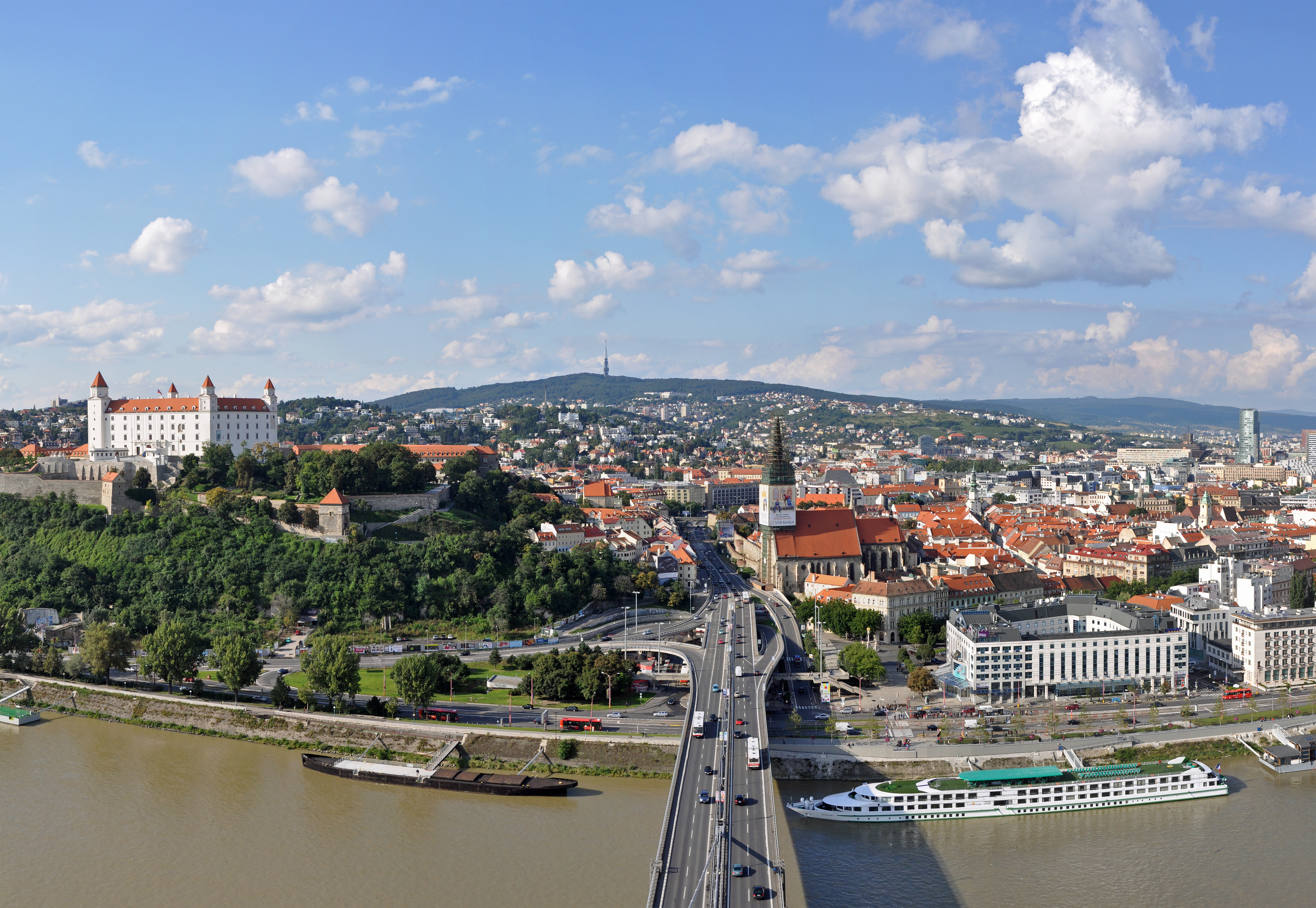
Bratislava (German: ''Pressburg'', Hungarian: ''Pozsony'') is the Capital city, capital and largest city of the Slovakia, Slovak Republic and the fourth largest of all List of cities and towns on the river Danube, cities on the river Danube. Officially, the population of the city is about 475,000; however, some sources estimate daily number of people moving around the city based on mobile phone SIM cards is more than 570,000. Bratislava is in southwestern Slovakia at the foot of the Little Carpathians, occupying both banks of the Danube and the left bank of the Morava (river), River Morava. Bordering Austria and Hungary, it is the only national capital to border two sovereign states. The city's history has been influenced by people of many nations and religions, including Austrians, Bulgarians, Croats, Czechs, Germans, Hungarian people, Hungarians, Jews and Slovaks. It was the coronation site and legislative center and capital of the Kingdom of Hungary from 1536 to 1783; elev ... [...More Info...] [...Related Items...] OR: [Wikipedia] [Google] [Baidu] |


