|
Jablunkov
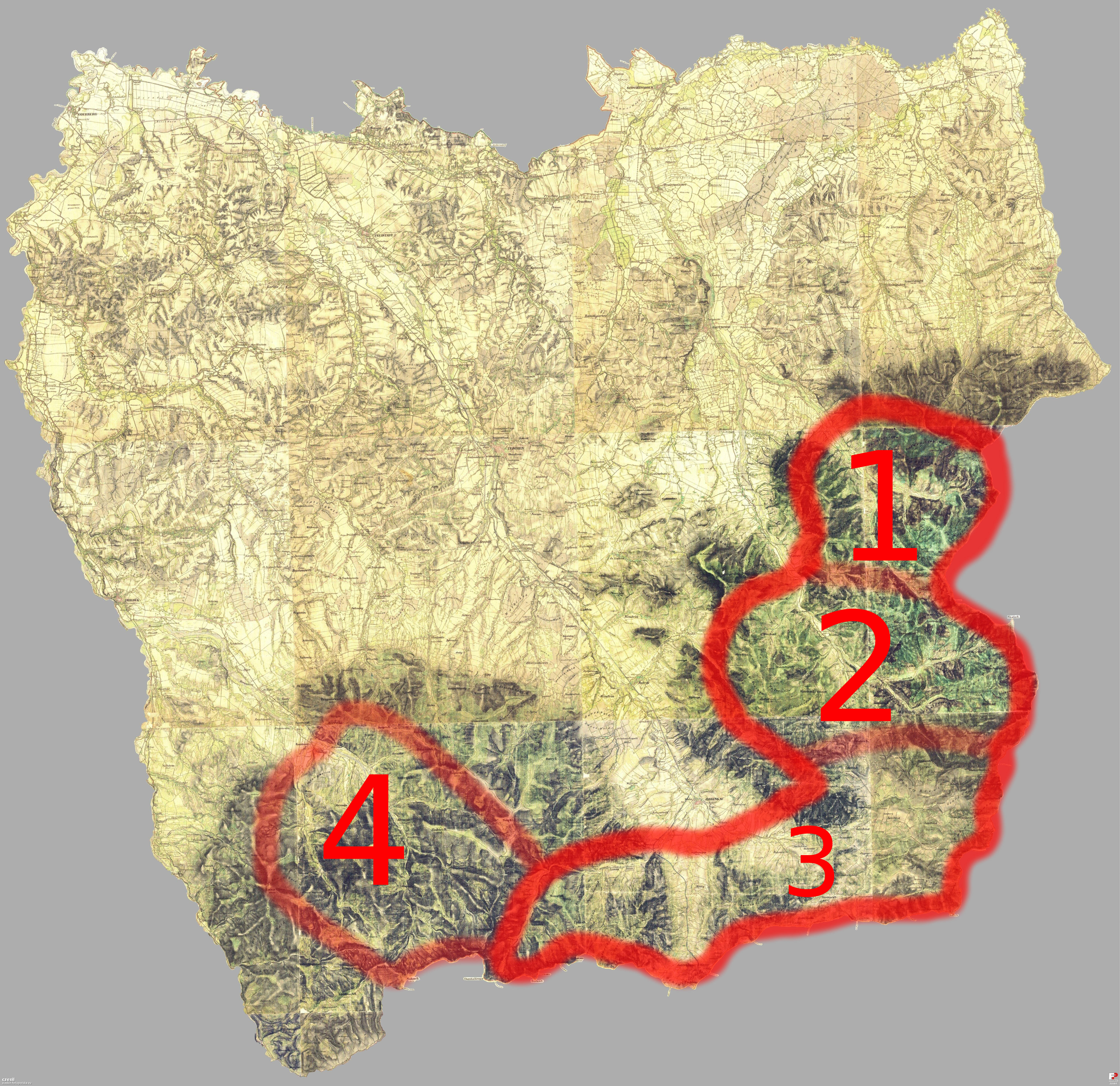
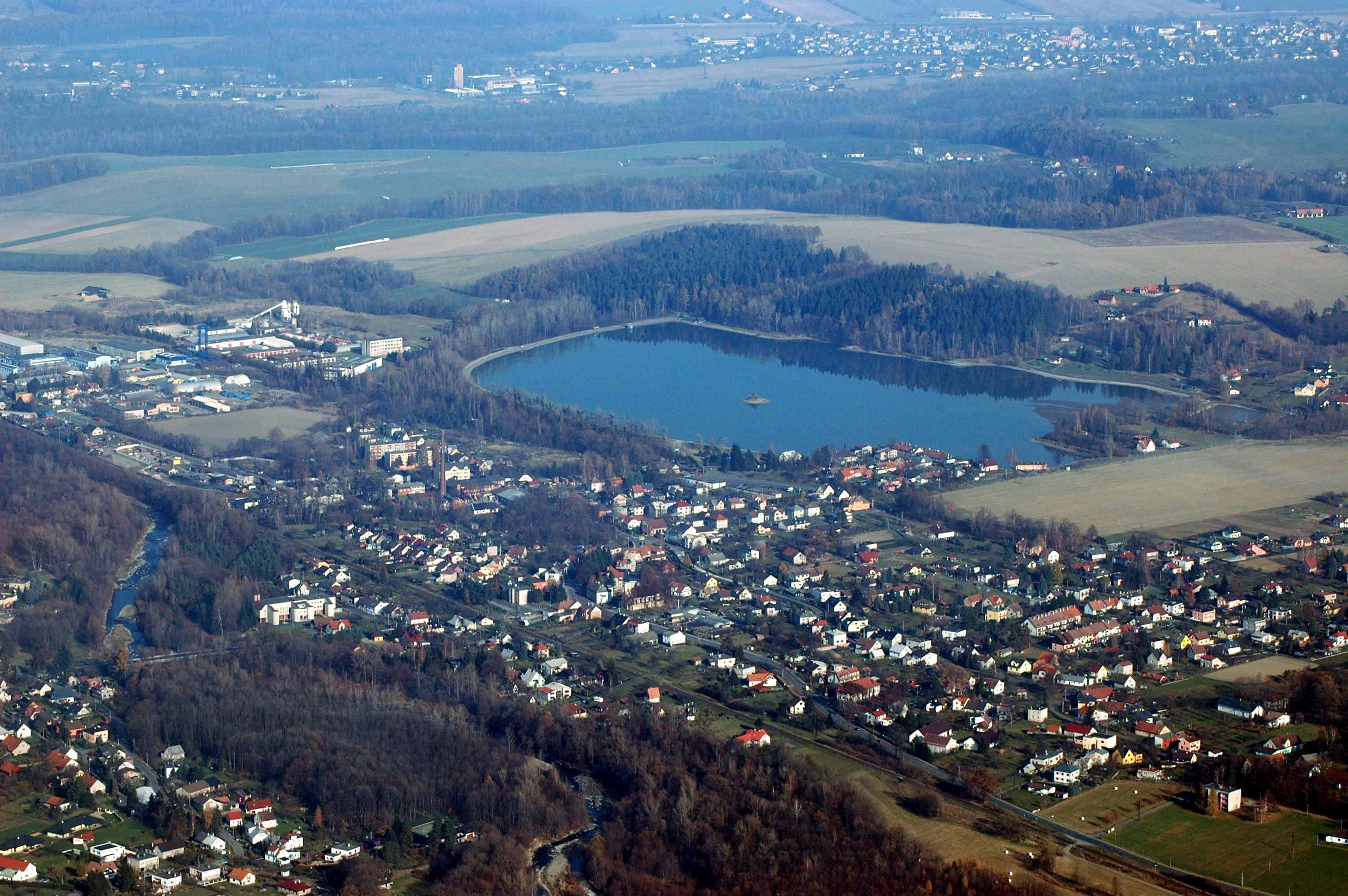
Jablunkov (; , ) is a town in Frýdek-Místek District in the Moravian-Silesian Region of the Czech Republic. It has about 5,300 inhabitants. The town has a significant Polish minority in the Czech Republic, Polish minority. It is inhabited by a large amount of Silesian Gorals. Geography Jablunkov is located about southeast of Frýdek-Místek and southeast of Ostrava. It lies in the historical region of Cieszyn Silesia, and is the easternmost town of the country. It is located mainly in the Jablunkov Furrow lowland, but the municipal territory also extends to the Silesian Beskids on the east. The highest point is the hill Lysá at above sea level. Jablunkov lies at the confluence of the Olza (river), Olza and Lomná (river), Lomná rivers. History According to historians, the predecessor of Jablunkov is to be found in the place where the present-day village of Hrádek (Frýdek-Místek District), Hrádek or Nýdek is located. The first written mention of Jablunkov is from 1435 ... [...More Info...] [...Related Items...] OR: [Wikipedia] [Google] [Baidu] |
Hrádek (Frýdek-Místek District)
Hrádek (; , ) is a municipality and village in Frýdek-Místek District in the Moravian-Silesian Region of the Czech Republic. It has about 1,900 inhabitants. The municipality has a significant Polish minority in the Czech Republic, Polish minority. Etymology The name of the municipality is a diminutive form of the word ''hradiště'' in Czech and ''gród'' in Polish, meaning 'gord (archaeology), gord'. Geography Hrádek is located about east of Frýdek-Místek and southeast of Ostrava, in the historical region of Cieszyn Silesia. The western part of the municipality lies in the Jablunkov Furrow and the eastern part lies in the Silesian Beskids. The highest point is near the top of the Loučka mountain at above sea level. The Olza (river), Olza River flows through the municipality. History The beginnings of Hrádek can be traced back to the first half of the 12th century, when a small fort was built on a trade route running through the Jablunkov Pass around 1119. A settlemen ... [...More Info...] [...Related Items...] OR: [Wikipedia] [Google] [Baidu] |
Silesian Gorals
Silesian Gorals are a subgroup of the Gorals living in the Silesian Beskids and Moravian-Silesian Beskids within the historical region of Cieszyn Silesia. They are one of the four major ethnographic groups of Cieszyn Silesia. History Vlach colonization of the Silesian Beskids began in the late 15th century, roughly around the time when Brenna was first mentioned in 1490. It peaked in the following two centuries. The group shares many cultural traits with other Gorals of the Western Carpathians, stemming from a common way of living from shepherding in mountainous pastures, but they are also characterised by various different cultural and spiritual elements like dialect, beliefs, customs, costume, etc. Wincenty Pol in his survey of Gorals in the middle of the 19th century subdivided Silesian Gorals into four groups: * Breniacy – in Brenna. * Wiślanie – in Wisła. * Jabłonkowianie (Jablunkov Gorals) – in mountain villages around Jablunkov (Polish: Jabłonków) including ... [...More Info...] [...Related Items...] OR: [Wikipedia] [Google] [Baidu] |
Cieszyn Silesia
Cieszyn Silesia, Těšín Silesia or Teschen Silesia ( ; or ; or ) is a historical region in south-eastern Silesia, centered on the towns of Cieszyn and Český Těšín and bisected by the Olza River. Since 1920 it has been divided between Poland and Czechoslovakia, and later the Czech Republic. It covers an area of about and has about 810,000 inhabitants, of which (44%) is in Poland, while (56%) is in the Czech Republic. The historical boundaries of the region are roughly the same as those of the former independent Duchy of Teschen, Duchy of Cieszyn. Currently, over half of Cieszyn Silesia forms one of the euroregions, the Cieszyn Silesia Euroregion, with the rest of it belonging to Euroregion Beskydy. Administrative division From an administrative point of view, the Polish part of Cieszyn Silesia lies within the Silesian Voivodeship and comprises Cieszyn County, the western part of Bielsko County, and the western part of the town of Bielsko-Biała. The Czech par ... [...More Info...] [...Related Items...] OR: [Wikipedia] [Google] [Baidu] |
Frýdek-Místek District
Frýdek-Místek District () is a district in the Moravian-Silesian Region of the Czech Republic. Its capital is the city of Frýdek-Místek. Administrative division Frýdek-Místek District is divided into four administrative districts of municipalities with extended competence: Frýdek-Místek, Frýdlant nad Ostravicí, Jablunkov and Třinec. List of municipalities Cities and towns are marked in bold: Baška – Bílá – Bocanovice – Brušperk – Bruzovice – Bukovec – Bystřice – Čeladná – Dobrá – Dobratice – Dolní Domaslavice – Dolní Lomná – Dolní Tošanovice – Fryčovice – Frýdek-Místek – Frýdlant nad Ostravicí – Hnojník – Horní Domaslavice – Horní Lomná – Horní Tošanovice – Hrádek – Hrčava – Hukvaldy – Jablunkov – Janovice – Kaňovice – Komorní Lhotka – Košařiska – Kozlovice – Krásná – Krmelín – Kunčice pod Ondřejníkem – Lhotka – Lučina – Malenovice � ... [...More Info...] [...Related Items...] OR: [Wikipedia] [Google] [Baidu] |
Lomná (river)
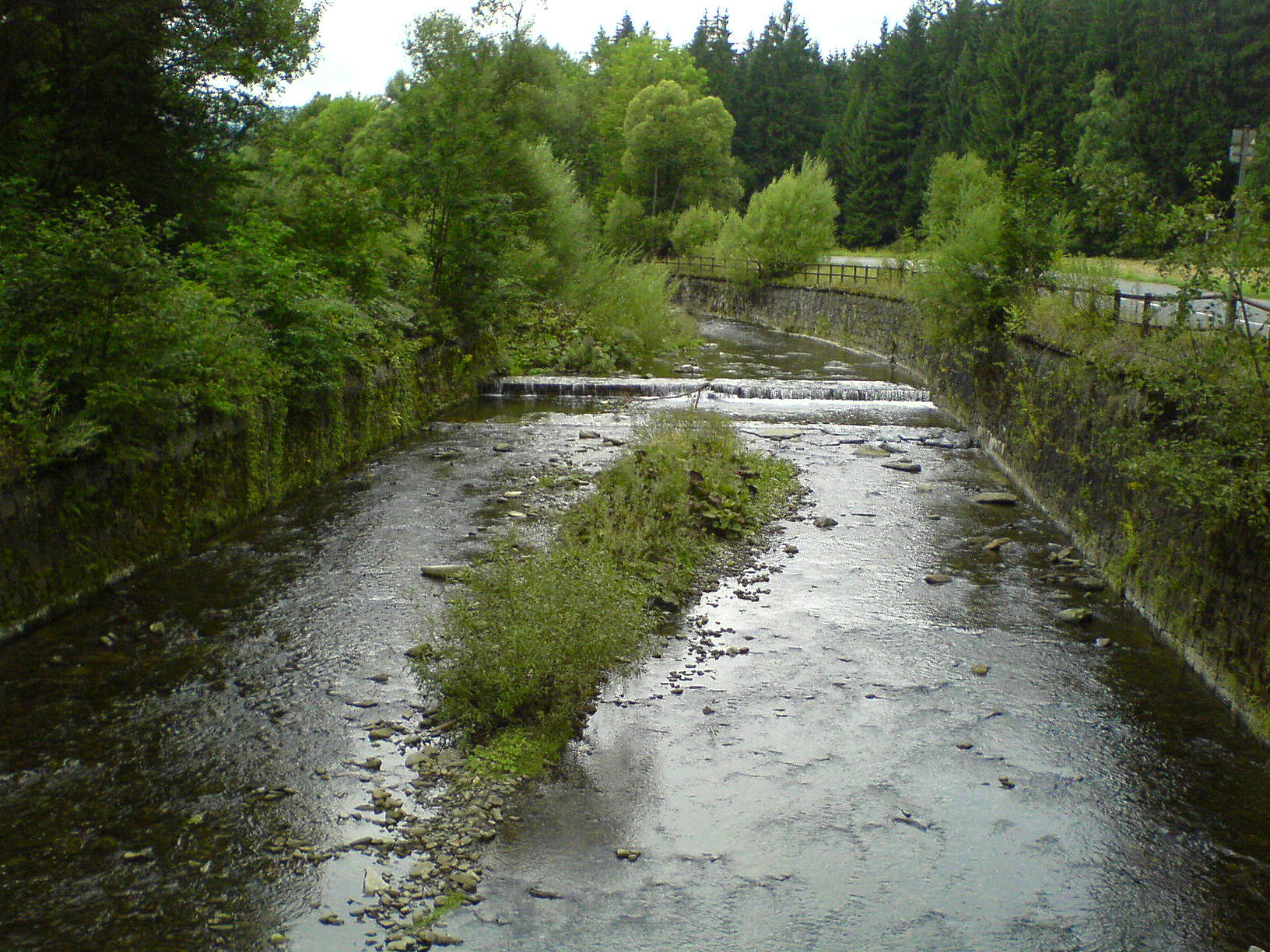
The Lomná () is a river in the Czech Republic, a left tributary of the Olza (river), Olza. It flows through the Moravian-Silesian Region. It is long. Etymology The name is derived from the Slavic word ''lom'', meaning 'turn', 'bend', but and earlier also 'clatter', 'rumble'. The name was first mentioned in 1592. Characteristic The Lomná originates in the territory of Horní Lomná in the Moravian-Silesian Beskids at an elevation of and flows to Jablunkov, where it merges with the Olza River at an elevation of . It is long. Its drainage basin has an area of . The average discharge at its mouth is 1.34 m3/s. The longest tributaries of the Lomná are: Course The river flows through the municipal territories of Horní Lomná, Dolní Lomná, Mosty u Jablunkova, Bocanovice and Jablunkov. Nature Most of the river flows through the Beskydy Protected Landscape Area. Among the protected species of fish living in the river are the common minnow and alpine bullhead. Part of the rive ... [...More Info...] [...Related Items...] OR: [Wikipedia] [Google] [Baidu] |
Polish Minority In The Czech Republic
The Polish minority in the Czech Republic is a Polish national minority living mainly in the Trans-Olza region of western Cieszyn Silesia. The Polish community is the only national (or ethnic) minority in the Czech Republic that is linked to a specific geographical area. Trans-Olza is located in the north-eastern part of the country. It comprises Karviná District and the eastern part of Frýdek-Místek District. Many Poles living in other regions of the Czech Republic have roots in Trans-Olza as well. Poles formed the largest ethnic group in Cieszyn Silesia in the 19th century, but at the beginning of the 20th century the Czech population grew. The Czechs and Poles collaborated on resisting Germanization movements, but this collaboration ceased after World War I. In 1920 the region of Trans-Olza was incorporated into Czechoslovakia after the Polish–Czechoslovak War. Since then the Polish population demographically decreased. In 1938 it was annexed by Poland in the context of th ... [...More Info...] [...Related Items...] OR: [Wikipedia] [Google] [Baidu] |
Olza (river)
The Olza (, ) is a river in the Czech Republic and Poland, a right tributary of the Oder River. It flows through the Silesian Voivodeship in Poland and through the Moravian-Silesian Region in the Czech Republic. It is long. The river forms a significant part of the Czech-Polish state border. Etymology The name is derived from the Proto-Slavic word ''oliga'', meaning "a river rich in water". The origin of the name was demonstrated in 1900 by Czech linguist and writer Vincenc Prasek and the revelation was confirmed by various etymological studies in the 20th century. There was also a theory that the name is a derivative of the Germanic ''Aliza'', meaning 'flow'. The oldest written mention of the Olza is in a letter written by Duke Mieszko in 1290. The river was then mentioned in a written document in 1611 as the ''Oldza''. At the end of the 19th century, with the rise of mass nationalism, both Polish and Czech activists claimed the name ''Olza'' to be not Polish enough, on the one ... [...More Info...] [...Related Items...] OR: [Wikipedia] [Google] [Baidu] |
Silesian Beskids
Silesian Beskids (, , ) is one of the Beskids mountain ranges in the Outer Western Carpathians in southern Silesian Voivodeship, Poland and the eastern Moravian-Silesian Region, Czech Republic. Most of the range lies in Poland. It is separated from the Moravian-Silesian Beskids by the Jablunkov Pass. The Polish part of the range includes the protected area called Silesian Beskids Landscape Park. The highest mountains Silesian Beskids have 20 mountains with a highest point above 1000 m, including three above 1200 m and nine above 1100 m. * Skrzyczne (1,257 m) - the highest mountain * Barania Góra (1,220 m) * Małe Skrzyczne (1,211 m) * Wierch Wisełka (1,192 m) * Równiański Wierch (1,160 m) * Zielony Kopiec (1,152 m) * Malinowska Skała (1,152 m) * Magurka Wiślańska (1,140 m) * Klimczok (1,117 m) * Malinów (1,115 m) * Magura (1,109 m) * Magurka Radziechowska (1,108 m) * Trzy Kopce (1,082 m) * Stołów (1,035 m) * Glinne (1,034 m) * Przysłop (1,02 ... [...More Info...] [...Related Items...] OR: [Wikipedia] [Google] [Baidu] |
Wenceslaus III Adam, Duke Of Cieszyn
Wenceslaus III Adam of Cieszyn (, , ; December 1524 – 4 November 1579) was a Duke of Cieszyn from 1528 until his death. He was the second but only surviving son of Wenceslaus II, co-Duke of Cieszyn, by his wife Anna, daughter of Frederick I, Margrave of Brandenburg-Ansbach. He was born one month after his father's death, on 17 November 1524. Life Since the time of his birth, Wenceslaus III Adam was placed under the guardianship of his grandfather Casimir II, Duke of Cieszyn as his only heir, until his death four-year later, in 1528. In his will, Duke Casimir II left his Duchy to his grandson under the regency of his mother Anna and the Bohemian magnate Jan, Baron of Pernštejn and Count of Kłodzko, called "''The Rich''". During his minority, the young Duke spent much time at the Imperial court in Vienna, where he was educated. Despite this, Wenceslaus III Adam adopted the new Evangelical faith, and followed this religion until his death. At the time of his mother's death i ... [...More Info...] [...Related Items...] OR: [Wikipedia] [Google] [Baidu] |
Moravian-Silesian Region
The Moravian-Silesian Region () is one of the 14 administrative regions of the Czech Republic. Before May 2001, it was called the Ostrava Region (). The region is located in the north-eastern part of its historical region of Moravia and in most of the Czech Silesia, Czech part of the historical region of Silesia. The region borders the Olomouc Region to the west and the Zlín Region to the south. It also borders two other countries – Poland (Opole Voivodeship, Opole and Silesian Voivodeships) to the north and Slovakia (Žilina Region) to the east. It is a highly Industrialisation, industrialized region, its capital Ostrava was actually called the "Steel Heart of the Republic". In addition, it has several mountainous areas where the landscape is relatively preserved. Nowadays, the economy of the region benefits from its location in the Czech/Polish/Slovak borderlands. Administrative division Traditionally, the region has been divided into six districts () which still exist a ... [...More Info...] [...Related Items...] OR: [Wikipedia] [Google] [Baidu] |
Nýdek
Nýdek (, ) is a municipality and village in Frýdek-Místek District in the Moravian-Silesian Region of the Czech Republic. It has about 2,100 inhabitants. The municipality has a significant Polish minority in the Czech Republic, Polish minority. Etymology The name of Nýdek was probably derived from the personal name ''Nidek''. Geography Nýdek is located about east of Frýdek-Místek and southeast of Ostrava, on the border with Poland. It lies in the historical region of Cieszyn Silesia, in the Silesian Beskids mountain range. The highest point is Czantoria Wielka, Velká Čantoryje at above sea level, located on the Czech-Polish border. The Hluchová River flows through the municipality. History The first written mention of Nýdek is from 1430, when Bolesław I, Duke of Cieszyn donated this territory to Nidek, who founded here a settlement. The first mention of the settlement is from 1456. Politically the village belonged then to the Duchy of Teschen that was a Fee (feuda ... [...More Info...] [...Related Items...] OR: [Wikipedia] [Google] [Baidu] |


