|
Holme St Cuthbert
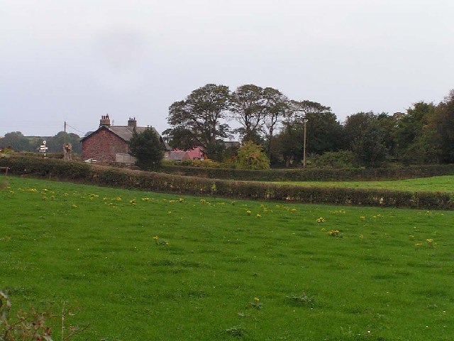
Holme St Cuthbert is a small village and civil parish in the Cumberland (unitary authority), Cumberland district of Cumbria, England. The village is located south-west of Carlisle. The parish covers a largely rural area containing a number of small hamlets; the largest village is Mawbray. The parish had a population of 413 at the 2021 United Kingdom census, 2021 census. Toponymy The name is derived from Old Norse, where the Norse word "holmr" meant "islet". Hence, "Holme St Cuthbert" means "St Cuthbert's islet". Saint Cuthbert was an early Anglo-Saxon Anglican saints, saint, known for his association with the Lindisfarne Gospels. It is unlikely he visited the parish, but he definitely visited Carlisle. This area was historically known as the St Cuthbert's quarter of the parish of Holme Cultram. Holme St Cuthbert took its name from a chapel of ease dedicated to St Cuthbert, which was known to have existed by at least 1538. That chapel did not endure and its exact location is unkn ... [...More Info...] [...Related Items...] OR: [Wikipedia] [Google] [Baidu] |
Cumberland (unitary Authority)
Cumberland is a Unitary authorities of England, unitary authority area in Cumbria, England, and a non-metropolitan county and Districts of England, district. It borders Scotland, Northumberland, Westmorland and Furness, and the Irish Sea. Part of the area is in the Lake District National Park and notable landmarks include Carlisle Cathedral, Carlisle Castle and Hadrian's Wall. In comparison to the Cumberland, historic county of Cumberland that existed before 1974, the district covers 77% of its area (excluding Penrith, Cumbria, Penrith area) and 90% of its population. When created, in April 2023, it took over the northern and western part of the 1974–2023 Cumbria non-metropolitan county's administration and the corresponding former Allerdale, City of Carlisle, Carlisle and Borough of Copeland, Copeland districts, while the new Westmorland and Furness unitary authority took over the remainder. History Elections to Cumbria County Council were due to take place in May 2021 but ... [...More Info...] [...Related Items...] OR: [Wikipedia] [Google] [Baidu] |
Dubmill
Dubmill is a settlement in the civil parish of Holme St. Cuthbert in Cumbria, United Kingdom. It is located approximately one mile south-west of the village of Mawbray, half-a-mile to the west of the hamlet of Salta, three-quarters of a mile south-west of the hamlet of Hailforth, and one-and-a-half miles north of the village of Allonby. Carlisle, Cumbria's county town, lies approximately twenty-eight miles to the north-east. The B5300, known locally as the coast road, runs through Dubmill. Dubmill lends its name to both Dubmill Point and Dubmill Scar. Dubmill Point is the name for the headland at the northernmost tip of Allonby Bay, and Dubmill Scar is the name for the rocky beach off Dubmill Point. History and etymology The name of Dubmill comes from the Old English ''dub-myln'' meaning "a mill at the pool". Historical variant spellings include Dubmil, Dubmilne, Dubhime, Dub-horn, and Dubbmill. A beck called the Black Dub runs near to Dubmill, and may be related to the ... [...More Info...] [...Related Items...] OR: [Wikipedia] [Google] [Baidu] |
Holme Abbey, Cumbria
Abbeytown is the main village in the civil parish of Holme Abbey in the Cumberland district of Cumbria, England. The parish was historically called Holme Cultram. The modern names of Abbeytown and Holme Abbey both reference Holmcultram Abbey, which was founded in 1150 and dissolved in 1538; the surviving nave from the abbey now serves as the parish church. The parish of Holme Abbey had a population of 757 at the 2021 census. Toponymy The parish was historically called Holme Cultram. It gave its name to the Cistercian abbey founded there in 1150. The name Abbeytown is recorded from at least the 17th century (''The Towne of the Abbey'', ''Abbey Towne''; ''Abbeytown'' from mid-18th century) and references it being the village where the abbey was located. The official name of the civil parish today is Holme Abbey, whereas the Royal Mail uses Abbeytown in postal addresses. Geography It is located five-and-a-half miles south-east of Silloth, and six-and-a-half miles north-west of W ... [...More Info...] [...Related Items...] OR: [Wikipedia] [Google] [Baidu] |
Holme Low
Holme Low is a List of civil parishes in Cumbria, civil parish in the Cumberland (unitary authority), Cumberland district of Cumbria, England. The parish covers a largely rural area with no significant settlements. It lies west of Carlisle. Geography The parish is entirely rural, and the population is scattered in small hamlets, including Barracks Bridge, Blackdyke, Blitterlees, Calvo, Cumbria, Calvo, Causewayhead, Greenrow, Seaville, and Wolsty. It borders the parishes of Holme St Cuthbert and Abbeytown, Holme Abbey to the south, Silloth-on-Solway to the north-west, and has a short stretch of coastline on the Solway Firth to the west. To the north, it is bordered by an unpopulated area known as Skinburness Marsh, which is common to the parishes of Holme St Cuthbert, Holme Low, and Holme Abbey. History In Roman Britain, Roman times, when the entire Solway coast was fortified to defend against incursions across the sea, a series of milefortlets were constructed beyond the west ... [...More Info...] [...Related Items...] OR: [Wikipedia] [Google] [Baidu] |
Seacroft Farm, Dubmill Point - Geograph
Seacroft is an outer-city suburb/township consisting mainly of council estate housing covering an extensive area of east Leeds, West Yorkshire, England. It lies in the LS14 Leeds postcode area, around east of Leeds city centre. It sits in the Killingbeck & Seacroft ward of Leeds City Council and Leeds East parliamentary constituency. The population of the corresponding Leeds City Ward was nearly 18,000 in 2001Office for National Statistics 2001 census for Seacroft ward 17,725 on 29 April 2001 and fell to 14,426 in 2011. The name is often used as a catch-all for Seacroft and the neighbouring areas of and |
Tarns, Cumbria
Tarns is a small farming settlement in the civil parish of Holme St. Cuthbert in Cumbria, United Kingdom. It is located two miles north-east of the village of Mawbray, and twenty-three miles south-west of Carlisle, Cumbria's county town. The B5301 road runs through the settlement, and along that road the town of Silloth-on-Solway is located five-and-a-half miles to the north, and Aspatria four-and-a-half miles to the south-east. Other nearby settlements include Aikshaw, Goodyhills, Jericho, and New Cowper. History and etymology The name Tarns comes from the Old Norse "tiorn", meaning a lake, and "tarn" is a word commonly used in northern England for a lake or pond. Such a lake is present at Tarns, giving the settlement its name. In the past, the name has been spelled as Ternis, Terns, and Tarnes. Tarns is a small settlement, and, in spite of appearing on local signposts, including on the B5300 coast road, it is not named on some contemporary mapping projects like Google Ma ... [...More Info...] [...Related Items...] OR: [Wikipedia] [Google] [Baidu] |


