|
Freetown, Massachusetts
Freetown is a town in Bristol County, Massachusetts, United States. The population was 9,206 at the 2020 census. Freetown is one of the oldest communities in the United States, having been settled by the Pilgrims and their descendants in the latter half of the 17th century. The town once included the city of Fall River (1659–1803), and a portion of Acushnet (1659–1815). The town celebrated its tricentennial in 1983. Freetown is currently divided into two villages, which historically developed almost entirely independent from one another: Assonet and East Freetown. Freetown lies on an old 18th century road and along old Indian trails from Freetown to Boston. Freetown is home to the Freetown-Fall River State Forest, and Profile Rock and is located approximately from Boston. Freetown is a part of the South Coast region of Massachusetts which encompasses the communities that surround Buzzards Bay (excluding the Elizabeth Islands, Bourne and Falmouth), Mount Hope Bay ... [...More Info...] [...Related Items...] OR: [Wikipedia] [Google] [Baidu] |
Assonet, Massachusetts
Assonet ( ) is one of two villages in the town of Freetown in Bristol County, Massachusetts, United States. An original part of the town, Assonet was settled in 1659 along with the city of Fall River, then a part of Freetown. It rests on the banks of the Assonet River. As of the 2000 census, the village had a total population of 4,084; up from 3,614 in 1990. As of the 2014 census, the village had a total estimated population of 9,093. History Assonet was first settled in 1659, shortly after the completion of Ye Freemen's Purchase. It was part of the Plymouth Colony until the 1691 merger with the Massachusetts Bay Colony. The word comes from the local Wampanoag Indians, who had a settlement in the area, and has two meanings: "place of rocks" and "song of praise". Those meanings are traditional, but the former can be segmented as ''(h)assun-et'' where'' hassun'' or ''assin'' is a word used by southern New England Algonquian to mean ''stone''. The ''-et'' is a locative suffi ... [...More Info...] [...Related Items...] OR: [Wikipedia] [Google] [Baidu] |
Acushnet, Massachusetts
Acushnet () is a town in Bristol County, Massachusetts, United States. The population was 10,559 at the 2020 census. Acushnet is a part of the South Coast region of Massachusetts which encompasses the cities and towns that surround Buzzards Bay (excluding the Elizabeth Islands, Bourne and Falmouth), Mount Hope Bay and the Sakonnet River. History Acushnet was purchased from the Wampanoag in 1652. It has been included as a part of three separate towns throughout its history. It was formerly the northeastern section of the town of Dartmouth, as well as Old Dartmouth, which included the towns of Westport, New Bedford, and Fairhaven. In 1787, New Bedford separated from Dartmouth, and included the lands of Fairhaven and Acushnet. In 1812, Fairhaven was incorporated as a separate town, again including the lands of Acushnet. Finally, the town was officially incorporated in 1860. The name "Acushnet", which is also the name of the river the town lies on, comes from the Wampano ... [...More Info...] [...Related Items...] OR: [Wikipedia] [Google] [Baidu] |
Wampanoag People
The Wampanoag, also rendered Wôpanâak, are a Native American people of the Northeastern Woodlands currently based in southeastern Massachusetts and formerly parts of eastern Rhode Island.Salwen, "Indians of Southern New England and Long Island," p. 171. Their historical territory includes the islands of Martha's Vineyard and Nantucket. Today, two Wampanoag tribes are federally recognized: * Mashpee Wampanoag Tribe * Wampanoag Tribe of Gay Head (Aquinnah). Herring Pond Tribe is a historical Wampanoag Tribe located in Plymouth and Bourne, Massachusetts The Wampanoag language, also known as Massachusett, is a Southern New England Algonquian language. Prior to English contact in the 17th century, the Wampanoag numbered as many as 40,000 people living across 67 villages composing the Wampanoag Nation. These villages covered the territory along the east coast as far as Wessagusset (today called Weymouth), all of what is now Cape Cod and the islands of Natocket and Noepe ( ... [...More Info...] [...Related Items...] OR: [Wikipedia] [Google] [Baidu] |
Assonet River
The Assonet River is located in Bristol County, Massachusetts. It flows U.S. Geological Survey. National Hydrography Dataset high-resolution flowline dataThe National Map, accessed April 1, 2011 in a westerly direction through Freetown and joins the Taunton River near Assonet Neck in Berkley, Massachusetts.USGS Quadrangle Map Description The Assonet River is formed from the Cedar Swamp River near the border of Freetown and Lakeville just south of Myricks village. It is joined by Quaker Brook at Forge Pond. From this point it flows parallel to Route 79 through a series of small mill ponds. It becomes tidal near the Elm Street Bridge in Assonet village where it widens and becomes Assonet Bay to the west of Route 24. Assonet Bay contains several small coves fed by small streams including Payne's Cove (fed by Terry Brook from the south) and Shepherd's Cove located at its southwest end. The bay is also fed by Stacy's Creek from the north. Assonet Bay is surrounded by severa ... [...More Info...] [...Related Items...] OR: [Wikipedia] [Google] [Baidu] |
National Register Of Historic Places
The National Register of Historic Places (NRHP) is the Federal government of the United States, United States federal government's official United States National Register of Historic Places listings, list of sites, buildings, structures, Historic districts in the United States, districts, and objects deemed worthy of Historic preservation, preservation for their historical significance or "great artistic value". The enactment of the National Historic Preservation Act (NHPA) in 1966 established the National Register and the process for adding properties to it. Of the more than one and a half million properties on the National Register, 95,000 are listed individually. The remainder are contributing property, contributing resources within historic district (United States), historic districts. For the most of its history, the National Register has been administered by the National Park Service (NPS), an agency within the United States Department of the Interior. Its goals are to ... [...More Info...] [...Related Items...] OR: [Wikipedia] [Google] [Baidu] |
Sakonnet River
The Sakonnet River is a tidal strait in the state of Rhode Island which flows approximately between Mount Hope Bay and Rhode Island Sound. It separates Aquidneck Island from the eastern portion of Newport County. Etymology "Sakonnet" is derived from the Sakonnet people, related to the Wampanoag people who spoke a dialect of the Massachusett language The Massachusett language is an Algonquian languages, Algonquian language of the Algic languages, Algic language family that was formerly spoken by several peoples of eastern coastal and southeastern Massachusetts. In its revived form, it is s ..., that inhabited the surrounding area. The name has been interpreted in a variety of ways including "where the water pours forth". Crossings Below is a list of all current and former crossings over the Sakonnet River. The list begins at the headwaters and goes downstream. * Sakonnet River Rail Bridge (formerly Old Colony and Newport Railway), removed * Old Sakonnet River ... [...More Info...] [...Related Items...] OR: [Wikipedia] [Google] [Baidu] |
Mount Hope Bay
Mount Hope Bay is a tidal estuary located at the mouth of the Taunton River on the Massachusetts and Rhode Island border. It is an arm of Narragansett Bay. The bay is named after Mount Hope, a small hill located on its western shore in what is now Bristol, Rhode Island. It flows into the East Passage of Narragansett Bay and also the Sakonnet River. Mount Hope Bay has played an important role to the history of the area, from pre-colonial times to the present. While many years of sewage and industrial pollution have severely degraded the quality of the shallow waters of the bay, there are currently major efforts underway to clean up and restore it. Geography Mount Hope Bay is part of the Narragansett Basin, formed as a rift in the Avalon terrane. It is underlaid by sedimentary rocks estimated to be several miles thick. The bay covers an area of about 13 square miles (36 square km), with an average depth of 18.7 feet, although portions of the southern end of the bay are as deep a ... [...More Info...] [...Related Items...] OR: [Wikipedia] [Google] [Baidu] |
Falmouth, Massachusetts
Falmouth ( ) is a New England town, town in Barnstable County, Massachusetts, United States. The population was 32,517 at the 2020 census, making Falmouth the second-largest municipality on Cape Cod after Barnstable, Massachusetts, Barnstable. The terminal for the The Woods Hole, Martha's Vineyard and Nantucket Steamship Authority, Steamship Authority ferries to Martha's Vineyard is located in the village of Woods Hole, Massachusetts, Woods Hole in Falmouth. Woods Hole also contains several scientific organizations such as the Woods Hole Oceanographic Institution (WHOI), the Marine Biological Laboratory (MBL), the Woodwell Climate Research Center, NOAA's Woods Hole Science Aquarium, and the scientific institutions' various museums. For geographic and demographic information on specific parts of the town of Falmouth, please see the articles on East Falmouth, Massachusetts, East Falmouth, Falmouth (CDP), Massachusetts, Falmouth Village, North Falmouth, Massachusetts, North Falmouth ... [...More Info...] [...Related Items...] OR: [Wikipedia] [Google] [Baidu] |
Bourne, Massachusetts
Bourne ( ) is a New England town, town in Barnstable County, Massachusetts, United States. The population was 20,452 at the 2020 census. For geographic and demographic information on specific parts of the town of Bourne, please see the articles on Bourne (CDP), Massachusetts, Bourne (CDP), Buzzards Bay, Massachusetts, Buzzards Bay, Monument Beach, Massachusetts, Monument Beach, Pocasset, Massachusetts, Pocasset, Sagamore, Massachusetts, Sagamore, and Sagamore Beach, Massachusetts, Sagamore Beach. History Bourne was first settled in 1640 by Ezra Perry as a part of the town of Sandwich, Massachusetts, Sandwich. Prior to its separation from Sandwich, the area was referred to as West Sandwich. It was officially incorporated in 1884, the last town to be incorporated in Barnstable County. It was named for Jonathan Bourne Sr. (1811–1889), whose ancestor Richard Bourne represented Sandwich in the first Massachusetts General Court and was the first preacher to the Mashpee Wampanoag on C ... [...More Info...] [...Related Items...] OR: [Wikipedia] [Google] [Baidu] |
Elizabeth Islands
The Elizabeth Islands are a chain of over 20 small islands extending southwest from the southern coast of Cape Cod, Massachusetts in the United States. They are located at the outer edge of Buzzards Bay, north of Martha's Vineyard, from which they are separated by Vineyard Sound, and constitute the town of Gosnold in Dukes County, Massachusetts. History The island's creation was caused by different gravels and soils entombed inside of glaciers. The glacial movement deposited much material as they melted, thus many small islands were formed. The islands were long known to and utilized by the Wampanoag and other indigenous peoples before European colonization. They utilized the islands for hunting and fishing. The Indigenous name, Pocutohhunkunnoh, meaning Lands End, was the inspiration for the name Cuttyhunk Island. Europeans first learned of the islands in 1602 when the English colonizer Bartholomew Gosnold sighted them on his way to Virginia. For three weeks, they b ... [...More Info...] [...Related Items...] OR: [Wikipedia] [Google] [Baidu] |
Buzzards Bay
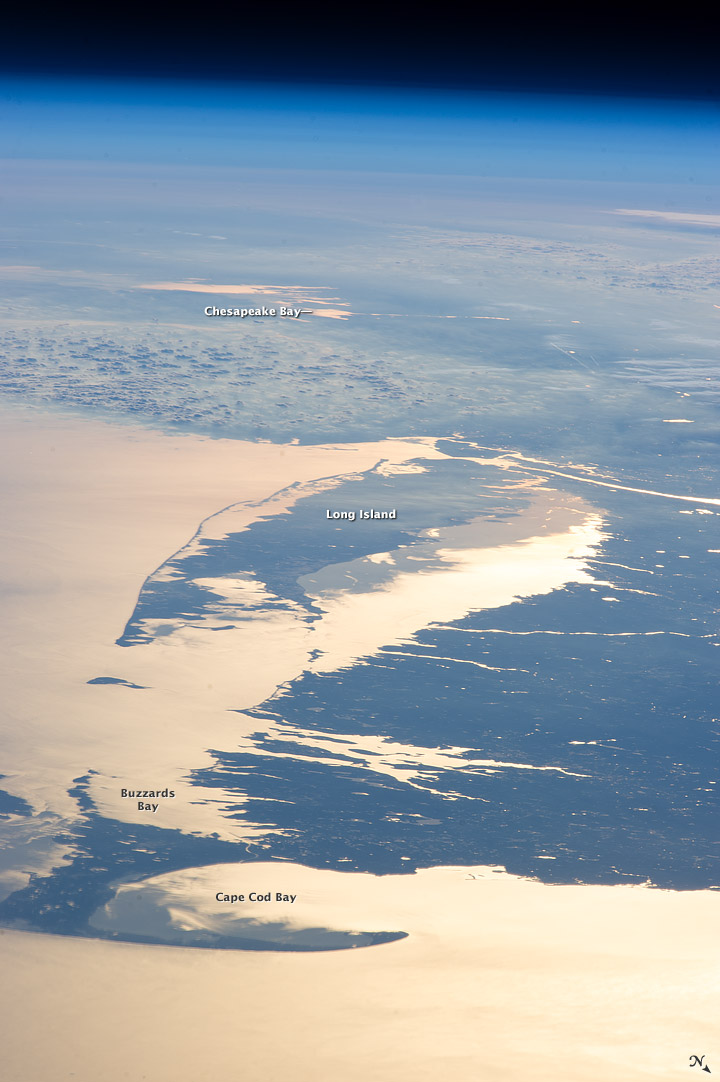
Buzzards Bay is a bay of the Atlantic Ocean adjacent to the U.S. state of Massachusetts. It is approximately 28 miles (45 kilometers) long by 8 miles (12 kilometers) wide. It is a popular destination for fishing, boating, and tourism. Buzzards Bay is often considered the finest sailing location on the East Coast and is frequently compared in terms of sailing conditions to San Francisco Bay. Since 1914, Buzzards Bay has been connected to Cape Cod Bay by the Cape Cod Canal. In 1988, under the Clean Water Act, the Environmental Protection Agency and the Commonwealth of Massachusetts designated Buzzards Bay to the National Estuary Program, as "an estuary of national significance" that is threatened by pollution, land development, or overuse. Geography It is surrounded by the Elizabeth Islands on the south, by Cape Cod on the east, and the southern coasts of Bristol and Plymouth counties in Massachusetts to the northwest. To the southwest, the bay is connected to Rhode Island ... [...More Info...] [...Related Items...] OR: [Wikipedia] [Google] [Baidu] |
South Coast (Massachusetts)
The South Coast of Massachusetts (sometimes stylized SouthCoast) is the region of southeastern Massachusetts consisting of the southern part of Bristol and Plymouth counties, bordering Buzzards Bay, and includes the cities of Fall River, New Bedford, the southeastern tip of East Taunton and nearby towns. The Rhode Island towns of Tiverton and Little Compton, located in Newport County, are often included within the South Coast designation due to regional similarities with adjacent communities. The term is recent, dating to the 1990s, and sometimes confused with the South Shore (a region southeast of Boston that includes eastern Norfolk and Plymouth counties, and does not overlap with the South Coast). Terminology The "South Coast" label was born as a public relations effort to counteract the perceived stigma of former terms like "Greater Fall River," "Greater New Bedford," or "New Bedford-Fall River," which conjured images, in many Massachusetts residents' minds, of depres ... [...More Info...] [...Related Items...] OR: [Wikipedia] [Google] [Baidu] |


