|
Ellsworth Mountains
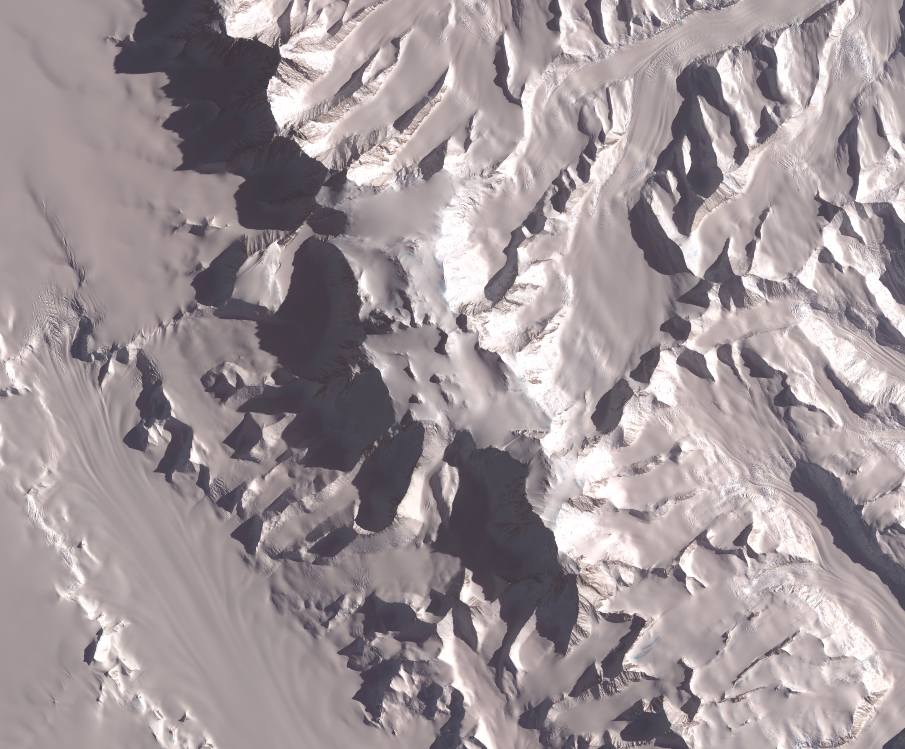
The Ellsworth Mountains are the highest mountain ranges in Antarctica, forming a long and wide chain of mountains in a north to south configuration on the western margin of the Ronne Ice Shelf in Marie Byrd Land. They are bisected by Minnesota Glacier to form the Sentinel Range to the north and the Heritage Range to the south. The former is by far the higher and more spectacular with Mount Vinson () constituting the highest point on the continent.Bockheim, J.G., Schaefer, C.E., 2015. ''Soils of Ellsworth Land, the Ellsworth Mountains''. In: Bockheim, J.G. (Ed.), ''The Soils of Antarctica. World Soils Book Series'', Springer, Switzerland, pp. 169–181. The mountains are located within the Chilean Antarctic territorial claim but outside of the Argentinian and British ones. Discovery The mountains were discovered on November 23, 1935, by the American explorer Lincoln Ellsworth in the course of a trans-Antarctic flight from Dundee Island to the Ross Ice Shelf. He gave the ... [...More Info...] [...Related Items...] OR: [Wikipedia] [Google] [Baidu] |
Mount Tyree
Mount Tyree (4852m) is the second highest mountain of Antarctica located 13 kilometres northwest of Mount Vinson (4,892 m), the highest peak on the continent. It surmounts Patton Glacier to the north and Cervellati Glacier to the southeast. History Mt. Tyree was discovered in January 1958 during reconnaissance flights by the United States Navy VX-6 squadron, and mapped later that month by the Marie Byrd Land Traverse Party. The mountain was named for Rear Admiral David M. Tyree, who was commander of the U.S. Naval Support Force in Antarctica, from April 14, 1959 to November 26, 1962. As of 2017, the summit had only been reached on six occasions, by a total of fifteen people, via three different routes: in January 1967 by John Evans and Barry Corbet (of Corbet's Couloir Corbet's Couloir is an expert ski run located at the Jackson Hole Mountain Resort in Teton Village, Wyoming. It is named after Jackson Hole ski instructor and mountain guide Barry Corbet who ... [...More Info...] [...Related Items...] OR: [Wikipedia] [Google] [Baidu] |
Dundee Island
Dundee Island () is an ice-covered island lying east of the northeastern tip of the Antarctic Peninsula and south of Joinville Island, Antarctica. Location Dundee Island is in the Joinville Island group in Graham Land. It is south of Joinville Island and east of the Trinity Peninsula, which in turn is the tip of the Antarctic Peninsula. It is separated from Joinville Island by Active Sound and the Firth of Tay, and separated from Trinity Peninsula by the Antarctic Sound. Features include the Petrel Base (Argentina) and Cape Purvis in the south. Nearby features include Eden Rocks and Paulet Island. Early history Dundee Island was discovered on January 8, 1893 by Captain Thomas Robertson of the ''Active'' and named for the home port, Dundee, Scotland, from whence the ship sailed in company with three other vessels in search of whales. It is from this island that the American businessman Lincoln Ellsworth, accompanied by the pilot Herbert Hollick-Kenyon, took off o ... [...More Info...] [...Related Items...] OR: [Wikipedia] [Google] [Baidu] |
Africa
Africa is the world's second-largest and second-most populous continent after Asia. At about 30.3 million km2 (11.7 million square miles) including adjacent islands, it covers 20% of Earth's land area and 6% of its total surface area.Sayre, April Pulley (1999), ''Africa'', Twenty-First Century Books. . With nearly billion people as of , it accounts for about of the world's human population. Demographics of Africa, Africa's population is the youngest among all the continents; the median age in 2012 was 19.7, when the worldwide median age was 30.4. Based on 2024 projections, Africa's population will exceed 3.8 billion people by 2100. Africa is the least wealthy inhabited continent per capita and second-least wealthy by total wealth, ahead of Oceania. Scholars have attributed this to different factors including Geography of Africa, geography, Climate of Africa, climate, corruption, Scramble for Africa, colonialism, the Cold War, and neocolonialism. Despite this lo ... [...More Info...] [...Related Items...] OR: [Wikipedia] [Google] [Baidu] |
Cape Fold Belt
The Cape Fold Belt (CFB) is a long fold-and-thrust mountain belt along the western and southern coastlines of Western Cape, South Africa. The Cape Fold Belt formed during the Permian period (300 to 250million years ago) in the late Paleozoic age, affecting the sequence of sedimentary rock layers of the siliciclastic Cape Supergroup with folding and faulted rocks, which were deposited in the Cape Basin in the southwestern corner of South Africa. The Cape Fold Belt was once part of a larger orogenic belt with other mountain ranges that formed as part of the same tectonic event that originally extended from Argentina, across southern Africa, and into Antarctica. It included the Ventana Mountains near Bahía Blanca in Argentina, the Pensacola Mountains in East Antarctica, the Ellsworth Mountains in West Antarctica, and the Hunter–Bowen orogeny in eastern Australia. The rocks involved in this fold system are primarily sandstones and shales, with shales from the Bokkeveld G ... [...More Info...] [...Related Items...] OR: [Wikipedia] [Google] [Baidu] |


