|
Chumur
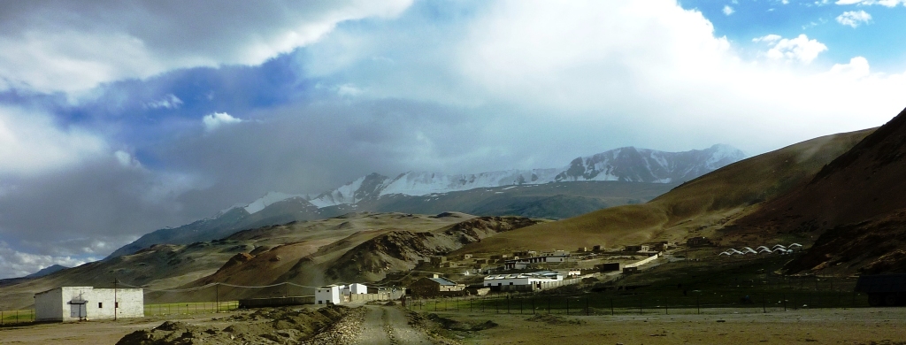
Chumar or Chumur () is a village located in south-eastern region of Ladakh, Ladakh, India and the centre of nomadic grazing. It is in Rupshu block, south of the Tso Moriri lake, on the bank of the Parang River (or ''Pare Chu''), close to Ladakh's border with Tibet. Since 2012, China has disputed the border region situated to the south and southeast of Chumur village within the Chumur sector. However, the Chumur village itself is undisputed and remains in India. The Indian border post at Chumur Peak, offering a view of disputed grazing lands, lies approximately 15-20 km to the south/southwest of Chumur village. In contrast, the Chinese post at Chepzi hamlet is situated 8-10 km south of Chumur village, directly opposite the Indian positions on Chumur Peak. Both Chumur village, nestled in a side valley along the Chumur Tokpo stream (a tributary of the Pare Chu river), and Chepzi are located along the course of the Pare Chu river. Chumar is reachable from east (Hanle (village), Hanle ... [...More Info...] [...Related Items...] OR: [Wikipedia] [Google] [Baidu] |
Tso Moriri
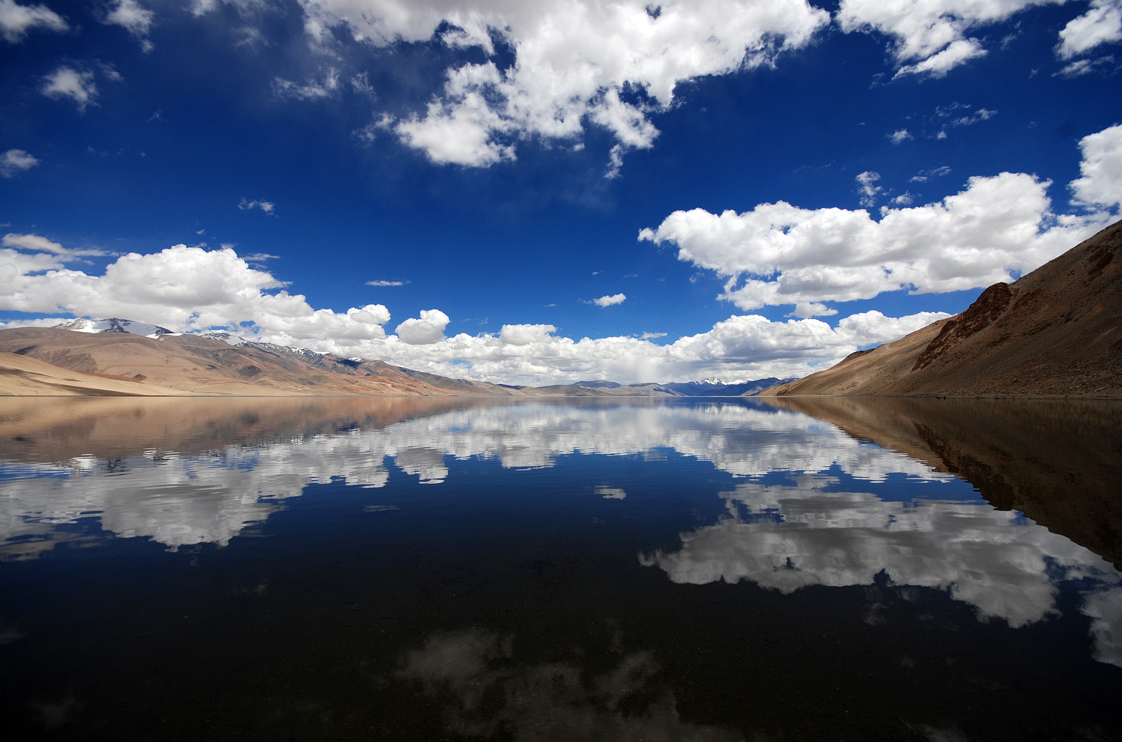
Tso Moriri or Lake Moriri , () or "Mountain Lake", is a pristine high-altitude lake and a Ramsar Wetland Site in the remote Changthang Plateau (literally: northern plains) in Leh district of the union territory of Ladakh in India. As the largest high-altitude lake entirely within India and Ladakh's Trans-Himalayan region, it spans 26 km north-south and 3-5 km wide. The lake is fed by three primary glacial streams - Karzok Phu (west), Gyama Phu (north), and Phirse Phu (southwest) - which form extensive marshes at their deltas. Though now an endorheic lake due to its blocked southern outlet, Tso Moriri maintains slightly brackish yet palatable waters. Its oligotrophic (nutrient-poor), alkaline ecosystem supports unique biodiversity. The area gained protection as the Tso Moriri Wetland Conservation Reserve, though accessibility remains limited mostly to summer months. Year-round settlements exist only at Karzok village (northwest shore) and military outposts along the eastern ... [...More Info...] [...Related Items...] OR: [Wikipedia] [Google] [Baidu] |
Parang River
The Parang River (), also called Para River () and Pare Chu () is an upstream tributary of the Sutlej River, that originates in the Indian state of Himachal Pradesh and ends in Himachal Pradesh again, but flows through Ladakh and Tibet before doing so. The origin of the river is near the Parang La pass in the Spiti subdistrict. After its circuitous journey, it joins the Spiti River near Sumdo in Himachal Pradesh and the combined river then joins Sutlej.: "... the Para River which, after passing through a small part of Tibet, later enters Spiti and joins the Spiti River." Name The name "Para River", which becomes ''Pare Chu'' in Tibetan, is based on the shepherds' ground of ''Para'' in Karab-Bargyok (in the Tibetan part of its course). In Kinnauri, the river was called ''Parati''. The Tibetans and Ladakhis were more likely to call it by the name of locale above their own, as the "Rupshu river" or "Tsotso river", Tsotso being the name of the valley in West Tibet through which ... [...More Info...] [...Related Items...] OR: [Wikipedia] [Google] [Baidu] |
Karzok
Karzok or Korzok (at an altitude of 14,995 ft or 4,570 m to 15,075 ft or 4,595 m above sea level), on the northwestern shores of the Tso Moriri lake, is a village in the Rupshu region and Community development block in India, block of the Leh district in Ladakh, India. Featuring among the List of highest cities in the world, highest permanent settlement of the world, it is located 60 southwest of Nyoma,Korzok , https://www.dangerousroads.org/asia/india/5683-korzok.html 40 km south of Puga separated by Salt Valley it is 80-100 northwest of Chumur, The Korzok Monastery, of Drukpa Lineage, Drukpa Tibetan Buddhism, Tibetan Buddhist lineage, is located here. History Karzok was on the Central Asian trade route until 1947 and was the headquarters of the Rupshu Valley. One of the kings, Rupshu Goba, who lived there with his family, built nine permanent houses there. The village has several houses, and the nomadic population who establish their tents (made of yak hair or s ... [...More Info...] [...Related Items...] OR: [Wikipedia] [Google] [Baidu] |
Spiti River
Spiti (pronounced as piti in Bhoti language) is a high-altitude region of the Himalayas, located in the north-eastern part of the northern Indian state of Himachal Pradesh. The name "Spiti" means "The middle land", i.e. the land between Tibet and India. Spiti incorporates mainly the valley of the Spiti River, and the valleys of several rivers that feed into the Spiti River. Some of the prominent side-valleys in Spiti are the Pin valley and the Lingti valley. Spiti is bordered on the east by Tibet, on the north by Ladakh, on the west and southwest by Lahaul, on the south by Kullu, and on the southeast by Kinnaur. Spiti has a cold desert environment. The valley and its surrounding regions are among the least populated regions of India. The Bhoti-speaking local population follows Tibetan Buddhism. Traditionally, agriculture was for subsistence, but has shifted to cash crops in the past few decades. Spiti is a popular destination for photography, snow leopard spotting, and ad ... [...More Info...] [...Related Items...] OR: [Wikipedia] [Google] [Baidu] |
Ryul Tso
Ryul Tso and Kyun Tso are a system of twin lakes in Ladakh. Geography The lakes are located about a mile from the Salsal La Pass (17062 ft.), on the way to Chumar Chumar or Chumur () is a village located in south-eastern region of Ladakh, India and the centre of nomadic grazing. It is in Rupshu block, south of the Tso Moriri lake, on the bank of the Parang River (or ''Pare Chu''), close to Ladakh's bor ..., which marks the Indo-China boundary. References Lakes of Ladakh {{Ladakh-geo-stub ... [...More Info...] [...Related Items...] OR: [Wikipedia] [Google] [Baidu] |
Tsamda County
13-06-2025 Zanda County or Tsamda County (, zh, s=札达县) is a county in the Ngari Prefecture to the extreme west of the Tibet Autonomous Region of China. Its seat of power is at Tholing, the former capital of the Guge kingdom. Zanda is said to mean “a place where there is grass downstream”, an allusion to the grassy river bed of the Sutlej river that flows through the county. Ancient Zanda horse ('' Hipparion zandaense'') skeletons have been found in Zanda County's Sutlej basin. horsetalk.co.nz, 25 April 2012. Zanda County is bounded by India's sta ... [...More Info...] [...Related Items...] OR: [Wikipedia] [Google] [Baidu] |
Tsosib Sumkyil Township
Tsosib Sumkyil () or Churup Sumkhel () is the westernmost township of the Zanda County in the Ngari Prefecture, Tibet region of China. It borders India's Spiti region in Himachal Pradesh as well as Rupshu region in Ladakh. The region is watered by the Pare Chu river, a tributary of the Spiti River and an upstream tributary of the Sutlej river. China has ongoing border disputes with India for the southwestern border of the region near Kaurik and the northern border near Chumar. Name The township is named after two villages, both of which appear to have two native names. Tsosib (, also spelt ''Tsosip'', ''Cosib'' and ''Cosip'') or Churup (, also spelt Tsurup) is a border village on the bank of Pare Chu just before the river enters the Indian Spiti district (). Sumkyil or Sumkhel ( or , also spelt ''Sumkyi'', ''Sumgyi'', Somgyi and ''Sonjie'') is a farming village on a tributary of Pare Chu called Sumkyil Chu. (). The Sumkyil Chu stream flows through a wide enough valley to s ... [...More Info...] [...Related Items...] OR: [Wikipedia] [Google] [Baidu] |
Himachal Pradesh
Himachal Pradesh (; Sanskrit: ''himācāl prādes;'' "Snow-laden Mountain Province") is a States and union territories of India, state in the northern part of India. Situated in the Western Himalayas, it is one of the thirteen Indian Himalayan Region, mountain states and is characterised by an extreme landscape featuring List of mountain peaks of Himachal Pradesh, several peaks and extensive river systems. Himachal Pradesh is the northernmost state of India and shares borders with the union territories of Jammu and Kashmir (union territory), Jammu and Kashmir and Ladakh to the north, and the states of Punjab (India), Punjab to the west, Haryana to the southwest, Uttarakhand to the southeast and a very narrow border with Uttar Pradesh to the south. The state also shares an international border to the east with the Tibet Autonomous Region in China. Himachal Pradesh is also known as ''Dev Bhoomi'', meaning 'Land of Gods' and ''Veer Bhoomi'' which means 'Land of the Brave'. The pre ... [...More Info...] [...Related Items...] OR: [Wikipedia] [Google] [Baidu] |
Takling La
Takling La is a parallel trek route through the Parana La (pass), located in the Himalayan Mountains. Parana La is the most famous trek route of Spiti and connects Kaza to Karzok. It has an altitude of 18,290 ft (5575 Meters) and follows the traditional trade route between Ladakh and Spiti Valley. This pass was initially used as a trade route between Spiti and Ladakh and was popular throughout the 19th century. Over the years, it diminished in use. In 1993, Romesh Bhattacharjee led a group of students from Delhi through this pass. According to Bhattacharjee, many points along the trail serve as the passage across the ridge known as Takling La (Pass). Geography Takling La is a mountain pass located in the Spiti district of Himachal Pradesh, India. It is a high pass and is parallel to Parang La. The pass is located in between Pare Chu river and Takshan Nala and is most easily accessible from June through September. Trek and tourism Takling La trek starts at Kibber villa ... [...More Info...] [...Related Items...] OR: [Wikipedia] [Google] [Baidu] |
Lahaul And Spiti District
The Lahaul and Spiti district is a high-altitude district in Himachal Pradesh, north India. This entirely mountainous district consists of two geographically distinct as well as formerly separate political-administrative units, called Lahaul () and Spiti (; or ). Lahaul and Spiti is the largest district by area in Himachal Pradesh, and one of the least populous districts in the whole of India. Kyelang (also spelled as 'Keylong') in Lahaul is the headquarters of the whole district, while Spiti also has a subdivisional headquarters, at Kaza. Geography Physical Geologically located in the Himalayas and the Tibetan Plateau, Lahaul and Spiti district is connected to Manali through the Rohtang Pass. Lahaul has three valleys, the Chandra valley (locally known as Rangloi valley), the Bhaga valley (locally known as Ghar valley), and the Chandra-Bhaga valley (locally known as Pattan valley, and further on as Chenab valley). The confluence of the Chandra and the Bhaga rivers ... [...More Info...] [...Related Items...] OR: [Wikipedia] [Google] [Baidu] |


