|
Boscastle
Boscastle () is a village and fishing port on the north coast of Cornwall, England, in the civil parish of Forrabury and Minster (where the 2011 Census population was included) . It is south of Bude and northeast of Tintagel. The harbour is a natural inlet protected by two stone harbour walls built in 1584 by Sir Richard Grenville and is the only significant harbour for along the coast. The village extends up the valleys of the River Valency and River Jordan. Heavy rainfall on 16 August 2004 caused extensive damage to the village. Boscastle lies within the Cornwall National Landscape (formerly Cornwall Area of Outstanding Natural Beauty, or AONB). The South West Coast Path passes through the village. History Boscastle was first inhabited by the Bottreaux family around 1080, and the name of the village comes from Bottreaux Castle (pronounced "Botro"), a 12th-century motte-and-bailey fortress, of which few remains survive. The castle, built sometime between 1154 and 11 ... [...More Info...] [...Related Items...] OR: [Wikipedia] [Google] [Baidu] |
Forrabury And Minster
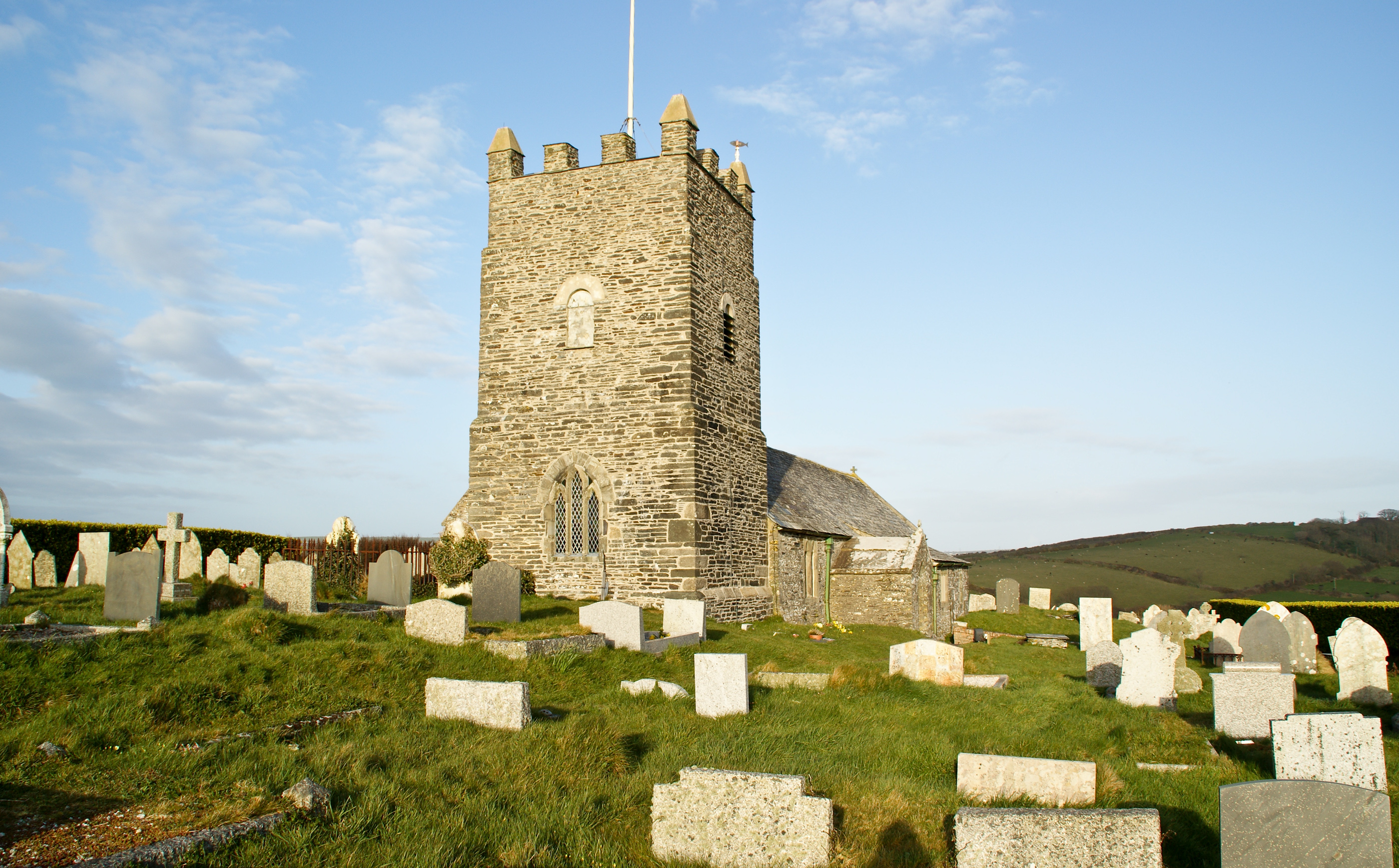
Forrabury and Minster is a civil parishes in England, civil parish on the north coast of Cornwall, England, United Kingdom. The parish was originally divided between the coastal parish of Forrabury and inland parish of Minster until they were united on the 1st of April 1919. The parish was in the Registration District of Camelford. It is bounded to the north by the Atlantic; to the east by the parishes of St Juliot, Lesnewth and Davidstow; to the south by Camelford parish (ecclesiastical parish of Lanteglos by Camelford); and to the west by Trevalga parish. The population of Forrabury and Minster parish in the 2001 census was 888, which decreased slightly to 838 at the 2011 census. Settlements and churches Boscastle is the principal settlement in the parish of Forrabury and Minster. It is south of Bude and north-east of Tintagel. Forrabury parish church, dedicated to St Symphorian and Timotheus, Symphorian, is in Boscastle at . However, the mother church of Boscastle is d ... [...More Info...] [...Related Items...] OR: [Wikipedia] [Google] [Baidu] |
Boscastle Slate Quarries
Boscastle Slate Quarries are a series of disused coastal quarries between Willapark and Trevalga on the north coast of Cornwall, South West England. The quarries *California Quarry *Welltown Quarry *Grower Quarry *Boscastle Quarry California Quarry The quarry is cut into the cliffs just south of Willapark. It is also known as Swanser Quarry. The quarry can be identified by a stone strongpoint overhanging the cliff. On this will have stood a wooden platform supporting a horse-operated whim which hoisted blocks to the top of the cliff. Various ruined buildings can be found on the cliff top including shelters and splitting sheds where thin roofing slates were produced. Old photographs show a small railway with its iron wagons, though this has since disappeared. Welltown Quarry The quarry cuts a right angle into the cliffs just north of the inlet known as Grower Gut. Grower Quarry The quarry hacks a deep notch into the cliffs forming an inlet known as Grower Gut. It is al ... [...More Info...] [...Related Items...] OR: [Wikipedia] [Google] [Baidu] |
Bottreaux Castle
Bottreaux Castle (pronounced "Botro"), colloquially known as The Courte during the time John Leyland visited, and later known as Boscastle Castle, is a ruined motte and bailey castle in Boscastle, England. It was originally built in the 12th century and only earthworks remain today. History Bottreaux Castle was likely built sometime between 1154 and 1189 (during the reign of Henry II) by Sir William des Bottreaux, and it was anciently in the possession of the de Botreaux family, which became under William de Botreaux (1337–91) the Barons Botreaux; the castle does not actually appear in records until the 13th century. The last member of the Bottreaux family died in 1462, and the castle soon fell into decay. In 1478, William Worcester mentioned Bottreaux Castle only as a manor house, John Leyland visited the castle in 1538, but the castle was likely demolished before he visited; he commented on the ruins, calling them "''far unworthie the name of a castel; the people there, c ... [...More Info...] [...Related Items...] OR: [Wikipedia] [Google] [Baidu] |
River Valency
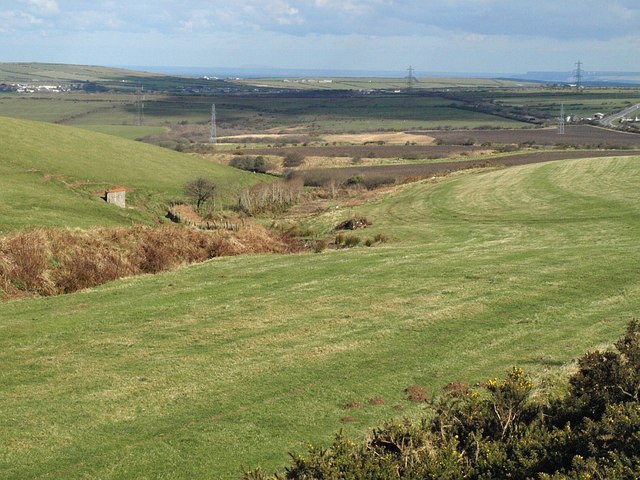
The River Valency () is a short river in north Cornwall Cornwall (; or ) is a Ceremonial counties of England, ceremonial county in South West England. It is also one of the Celtic nations and the homeland of the Cornish people. The county is bordered by the Atlantic Ocean to the north and west, ..., England, UK, with many small tributaries. After running past Lesnewth it cuts a valley before entering the sea at the harbour of the village of Boscastle. One of its tributaries is the Jordan, which runs north before joining the Valency in Boscastle just before the B3263 road bridge. The Valency valley is steep-sided and the sides of the lower section are wooded. The valley has been flooded many times, most seriously in the Boscastle flood of 2004 when significant channel erosion occurred. (Heavy rainfall for 7 hours over a wide area in the afternoon of 16 August 2004 led to severe flooding and structural damage.) The agricultural use and fast drainage within the catch ... [...More Info...] [...Related Items...] OR: [Wikipedia] [Google] [Baidu] |
River Jordan, Cornwall
The River Jordan in Cornwall is a river and a tributary to the River Valency where it merges in the village of Boscastle Boscastle () is a village and fishing port on the north coast of Cornwall, England, in the civil parish of Forrabury and Minster (where the 2011 Census population was included) . It is south of Bude and northeast of Tintagel. The harbour ....https://www.rgs.org/schools/resources-for-schools/weather-and-climate-resources-key-stage-three/boscastle-floods References Rivers of Cornwall Boscastle {{UK-river-stub ... [...More Info...] [...Related Items...] OR: [Wikipedia] [Google] [Baidu] |
Trevalga
Trevalga () is a coastal civil parishes in England, civil parish and hamlet in north Cornwall, England, United Kingdom. The parish is bounded on the north by the Celtic Sea, on the southeast by Forrabury and Minster parish and on the west by Tintagel parish. Description Dating from the time of the Domesday Book (1086), the hamlet of Trevalga lies 500 metres (1,600 ft) from the coast on the seaward side of the road from Boscastle to Tintagel. Trevalga is mentioned in the song Black and Gold (Will Coleman song), ''Black and Gold'' along with other places nearby. Unusually, much of the hamlet (The Manor of Trevalga) was, from 1961 to 2023, part of an estate held by The Gerald Curgenven Will Trust with profits after maintenance going to Marlborough College, a Public school (UK), public school in Wiltshire. The intent of this trust was ensure Trevalga’s preservation from development, and to have the Manor managed as much as possible in the way Curgenven had during his lif ... [...More Info...] [...Related Items...] OR: [Wikipedia] [Google] [Baidu] |
Tintagel
Tintagel () or Trevena (, meaning ''Village on a Mountain'') is a civil parishes in England, civil parish and village situated on the Atlantic Ocean, Atlantic coast of Cornwall, England, United Kingdom. The village and nearby Tintagel Castle are associated with the legends surrounding King Arthur and in recent times have become a tourist attraction. It was claimed by Geoffrey of Monmouth that the castle was the place of Arthur's conception. Toponymy Toponymy, Toponymists have had difficulty explaining the origin of 'Tintagel': the probability is that it is Norman French, as the Cornish language, Cornish of the 13th century would have lacked the soft 'g' ('i/j' in the earliest forms: see also Tintagel Castle). If it is Cornish then 'Dun' would mean ''Fort''. Oliver Padel proposes 'Dun' '-tagell' meaning ''narrow place'' in his book on place names. There is a possible cognate in the Channel Islands named ''Tente d'Agel'', but that still leaves the question subject to doubt. T ... [...More Info...] [...Related Items...] OR: [Wikipedia] [Google] [Baidu] |
William De Botreaux, 1st Baron Botreaux
William de Botreaux (1337–1391) (pronounced "But'ry") (or Bottreaux, corrupted to Boterel, Battrell, Bartle, etc.) was a prominent British West-Country baron during the reigns of King Edward III (1327–1377) and King Richard II (1377–1399). Origins He was the son and heir of William de Botreaux (d. 22 July 1349) of Forrabury, Cornwall (renamed after his family Boscastle, anciently "Bottreaux Castle", ) Sheriff of Cornwall, by Isabel de Moels, younger daughter and co-heiress (with her sister Muriel, the wife of Thomas Courtenay (d. 1363) 5th son of Hugh de Courtenay, 1st Earl of Devon) of John de Moels, 4th Baron Moels(d.1337), of East Berkhampstead, Hertfordshire and feudal baron of a moiety of North Cadbury, Somerset, by his wife Joan Lovel, daughter of Richard Lovel of Castle Cary, Somerset. The family is believed to have come from ''Les Bottereaux'', in Upper Normandy near Evreux, France. His father William (d. 1349) was the son of Reynold (d. 1346), son of William ( ... [...More Info...] [...Related Items...] OR: [Wikipedia] [Google] [Baidu] |
South West Coast Path
The South West Coast Path is England's longest waymarked Long-distance footpaths in the UK, long-distance footpath and a National Trail. It stretches for , running from Minehead in Somerset, along the coasts of Devon and Cornwall, to Poole Harbour in Dorset. Because it rises and falls with every river mouth, it is also one of the more challenging trails. The total height climbed has been calculated to be 114,931 ft (35,031 m), almost four times the height of Mount Everest. It has been voted 'Britain's Best Walking route' twice in a row by readers of The Ramblers' ''Walk'' magazine, and regularly features in lists of the world's best walks. The final section of the path was designated as a National Trail in 1978. Many of the landscapes which the South West Coast Path crosses have special status, either as a national parks of England and Wales, national park or one of the heritage coasts. The path passes through two World Heritage Sites: the Dorset and East Devon Coast, ... [...More Info...] [...Related Items...] OR: [Wikipedia] [Google] [Baidu] |
St Juliot
St Juliot is a civil parishes in England, civil parish in north-east Cornwall, England, United Kingdom. The parish is entirely rural and the settlements within it are the hamlets of Beeny and Tresparrett. - plus a part of the adjacent village of Marshgate. The parish population at the 2011 census was 328. History The manor of St Juliot was recorded in the Domesday Book (1086) when it was held by Thurstan from Robert, Count of Mortain. There was 1 virgate of land and land for 3 ploughs. There were half a plough, 2 serfs, 2 villeins, 30 acres of pasture and 2 cows. The value of the manor was 5 shillings though it had formerly been worth 7 shillings. Parish Church St Julitta's church is dedicated to St Julitta (Cornwall), Julitta (Juliot) and stands in an isolated location above the valley of the River Valency at The parish church of Lanteglos by Camelford and the castle chapel at Tintagel Castle, Tintagel are also dedicated to St Julitta. The chapel of St Julitta was acquired in ... [...More Info...] [...Related Items...] OR: [Wikipedia] [Google] [Baidu] |
North Cornwall (UK Parliament Constituency)
North Cornwall is a List of United Kingdom Parliament constituencies, constituency represented in the House of Commons of the United Kingdom, House of Commons of the UK Parliament by Ben Maguire, a Liberal Democrat (UK), Liberal Democrat since the 2024 United Kingdom general election, 2024 general election. Like all British constituencies, the seat elects one Member of Parliament (United Kingdom), Member of Parliament (MP) by the first past the post system of election at least every five years. The seat was created in 1918. Since 1950, the constituency has been held by MPs from either the Conservative Party or the Liberal Democrats (UK), Liberal Democrats (including the party's predecessor, the Liberal Party (UK), Liberal Party). History This constituency was created under the Representation of the People Act 1918. With exceptions in 1997, 2001 and 2019, the seat's margin of victory has been less than 20% of the vote. It has been consistently fought over between and won by the ... [...More Info...] [...Related Items...] OR: [Wikipedia] [Google] [Baidu] |
Richard Grenville
Sir Richard Grenville ( – ), also spelt Greynvile, Greeneville, and Greenfield, was an English privateer and explorer. Grenville was lord of the manors of Stowe, Cornwall and Bideford, Devon. He subsequently participated in the plantations of Ireland specifically the Munster plantations, the English colonisation of the Americas and the repulse of the Spanish Armada. Grenville also served as Member of Parliament for Cornwall, High Sheriff for County Cork and Sheriff of Cornwall. In 1591, Grenville died at the battle of Flores fighting against an overwhelmingly larger Spanish fleet near the Azores. He and his crew on board the galleon fought against the 53-strong Spanish fleet to allow the other English ships to escape. Grenville was the grandfather of Sir Bevil Grenville, a prominent military officer during the English Civil War. Origins Richard Grenville was the eldest son and heir of Sir Roger Grenville (d. 1545), who was captain of when she sank in Portsmouth ... [...More Info...] [...Related Items...] OR: [Wikipedia] [Google] [Baidu] |


