|
Berkhamsted
Berkhamsted ( ) is a historic market town in Hertfordshire, England, in the River Bulbourne, Bulbourne valley, north-west of London. The town is a Civil parishes in England, civil parish with a town council within the borough of Dacorum which is based in the neighbouring large new town of Hemel Hempstead. Berkhamsted, along with the adjoining village of Northchurch, is encircled by countryside, much of it in the Chiltern Hills which is an Area of Outstanding Natural Beauty (AONB). The High Street is on a pre-Roman route known by its Saxon name: Akeman Street. The earliest written reference to Berkhamsted was in 970. The settlement was recorded as a ''burbium'' (ancient borough) in the Domesday Book in 1086. The most notable event in the town's history occurred in December 1066. After William the Conqueror defeated Harold Godwinson, King Harold's Anglo-Saxon army at the Battle of Hastings, the Anglo-Saxon leadership surrendered to the Norman Conquest, Norman Military camp, enca ... [...More Info...] [...Related Items...] OR: [Wikipedia] [Google] [Baidu] |
Church Of St Peter, Great Berkhamsted
The Parish Church of St Peter, Great Berkhamsted, is a Church of England, Grade II* listed church in the town of Berkhamsted, Hertfordshire, in the United Kingdom. It stands on the main High Street of the town and is recognisable by its clock tower. The building is medieval in origin, the earliest part dating from c.1200, and the architecture spans at least five architectural periods, mostly 14th and 15th centuries. The church was altered greatly during the Victorian architecture, Victorian era, most notably undergoing a Victorian restoration, restoration by William Butterfield. It is one of the largest churches in Hertfordshire. Because of its proximity to Berkhamsted Castle, St Peter's has had a long association with List of English monarchs, Royalty, with the reigning monarch acting as patronage, patron to Berkhamsted rectors for several centuries. Many members of the congregation also worked in important positions for the Royal household. The church has counted among its wors ... [...More Info...] [...Related Items...] OR: [Wikipedia] [Google] [Baidu] |
Berkhamsted Castle
Berkhamsted Castle is a Norman motte-and-bailey castle in Berkhamsted, Hertfordshire. The castle was built to obtain control of a key route between London and the Midlands during the Norman conquest of England in the 11th century. Robert of Mortain, William the Conqueror's half brother, was probably responsible for managing its construction, after which he became the castle's owner. The castle was surrounded by protective earthworks and a deer park for hunting. The castle became a new administrative centre of the former Anglo-Saxon settlement of Berkhamsted. Subsequent kings granted the castle to their chancellors. The castle was substantially expanded in the mid-12th century, probably by Thomas Becket. The castle was besieged in 1216 during the civil war between King John and rebellious barons, who were supported by France. It was captured by Prince Louis, the future Louis VIII, who attacked it with siege engines for twenty days, forcing the garrison to surrende ... [...More Info...] [...Related Items...] OR: [Wikipedia] [Google] [Baidu] |
Berkhamsted Town Hall
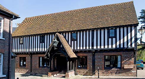
Berkhamsted Town Hall is a Grade II Listed building, listed municipal building in the High Street, Berkhamsted, Hertfordshire, England. History The current building was commissioned to replace a 16th century town hall in Church Lane which still stands and is now known as the "Court House". It was also intended to replace a tudor architecture, Tudor market hall which had been located further east along the High Street and which had burnt down in 1854. Marian Alford, Lady Marian Alford was closely involved in the initiative to establish the new town hall and a site was selected for the new building which had previously been occupied by the offices and stables of a firm of London carriers. The new building, which was designed by Edward Buckton Lamb in the Gothic Revival architecture, Gothic Revival style was financed by public subscription and completed in 1859. A substantial contribution to the cost was made by Baron Brownlow, John Egerton-Cust, 2nd Earl Brownlow. The design invo ... [...More Info...] [...Related Items...] OR: [Wikipedia] [Google] [Baidu] |
The Rex, Berkhamsted
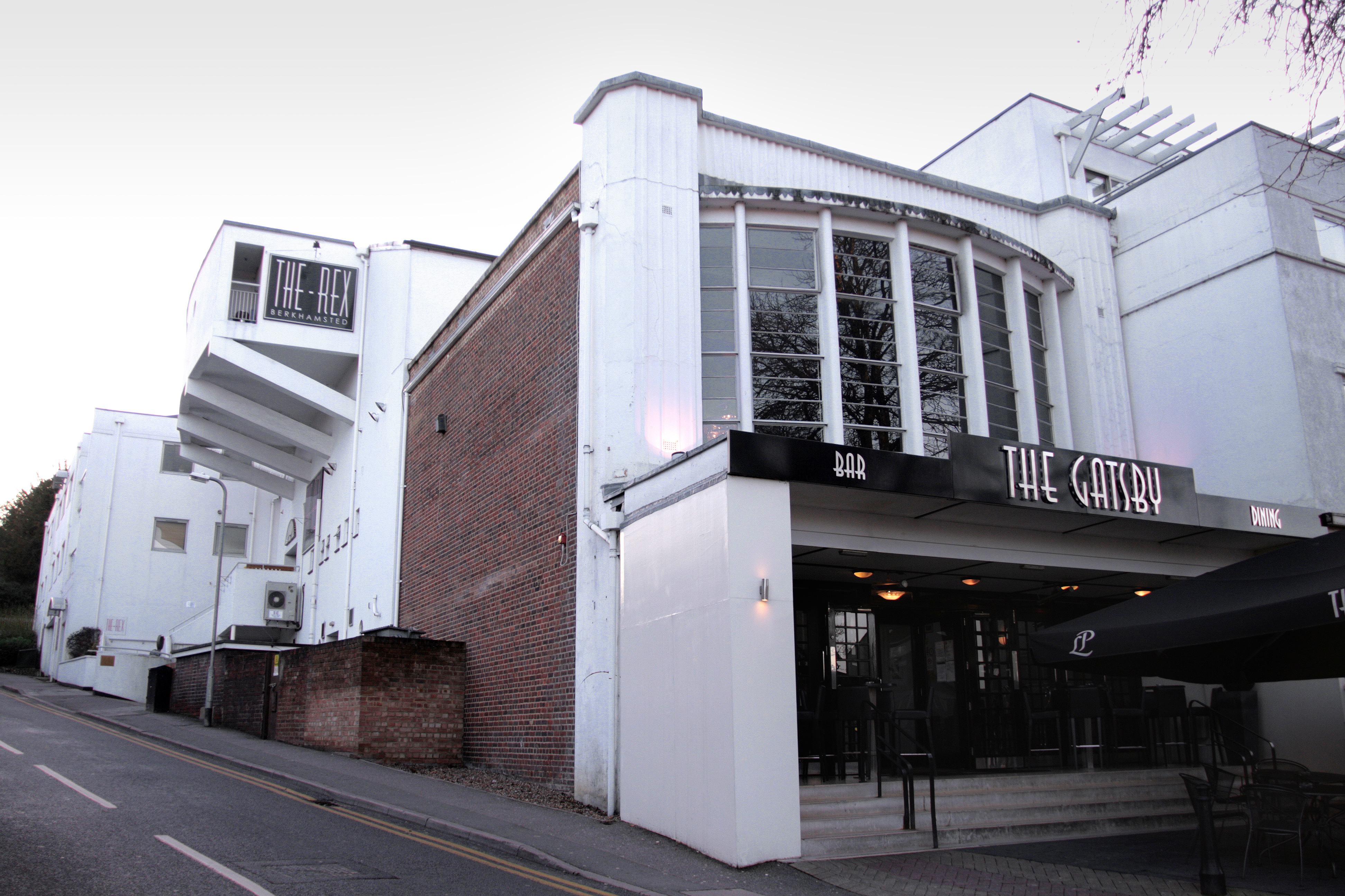
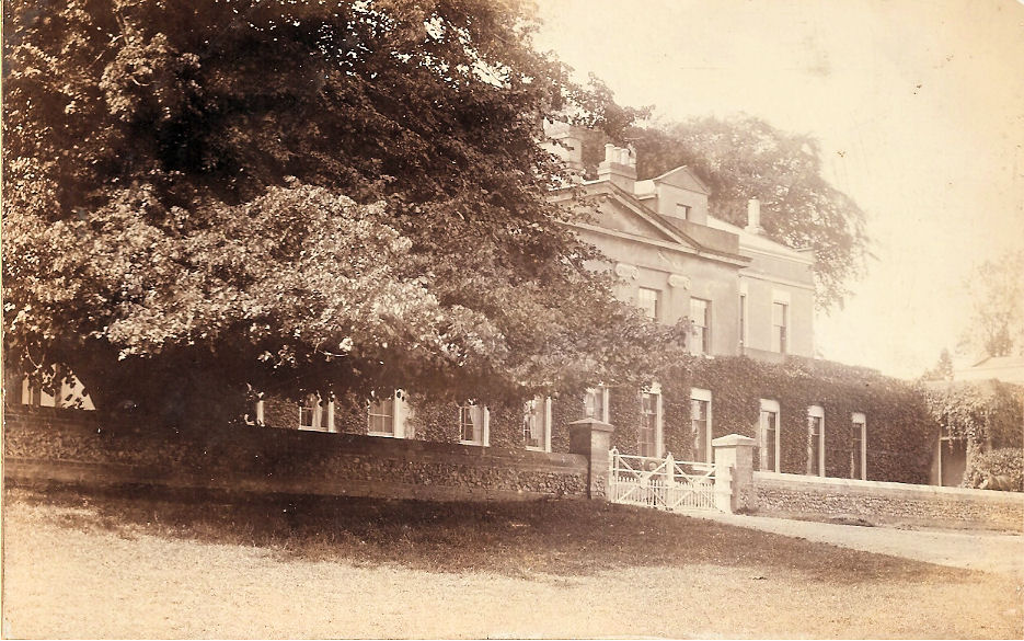
The Rex is a movie theatre, cinema in the town of Berkhamsted, Hertfordshire, England. Designed in the art deco style by David Evelyn Nye in 1936, the cinema opened to the public in 1938. After 50 years of service, the cinema closed in 1988 and became derelict. The building was listed listed building, Grade II by English Heritage, and following a campaign to save the Rex by a local entrepreneur, the cinema re-opened to the public in 2004. Today, the cinema is a fully operational independent cinema, screening films 362 days of the year. The programme ranges from vintage classic films to modern Blockbuster (entertainment), blockbusters which often attract large box office queues. History Prior to the development of the Rex Cinema, Egerton House, Berkhamsted, Egerton House, an Elizabethan architecture, Elizabethan English country house, mansion had stood on the site for approximately 350 years. Built during the reign of Queen Elizabeth I, the house was latterly noted for its liter ... [...More Info...] [...Related Items...] OR: [Wikipedia] [Google] [Baidu] |
River Bulbourne
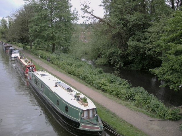
The River Bulbourne is a small river in Dacorum, Hertfordshire, England. The word bourne derives from the Anglo-Saxon word for a stream. It is an unnavigable tributary of the River Gade, which flows into the River Colne, which in turn is a tributary of the River Thames. The Bulbourne is an example of a chalk stream, which is a watercourse that flows from chalk-fed groundwater. Chalk streams are a very rare habitat globally, with more than 85% of all the 210 chalk streams in the world found in England. The river is reduced in size, due to human activity, the main one being the building of the London to Birmingham Grand Union Canal through the narrow valley which takes most of the river's water. Geography The Bulbourne flows in the Chiltern Hills, part of a system of chalk downlands throughout eastern and southern England, which formed between 84 and 100 million years ago in the Cretaceous Period when the area was a chalk-depositing marine environment. The valley is at the sout ... [...More Info...] [...Related Items...] OR: [Wikipedia] [Google] [Baidu] |
Harpenden And Berkhamsted (UK Parliament Constituency)
Harpenden and Berkhamsted is a constituency of the House of Commons in the UK Parliament. It was established by the 2023 periodic review of Westminster constituencies and was first contested at the 2024 general election. It is represented by Victoria Collins of the Liberal Democrats. Constituency profile This is a generally affluent seat with low deprivation and high incomes, facilitated by two railway lines to Central London. Boundaries The constituency is composed of the following electoral wards: * The Borough of Dacorum wards of Aldbury and Wigginton, Ashridge, Berkhamsted Castle, Berkhamsted East, Berkhamsted West, Northchurch, Tring Central, Tring East, Tring West and Rural, and Watling. * The City of St Albans wards of Harpenden East, Harpenden North & Rural, Harpenden South, Harpenden West, Marshalswick East & Jersey Farm (part), Redbourn, Sandridge & Wheathampstead, and parts of the Marshalswick West, St Stephen and Verulam wards. It covers the following areas: ... [...More Info...] [...Related Items...] OR: [Wikipedia] [Google] [Baidu] |
Northchurch
Northchurch is a village and civil parish in the River Bulbourne, Bulbourne valley in the county of Hertfordshire in the United Kingdom. It lies between the towns of Berkhamsted and Tring. Situated on the Roman road Akeman Street, a major Northchurch Roman villa, Roman villa dating from about AD 60 was discovered in the village in the 1970s. The settlement predates the neighbouring larger town of Berkhamsted.St Mary's church - Our History Accessed July 2011 History Other earlier names for Northchurch include Berkhamsted St. Mary and Berkhamsted Minor. Both names support the view that Northchurch may have been the site of the original Berkhamsted which expanded down the Bulbourne Valley following the construction of Berkhamsted Castle 2 miles to the south west. The villag ...[...More Info...] [...Related Items...] OR: [Wikipedia] [Google] [Baidu] |
Hemel Hempstead
Hemel Hempstead () is a town in the Dacorum district in Hertfordshire, England. It is located north-west of London; nearby towns and cities include Watford, St Albans and Berkhamsted. The population at the 2021 United Kingdom census, 2021 census was 95,961. Hemel Hempstead has existed since at least the 8th century and was granted its Royal charter, town charter by Henry VIII in 1539. However, it has expanded and developed in recent decades after being designated as a New towns in the United Kingdom, new town after the end of the Second World War. History Origin of the name The Human settlement, settlement was called Henamsted or Hean-Hempsted in Anglo-Saxon times and Hemel-Amstede by the time of William the Conqueror. The name is referred to in the Domesday Book as Hamelamestede, but in later centuries it became Hamelhamsted, and, possibly, Hemlamstede. In Old English, ''-stead'' or ''-stede'' simply meant "place" (reflected in German ''Stadt'' and Dutch ''stede'' or ''sta ... [...More Info...] [...Related Items...] OR: [Wikipedia] [Google] [Baidu] |
Hertfordshire
Hertfordshire ( or ; often abbreviated Herts) is a ceremonial county in the East of England and one of the home counties. It borders Bedfordshire to the north-west, Cambridgeshire to the north-east, Essex to the east, Greater London to the south and Buckinghamshire to the west. The largest settlement is Watford, and the county town is Hertford. The county has an area of and had a population of 1,198,800 at the 2021 census. After Watford (131,325), the largest settlements are Hemel Hempstead (95,985), Stevenage (94,470) and the city of St Albans (75,540). For local government purposes Hertfordshire is a non-metropolitan county with ten districts beneath Hertfordshire County Council. Elevations are higher in the north and west, reaching more than in the Chilterns near Tring. The county centres on the headwaters and upper valleys of the rivers Lea and the Colne; both flow south and each is accompanied by a canal. Hertfordshire's undeveloped land is mainly agricultural ... [...More Info...] [...Related Items...] OR: [Wikipedia] [Google] [Baidu] |
Dacorum
Dacorum is a Non-metropolitan district, local government district with borough status in the United Kingdom, borough status in Hertfordshire, England. The council is based in Hemel Hempstead. The borough also includes the towns of Berkhamsted and Tring and surrounding villages. The borough had a population of 155,081 in 2021. Dacorum was created in 1974 and is named after the ancient Hundred (county division), hundred of Danais (hundred), Dacorum which had covered a similar area. The borough of Dacorum is the westernmost of Hertfordshire's ten districts. It borders St Albans City and District, St Albans, Three Rivers District, Three Rivers, Buckinghamshire Council, Buckinghamshire and Central Bedfordshire. History Dacorum was one of the hundreds of Hertfordshire. The term 'Dacorum' literally means "of the Dacians", with Dacia being an ancient territory of south-east Europe centred on modern Romania. However, in medieval Latin, 'Dacorum' came to be used to mean "of the Danes", ... [...More Info...] [...Related Items...] OR: [Wikipedia] [Google] [Baidu] |
Akeman Street
Akeman Street is a Roman road in southern England between the modern counties of Hertfordshire and Gloucestershire. It is approximately long and runs roughly east–west. Akeman Street linked Watling Street just north of Verulamium (near modern St Albans) with the Fosse Way at Corinium Dobunnorum (now Cirencester). Evidence suggests that the route may well have been an older track, metalled and reorganised by the Romans. Its course passes through towns and villages including Hemel Hempstead, Berkhamsted, Tring, Aylesbury, Alchester (outside modern Bicester), Stonesfield (where a large Roman villa was discovered around 1712), Chesterton, Kirtlington, Ramsden and Asthall. Parts of the A41 road between Berkhamsted and Bicester use the course of the former Roman road, as did the Sparrows Herne turnpike between Berkhamsted and Aylesbury. A minor road between Chesterton and Kirtlington also uses its course. Other parts are in use as public footpaths, including a stretch ... [...More Info...] [...Related Items...] OR: [Wikipedia] [Google] [Baidu] |
Chiltern Hills
The Chiltern Hills or the Chilterns are a chalk escarpment in southern England, located to the north-west of London, covering across Oxfordshire, Buckinghamshire, Hertfordshire and Bedfordshire; they stretch from Goring-on-Thames in the south-west to Hitchin in the north-east. The hills are at their widest. In 1964, 833 square kilometers - almost half of the Chiltern Hills - were designated by the Countryside Commission as an Area of Outstanding Natural Beauty (AONB) under the powers established by the National Parks and Access to the Countryside Act 1949. The north-west boundary of the Chilterns is clearly defined by the escarpment. The dip slope is by definition more gradual and merges with the landscape to the south-east. The south-west endpoint is the River Thames. The hills decline slowly in prominence in north-east Bedfordshire. [...More Info...] [...Related Items...] OR: [Wikipedia] [Google] [Baidu] |


