|
Bilston
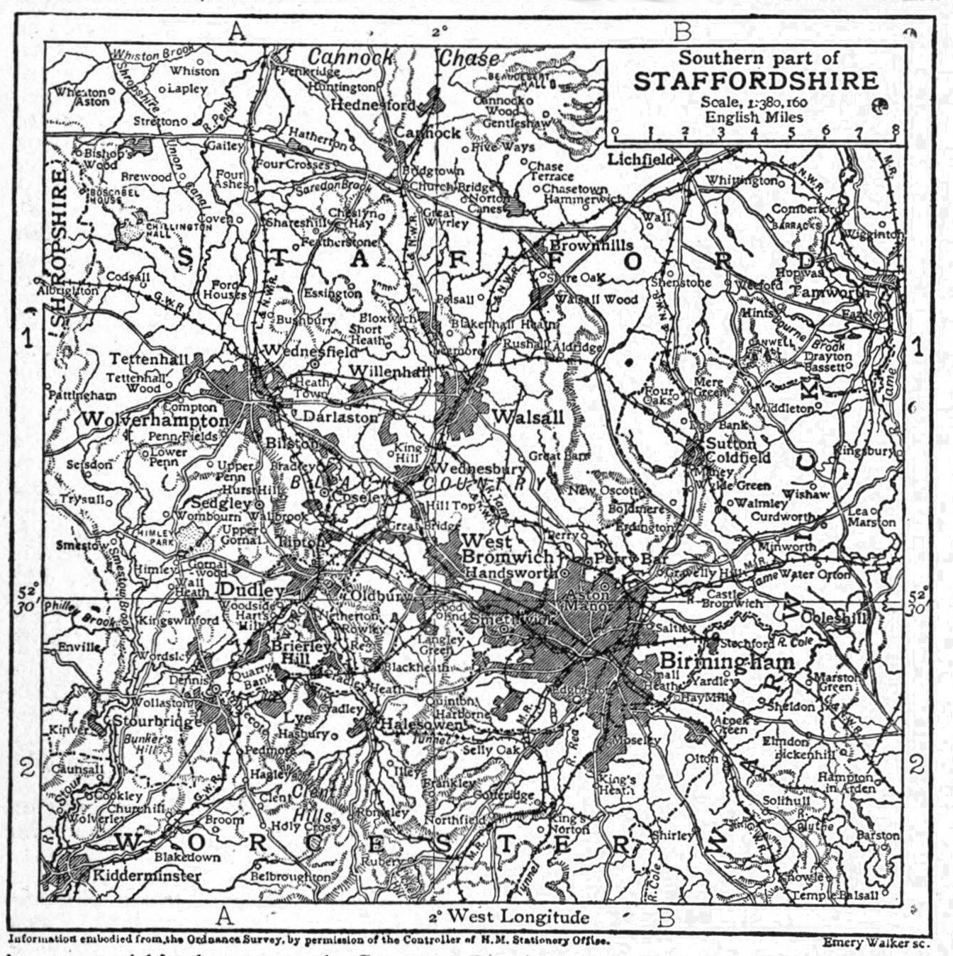
Bilston is a market town in the City of Wolverhampton in the West Midlands County, West Midlands, England. It is in the Black Country, south east of Wolverhampton city centre and close to the borders of Sandwell Metropolitan Borough, Sandwell and Walsall Metropolitan Borough, Walsall. The town was known for Vitreous enamel, enamelling from the mid-17th century, and is a former coal and iron mining district. Iron works dominated in Victorian era, Victorian times and the area became a centre for steel production. The town had a population of 34,639 at the 2021 Census. History Bilston was first referred to in AD 985 as ''Bilsatena'' when Wolverhampton was granted to Wulfrun then in 996 as ''Bilsetnatun'' in the grant charter of St. Mary's Church (now St. Peter's Collegiate Church, Wolverhampton). ''Bilsetnatun'' can be interpreted as meaning the settlement (''ton'') of the folk (''saetan'') of the ridge (''bill''). It is mentioned in the Domesday Book as a village called ''Billes ... [...More Info...] [...Related Items...] OR: [Wikipedia] [Google] [Baidu] |
The City Of Wolverhampton
Wolverhampton ( ) is a city and metropolitan borough in the West Midlands of England. Located around 12 miles (20 km) north of Birmingham, it forms the northwestern part of the West Midlands conurbation, with the towns of Walsall to the east and Dudley to the south. The population in 2021 was 263,700, making it the third largest city in the West Midlands after Birmingham and Coventry. Historically in Staffordshire, Wolverhampton grew as a market town specialising in the wool trade. During the Industrial Revolution, it became a major centre for coal mining, steel production, lock making, and automotive manufacturing; the economy of the city is still based on engineering, including a large aerospace industry, as well as the service sector. The city is also home to the University of Wolverhampton. A town for most of its history, it gained city status in 2000. The M6 motorway runs just outside Wolverhampton's east and northeast borders, while the M54 motorway starts to the north an ... [...More Info...] [...Related Items...] OR: [Wikipedia] [Google] [Baidu] |
Wolverhampton
Wolverhampton ( ) is a city and metropolitan borough in the West Midlands (county), West Midlands of England. Located around 12 miles (20 km) north of Birmingham, it forms the northwestern part of the West Midlands conurbation, with the towns of Walsall to the east and Dudley to the south. The population in 2021 was 263,700, making it the third largest city in the West Midlands after Birmingham and Coventry. Historic counties of England, Historically in Staffordshire, Wolverhampton grew as a market town specialising in the wool trade. During the Industrial Revolution, it became a major centre for coal mining, steel production, lock making, and automotive manufacturing; the economy of the city is still based on engineering, including a large aerospace industry, as well as the Tertiary sector of the economy, service sector. The city is also home to the University of Wolverhampton. A town for most of its history, it gained city status in the United Kingdom, city status in 2000. The ... [...More Info...] [...Related Items...] OR: [Wikipedia] [Google] [Baidu] |
Bilston Town Hall
Bilston Town Hall is a municipal facility in Church Street, Bilston, West Midlands, England. It is a Grade II listed building. History The building was commissioned to replace an earlier timber-framed town hall in Lichfield Street. The foundation stone for the new building was laid by Edward Pugh, treasurer of the local board of health, on 2 April 1872. The new building, which was designed by architects Bidlake and Lovatt of Wolverhampton in the Classical style and built by a Mr Nelson from Dudley at a cost of £6,000, was officially opened on 14 June 1873. An extension incorporating a larger free library and a new reading room in the same architectural style as the original building was added in 1880. A clock, by John Smith & Sons of Derby, was installed in the tower over the main entrance in 1881. The ball room on the first floor was, in 1910, leased to Joseph Woods as a cinema: after he built Wood's Palace, on the other side of the road, the ballroom reverted to community ... [...More Info...] [...Related Items...] OR: [Wikipedia] [Google] [Baidu] |
Wolverhampton South East (UK Parliament Constituency)
Wolverhampton South East is a constituency in West Midlands that was created in 1974. The seat has been represented in the House of Commons of the Parliament of the United Kingdom by Pat McFadden of the Labour Party since 2005. McFadden currently serves as Chancellor of the Duchy of Lancaster under the government of Keir Starmer. Boundaries Historic 1974–1983: The County Borough of Wolverhampton wards of Bilston East, Bilston North, Blakenhall, Ettingshall, Parkfield, and Spring Vale. 1983–2010: The Metropolitan Borough of Wolverhampton wards of Bilston East, Bilston North, Blakenhall, East Park, Ettingshall, and Spring Vale. 2010–2024: The City of Wolverhampton wards of Bilston East, Bilston North, Blakenhall, East Park, Ettingshall, and Spring Vale, and the Metropolitan Borough of Dudley ward of Coseley East. Current Further to the 2023 periodic review of Westminster constituencies, which was based on the ward structure in place on 1 December 2020, and taking ... [...More Info...] [...Related Items...] OR: [Wikipedia] [Google] [Baidu] |
Bilston Central Railway Station
Bilston Central railway station was a station on the Paddington station, London Paddington to Birkenhead via Birmingham Snow Hill railway station, Birmingham Snow Hill line. It was built in 1854 and served the town of Bilston in the West Midlands (county), West Midlands. It closed in 1972, with the end of passenger services on the Birmingham Snow Hill railway station, Snow Hill and the line to Wolverhampton, although goods trains continued to pass through the site of the station until this section of the line was closed in January 1983. It saw a second incarnation when a Midland Metro Bilston Central tram stop, stop of the same name was opened a few hundred yards away in May 1999. Gallery References Disused railway stations in Wolverhampton Former Great Western Railway stations Railway stations in Great Britain opened in 1854 Railway stations in Great Britain closed in 1972 1854 establishments in England Bilston {{WestMidlands-railstation-stub ... [...More Info...] [...Related Items...] OR: [Wikipedia] [Google] [Baidu] |
Black Country
The Black Country is an area of England's West Midlands. It is mainly urban, covering most of the Dudley and Sandwell metropolitan boroughs, with the Metropolitan Borough of Walsall and the City of Wolverhampton. The road between Wolverhampton and Birmingham was described as "one continuous town" in 1785. The area was one of the Industrial Revolution's birthplaces. Its name was first recorded in the 1840s, and derives either from the thick coal seam close to the surface or the production of coal, coke, iron, glass, bricks and steel which produced high levels of soot and air pollution. Extent The Black Country has no single set of defined boundaries. Some traditionalists define it as "the area where the coal seam comes to the surface – so West Bromwich, Coseley, Oldbury, Blackheath, Cradley Heath, Old Hill, Bilston, Dudley, Tipton, Wednesbury, and parts of Halesowen, Walsall and Smethwick or what used to be known as Warley." There are records from the 18th century ... [...More Info...] [...Related Items...] OR: [Wikipedia] [Google] [Baidu] |
Bradley, West Midlands
Bradley ( ) is a suburban village in the City of Wolverhampton, West Midlands County, England. It is located in the Bilston East ward. History Originally part of the ancient manor of Sedgley, from 1894 to 1966 it was part of Coseley Urban District Council until being transferred into the Wolverhampton County Borough as a suburb of Bilston, although a small section of it was transferred into the expanded West Bromwich borough (which in turn merged with Warley in 1974 to become Sandwell) which had also taken over the bulk of neighbouring Tipton and Wednesbury. Bradley sprang up during the 19th century with several factories and farms surrounded by mostly terraced houses in which the factory and farm workers lived. But almost all of Bradley had been redeveloped by the early 1970s, the majority of homes in the area were council-owned. The Wednesbury Oak Loop of the Birmingham Canal Navigations winds round the north of the village. This was originally part of the main line o ... [...More Info...] [...Related Items...] OR: [Wikipedia] [Google] [Baidu] |
Ettingshall
Ettingshall is an area of Wolverhampton, West Midlands, England. It lies within two wards of Wolverhampton City Council: Ettingshall North and Ettingshall South and Spring Vale. The population of Ettingshall taken at the 2011 census was 13,482. History Historically part of Staffordshire, Ettingshall was mentioned as an ancient manor in the Domesday Book of 1086. The surrounding areas of Priestfield, Parkfield, Lanesfield and Millfields are believed to have been property of the manor. From the 18th century onwards, Ettingshall became heavily industrialised as a result of the Industrial Revolution. Until April 1979, an area of wasteland on the southside of Millfields Road was the location of the Bilston Steelworks and old Bilston quarries. Ettingshall Road was the location for Cables and Instruments, Dixon's Wallcoverings and Tools and Machines. Spring Road was the location of Tarmac Limited (head office closed 2013) and John Thompson Limited (closed 2004). Ettingshall wa ... [...More Info...] [...Related Items...] OR: [Wikipedia] [Google] [Baidu] |
West Midlands County
West Midlands is a Metropolitan county, metropolitan and Ceremonial counties of England, ceremonial county in the larger West Midlands (region), West Midlands region of England. A landlocked county, it is bordered by Staffordshire to the north and west, Worcestershire to the south, and is almost surrounded by Warwickshire to the east. The largest settlement is the city of Birmingham. The county is almost entirely urban, with an area of and a population of 2,953,816, making it the List of ceremonial counties of England, second most populous county in England after Greater London. After Birmingham (1,144,919) the largest settlements are the cities of Coventry (345,324) and Wolverhampton (263,700), Solihull (126,577), and Sutton Coldfield (109,899). Nearly all of the county's settlements belong to the West Midlands conurbation, West Midlands and Coventry and Bedworth urban area, Coventry built-up areas, though the 'Meriden Gap' between them is rural. For Local government in Engl ... [...More Info...] [...Related Items...] OR: [Wikipedia] [Google] [Baidu] |
The Lunt
The Lunt is a residential area of Bilston within the city of Wolverhampton and is part of the West Midlands conurbation in England. It was mostly laid out by the local council during the 1920s and 1930s, with houses being built to rehouse people from town centre slums. These houses featured electricity, running water, bathrooms and some with indoor toilets, things that were previously unknown to virtually all of their inhabitants. There were also a few private houses built in the area, although council properties dominated the local scene, with 1,000 having been built by 1927. In the 1990s, a street of houses on the east of the estate were demolished and replaced by a larger mix of private and rented homes. Further demolition was planned a decade later, with a greater number of homes earmarked for demolition, but these plans were scrapped in 2007 and the homes will be renovated instead. However, demolition of another part of the estate took place during 2009. The Lunt is situ ... [...More Info...] [...Related Items...] OR: [Wikipedia] [Google] [Baidu] |


