|
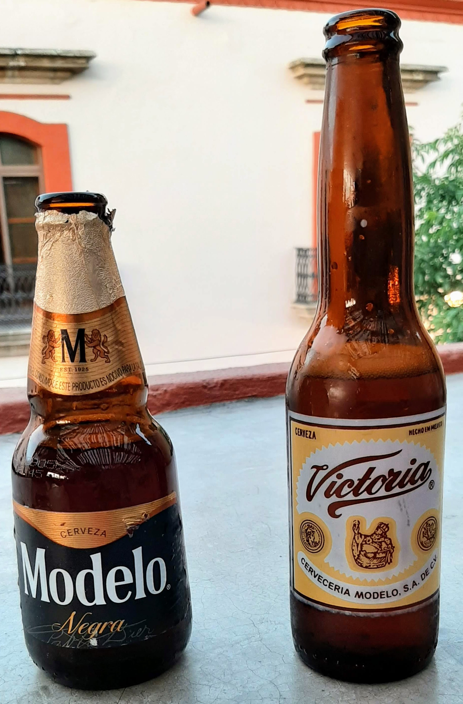
Beer In Mexico
History of beer in Mexico dates from the Spanish conquest of the Aztec Empire. While Mesoamerican cultures knew of Brewing#Fermenting, fermented alcoholic beverages, including a corn beer, long before the 16th century, European style beer brewed with barley was introduced with the Spanish invasion soon after Hernán Cortés's arrival. Production of this beer here was limited during the colonial period due to the lack of materials and severe restrictions and taxes placed on the product by Spanish authorities. After the Mexican War of Independence, these restrictions disappeared, and the industry was permitted to develop. Furthermore, the arrival of German Mexican, German immigrants during the ephemeral Second Mexican Empire of elected Maximilian I of Mexico, born an Austrian archduke, in the 19th century provided the impetus for the opening of many breweries in various parts of the country. By 1918, there were 36 brewing companies, but over the 20th century, the industry consolid ... [...More Info...] [...Related Items...] OR: [Wikipedia] [Google] [Baidu] |
Pulque
Pulque (; ), occasionally known as octli or agave wine, is an alcoholic beverage made from the fermented sap of the maguey (agave) plant. It is traditional in central Mexico, where it has been produced for millennia. It has the color of milk, a rather viscous consistency and a sour yeast-like taste. The drink's history extends far back into the Mesoamerican period, when it was considered sacred, and its use was limited to certain classes of people. After the Spanish conquest of the Aztec Empire, the drink became secular and its consumption rose. The consumption of pulque reached its peak in the late 19th century. In the 20th century, the drink fell into decline, mostly because of competition from beer, which became more prevalent with the arrival of European immigrants, but pulque remains popular in many parts of Central Mexico, however, and there have been some efforts to revive the drink's popularity elsewhere through tourism. Similar drinks exist elsewhere in Latin Ameri ... [...More Info...] [...Related Items...] OR: [Wikipedia] [Google] [Baidu] |
Piloncillo
Panela () or rapadura (Portuguese pronunciation: ) is an unrefined whole cane sugar, typical of Latin America. It is a solid form of sucrose derived from the boiling and evaporation of sugarcane juice. Panela is known by other names in Latin America, such as ''chancaca'' in Chile, Bolivia, and Peru, ''piloncillo'' in Mexico (where ''panela'' refers to a type of cheese, '' queso panela''). Just like brown sugar, two varieties of ''piloncillo'' are available; one is lighter () and one darker (''oscuro''). Unrefined, it is commonly used in Mexico, where it has been around for at least 500 years. Made from crushed sugar cane, the juice is collected, boiled, and poured into molds, where it hardens into blocks. It is similar to jaggery, which is used in South Asia. Both are considered non-centrifugal cane sugars. Panela is sold in many forms, including liquid, granulated, and solid blocks, and is used in the canning of foods, as well as in confectionery, soft drinks, baking, and ... [...More Info...] [...Related Items...] OR: [Wikipedia] [Google] [Baidu] |
Mexico State
The State of Mexico, officially just Mexico, is one of the administrative divisions of Mexico, 32 federal entities of the United Mexican States. Colloquially known as Edomex (from , the abbreviation of , and ), to distinguish it from the name of the whole country, it is the list of Mexican states by population, most populous state and the list of Mexican states by population density, second most densely populated. Located in central Mexico, the state is divided into Municipalities of the State of Mexico, 125 municipalities. The state capital city is Toluca, Toluca de Lerdo ("Toluca"), while its largest city is Ecatepec de Morelos ("Ecatepec"). The State of Mexico surrounds Mexico City on three sides. It borders the states of Querétaro and Hidalgo (state), Hidalgo to the north, Morelos and Guerrero to the south, Michoacán to the west, and Tlaxcala and Puebla to the east. The territory now comprising the State of Mexico once formed the core of the pre-Hispanic Aztec Empire. Dur ... [...More Info...] [...Related Items...] OR: [Wikipedia] [Google] [Baidu] |
Amecameca
Amecameca is a municipality located in the eastern panhandle of Mexico State between Mexico City and the Iztaccíhuatl and Popocatépetl volcanos of the Sierra Nevada mountain range. It is located on federal highway 115 which leads to Cuautla, which is called the Volcano Route (Ruta de los Volcanes). Amecameca area is a popular resort destination for visitors from Mexico City, Puebla and Morelos, owing to its mountain scenery, food scene, and other attractions. However, when Popocatépetl is active, tourism here drops dramatically. The area receives many visitors during the annual Carnival/Festival del Señor del Sacromonte, which extends over the week containing Ash Wednesday and is considered to be one of the most important festivals in Mexico State. The name Amecameca comes from Nahuatl. It has been interpreted to mean “place where the papers signal or mark,” or “paper used ceremoniously.” History Settled human habitation in this area began early mostly in disperse ... [...More Info...] [...Related Items...] OR: [Wikipedia] [Google] [Baidu] |
Metro Portales
Portales is a station on Line 2 of the Mexico City Metro system. It is located in the Colonia Albert and Colonia Portales neighborhoods of the Benito Juárez borough of Mexico City, directly south of the city centre in the median of Calzada de Tlalpan. It is a surface station. General information The station logo depicts an architectural portal. In the early 20th century there were many ranches in the surrounding zone, which were later divided up by Emiliano Zapata Emiliano Zapata Salazar (; 8 August 1879 – 10 April 1919) was a Mexican revolutionary. He was a leading figure in the Mexican Revolution of 1910–1920, the main leader of the people's revolution in the Mexican state of Morelos, and the insp ... as part of his land redistribution plans. The area later became famous for the manufacture of bricks for the construction area. The station opened on 1 August 1970. Portales provides a transfer to trolleybus Line "D", which runs between Metro Mixcoac and the San An ... [...More Info...] [...Related Items...] OR: [Wikipedia] [Google] [Baidu] |
Cocoa Bean
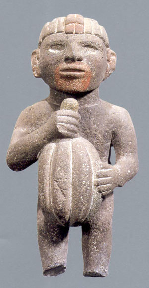
The cocoa bean, also known as cocoa () or cacao (), is the dried and fully fermented seed of ''Theobroma cacao'', the cacao tree, from which cocoa solids (a mixture of nonfat substances) and cocoa butter (the fat) can be extracted. Cacao trees are native to the Amazon rainforest. They are the basis of chocolate and Mesoamerican foods including tejate, an indigenous Mexican drink. The cacao tree was first domesticated at least 5,300 years ago by the Mayo-Chinchipe culture in South America before it was introduced in Mesoamerica. Cacao was consumed by pre-Hispanic cultures in spiritual ceremonies, and its beans were a common currency in Mesoamerica. The cacao tree grows in a limited geographical zone; today, West Africa produces nearly 81% of the world's crop. The three main varieties of cocoa plants are Forastero, Criollo, and Trinitario, with Forastero being the most widely used. In 2024, global cocoa bean production reached 5.8 million tonnes, with Ivory Coast leading a ... [...More Info...] [...Related Items...] OR: [Wikipedia] [Google] [Baidu] |
Tabasco
Tabasco, officially the Free and Sovereign State of Tabasco, is one of the Political divisions of Mexico, 32 Federal Entities of Mexico. It is divided into Municipalities of Tabasco, 17 municipalities and its capital city is Villahermosa. It is located in southeast Mexico and is bordered by the states of Campeche to the northeast, Veracruz to the west, and Chiapas to the south and the Petén Department, Petén department of Guatemala to the southeast. It has a coastline to the north with the Gulf of Mexico. Most of the state is covered in rainforest as, unlike most other areas of Mexico, it has plentiful rainfall year-round. The state is also home to La Venta, the major site of the Olmecs, Olmec civilization, considered to be the origin of later Mesoamerican cultures. It produces significant quantities of petroleum and natural gas. Geography The state is located in the southeast of Mexico, bordering the states of Campeche, Chiapas, and Veracruz, with the Gulf of Mexico to the n ... [...More Info...] [...Related Items...] OR: [Wikipedia] [Google] [Baidu] |
Chiapas
Chiapas, officially the Free and Sovereign State of Chiapas, is one of the states that make up the Political divisions of Mexico, 32 federal entities of Mexico. It comprises Municipalities of Chiapas, 124 municipalities and its capital and largest city is Tuxtla Gutiérrez. Other important population centers in Chiapas include Ocosingo, Tapachula, San Cristóbal de las Casas, Comitán, and Arriaga, Chiapas, Arriaga. Chiapas is the southernmost state in Mexico, and it borders the states of Oaxaca to the west, Veracruz to the northwest, and Tabasco to the north, and the Petén Department, Petén, Quiché Department, Quiché, Huehuetenango Department, Huehuetenango, and San Marcos Department, San Marcos departments of Guatemala to the east and southeast. Chiapas has a significant coastline on the Pacific Ocean to the southwest. In general, Chiapas has a humid, tropical climate. In the northern area bordering Tabasco, near Teapa Municipality, Teapa, rainfall can average more than pe ... [...More Info...] [...Related Items...] OR: [Wikipedia] [Google] [Baidu] |
Oaxaca
Oaxaca, officially the Free and Sovereign State of Oaxaca, is one of the 32 states that compose the political divisions of Mexico, Federative Entities of the Mexico, United Mexican States. It is divided into municipalities of Oaxaca, 570 municipalities, of which 418 (almost three quarters) are governed by the system of (customs and traditions) with recognized local forms of self-governance. Its capital city is Oaxaca City, Oaxaca de Juárez. Oaxaca is in southern Mexico. It is bordered by the states of Guerrero to the west, Puebla to the northwest, Veracruz to the north, and Chiapas to the east. To the south, Oaxaca has a significant coastline on the Pacific Ocean. The state is best known for #Indigenous peoples, its indigenous peoples and cultures. The most numerous and best known are the Zapotec peoples, Zapotecs and the Mixtecs, but 16 are officially recognized. These cultures have survived better than most others in Mexico due to the state's rugged and isolating terrain. M ... [...More Info...] [...Related Items...] OR: [Wikipedia] [Google] [Baidu] |


