|
Battleford Bridge
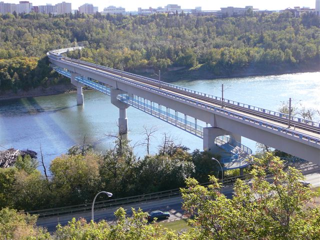
The Battleford Bridge, also known as the Old Bridges, is an eight-span steel truss bridge that crosses the North Saskatchewan River connecting North Battleford and Battleford in the Provinces and territories of Canada, Canadian province of Saskatchewan. Built in 1907–08, the bridge consists of two separate bridges — one from Battleford to Finlayson Island in the middle of the river and the other from Finlayson Island to North Battleford. The south bridge is commonly called the South Truss Bridge while the north one is called the North Truss Bridge. It is the oldest highway bridge in Saskatchewan and the longest of its type. The bridge was along the route of Saskatchewan Highway 16, Highway 16 (the Yellowhead Trail) and then Suffixed routes of Saskatchewan Highway 16#The Battlefords, Highway 16A until it was closed to through traffic in 2003. Highway 16 now crosses the river upstream at the Battlefords Bridge and 16A was decommissioned with the closing of Battleford Bridge. I ... [...More Info...] [...Related Items...] OR: [Wikipedia] [Google] [Baidu] |
North Saskatchewan River
The North Saskatchewan River is a glacier-fed river that flows from the Canadian Rockies continental divide east to central Saskatchewan, where it joins with the South Saskatchewan River to make up the Saskatchewan River. Its water flows eventually into the Hudson Bay. The Saskatchewan River system is the largest shared between the Provinces and territories of Canada, Canadian provinces of Alberta and Saskatchewan. Its watershed includes most of southern and central Alberta and Saskatchewan. Course The North Saskatchewan River has a length of , and a drainage area of . At its end point at Saskatchewan River Forks it has a mean discharge of . The yearly discharge at the Alberta–Saskatchewan border is more than . The river begins above at the toe of the Saskatchewan Glacier in the Columbia Icefield, and flows southeast through Banff National Park alongside the Icefields Parkway. At the junction of the David Thompson Highway (Highway 11), it initially turns northeast for b ... [...More Info...] [...Related Items...] OR: [Wikipedia] [Google] [Baidu] |
Suffixed Routes Of Saskatchewan Highway 16
There are three suffixed routes of Saskatchewan's Highway 16 (the Yellowhead Highway) in the Canadian province of Saskatchewan: Highway 16A Yorkton The Yorkton segment of Highway 16A is about long. It runs concurrently with Highway 10A along Broadway Street before it leaves the concurrency at Gladstone Avenue N and travels north to York Road. Major intersections From northwest to southeast: The Battlefords The Battlefords segment of Highway 16A was located in North Battleford and Battleford and was about long. It existed until 2003 when the Battlefords Bridge was twinned along the Highway 4 / Highway 16 / Highway 40 corridor. The original Battleford Bridge via Finlayson Island was closed to vehicular traffic (it remained open to bicycles and pedestrians) and Highway 16A was decommissioned. Major intersections From west to east: Highway 16B Highway 16B is a highway in Saskatchewan. It runs from Highway 16 / Highway 40 at North Battleford ... [...More Info...] [...Related Items...] OR: [Wikipedia] [Google] [Baidu] |
Bridges Over The North Saskatchewan River
A bridge is a structure built to Span (engineering), span a physical obstacle (such as a body of water, valley, road, or railway) without blocking the path underneath. It is constructed for the purpose of providing passage over the obstacle, which is usually something that is otherwise difficult or impossible to cross. There are many different designs of bridges, each serving a particular purpose and applicable to different situations. Designs of bridges vary depending on factors such as the function of the bridge, the nature of the terrain where the bridge is constructed and anchored, the material used to make it, and the funds available to build it. The earliest bridges were likely made with fallen trees and stepping stones. The Neolithic people built boardwalk bridges across marshland. The Arkadiko Bridge, dating from the 13th century BC, in the Peloponnese is one of the oldest arch bridges in existence and use. Etymology The ''Oxford English Dictionary'' traces the origin of ... [...More Info...] [...Related Items...] OR: [Wikipedia] [Google] [Baidu] |
Road Bridges In Saskatchewan
A road is a thoroughfare used primarily for movement of traffic. Roads differ from street A street is a public thoroughfare in a city, town or village, typically lined with Building, buildings on one or both sides. Streets often include pavements (sidewalks), pedestrian crossings, and sometimes amenities like Street light, streetligh ...s, whose primary use is local access. They also differ from stroads, which combine the features of streets and roads. Most modern roads are Road surface, paved. The words "road" and "street" are commonly considered to be interchangeable, but the distinction is important in urban design. There are road hierarchy, many types of roads, including parkways, avenue (landscape), avenues, controlled-access highways (freeways, motorways, and expressways), tollways, interstates, highways, and local roads. The primary features of roads include lanes, sidewalks (pavement), roadways (carriageways), median strip, medians, shoulder (road), shoulders, road ... [...More Info...] [...Related Items...] OR: [Wikipedia] [Google] [Baidu] |
Pedestrian Bridges In Saskatchewan
A pedestrian is a person traveling on foot, by wheelchair or with other mobility aids. Streets and roads often have a designated footpath for pedestrian traffic, called the ''sidewalk'' in North American English, the ''pavement'' in British English, and the ''footpath'' in Australian and New Zealand English. There are also footpaths not associated with thoroughfares; these include rural paths and urban short cuts. Historically, walking has been the main way people get around. In the early use of the word, ''pedestrian'' meant a "professional walker", or somebody who held a record for speed or endurance. With the advent of cars, it started to be used as an opposite: somebody who is not riding or driving. As walking is a healthy and sustainable mode of transport, there are efforts to make cities more walkable. For instance, by creating wider sidewalks, a pedestrian network, or restricting motor vehicles in city centres. Pedestrians are vulnerable and can be injured, for exampl ... [...More Info...] [...Related Items...] OR: [Wikipedia] [Google] [Baidu] |
Bridges Completed In 1908
A bridge is a structure built to span a physical obstacle (such as a body of water, valley, road, or railway) without blocking the path underneath. It is constructed for the purpose of providing passage over the obstacle, which is usually something that is otherwise difficult or impossible to cross. There are many different designs of bridges, each serving a particular purpose and applicable to different situations. Designs of bridges vary depending on factors such as the function of the bridge, the nature of the terrain where the bridge is constructed and anchored, the material used to make it, and the funds available to build it. The earliest bridges were likely made with fallen trees and stepping stones. The Neolithic people built boardwalk bridges across marshland. The Arkadiko Bridge, dating from the 13th century BC, in the Peloponnese is one of the oldest arch bridges in existence and use. Etymology The ''Oxford English Dictionary'' traces the origin of the word ''bridge' ... [...More Info...] [...Related Items...] OR: [Wikipedia] [Google] [Baidu] |
List Of Bridges In Canada
This is a list of bridges and viaducts in Canada, including those for pedestrians and vehicular traffic. Historical and architectural interest bridges There are only a few covered bridges left in Canada. In Quebec, despite over 1,200 existing in the last century, today there are only 88 remaining. In New Brunswick, 58 covered bridges have been identified. Major road and railway bridges Canada's longest bridge is the Confederation Bridge in the Gulf of St. Lawrence with a total of between abutments, it's also the world's longest bridge over ice-covered water. More than 5,000 local workers helped with the project, which cost about $1 billion. The Quebec Bridge has been the longest cantilever bridge span in the world since 1917, measuring between its two piles. It held the record of all-categories longest span in the world until the opening of the Ambassador Bridge. It's the last bridge that broke such a record before suspension bridges hold the award by far. It was de ... [...More Info...] [...Related Items...] OR: [Wikipedia] [Google] [Baidu] |
List Of Crossings Of The North Saskatchewan River ...
This is a list of crossings of the North Saskatchewan River in the Canadian provinces of Saskatchewan and Alberta from the river's confluence with the South Saskatchewan River upstream to its source. Saskatchewan Alberta See also *List of crossings of the South Saskatchewan River Notes References * *{{Google maps, url=https://www.google.ca/maps/@52.9929052,-111.1706652,5.75z, title=North Saskatchewan River in Western Canada, accessdate=November 17, 2016 * North Saskatchewan River The North Saskatchewan River is a glacier-fed river that flows from the Canadian Rockies continental divide east to central Saskatchewan, where it joins with the South Saskatchewan River to make up the Saskatchewan River. Its water flows event ... [...More Info...] [...Related Items...] OR: [Wikipedia] [Google] [Baidu] |
Regina, Saskatchewan
Regina ( ) is the capital city of the Provinces and territories of Canada, Canadian province of Saskatchewan. The city is the second-largest in the province, and is a commercial centre for southern Saskatchewan. As of the 2021 Canadian census, 2021 census, Regina had a List of cities in Saskatchewan, city population of 226,404, and a List of census metropolitan areas and agglomerations in Canada, metropolitan area population of 249,217. It is governed by Regina City Council. The city is surrounded by the Rural Municipality of Sherwood No. 159. Regina was History of Northwest Territories capital cities, previously the seat of government of the Northwest Territories, North-West Territories, of which the current provinces of Saskatchewan and Alberta originally formed part, and of the District of Assiniboia. The site was previously called Wascana (from "Buffalo Bones"), but was renamed to ''Regina'' (Latin for "Queen") in 1882 in honour of Queen Victoria. The name was proposed by Q ... [...More Info...] [...Related Items...] OR: [Wikipedia] [Google] [Baidu] |
Rusty Bridge Across The North Saskatchewan River In North Battleford -a
Rusty may refer to something covered with rust or with a rust (color). Rusty is also a nickname for people who have red hair, have a rust-hued skin tone, or have the given name Russell. Rusty may also refer to: People *Rusty Anderson (born 1959), American guitarist *Rusty Areias (born 1949), American politician *Rusty Bryant (1929–1991), American saxophonist * Rusty Cooley (born 1970), American guitarist * Rusty Crawford (1885–1971), Canadian ice hockey player *Rusty Cundieff (born 1960), American actor and director *Rusty Day (1945–1982), American musician *Rusty Dedrick (1918–2009), American trumpeter * Rusty DeWees (born 1960), American actor and comedian *Rusty Draper (1923–2003), American singer *Rusty Duke, American judge *Rusty Edwards Rusty Edwards is a hymnwriter who was born in Dixon, Illinois, on January 22, 1955. Dozens of his hymns have been published in 100 books in Australia, Brazil, Canada, China, Czech Republic, England, Ireland, Japan, New Zealand, ... [...More Info...] [...Related Items...] OR: [Wikipedia] [Google] [Baidu] |


